
Bhu Naksha Karnataka: The Map Layer Explained
Karnataka's survey establishment has quietly built the best mapping stack in Indian land administration: village sheets digitised, parcel layers online, a GPS app that names the survey number under your feet. Bhu Naksha is the viewing layer of that stack. Used with the RTC, it answers the question paper never can: where, exactly, is this land.
What Bhu Naksha Karnataka shows
Definition
Bhu Naksha Karnataka renders the digitised village map: each survey number and hissa as a polygon in its village context, drawn from the survey department's records. It is the orientation layer of the SSLR ecosystem, sitting alongside Dishaank for GPS position and Mojini for formal survey services.
Use the layer to interrogate a deal's geography before its paperwork. Whether the hissa touches the road it is priced for, whether its shape can carry the farmhouse or layout being imagined, how it sits against neighbours and nalas, all of it is visible from a desk.
Karnataka's advantage is the stack around the viewer. When the on-screen polygon raises a question, Dishaank can stand you on the ground and confirm which parcel is underfoot, and Mojini can order the formal sketch or subdivision survey that settles it. Few states hand a buyer that escalation path.
The hierarchy still holds. The digitised polygon approximates the village sheet; the survey records behind it are the authority; and a boundary that will carry a fence or a wall deserves a licensed surveyor's stones, not a screenshot.
Reading Bhu Naksha before a site visit
Ten desk minutes that regularly save a wasted trip.
Viewer method
Escalation stack
The Karnataka mapping stack
Four layers, one question each.
| Layer | Question it answers | Authority |
|---|---|---|
| Bhu Naksha viewer | Where does the parcel sit? | Orientation |
| Dishaank app | Which parcel am I standing on? | Field check |
| Village sheet / survey records | What are the recorded lines? | The record |
| Mojini services | Can I get a formal sketch or split? | Survey office |
| Licensed demarcation | Where do the lines run on the ground? | Binding |
Common Bhu Naksha issues, and the fix
Map work in Karnataka hits four recurring snags.
Why the map comes before the visit
Land fails on geography faster than on paper.
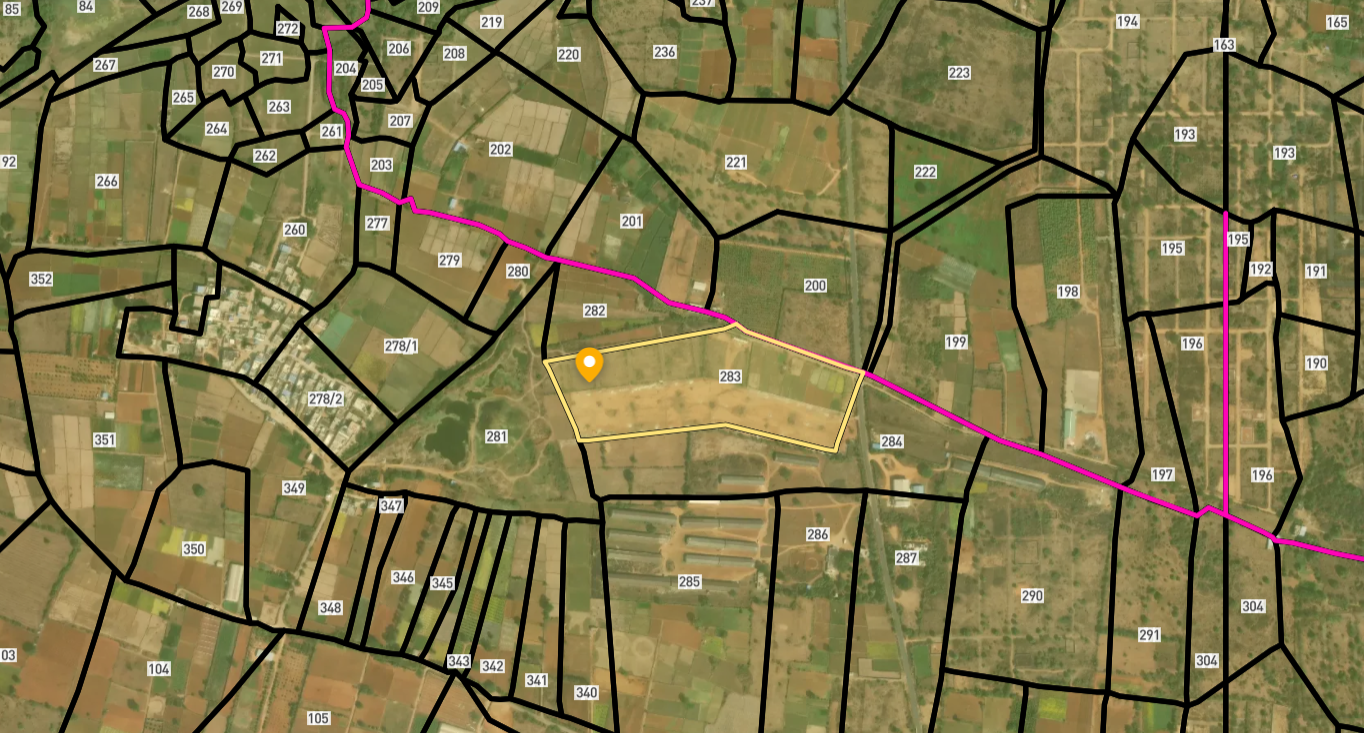
Survey Numbers View on Map Boundaries and numbers come from published state cadastral records. See all map layers.
Looking to sell your land in Karnataka?

Browse 1,300+ verified lands & plots in Karnataka
Frequently asked questions
What is Bhu Naksha Karnataka?
Is the on-screen boundary authoritative?
How does Dishaank fit in?
What is Mojini for?
The map does not show a recent split?
Can the map settle a boundary dispute?
Other Related Guides
Bhoomi
Every Karnataka land record service in one place, with a guide for each.
Read guide →Akarband Karnataka: Village Boundary Record Guide 2026
Akarband Karnataka guide: check survey completeness, read kharab land entries, download from Bhoomi, and verify land classification before you buy agricultural land.
Read guide →Encumbrance Certificate Karnataka: Kaveri EC Guide 2026
Encumbrance Certificate Karnataka guide: apply on Kaveri portal, read Form 15 vs Form 16, cover 30 years, and catch what a Nil EC misses before you buy.
Read guide →RTC Pahani Karnataka: Complete Guide 2026
RTC Pahani Karnataka is the primary land ownership record. Learn what it contains, how to download it from Bhoomi, key columns to check, and risks every buyer must avoid.
Read guide →BBMP Property Tax Receipt Bangalore: Complete Guide 2026
BBMP property tax receipt proves all dues are cleared on a Bangalore property. Unpaid arrears block Khata transfer. Verify online before you buy full guide here.
Read guide →Mutation Extract Karnataka: Complete Guide 2026
Mutation Extract Karnataka records every ownership change on a land parcel. Learn what it contains, how to get it on Bhoomi, and why 30-day follow-up is critical.
Read guide →