
The FMB Sketch: Tamil Nadu's Measured Truth
Survey parties measured Tamil Nadu field by field generations ago and drew what they measured. The Field Measurement Book holds those drawings, one dimensioned sketch per survey field, and everything since, subdivisions, demarcations, boundary arguments, refers back to them. TN e-Services now serves the sketch in minutes; the authority it carries took a century to earn.
Why the FMB sketch outranks every other picture
Definition
The FMB is the survey establishment's book of measured drawings for Tamil Nadu's survey fields: dimensioned sides, reference points and adjacent fields as physically measured. The e-Services sketch view serves digitised copies; the taluk survey records hold the originals; and wherever pictures of the parcel disagree, the FMB is the one that governs.
Read it like the surveyor who will one day stake it. The dimensioned sides let you compute the frontage the price assumes; the adjacency labels name which fields share each boundary; the reference marks are what a demarcation team hunts for when the lines move from paper to ground.
Subdivision is where the sketch decides deals. A survey field splits into saleable pieces only when the survey side draws the subdivision, and a plot whose subdivision sketch exists is a different legal object from a plot that exists on a layout brochure. Part-parcel purchases in Tamil Nadu begin with this drawing or they begin wrong.
Online coverage is honest rather than complete: districts and survey eras digitised unevenly, so an e-Services miss means a trip to the taluk survey records, not a missing record. Verify what your district serves rather than generalising from one lookup.
Pulling and reading the FMB sketch
The survey field and subdivision are all you need.
The pull
Questions the FMB answers before money moves
Interrogate the drawing in this order.
| Question | Where the sketch answers | If it fails |
|---|---|---|
| Is the frontage real? | The dimensioned road side | Reprice; frontage inflation is routine |
| Does the area reconcile? | Computed vs patta and ledger extents | Survey clarification before advance |
| Who borders each side? | Adjacency field numbers | Prepare the encroachment questions |
| Does my plot legally exist? | The subdivision's own sketch | No sketch, no independent parcel |
| Can lines be re-staked? | Reference marks on the drawing | Demarcation feasibility check |
Common FMB sketch issues, and the fix
Sketch work in Tamil Nadu snags four ways.
Where the FMB earns its place in the file
Frontage-priced land, layout plots, anything you will build to the edge of: these are sketch purchases, and the drawing belongs in the file before the token advance, with a demarcation before the balance where the lines will carry a wall.
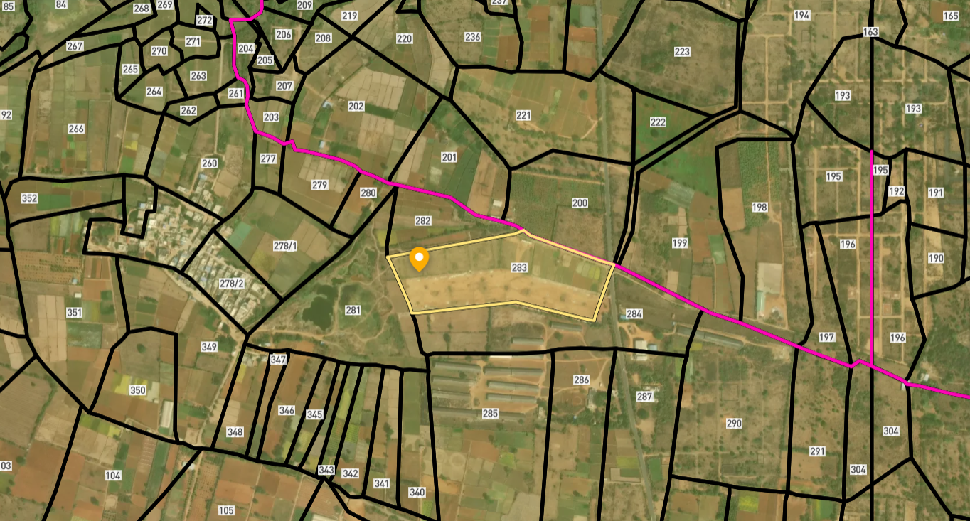
Survey Numbers View on Map Boundaries and numbers come from published state cadastral records. See all map layers.
Looking to sell your land in Tamil Nadu?

Browse 1,300+ verified lands & plots in Tamil Nadu
Frequently asked questions
What is the FMB in Tamil Nadu?
How do I get the FMB sketch?
Is the online sketch always available?
Why does the subdivision sketch matter for plots?
The sketch area differs from the patta?
Who fixes boundaries on the ground?
Other Related Guides
TN e-Services
Every Tamil Nadu land record service in one place, with a guide for each.
Read guide →Encumbrance Certificate Tamil Nadu: TNREGINET EC Guide 2026
Apply for the Encumbrance Certificate Tamil Nadu on TNREGINET in 5 minutes. Pull a 30-year EC, decode Form 15, and spot unreleased mortgages before buying.
Read guide →Property Tax Receipts Tamil Nadu: Pay Online Guide 2026
Pay Property Tax Receipts Tamil Nadu online via tnurbanepay.tn.gov.in or GCC portal. Demand a Nil Dues Certificate before any purchase. Skip the inherited tax shock.
Read guide →Panchayat Municipality NOC Tamil Nadu: Guide 2026
Get the Panchayat Municipality NOC Tamil Nadu before any building or layout approval. The Annexure-XVII access road certificate from EO, BDO, or Commissioner is mandatory.
Read guide →Building Plan Approval Tamil Nadu: Sanction Guide 2026
Apply for Building Plan Approval Tamil Nadu through onlineppa.tn.gov.in. Verify plan matches structure before buying. CMDA, GCC, DTCP routes explained.
Read guide →CRZ Clearance Tamil Nadu: TNCZMA Coastal Guide 2026
Verify CRZ Clearance Tamil Nadu through TNCZMA before buying coastal plots in Chennai, Rameswaram, or Kanyakumari. Check NDZ, HTL, and zone category.
Read guide →