Visakhapatnam VMRDA Masterplan 2041: Zone Check and Land Use Guide
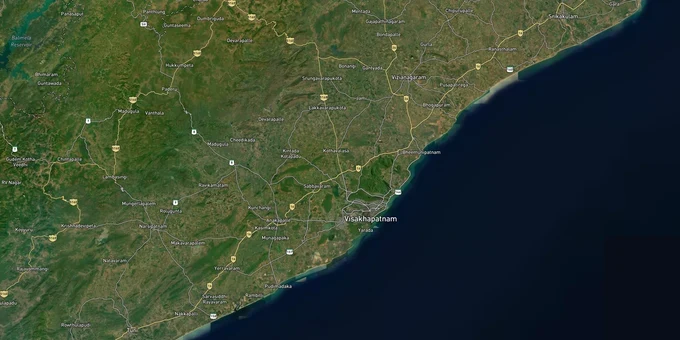
Visakhapatnam Masterplan Preview
Try the Visakhapatnam VMRDA Masterplan 2041 on the map
Sign in once and explore the layer for a full day.
- No card details needed
- Find nearby verified lands for sale
Overview
The VMRDA Masterplan 2041 zone classification governs every parcel across the 4,380.67 sq km of the Visakhapatnam Metropolitan Region (VMR), spanning Visakhapatnam, Vizianagaram, and Anakapalli districts. The VMRDA Masterplan 2041 was sanctioned under G.O.Ms.No.136 on 8 November 2021, replacing the earlier VUDA framework and bringing all land development under the Zoning and Development Promotion Regulations (ZDPR) for VMR 2041. The AP government directed a comprehensive revision in January 2025 following public objections; a consultant has been engaged and a public objection window opened in May 2025. The 2021 plan remains operative in the interim, but zone classifications may change during revision. This page covers the regulatory traps buyers miss, the corridors where zone classification drives investable demand, and how to verify any plot using 1acre's tools before making an offer.
Block Layout Plans and the Layout Permission (LP) Number Trap: The VMRDA Zone Risk That Catches Buyers Twice
The most consequential mistake buyers make in the Visakhapatnam market is treating a Block Layout Plan (BLP) as proof of legal approval. A BLP is a tentative sanction only. The only document that confirms a layout is legally valid under the VMRDA masterplan 2041 zone framework is a final Layout Plan bearing an LP Number authenticated by VMRDA. Thousands of plots across the VMR region have been sold on the basis of BLP documentation, with buyers discovering the deficiency only when applying for registration, utilities, or building permission.
Illegal layouts compound this risk further. VMRDA data shows that unapproved layout developers routinely sell over 80 cents of developable land per acre, far exceeding the 60 cents permitted under sanctioned layout rules. These layouts do not conform to ZDPR zoning regulations and are treated as continuing offences by the authority. VMRDA received approximately 4,400 applications under the Layout Regularisation Scheme (LRS) to address this backlog, but plots not covered by LRS remain legally vulnerable.
The table below sets out the zone codes under VMRDA ZDPR 2041 and the key question each raises for a buyer.
Zone Code
Zone Name
Key Buyer Risk
R
Residential
Check if the LP Number is authenticated; BLP is not a valid title
C
Commercial
Verify zone code matches intended use before any offer
MU
Mixed Use
Permitted mix of uses must match the specific Sub-zone
I
Industrial
Township residential permitted near clusters; check proximity to Visakhapatnam-Chennai Industrial Corridor (VCIC)
A
Agricultural
No residential layout permitted without a formal zone conversion
SA
Special Area
Bhogapuram influence zone; form-based categories override ZDPR defaults
PU
Protected Use
No private development permitted without a specific Authority order
If a seller cannot produce the final LP Number and VMRDA authentication documents, the layout is unverified. Walk away and check the VMRDA Unauthorised Layouts list before proceeding.
Pendurthi to Bhogapuram: Where the VMRDA Masterplan 2041 Zone Changes Land Value Most
The VMRDA Masterplan 2041 maps the entire VMR region around five strategic growth axes, and the zone classification on these axes determines whether land is investable, speculative, or restricted. Satellite townships are designated at Vizianagaram, Bhogapuram Aerocity, Pendurthi-Kothavalasa, Anakapalle-Atchutapuram, Bheemunipatnam, and Nakkapalli. Corridors not on these axes remain in agricultural or protected zone categories with no clear residential conversion pathway under the current plan horizon.
The Bhogapuram airport influence zone operates under a separate form-based planning framework within the VMRDA masterplan 2041. It uses five land-use categories (Natural/No Development, Mixed Use-1 through Mixed Use-3, Industrial, and Special Development) rather than the standard ZDPR zone codes. Any land marketed for residential development in this zone must be verified against the specific influence zone map, not the general masterplan sheet.
The table below shows the corridors with the strongest zone-to-infrastructure alignment as of the sanctioned 2041 plan.
Corridor
Zone Profile
Infrastructure Driver
Key Risk
Pendurthi
Residential / Satellite Township
Metro link, Radial Corridor 7
Confirm LP Number; active BLP sales reported
Bhogapuram
Special Area (Aerocity influence zone)
Bhogapuram International Airport
Form-based zone categories override standard ZDPR
Anakapalle-Atchutapuram
Industrial / Mixed Use
VCIC mega industrial cluster, SEZ, Naval Base
Residential near an industrial zone; verify buffer distance
Bheemunipatnam
Residential / Satellite Township
Coastal corridor
Confirm zone is residential, not protected coastal
Nakkapalli
Industrial / Township
VCIC node
Township residential is permitted near the cluster only
The VCIC corridor at Atchutapuram is the most misread. Residential plots marketed in this corridor often sit on the boundary of industrial and mixed-use designations. A parcel zoned Industrial under the 2041 plan does not permit a standalone residential layout without a formal conversion order from the Competent Authority.
Was this layer helpful?
Anything wrong, outdated, or missing we want to hear it.
For Land Owners & Agents
Looking to sell your land in Andhra Pradesh?
I want to sell my land in Amaravati
10:32
Plz share your Land's location - We will list it on 1acre map, for Free.
10:32

For Land Buyers
Browse all verified lands & plots in Andhra Pradesh
Every listing goes through our Preliminary Verification Process.
More Layers in Andhra Pradesh
See all 17 layers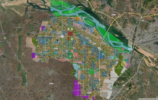
Amaravati APCRDA Masterplan 2050: Zone Check and Land Use Guide
View Amaravati Masterplan as a live map overlay – check any plot's land use zone for free on 1acre.in. APCRDA masterplan...
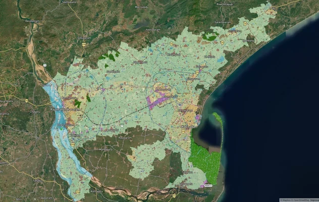
Kakinada Masterplan: Zone Check and Land Use Guide
View Kakinada Masterplan as a live map overlay – check any plot's land use zone for free on 1acre.in. Kakinada masterpla...
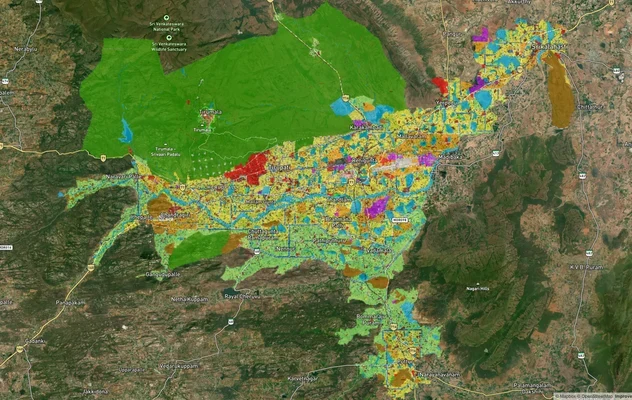
Tirupati TUDA Masterplan: Zone Check and Land Use Guide
View Tirupati Masterplan as a live map overlay – check any plot's land use zone for free on 1acre.in. Tirupati TUDA mast...
More Layers in Andhra Pradesh
Amaravati APCRDA Masterplan 2050: Zone Check and Land Use Guide
View Amaravati Masterplan as a live map overlay – check any plot's land use zone for free on 1acre.in. APCRDA masterplan...
Kakinada Masterplan: Zone Check and Land Use Guide
View Kakinada Masterplan as a live map overlay – check any plot's land use zone for free on 1acre.in. Kakinada masterpla...
Tirupati TUDA Masterplan: Zone Check and Land Use Guide
View Tirupati Masterplan as a live map overlay – check any plot's land use zone for free on 1acre.in. Tirupati TUDA mast...