
Bhu Naksha Goa: Boundaries Worth Their Price
Nowhere in India does a metre of boundary cost more than in Goa. Plots are small, subdivided across generations, hemmed by lanes and neighbours and the occasional coconut grove with three owners, and the difference between where a fence stands and where the survey says it should stand is routinely worth more than a car. The map layer, the DSLR's survey plans for each survey and subdivision number, is how buyers price the land they are actually getting rather than the land being described.
What Bhu Naksha answers in Goa
Definition
Goa's Bhu Naksha function runs on the DSLR's survey plans: the drawn plot for each survey and subdivision number, showing shape, dimensions and neighbours, checkable against Form I & XIV's area and the ground itself. Online map services should be verified for current coverage; the DSLR's certified plan remains the version that settles arguments, and its measurement machinery the way disputes actually end.
The Goan map questions are compact and expensive. Is the drawn shape the shape being sold, or has a generation of informal adjustments moved the fences? Does the recorded area survive measurement, on plots where a few square metres price like jewellery? Does access, that lane, that shared path, legally touch the subdivision, or does it live on a neighbour's number as a courtesy that a sale can end?
Answer them in the right order: plan first, ground second, disagreement to the surveyors. Walk the boundary with the plan in hand and the neighbours present, because Goan neighbours hold boundary opinions of great antiquity and occasional accuracy, and where the plan, the fences and the opinions diverge, the DSLR's measurement is the referee whose version courts respect.
And keep the map honest about its scope: it draws the plot the record describes, nothing more. Who owns, what the tenants and Mundkar columns say, what the older layers hold, those are the form's questions. Shape without title buys a beautiful argument.
Checking plot against plan in Goa
Plan, form, ground, referee.
The method
Goa's boundary economics
Why small errors carry large prices here.
| Situation | The Goan reality | The protection |
|---|---|---|
| A metre of drift | Serious money on coastal plots | Measured, not assumed, boundaries |
| A shared lane | Access by courtesy, not right | The access position in writing |
| An old family split | Fences that ignored the plan | The subdivision's own drawn lines |
| A neighbour's memory | Antiquity mistaken for accuracy | The DSLR's certified plan |
| A pretty view | Priced before the buildable check | Zoning and coastal layers read first |
Common Bhu Naksha issues, and the fix
Boundary work fails four Goan ways.
Bhu Naksha disputes: how they end
They end with instruments: the DSLR's measurement, conducted on notice with the plan as reference, producing the version of the line that offices and courts act on.
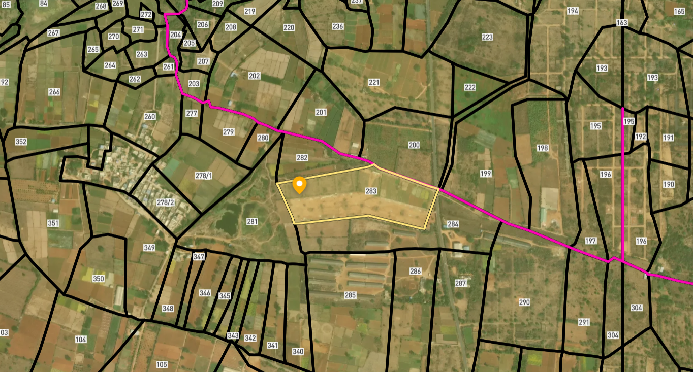
Survey Numbers View on Map Boundaries and numbers come from published state cadastral records. See all map layers.
Looking to sell your land in Goa?

Browse 92+ verified lands & plots in Goa
Frequently asked questions
What is Bhu Naksha in Goa?
How do I see my plot's plan?
Why do boundaries matter so much here?
What if the fence and plan disagree?
Does the plan show ownership or zoning?
Is access ever a map question?
Other Related Guides
Goa Land Records
Every Goa land record service in one place, with a guide for each.
Read guide →Form I & XIV in Goa: Record of Rights Complete 2026 Guide
Read, obtain, and verify Form I & XIV in Goa. Covers DSLR portal, Mamlatdar process, Section 105 presumption, tenant entries, mundkar warnings, and mutation.
Read guide →Mining Zone Check Goa: Mines & Geology Verification Guide 2026
The Mining Zone Check Goa confirms whether land sits in an active or legacy iron ore mining area. Former mining zones carry construction restrictions and health hazards.
Read guide →Property Tax Receipts Goa: Nil Dues Verification Guide 2026
Property Tax Receipts Goa prove the seller paid all dues. Pull 5 years minimum and a Nil Dues Certificate. Unpaid tax transfers with the property to the buyer.
Read guide →Water Bill Dues in Goa: Buyer's Guide 2026
Water Bill Dues in Goa stay with the meter. Verify nil water dues using the 8-digit Consumer ID, transfer the connection, avoid PWD disconnection.
Read guide →TCP Technical Clearance Goa: FAR Certificate Guide 2026
The TCP Technical Clearance Goa confirms FAR and height compliance under the T&CP Act 1974. Excess construction is illegal. Verify before buying any built property.
Read guide →