
The Survey Plan: Goa's Plot, Drawn and Certified
Somewhere in the DSLR's survey records is a drawing of your plot: the survey plan, the NAKSHA, with its subdivision's shape, dimensions and neighbours as the settlement survey fixed them. It is the document the boundary conversation keeps returning to, the exhibit measurement proceedings open with, and the page inventory files and sale packets are incomplete without, and obtaining the certified version is among the cheapest serious steps a Goa buyer or family can take.
What the survey plan is, and holds
Definition
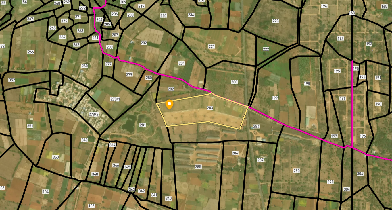
The survey plan is the DSLR's drawn record of a plot: the survey and subdivision number's shape, dimensions and adjoining numbers as fixed by the settlement survey and its updates, issued as a certified copy through the survey machinery and served online as BhuNaksha at bhunaksha.goa.gov.in. Note the naming: BhuNaksha is Goa's routine, statewide cadastral map service. NAKSHA, in capitals, is a separate national urban survey programme running in Goa only in Panaji, Margao and Cuncolim, and its data is not yet linked to Form I and XIV. For an ordinary purchase file it is BhuNaksha and the DSLR's certified plan you want.
Read the plan as the plot's identity card. The shape and dimensions are its face; the adjoining numbers its context; and the correspondence between plan, Form I & XIV and deed schedule is the three-way match every clean Goa file demonstrates. A plan that disagrees with its form, in area, in shape, in the subdivisions it shows, is not a nuisance but a finding, and the survey office is where findings go.
Goa's depth shows here too: plots with long histories may have been drawn more than once, across settlement operations and subdivision proceedings, and the earlier sheets remain part of the records. Old-title work, inventories dividing ancestral land, disputes about historic splits, regularly needs the earlier drawings beside the current one, and requesting them is a known exercise, not an eccentric one.
Practically, the certified plan belongs in every serious packet: the buyer's diligence file, the sale deed's annexures, the loan application, the inventory bundle, the dispute brief. It costs little, answers instantly, and its absence is the first thing a careful lawyer notices.
Obtaining the survey plan in Goa
Identify, apply, certify, file.
The method
Where the survey plan earns its place
Five files, one indispensable page.
| File | The plan's role | Without it |
|---|---|---|
| A purchase packet | The plot's certified geometry | Boundaries by description alone |
| A sale deed's annexures | The drawing the schedule references | Ambiguity inherited by the buyer |
| A loan application | The security, drawn | Queries and delay |
| An inventory bundle | The estate's plots, sheet by sheet | Divisions argued in prose |
| A boundary dispute | The exhibit measurement starts from | The fence's word against yours |
Common survey plan issues, and the fix
Plan work fails four ways.
The plan in every Goa file
Make it a habit with the force of a rule: no Goa transaction, loan, inventory or dispute proceeds without the certified plan in the file.
Survey Numbers View on Map Boundaries and numbers come from published state cadastral records. See all map layers.
Looking to sell your land in Goa?

Browse 92+ verified lands & plots in Goa
Frequently asked questions
What is the survey plan or NAKSHA?
How do I obtain it?
What do I check on receipt?
Why would I need older plans?
Does the plan settle boundary disputes?
Which files should include it?
Other Related Guides
Goa Land Records
Every Goa land record service in one place, with a guide for each.
Read guide →Form I & XIV in Goa: Record of Rights Complete 2026 Guide
Read, obtain, and verify Form I & XIV in Goa. Covers DSLR portal, Mamlatdar process, Section 105 presumption, tenant entries, mundkar warnings, and mutation.
Read guide →Mining Zone Check Goa: Mines & Geology Verification Guide 2026
The Mining Zone Check Goa confirms whether land sits in an active or legacy iron ore mining area. Former mining zones carry construction restrictions and health hazards.
Read guide →Property Tax Receipts Goa: Nil Dues Verification Guide 2026
Property Tax Receipts Goa prove the seller paid all dues. Pull 5 years minimum and a Nil Dues Certificate. Unpaid tax transfers with the property to the buyer.
Read guide →Water Bill Dues in Goa: Buyer's Guide 2026
Water Bill Dues in Goa stay with the meter. Verify nil water dues using the 8-digit Consumer ID, transfer the connection, avoid PWD disconnection.
Read guide →TCP Technical Clearance Goa: FAR Certificate Guide 2026
The TCP Technical Clearance Goa confirms FAR and height compliance under the T&CP Act 1974. Excess construction is illegal. Verify before buying any built property.
Read guide →