
The Dishaank App: Which Survey Number Am I On?
The survey department built the tool every land buyer in India wanted: point your phone at your feet and learn the survey number you are standing on. Dishaank overlays Karnataka's cadastral fabric on live GPS, so the gap between the parcel described and the parcel shown closes in one glance, in the field, for free.
What Dishaank does on the ground
Definition
Dishaank is the Karnataka survey establishment's mobile app that reads the phone's GPS position and displays the survey number and parcel polygon at that location, with the surrounding cadastral fabric. It is a field-verification tool: the bridge between the record's numbers and the soil underfoot.
Its target is the oldest deception in land: walk a buyer over a handsome parcel, sell them the scrub two fields away. When the phone names the survey number underfoot, the description, the record and the ground can be cross-examined together, on the spot, in front of everyone.
Read it the way surveyors read consumer GPS: trustworthy in the middle, indicative at the edges. Metres of drift are normal, worse under canopy and beside structures, so a reading taken mid-parcel is solid while a reading straddling a boundary line is a question for better instruments.
It slots into a stack. Bhu Naksha framed the parcel at your desk; Dishaank confirms it under your feet; Mojini orders the formal sketch when something needs settling; a licensed surveyor plants the stones when money will sit on the line.
Using Dishaank on a site visit
Two minutes in the field, planned slightly in advance.
Field method
What a Dishaank reading settles
Use it inside its competence and it never misleads.
| Question | Dishaank's answer | Escalate to |
|---|---|---|
| Am I on the described parcel? | Yes, at parcel centre | RTC match completes it |
| Is this the parcel from the map? | Yes, closes desk-to-field gap | Bhu Naksha screenshot |
| Where exactly is the boundary? | Indicative only | Mojini sketch, demarcation |
| Is the neighbour encroaching? | Suggestive at best | Licensed survey |
| Does extent match the claim? | No | Measurement survey |
Common Dishaank issues, and the fix
Field readings go sideways in four ways.
Why every Karnataka site visit ends with Dishaank
The app compresses the most expensive verification in land buying into a free glance.
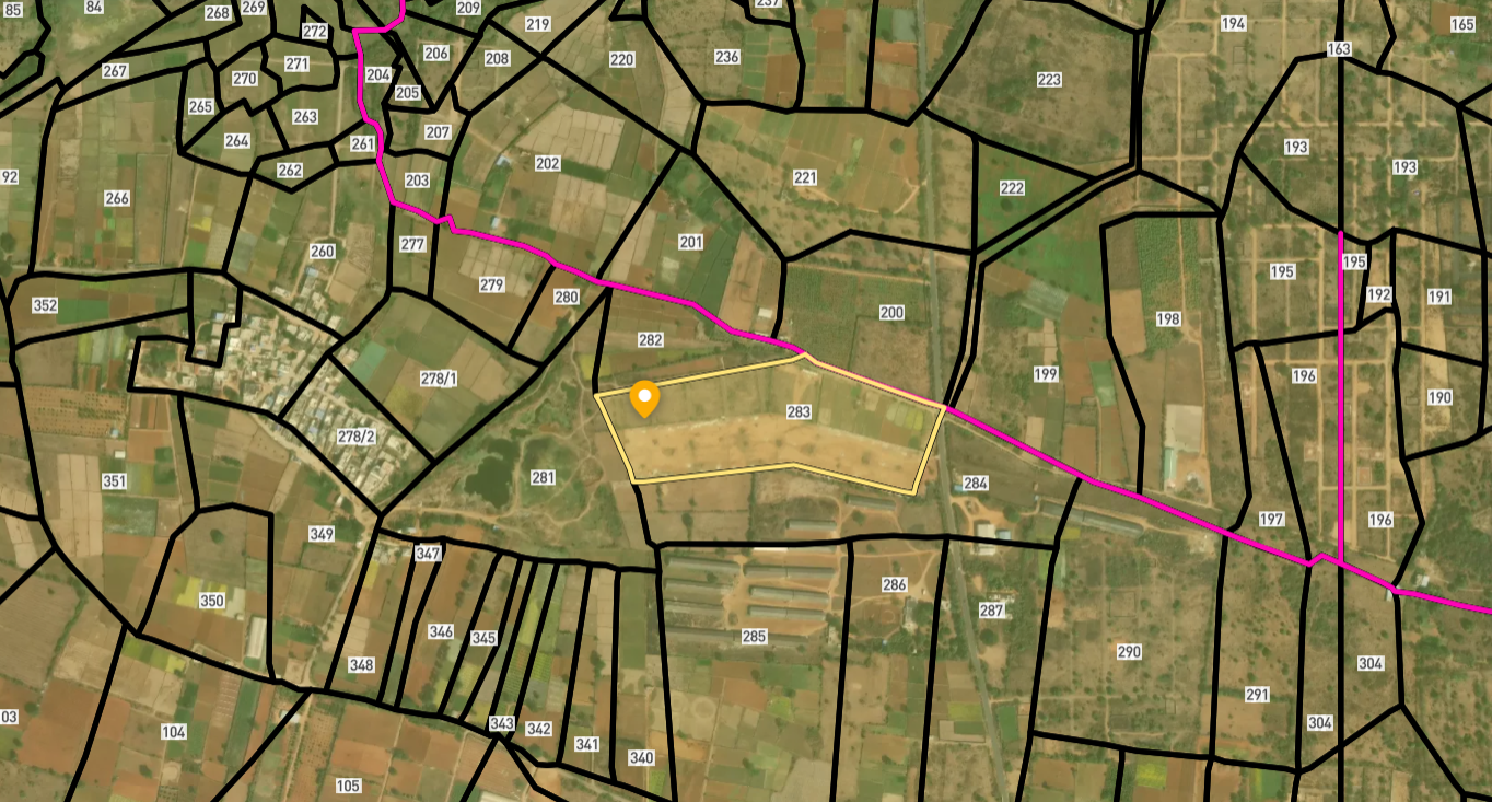
Survey Numbers View on Map Boundaries and numbers come from published state cadastral records. See all map layers.
Looking to sell your land in Karnataka?

Browse 1,300+ verified lands & plots in Karnataka
Frequently asked questions
What is the Dishaank app?
How accurate is Dishaank?
Can Dishaank prove a boundary?
What if the reading contradicts the seller?
Does it work without mobile signal?
How does it fit with Bhu Naksha and Mojini?
Other Related Guides
Bhoomi
Every Karnataka land record service in one place, with a guide for each.
Read guide →Akarband Karnataka: Village Boundary Record Guide 2026
Akarband Karnataka guide: check survey completeness, read kharab land entries, download from Bhoomi, and verify land classification before you buy agricultural land.
Read guide →Encumbrance Certificate Karnataka: Kaveri EC Guide 2026
Encumbrance Certificate Karnataka guide: apply on Kaveri portal, read Form 15 vs Form 16, cover 30 years, and catch what a Nil EC misses before you buy.
Read guide →RTC Pahani Karnataka: Complete Guide 2026
RTC Pahani Karnataka is the primary land ownership record. Learn what it contains, how to download it from Bhoomi, key columns to check, and risks every buyer must avoid.
Read guide →BBMP Property Tax Receipt Bangalore: Complete Guide 2026
BBMP property tax receipt proves all dues are cleared on a Bangalore property. Unpaid arrears block Khata transfer. Verify online before you buy full guide here.
Read guide →Mutation Extract Karnataka: Complete Guide 2026
Mutation Extract Karnataka records every ownership change on a land parcel. Learn what it contains, how to get it on Bhoomi, and why 30-day follow-up is critical.
Read guide →