Pithampur Development Plan 2035: DMIC Zone Check and Land Use Guide
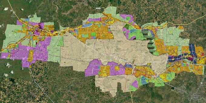
Pithampur Masterplan Preview
Try the Pithampur Development Plan 2035 on the map
Sign in once and explore the layer for a full day.
- No card details needed
- Find nearby verified lands for sale
Overview
The Pithampur masterplan 2035 land zone map is governed by the Pithampur Development Plan 2035, notified by the Directorate of Town & Country Planning (DTCP) under the MP Town & Country Planning Act 1973, Section 19(2). The plan covers approximately 40,000 hectares across 65 villages spanning Dhar and Indore districts, with 31 villages partially included and 34 fully within the planning boundary. A High Court stay on selected petitions means certain khasra numbers carry a status quo restriction. This page tells you exactly how to check whether your target plot is one of them, and how to cross-reference it against the Indore-Pithampur Economic Corridor's active land pooling.
Pithampur Development Plan 2035: the zone trap that catches buyers off guard
The single biggest risk in Pithampur is not fraud, it is misrepresentation of zone classification. The DTCP plan designates land across residential, general residential, industrial, agricultural, and green belt categories. Brokers routinely market agricultural khasras as "residential investment" plots simply because they lie adjacent to a residential zone boundary on the map.
The regulatory complexity runs deeper here than in most Central Indian towns. The Pithampur masterplan 2035 land zone operates alongside a second, parallel land regime: the Pithampur Investment Region (12,450 hectares under the MP Investment Region Development and Management Act 2013) administered by MPIDC, not DTCP. A plot can fall inside both the Development Plan area and the Investment Region scheme area simultaneously, with different development rules applying depending on which authority controls the khasra.
Zone Type
Permitted Use
Development Without Conversion
Key Risk
Residential
Housing, low-rise mixed use
Permitted with building permission from DTCP
Verify zone code in the notified plan map, not broker's sketch
General Residential
Housing with slightly relaxed FAR
Permitted
Often confused with core Residential zone, they carry different FAR limits
Industrial
Manufacturing, warehousing
Permitted within MPIDC scheme rules
Land adjacent to Sector 1, 2, 3 may be buffered, check DTCP map
Agricultural
Farming only
No, requires CLU (Change of Land Use) order from DTCP
Most commonly misrepresented category near residential growth edges
Green Belt
No construction
No, cannot be converted
Plots in Betma Reserve Forest or Vindhya Reserve Forest edge fall here
Additionally, the High Court of Madhya Pradesh allowed the masterplan notification to proceed with status quo orders on selected petitions. Khasras in those petitions cannot be registered or developed until the court resolves them. Any broker who cannot produce the gazette notification reference and confirm that your specific khasra number is not listed in the stay proceedings should not get your deposit.
Indore-Pithampur Economic Corridor: where the real growth money is positioned
The investable corridor in Pithampur is not Pithampur town itself, it is the 19.60 km Indore-Pithampur Economic Corridor, a ₹2,400 crore MPIDC project spanning 1,331 hectares across 17 villages. MPIDC issued the draft notification in February 2025, with consent collection and claims/objections across 17 villages. Construction was scheduled to begin within six months of notification, with farmers receiving 60% of developed plotting area as compensation. That is not a speculation story, it is an active government land pooling with published khasra numbers and a notified scheme.
The corridor land use breakdown gives a clear picture of where value is forming and where it is speculative.
Area Type
Share of Net Planning Area
Corridors / Localities
Commercial plots
26.12%
Sindora, Nanod, Bhainslay, frontage along 75m corridor road
Mixed use plots
15.66%
Rinjlai, Bislavada, Navda Panth
Roads and circulation
30.66%
Full 75m right-of-way plus 300m development influence strip
Industrial / green industry
4.87%
3–5 km industrial zone strips on corridor flanks
Residential
3.24%
Primarily group housing near Teehi station and Dhad village
Catalyst projects (Aero City, Fintech, Affordable Housing)
8.58%
Near Rau toll and airport proximity zone
The most misunderstood corridor is the Rau-Pithampur Road. Prices along this stretch have been quoted at 70–80% below Super Corridor rates, which is accurate, but only for plots with a confirmed residential or mixed-use zone designation. Agricultural khasras along the same road cannot be built on without a CLU approval, which can take 18–24 months and is not guaranteed. Buy the zone classification first, the location second.
Was this layer helpful?
Anything wrong, outdated, or missing we want to hear it.
For Land Owners & Agents
Looking to sell your land in Madhya Pradesh?
I want to sell my land in Madhya Pradesh
10:32
Plz share your Land's location - We will list it on 1acre map, for Free.
10:32

For Land Buyers
Browse all verified lands & plots in Madhya Pradesh
Every listing goes through our Preliminary Verification Process.
More Layers in Madhya Pradesh
See all 5 layers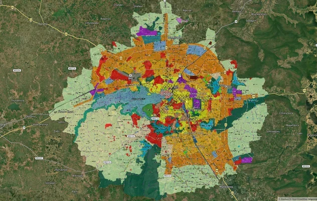
Bhopal Masterplan 2031: BDA Zone Check and Land Use Guide
View Bhopal Masterplan as a live map overlay – check any plot's land use zone for free on 1acre.in. Bhopal masterplan 20...
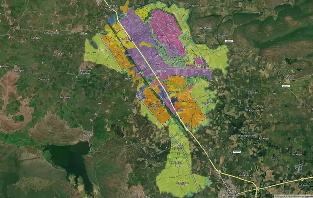
Mandideep Masterplan 2031: Zone Check and Land Use Guide
View Mandideep Masterplan as a live map overlay – check any plot's land use zone for free on 1acre.in. Mandideep Master ...
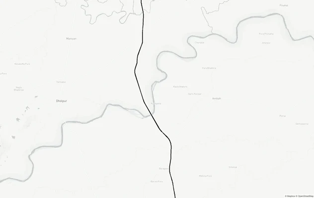
Agra - Gwalior Expressway
View Agra - Gwalior Expressway alignment as a live map overlay – check land acquisition risk and plot proximity free on ...
More Layers in Madhya Pradesh
Bhopal Masterplan 2031: BDA Zone Check and Land Use Guide
View Bhopal Masterplan as a live map overlay – check any plot's land use zone for free on 1acre.in. Bhopal masterplan 20...
Mandideep Masterplan 2031: Zone Check and Land Use Guide
View Mandideep Masterplan as a live map overlay – check any plot's land use zone for free on 1acre.in. Mandideep Master ...
Agra - Gwalior Expressway
View Agra - Gwalior Expressway alignment as a live map overlay – check land acquisition risk and plot proximity free on ...