
The FMB and Village Map: AP's Measured Truth
Long before portals, survey parties walked Andhra Pradesh's fields with chains and recorded what they measured. The Field Measurement Book is that record's descendant, a dimensioned drawing for every survey number, and it remains the geometry that courts, surveyors and subdivision decisions defer to. Meebhoomi now serves it in seconds.
Why the FMB outranks every other map
Definition
The Field Measurement Book holds the surveyed drawing of each Andhra Pradesh survey number: dimensioned sides, reference points and adjacencies as physically measured. Digital viewers render approximations of it; the FMB itself is what they approximate, which is why it governs whenever layers disagree.
Read the sketch as a surveyor would. The side dimensions let you compute the frontage a seller claims; the adjacency labels tell you which survey numbers share each boundary; the reference marks are what a demarcation team will hunt for when re-staking the lines.
Subdivision is where the FMB becomes decisive. A parent survey splits only when the survey establishment draws the child sketches, so a plot's independent legal geometry exists exactly when its subdivision FMB does. Ventures selling ahead of that drawing are selling intention, not parcels.
The village map wraps context around the sketch: the road network the parcel feeds from, channels and tanks nearby, the pattern of surrounding surveys. Together the pair answers shape, access and neighbourhood in one sitting.
Pulling the FMB and village map on Meebhoomi
The survey number, with its subdivision, is all you need.
Portal method
Beyond the portal
Questions the FMB answers before you pay
Interrogate the sketch with these, in order.
| Question | Where the sketch answers | Deal consequence |
|---|---|---|
| Is the claimed frontage real? | Dimensioned road-facing side | Frontage inflation is common |
| Does extent match the record? | Computed area vs 1B extent | Gaps need survey clarification |
| Who borders each side? | Adjacency survey numbers | Prepares encroachment questions |
| Does my plot legally exist? | Presence of subdivision sketch | No child FMB, no independent plot |
| Can lines be re-staked? | Reference points on the sketch | Demarcation feasibility |
Common FMB issues, and the fix
FMB work surfaces four recurring situations.
Where the FMB earns its place in the file
Frontage-priced parcels, layout plots, any land you will fence or build to the edge of: these are FMB purchases, and the sketch belongs in the file before the token advance, with a demarcation survey before the balance.
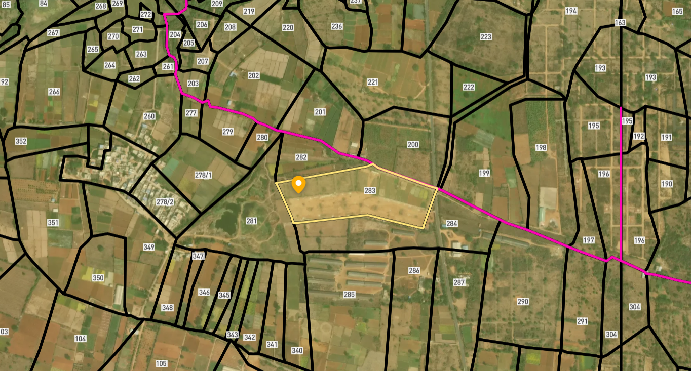
Survey Numbers View on Map Boundaries and numbers come from published state cadastral records. See all map layers.
Looking to sell your land in Andhra Pradesh?

Browse 1,300+ verified lands & plots in Andhra Pradesh
Frequently asked questions
What exactly is the FMB?
FMB or Bhu Naksha, which governs?
How do I check a layout plot's legality?
The online sketch is missing. What now?
Sketch area and record extent differ?
Who can mark my boundaries physically?
Other Related Guides
Meebhoomi
Every AP land record service in one place, with a guide for each.
Read guide →Pahani ROR 1B Andhra Pradesh: Complete Guide 2026
Check Pahani ROR 1B Andhra Pradesh free on Meebhoomi. Learn what it contains, why it must match the Pattadar Passbook, and how to fix errors before buying land.
Read guide →Adangal Andhra Pradesh Land Records: 2026 Guide
Check Adangal Andhra Pradesh free on Meebhoomi. Learn what wet, dry and waste classification means, how it affects your purchase, and how to spot land use problems.
Read guide →Pattadar Passbook Andhra Pradesh: Complete Guide 2026
What Pattadar Passbook Andhra Pradesh contains, why banks need it for agri loans, how to download it on Meebhoomi, and why transfer after purchase is mandatory.
Read guide →Deed Mother Deed Andhra Pradesh: 2026 Guide
Understand Title Deed and Mother Deed in Andhra Pradesh, how to verify the 30-year chain on IGRS AP, and why a missing link costs you the deal.
Read guide →Mutation Andhra Pradesh Land Records: Complete Guide 2026
How mutation Andhra Pradesh land records works, why buyers must verify within 90 days, how auto mutation updates 1B, and what to do when mutation is pending or rejected.
Read guide →