
CRZ Rules in India: How Far From the Coast You Can Build
Understand CRZ rules in India, how far from the coast you can build, and which zone your coastal plot falls under.
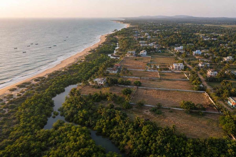
- CRZ rules control construction near the coastline and decide whether a plot is buildable at all.
- The 2019 notification cut the No Development Zone in dense rural coast from 200 metres to 50 metres, but only once the Coastal Zone Management Plan (CZMP) applicable to your location is approved under it. Until then, 200 metres continues.
- Every coastal project needs prior clearance, and courts have demolished completed buildings that lacked it.
What the CRZ Is and Why It Exists
The Coastal Regulation Zone is the legal boundary within which activity along India's coastline is controlled. It is notified under the Environment (Protection) Act, 1986, with the Ministry of Environment, Forest and Climate Change as nodal authority and enforcement by Coastal Zone Management Authorities.
The Coastal Regulation Zone, or CRZ, is a regulatory framework established under the Environment Protection Act, 1986, to govern land use and construction activity along India's coastline.
It exists to protect fragile coastal ecosystems, including mangroves, wetlands, and dunes, while balancing the livelihood needs of fishing communities and coastal development. CRZ notifications classify coastal land into distinct zones, each carrying specific restrictions on construction, industry, and land conversion near the high tide line.
The Four CRZ Zones: What Each One Allows
CRZ-I: Ecologically Sensitive Areas
CRZ-IA covers mangroves and coral reefs. CRZ-IB covers the intertidal strip between the tide lines. New construction is essentially off the table, with narrow exceptions for defence, atomic energy and major public infrastructure.
CRZ-II: Urban Coastal Areas
Already-developed municipal coastline. Construction is allowed only on the landward side of existing roads or authorised structures, never toward the sea, and must follow local FSI and FAR.
CRZ-III: Rural Areas
Split by population density on Census 2011 data. CRZ-IIIA is dense rural coast, above 2,161 people per sq km, with a 50 metre NDZ once the CZMP is approved, and 200 metres until then. CRZ-IIIB is sparse coast, at 200 metres.
The reduced No Development Zone applies only after the relevant state's Coastal Zone Management Plan (CZMP) is approved under the latest CRZ Notification. Until then, the earlier setback requirements continue.
CRZ-IV: The Water Zone
CRZ-IVA covers open sea from the low tide line to 12 nautical miles. CRZ-IVB covers tidal-influenced inland waters. Traditional fishing is protected and untreated discharge banned.
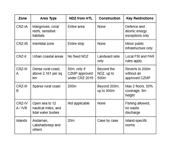
CRZ Zone Classification at a Glance
The table sets each zone against its setback and permissions.
What Changed in the 2019 Notification
The CRZ Notification, 2019 removed the long-standing freeze on Floor Space Index (FSI) in eligible coastal areas, allowing development to follow applicable local planning regulations subject to CRZ conditions.
It also decentralized many project clearances by expanding the role of state coastal zone management authorities, while the central ministry continues to appraise specified categories of projects under the notification.
Many of the notification's key relaxations, including reduced No Development Zones in eligible rural areas and revised development norms, take effect only after a state's Coastal Zone Management Plan (CZMP) prepared under the 2019 framework receives formal approval.
What's Permanently Off-Limits
Whatever zone your land sits in, some activities stay banned: new industries, hazardous storage, sand and coral mining, land reclamation, and bunding within the regulated distance.
Groundwater extraction is prohibited within 200 metres of the HTL except for community use. Between 200 and 500 metres, only manual extraction from ordinary wells, and only where no alternative exists.
Getting CRZ Clearance
CRZ clearance is mandatory before any construction begins within the regulated zone, with jurisdiction split by category. CRZ-I and CRZ-IV applications go to the central Ministry, while CRZ-II and CRZ-III, covering most residential and commercial construction, are handled by the State Coastal Zone Management Authority.
Self-dwelling units up to 300 square metres qualify for a simpler approval path through the local authority, bypassing a separate state-level recommendation.
How 1acre.in Helps
1acre.in helps buyers compare verified survey numbers with official coastal planning information before purchasing land near the shoreline.
A verified survey number and map overlay are the first step, not the answer. They do not tell you whether the Coastal Zone Management Plan (CZMP) applicable to your location is approved under CRZ 2019; they are not the 1:4000 site map a clearance needs, and they do not replace a certified extract from your State Coastal Zone Management Authority (CZMA).
Before You Build Near the Coast
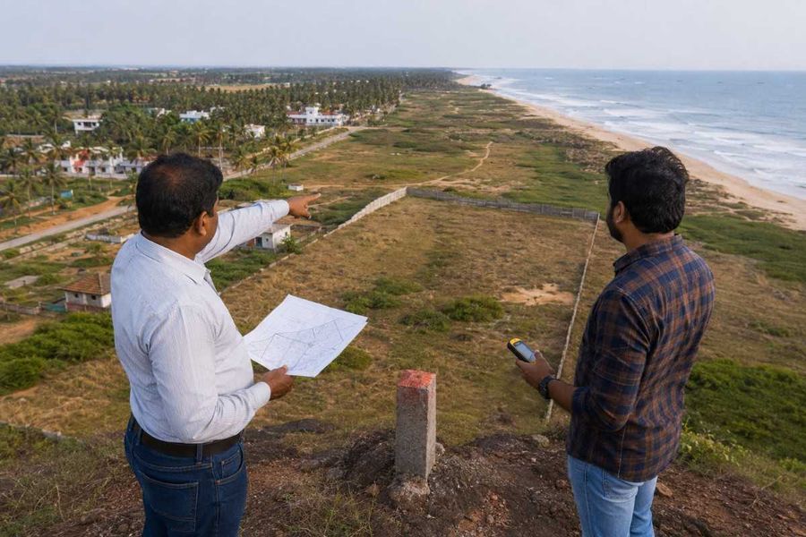
Before building near the coast, confirm which CRZ regime applies to the specific survey number, since the reduced 50-metre setback only takes effect once the relevant state's Coastal Zone Management Plan is formally approved under CRZ 2019.
Measure distance from the officially demarcated high tide line rather than the visible waterline and identify which authority, central or state, governs clearance for that zone.
A certified CZMP extract for the exact survey number, paired with advice from a property lawyer experienced in coastal regulations, remains essential before any purchase or construction decision.
Conclusion
CRZ rules determine whether coastal land can be developed and what approvals are required before construction begins. Always verify the applicable CRZ category, approved CZMP, and High Tide Line for your survey number before purchasing or building. Taking these steps early helps avoid costly legal disputes, environmental violations, and the risk of demolition.


-900x600.jpg)
-900x600.jpg)
-900x600.jpg)
-900x600.jpg)