
The Lucknow Kanpur Expressway, officially National Expressway 6 and known as the Awadh Expressway, opened on 13 July 2026. The 63 kilometre corridor cuts travel between the two cities to around 35 to 45 minutes. For land buyers, the useful question is not whether prices have moved but whether a specific plot sits inside the Right of Way, near an access node, or neither.
- Officially NE-6, also called the Awadh Expressway, opened July 2026
- Runs 63 km from Shaheed Path in Lucknow to Azad Chauraha near Kanpur
- Travel time down from roughly 2.5 to 3 hours to about 35 to 45 minutes
- Passes 42 villages across Lucknow and Unnao, with over 400 hectares acquired
- Right of Way runs 35 metres on brownfield and 90 metres on greenfield sections
- The Defence Industrial Corridor is the larger demand driver, not the road alone
What Is the Lucknow Kanpur Expressway?
A six lane, access-controlled highway connecting two of Uttar Pradesh's largest cities, designated National Expressway 6 by the Ministry of Road Transport and Highways and renamed the Awadh Expressway in July 2022.
It was developed by NHAI at an estimated ₹4,700 crore, built by PNC Infratech under the Hybrid Annuity Model. The existing route, primarily NH-27, was congested and slow, often close to three hours for roughly 90 kilometres.
The expressway does not replace NH-27. It runs parallel as a faster controlled-access alternative, so both remain usable depending on where a journey starts and ends.
Lucknow Kanpur Expressway Route Map
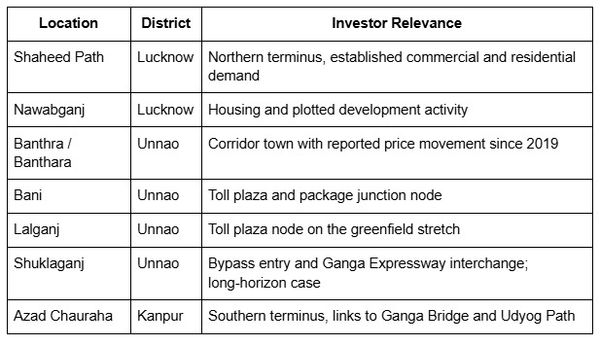
The corridor begins at its junction with NH-27 near Shaheed Path in south Lucknow and terminates at NH-27 near Azad Chauraha in Kanpur, close to the Ganga Bridge, connecting to Udyog Path. It passes Bani, Kantha and Amarsas along the way.
It is built in two packages. Package 1 covers roughly 17.5 kilometres through built-up Lucknow, largely elevated, following the NH-27 alignment. Package 2 runs the greenfield stretch through Unnao district on newly acquired land. That split let the project avoid heavy demolition in urban Lucknow while keeping the alignment direct.
The corridor also intersects the Ganga Expressway, National Expressway 7, in Unnao district near Shuklaganj via a dedicated interchange, linking into the Meerut to Prayagraj alignment. That junction matters more for long-term land demand around Shuklaganj than the bypass entry alone.
Entry and Exit Points
Access is limited to five designated locations across Lucknow, Unnao and Kanpur, at Miranpur Pinwat, Khandedev, Bani, Lalganj in Unnao, and the Shuklaganj bypass entry. Controlled access is deliberate: it keeps flow efficient and prevents the unregulated entry that degrades older highways. It also means proximity to the road itself is worth little without proximity to a node.
Current Status and Opening Timeline
The Detailed Project Report was finalised in November 2018, with the foundation stone laid in March 2019 and again in January 2022. NE-6 designation came through the Gazette of India in December 2020. PNC Infratech was selected in February 2022.
Construction targeted completion by 30 November 2025. That slipped, largely on an unfinished stretch near the Scooters India crossing in Lucknow. The expressway was inaugurated on 13 July 2026.
Travel time has fallen from roughly 2.5 to 3 hours to about 35 to 45 minutes, with design speed at 120 km/h on the greenfield section and 100 km/h on the brownfield stretch.
Villages and Districts Along the Corridor
The corridor crosses 42 villages across Lucknow and Unnao, with more than 400 hectares acquired, covering Banthara, Bani, Datauli Kantha, Taura, Neorna, Amarsas and Rawal.
Unnao carries the larger share, with around 31 villages affected against 11 in Lucknow, which is why Unnao features in logistics and warehousing discussion: it sits along the greenfield stretch with access to larger parcels.
Proximity alone is not the picture. A plot in an acquisition-corridor village is a different proposition from a plot merely located near Unnao, and only certain villages carry access-point advantage.
What It Means for Land Prices
Reported land values in corridor towns including Banthra, Unnao and Shuklaganj have roughly doubled since 2019, according to real estate market commentary. Treat that as reported market movement rather than verified transaction data, and note that sources publishing corridor price growth frequently sell in the corridor.
The larger driver is policy rather than pavement. The UP Defence Industrial Corridor has active nodes at Kanpur and Lucknow, and UPDIC allocations are the most material lever for industrial land demand in this region over the coming decade. Commercial development around new expressways typically follows industry, not the ribbon-cutting.
Land within roughly two kilometres of a toll plaza on comparable corridors such as the Yamuna and Purvanchal expressways has historically attracted petrol pumps, warehousing and hospitality first. That pattern is a reasonable guide to where demand appears earliest, not a guarantee it will repeat here.
Key Risks and Verification Steps for Land Buyers
Right of Way. The RoW runs 35 metres on the brownfield section and 90 metres on the greenfield stretch. A plot inside that buffer has no legal standing for development. If a seller cannot produce a title document showing the survey number sits outside the NHAI acquisition boundary, stop there.
Compensated land back on the market. Around ₹800 crore in compensation was distributed across corridor villages, and some of that land has re-entered the informal market. Verify the ownership chain back at least two transfers.
Land use classification. Most land along the greenfield stretch is agricultural. Under Section 80 of the UP Zamindari Abolition and Land Reforms Act, conversion is required before non-agricultural use. Ask for the conversion order, not an assurance that it is coming.
Record verification. Pull the khatauni, the record of rights listing the holder and plot details, from upbhulekh.gov.in, and the plot map from Bhu-Naksha, using the khasra number that identifies the individual plot. Match both against the sale documents.
Generic corridor marketing. "Near expressway" covers everything from an access-node parcel to farmland twenty kilometres away with no route to it. Ask which node, how far, and by which road.
Checking a Plot Against the Corridor
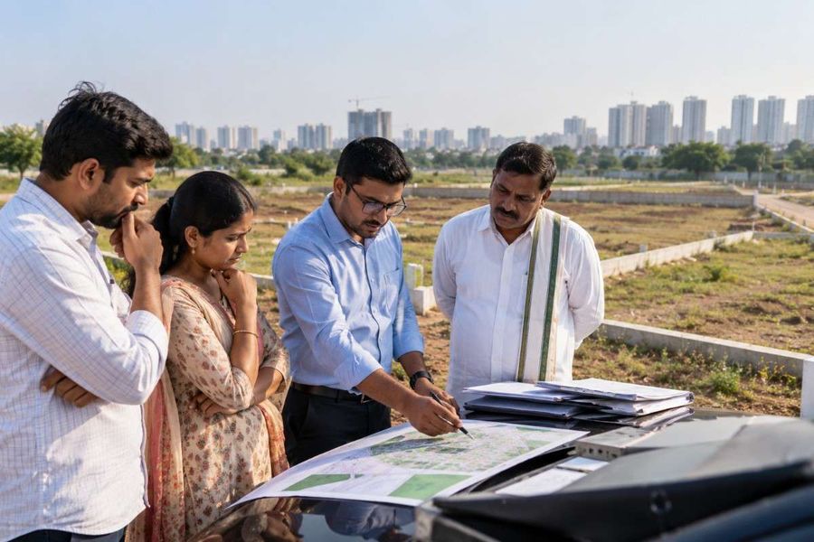
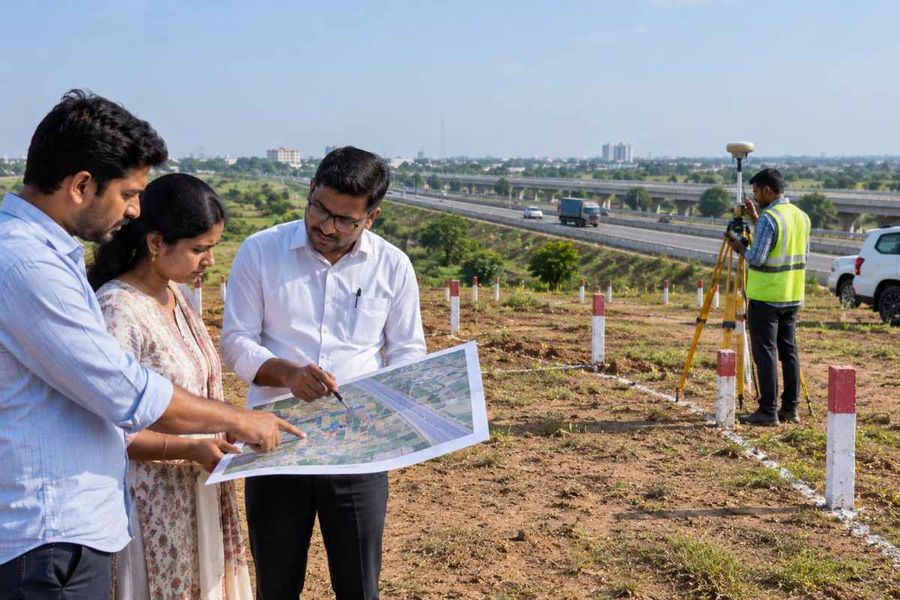
Everything above resolves to a boundary question that a buyer can settle before paying anything: where does this survey number sit relative to the Right of Way and the access nodes.
1acre maintains a Lucknow-Kanpur Expressway layer mapping the alignment, toll plaza locations and Defence Corridor linkage, so a specific parcel can be positioned against the corridor rather than described in relation to it.
The honest limits. A map layer shows alignment and nodes. It does not show title, land use classification or whether a past compensation payment sits in the ownership chain. Those come from the khatauni, the Bhu-Naksha and the Sub-Registrar record, and for anything binding those remain the documents that count.
What to Do Next
Confirm the survey number sits outside the NHAI Right of Way before any payment
Pull the khatauni on upbhulekh.gov.in and the plot map on Bhu-Naksha
Trace the ownership chain back at least two transfers on compensated-village land
Ask for the Section 80 conversion order if you intend to build
Measure real distance to an access node, not to the district
Track UPDIC allocations at the Kanpur and Lucknow nodes, since industry drives demand more than the road