Lucknow - Kanpur Expressway
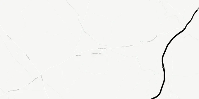
Lucknow Kanpur Expressway Preview
Try the Lucknow - Kanpur Expressway on the map
Sign in once and explore the layer for a full day.
- No card details needed
- Find nearby verified lands for sale
Overview
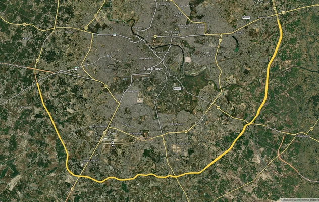
The Lucknow Kanpur Expressway, officially designated National Expressway 6 (NE-6) and also called the Awadh Expressway, is a 63-kilometre, six-lane access-controlled road connecting Shaheed Path in Lucknow to Azad Chauraha near Kanpur's Ganga Bridge. Notified in the Gazette of India in December 2020 and built by NHAI (National Highways Authority of India) at a project cost of approximately Rs 4,700 crore, the corridor cuts through 42 villages across Lucknow and Unnao districts. This page maps the expressway's alignment on 1acre's GIS layer, identifies the active growth pockets along the Lucknow Kanpur Expressway land corridor, and flags the on-ground risks buyers are encountering right now.
Red Flags Buyers Are Ignoring Along the NE-6 Corridor
The Unnao to Banthra stretch is complete. The 18-kilometre elevated section in Lucknow was still under construction through early 2026, with Construction was reported complete as of late 2025, with final safety audits and toll system commissioning pending as of early 2026. That timing gap is where the risk sits: brokers are pricing land near the Lucknow Kanpur Expressway land corridor as though inauguration has already happened, while key infrastructure, including toll plazas, interchanges, and service roads, remains unfinished.
Three categories of land near expressway Kanpur deserve immediate scrutiny before any transaction.
Risk Category
What to Check
Why It Matters
Acquired land resale
Verify the khasra is not listed in NHAI's 42-village acquisition schedule
Farmers compensated by NHAI have sold some parcels twice
ROW buffer plots
Confirm the plot boundary sits outside the 35-90 m Right of Way
Plots within ROW cannot be registered; buyers lose money
Access-road dependency
Ask for the approved layout plan from LDA (Lucknow Development Authority) or KDA
Plots without a sanctioned approach road have no legal entry point
Forest land overlap
Cross-check with forest clearance records
NE-6 required clearance for 34 hectares of forest land; adjacency matters
Defence Corridor adjacency
Check UPDIC (UP Defence Industrial Corridor) node notifications for Lucknow and Kanpur
Development restrictions apply near designated defence manufacturing zones
The Right of Way on this corridor ranges from 35 metres on the brownfield section to 90 metres on the greenfield stretch. Any plot within that buffer has no legal standing for development. If the broker cannot produce a title document showing the survey number is outside the NHAI acquisition boundary, do not sign anything. The project passes through villages in both Lucknow and Unnao districts where Rs 800 crore in compensation was distributed to farmers. Some of that compensated land has re-entered the informal market. Verify ownership chain back at least two transfers before proceeding.
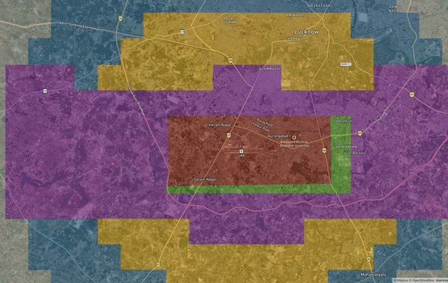
Growth Corridors Along the Lucknow Kanpur Expressway
The Awadh Expressway intersects with two other major infrastructure projects: the Ganga Expressway in Unnao district and the Kanpur Ring Road at Udyog Path. That tri-junction near Kanpur and Unnao is where the most credible long-term appreciation case exists. Banthra, Unnao, and Shuklaganj have seen land values roughly double since 2019 according to market reports, though that movement also reflects speculative pricing that arrived before the road opened.
The Shaheed Path land Lucknow end of the expressway is a different market entirely: already urbanised, with residential and commercial land largely absorbed. Amausi recorded around 8% year-on-year residential land price growth and Banthara around 6%, per 99acres data. These are confirmed pockets with road visibility; the fringe agricultural land between them and the expressway edge is where buyers are overpaying.
Corridor
Zone Type
Key Driver
Watch-Out
Banthra to Unnao (Greenfield)
Peri-urban / Industrial
Ganga Expressway trijunction
Compensated land re-entering market
Shaheed Path belt, Lucknow
Urbanised
Existing commercial pull
Already priced; limited upside land
Nawabganj, Unnao
Affordable residential
Mid-corridor access, NH-27 proximity
No sanctioned layouts yet at many parcels
Shuklaganj, Kanpur end
Logistics / Industrial
Kanpur Ring Road connection
Expressway entry ramp not yet confirmed for all nodes
Amausi elevated section
Mixed-use
Airport proximity
Elevated ROW creates no-build shadow land on either side
The Shuklaganj land investment case is real but requires patience: the expressway ramp near the Shuklaganj bypass is built, but commercial demand follows industry, and the Defence Corridor Kanpur Lucknow land node will determine how fast that translates to prices. UPDIC's Kanpur and Lucknow nodes are part of the UP Defence Industrial Corridor, which is the single most material policy lever for industrial land demand in this region over the next decade. For buyers looking at agricultural land along the greenfield stretch, the 5 toll plaza locations, Miranpur Pinwat, Khandedev, Bani, Lalganj in Unnao, and the Shuklaganj bypass entry, are the nodes that will see the first commercial demand. Land within 2 km of a toll plaza on a comparable corridor (Yamuna Expressway, Purvanchal Expressway) has historically attracted petrol pumps, warehousing, and hospitality first.
Was this layer helpful?
Anything wrong, outdated, or missing we want to hear it.
For Land Owners & Agents
Looking to sell your land in Uttar Pradesh?
I want to sell my land in Uttar Pradesh
10:32
Plz share your Land's location - We will list it on 1acre map, for Free.
10:32

For Land Buyers
Browse all verified lands & plots in Uttar Pradesh
Every listing goes through our Preliminary Verification Process.
More Layers in Uttar Pradesh
See all 32 layers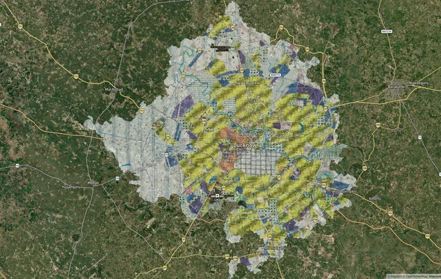
Lucknow Masterplan
View Lucknow Masterplan as a live map overlay – check any plot's land use zone for free on 1acre.in. Lucknow masterplan ...
Lucknow Outer Ring Road
View the Lucknow Outer Ring Road corridor on a live map overlay – check zoning, approvals and acquisition risk free on 1...
Lucknow Air Funnel Zones
View Lucknow Air Funnel Zones on a live map – check height clearance restrictions on any plot for free on 1acre.in. Luck...
More Layers in Uttar Pradesh
Lucknow Masterplan
View Lucknow Masterplan as a live map overlay – check any plot's land use zone for free on 1acre.in. Lucknow masterplan ...
Lucknow Outer Ring Road
View the Lucknow Outer Ring Road corridor on a live map overlay – check zoning, approvals and acquisition risk free on 1...
Lucknow Air Funnel Zones
View Lucknow Air Funnel Zones on a live map – check height clearance restrictions on any plot for free on 1acre.in. Luck...