Diu CRZ
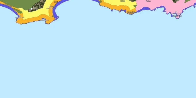
Diu Crz Preview
Try the Diu CRZ on the map
Sign in once and explore the layer for a full day.
- No card details needed
- Find nearby verified lands for sale
Overview
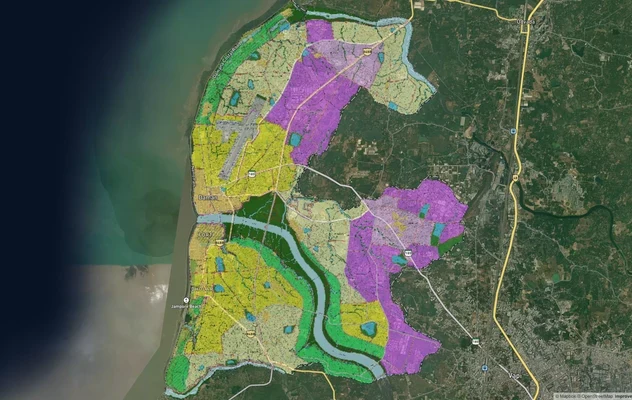
The Diu CRZ layer plots the Coastal Regulation Zone footprint across the 40 sq km island of Diu, governed by CRZ Notification 2019 (G.S.R. 37(E)) and the Coastal Zone Management Plan prepared by NCSCM (National Centre for Sustainable Coastal Management) for the U.T. of Dadra and Nagar Haveli and Daman and Diu. As of early 2025, the Daman & Diu CZMP under CRZ Notification 2019 had not received confirmed MoEFCC approval. Buyers should verify whether CRZ 2011 or CRZ 2019 provisions are operative for their specific survey number with the Diu Collector / Daman & Diu Coastal Zone Management Authority. The Collector, Diu is the designated monitoring and enforcing authority. This page shows what falls inside CRZ-I, CRZ-II, CRZ-III, and CRZ-IV across Diu town, Nagoa, Ghoghla, Vanakbara, Bucharwada, and the surrounding coastline.
Regulatory Red Flags Inside the 60 Metre Setback
Diu does not follow the standard CRZ-III rule book. Under the Diu-specific CZMP, the 60 metre setback Diu rule fixes construction distance at 60 metres from the High Tide Line or the width of the sandy beach, whichever is more, in CRZ-III stretches. That is a Diu-only relaxation; mainland CRZ-III B forces 200 metres. CRZ-1991 had once classified parts of Diu as CRZ-IV. CRZ Notification 2011 dropped that, and the 2019 plan reclassified the island stretches.
The fact-pack on what each zone permits on Diu, drawn from CRZ Notification 2019 and the Daman & Diu CZMP cover order.
Zone Code
Permitted Use
Requires CRZ Clearance?
Prohibited Without?
Commonly Misrepresented?
CRZ-I A
Sand dunes, mangroves, fish breeding areas
No new building; only utility/strategic
Any private structure
Sold as "private beach plots"
CRZ-I B
Inter-tidal area between LTL (Low Tide Line) and HTL (High Tide Line)
Salt works, pipelines only
Resorts, dwellings
Marketed as "shoreline land"
CRZ-II
Built-up Diu town municipal area
Yes, on landward side of existing road
Construction on seaward side
Confused with CRZ-III rural
CRZ-III
Rural beach stretches; 60 m setback or beach width
Beyond setback only
Anything inside 60 m
Quoted with mainland 50 m or 200 m rule
CRZ-IV A
Sea up to 12 nautical miles
Fishing, traditional use
Solid waste, dumping
Not applicable to plots
CRZ-IV B
Tidal water bodies and creeks
Fishing only
Reclamation
Sold as "sea-facing"
If a seller in Diu quotes the mainland 50 m or 200 m No Development Zone (NDZ (No Development Zone)) number, they are reading the wrong notification. The setback in Diu's CRZ-III is 60 m or the width of the beach, whichever is greater. Confirm against the CZMP map before signing.
Growth Corridors Around Nagoa, Ghoghla and Diu Town
Diu's tourism push, Ghoghla's Blue Flag status, and the limited 40 sq km land bank make every coastal parcel here either premium or restricted. Most of the island sits inside the 500 m CRZ belt by default. The Nagoa Beach Ghoghla Beach belt is the most actively transacted, but also the most actively monitored.
The corridors buyers ask about most, mapped against CRZ exposure under the CZMP Daman and Diu.
Corridor / Locality
Zone (Diu CZMP 2019)
Growth Driver
Known Risk
Nagoa (Bucharwada)
CRZ-III + CRZ-I A pockets
Horseshoe beach, water sports, resorts
60 m setback strictly enforced
Ghoghla (entrance to island)
CRZ-III; Blue Flag beach
Largest beach, tourism push
Blue Flag relaxations only for public facilities, not private
Diu Town
CRZ-II (Diu Municipal Council)
Heritage, fort, Portuguese-era core
Construction allowed only on landward side
Chakratirth, Jallandhar
CRZ-III + CRZ-I sand dunes
Town-adjacent beaches
Sand dune buffer locks parcels
Vanakbara, Saudwadi
CRZ-III + CRZ-IV B (creek)
Fishing harbour; village stretch
Fish landing centre buffer in CZMP
Fudam, Bucharwada interior
CRZ-III B parameters
Resort land, semi-rural
NDZ varies; verify on 1:25,000 map
The most misunderstood corridor is the Ghoghla stretch. Buyers see "Blue Flag beach" and assume tourism construction is unlocked. The 2021 gazette relaxation permits specific public facilities (toilet blocks, change rooms, drinking water, walkways) within 10 m of the HTL only for Blue Flag certification purposes. Private resorts and homes still need full CRZ clearance through the Daman & Diu CZMA (Coastal Zone Management Authority), and the 60 m setback still applies to private builds in CRZ-III.
Was this layer helpful?
Anything wrong, outdated, or missing we want to hear it.
For Land Owners & Agents
Looking to sell your land in The Dadra And Nagar Haveli And Daman And Diu?
I want to sell my land in The Dadra And Nagar Haveli And Daman And Diu
10:32
Plz share your Land's location - We will list it on 1acre map, for Free.
10:32

For Land Buyers
Browse all verified lands & plots in The Dadra And Nagar Haveli And Daman And Diu
Every listing goes through our Preliminary Verification Process.
More Layers in The Dadra And Nagar Haveli And Daman And Diu
See all 5 layers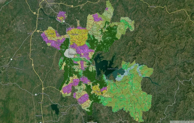
Dadra and Nagar Haveli Masterplan
View Dadra and Nagar Haveli Masterplan as a live map overlay – check any plot's land use zone for free on 1acre.in. Dadr...
Daman and Diu Masterplan
View Daman and Diu Masterplan as a live map overlay – check any plot's land use zone for free on 1acre.in. Daman Distric...
Daman CRZ
View Daman CRZ alignment as a live map overlay – check land acquisition risk and plot proximity free on 1acre.in.
More Layers in The Dadra And Nagar Haveli And Daman And Diu
Dadra and Nagar Haveli Masterplan
View Dadra and Nagar Haveli Masterplan as a live map overlay – check any plot's land use zone for free on 1acre.in. Dadr...
Daman and Diu Masterplan
View Daman and Diu Masterplan as a live map overlay – check any plot's land use zone for free on 1acre.in. Daman Distric...
Daman CRZ
View Daman CRZ alignment as a live map overlay – check land acquisition risk and plot proximity free on 1acre.in.