
IAF Air Funnel Zones - Jammu


Iaf_air_funnel_zones_jammu Preview
Try the IAF Air Funnel Zones - Jammu on the map
Sign in once and explore the layer for a full day.
- No card details needed
- Find nearby verified lands for sale
Overview
The Jammu Satwari Air Funnel Zone covers the construction height restrictions around Jammu Airport, officially the Jammu Civil Enclave, an Indian Air Force-owned aerodrome located in the Satwari locality within Jammu city itself. The airport traces back to 1947, was formally developed by the IAF from 1948, and got its AAI-run civil enclave in 1985, and it has since grown into one of the busiest IAF-civil airports in North India, handling over 1.6 million passengers with double-digit growth in the most recent year. Every structure within 20 km of the Aerodrome Reference Point needs a No Objection Certificate under GSR 751(E), and because Satwari sits inside the city rather than on its outskirts, this restriction reaches deep into Jammu's most established neighbourhoods. This page explains what each surface zone permits and why Jammu's rapid growth makes getting this check right unusually urgent.
Regulatory Red Flags Around the Jammu Satwari Air Funnel Zone
AAI's height clearance requirement is not a minor technicality confined to a few cities. Nationally, it applies across roughly 578,000 sq km, about 18 percent of India's entire landmass, and roughly 40 percent of height clearance NOC applications submitted to AAI get rejected outright. Jammu's airport, sitting inside city limits with the Satwari neighbourhood built up close around it, is exactly the kind of dense urban setting where that rejection rate matters most to a buyer.
Zone Type
Location
Height Cap
Requires
Commonly Misrepresented?
No-construction strip
Within 500 metres of the runway strip
No construction permitted at all
Not applicable, an absolute prohibition
Rarely, the restriction is usually visible on the ground
Inner Horizontal Surface
Up to 4 km from the Aerodrome Reference Point
Maximum 45 metres
AAI NOC for civilian construction, alongside Air Force review since the airport remains IAF-owned
Yes, plots in Satwari are marketed without disclosing that Air Force ownership adds a review layer beyond the standard AAI process
Outer Horizontal Surface
4 km to 15 km radius
Height increases 1 metre for every 20 metres of distance, capped at 300 metres
AAI or IAF NOC still mandatory at every distance
Sometimes assumed unrestricted once past 4 km, which is incorrect
Peripheral Zone
15 km to 20 km radius
No fixed height cap
An NOC is still required even though no specific height ceiling applies
Yes, buyers assume no cap means no clearance is needed, which is wrong
Zone Type
Location
Height Cap
Requires
Commonly Misrepresented?
No-construction strip
Within 500 metres of the runway strip
No construction permitted at all
Not applicable, an absolute prohibition
Rarely, the restriction is usually visible on the ground
Inner Horizontal Surface
Up to 4 km from the Aerodrome Reference Point
Maximum 45 metres
AAI NOC for civilian construction, alongside Air Force review since the airport remains IAF-owned
Yes, plots in Satwari are marketed without disclosing that Air Force ownership adds a review layer beyond the standard AAI process
Outer Horizontal Surface
4 km to 15 km radius
Height increases 1 metre for every 20 metres of distance, capped at 300 metres
AAI or IAF NOC still mandatory at every distance
Sometimes assumed unrestricted once past 4 km, which is incorrect
Peripheral Zone
15 km to 20 km radius
No fixed height cap
An NOC is still required even though no specific height ceiling applies
Yes, buyers assume no cap means no clearance is needed, which is wrong
A detail worth knowing specifically: Colour Coded Zoning Maps for major civil airports are published for public and local body use, but CCZMs for IAF-owned aerodromes are prepared separately and held with the local Air Force Station rather than distributed the same way. Since Jammu Airport is IAF-owned with an AAI-run civil enclave, a buyer cannot simply pull a public CCZM the way they might for a purely civilian airport; confirming the Permissible Top Elevation for a specific plot requires going through NOCAS and, where relevant, the Station itself. Confirm the current Permissible Top Elevation for a specific survey number through NOCAS and, if needed, directly with the Air Force Station, since the airport's recent runway and terminal expansion works can shift these figures.
Growth Corridors and Micro Markets Around the Jammu Satwari Air Funnel Zone
Because the airport sits inside the city rather than on its edge, Jammu's funnel zone restrictions collide directly with some of its most established and in-demand neighbourhoods, not just outlying farmland.
Corridor / Locality
Zone Status
Growth Driver
Known Risk
Satwari, immediate airport locality
Inner Horizontal Surface and Funnel
The airport's own surrounding neighbourhood, already densely built up
The 45 metre cap collides directly with established urban demand for taller construction
Trikuta Nagar, Gandhi Nagar, and inner Jammu city
Outer Horizontal Surface
Established commercial and residential core of Jammu city
Confirm the distance-based cap carefully; a plot minutes from the airport can be legally capped far below what comparable Indian cities allow
Jammu city core beyond the immediate airport belt
Outer Horizontal Surface tapering into the 15 to 20 km peripheral zone
City-wide growth, with both passenger and cargo traffic climbing by double digits
An NOC is still mandatory in the peripheral zone even though no fixed height ceiling applies there
Land adjoining the new terminal and expanded runway
Inner Horizontal Surface and Funnel, tied to the Rs 865 crore terminal project and extended 8,000 foot runway
Direct beneficiary of Jammu's major terminal investment and its new turnpad capable of handling Airbus A321 aircraft
Expansion works can shift the CCZM grid; confirm the current Permissible Top Elevation rather than an older, pre-expansion figure
Corridor / Locality
Zone Status
Growth Driver
Known Risk
Satwari, immediate airport locality
Inner Horizontal Surface and Funnel
The airport's own surrounding neighbourhood, already densely built up
The 45 metre cap collides directly with established urban demand for taller construction
Trikuta Nagar, Gandhi Nagar, and inner Jammu city
Outer Horizontal Surface
Established commercial and residential core of Jammu city
Confirm the distance-based cap carefully; a plot minutes from the airport can be legally capped far below what comparable Indian cities allow
Jammu city core beyond the immediate airport belt
Outer Horizontal Surface tapering into the 15 to 20 km peripheral zone
City-wide growth, with both passenger and cargo traffic climbing by double digits
An NOC is still mandatory in the peripheral zone even though no fixed height ceiling applies there
Land adjoining the new terminal and expanded runway
Inner Horizontal Surface and Funnel, tied to the Rs 865 crore terminal project and extended 8,000 foot runway
Direct beneficiary of Jammu's major terminal investment and its new turnpad capable of handling Airbus A321 aircraft
Expansion works can shift the CCZM grid; confirm the current Permissible Top Elevation rather than an older, pre-expansion figure
Jammu's growth numbers explain why this matters more here than in slower-growing cities. Passenger traffic rose 10.8 percent to over 1.6 million in the most recent year, aircraft movements climbed 19.1 percent, and cargo tonnage grew 20.2 percent, all pointing to sustained pressure for more commercial and hospitality development close to the airport. That pressure runs straight into a funnel zone that, unlike many Indian airports, sits embedded in the city rather than at its periphery.
A buyer targeting Satwari or the neighbourhoods immediately around it for that growth story needs the actual Permissible Top Elevation for their specific plot, not an assumption based on how tall nearby buildings already appear to be.
Was this layer helpful?
Anything wrong, outdated, or missing we want to hear it.
For Land Owners & Agents
Looking to sell your land in Jammu And Kashmir?
I want to sell my land in Jammu And Kashmir
10:32
Plz share your Land's location - We will list it on 1acre map, for Free.
10:32


For Land Buyers
Browse all verified lands & plots in Jammu And Kashmir
Every listing goes through our Preliminary Verification Process.
More Layers in Jammu And Kashmir
See all 5 layers
Srinagar Awantipur Air Funnel Zones
The Srinagar Awantipur Air Funnel Zones cover the construction height restrictions radiating from two active Indian Air ...

Jammu Master Plan 2032 Zone Check
The Jammu Master Plan 2032 zone check starts with a number that's still moving: the plan area has grown from 652.33 sq k...
Srinagar Masterplan
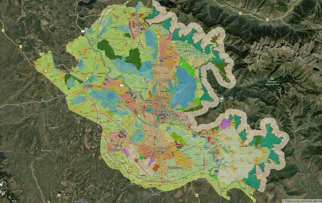
View Srinagar Masterplan as a live map overlay – check any plot's land use zone for free on 1acre.in. Srinagar Master Pl...
More Layers in Jammu And Kashmir
Srinagar Awantipur Air Funnel Zones
The Srinagar Awantipur Air Funnel Zones cover the construction height restrictions radiating from two active Indian Air ...
Jammu Master Plan 2032 Zone Check
The Jammu Master Plan 2032 zone check starts with a number that's still moving: the plan area has grown from 652.33 sq k...
Srinagar Masterplan
View Srinagar Masterplan as a live map overlay – check any plot's land use zone for free on 1acre.in. Srinagar Master Pl...