
IAF Air Funnel Zones - Srinagar


Iaf_air_funnel_zones_srinagar Preview
Try the IAF Air Funnel Zones - Srinagar on the map
Sign in once and explore the layer for a full day.
- No card details needed
- Find nearby verified lands for sale
Overview
The Srinagar Awantipur Air Funnel Zones cover the construction height restrictions radiating from two active Indian Air Force aerodromes in Jammu and Kashmir: Srinagar Airport, an IAF-owned facility with an AAI-operated civil enclave in Budgam, and Awantipur Air Force Station, a pure military base near Pulwama with no civilian traffic. Every structure within 20 km of either Aerodrome Reference Point needs a No Objection Certificate under the Ministry of Civil Aviation's GSR 751(E) rules, and the exact height allowed depends on precise distance bands defined in law, not guesswork. This page maps which surface zone applies to which locality, what each one actually permits, and where buyers most often get misled about buildable height.
Regulatory Red Flags Around the Srinagar Awantipur Air Funnel Zones
The height math here is not a rough estimate. GSR 751(E), the 2015 statutory order that governs height clearance nationwide, sets out fixed distance bands with specific limits, and both Srinagar and Awantipur fall fully under it. Srinagar carries an added layer because the airport itself is owned by the Indian Air Force, with the Airports Authority of India only operating the civil enclave, so a construction application near Srinagar can touch both civil and defence channels depending on where exactly the plot sits.
Zone Type
Location
Height Cap
Requires
Commonly Misrepresented?
No-construction strip
Within 500 metres of the runway strip
No construction permitted at all
Not applicable, an absolute prohibition
Rarely, the restriction is usually visible on the ground
Inner Horizontal Surface
Up to 4 km from the aerodrome
Maximum 45 metres
AAI NOC mandatory regardless of the requested height
Yes, plots within this 4 km ring are marketed as buildable without disclosing the 45 metre ceiling
Outer Horizontal Surface
4 km to 15 km radius
Height increases 1 metre for every 20 metres of distance, capped at 300 metres
AAI NOC still mandatory at every distance
Sometimes assumed unrestricted once past 4 km, which is incorrect
Approach or Funnel Surface
Runway approach and departure path, both ends
Height equals 2 percent of the distance from the runway edge, a 1:50 slope
AAI NOC via NOCAS; Awantipur, being a pure military base, also runs a separate Air Force restricted-zone protocol
Yes, land under the direct flight path is marketed as ordinary residential land without disclosing the slope-based cap
Zone Type
Location
Height Cap
Requires
Commonly Misrepresented?
No-construction strip
Within 500 metres of the runway strip
No construction permitted at all
Not applicable, an absolute prohibition
Rarely, the restriction is usually visible on the ground
Inner Horizontal Surface
Up to 4 km from the aerodrome
Maximum 45 metres
AAI NOC mandatory regardless of the requested height
Yes, plots within this 4 km ring are marketed as buildable without disclosing the 45 metre ceiling
Outer Horizontal Surface
4 km to 15 km radius
Height increases 1 metre for every 20 metres of distance, capped at 300 metres
AAI NOC still mandatory at every distance
Sometimes assumed unrestricted once past 4 km, which is incorrect
Approach or Funnel Surface
Runway approach and departure path, both ends
Height equals 2 percent of the distance from the runway edge, a 1:50 slope
AAI NOC via NOCAS; Awantipur, being a pure military base, also runs a separate Air Force restricted-zone protocol
Yes, land under the direct flight path is marketed as ordinary residential land without disclosing the slope-based cap
The formula matters more than the ring a plot sits in. A structure 1,000 metres from the runway edge along the approach path is capped at roughly 20 metres, regardless of what the Outer Horizontal Surface would otherwise allow at that same straight-line distance, because the approach surface's 2 percent gradient overrides the more generous outer surface figure wherever the two overlap.
Buyers comparing two plots that look equally distant from the airport on a map can be looking at two very different legal ceilings depending on whether one sits under the flight path and the other sits to the side.
Awantipur adds a distinction worth naming directly. It has no civil enclave and no AAI passenger operations, so unlike Srinagar, there is no established civilian gateway easing entry into its restricted-zone process. Any construction proposal near Awantipur AFS runs through Indian Air Force channels for defence-specific clearance, in addition to the standard AAI height NOC that GSR 751(E) requires nationwide.
Confirm both the applicable AAI Permissible Top Elevation and, where relevant, the Air Force clearance requirement for any specific survey number before signing an agreement, since both aerodromes' operational status can affect processing timelines in this region.
Growth Corridors and Micro Markets Around the Srinagar Awantipur Air Funnel Zones
Land near these two aerodromes does not carry a single, uniform restriction. Distance from the runway, position relative to the flight path, and which of the two aerodromes governs a given plot all change what is actually buildable.
Corridor / Locality
Zone Status
Growth Driver
Known Risk
Budgam, immediate Srinagar Airport vicinity
Inner Horizontal Surface and Funnel overlap
Direct airport-adjacent land, benefiting from over 4.4 million annual passengers
The 45 metre inner surface cap applies regardless of distance-based formulas elsewhere; dual IAF-AAI ownership can add process time
Srinagar city core, roughly 12 km from SXR
Outer Horizontal Surface, generally more flexible
Established urban demand as the summer capital's administrative and tourism hub
Still requires an AAI NOC out to 20 km; assuming distance alone exempts a plot is a common and costly mistake
Awantipora and Malangpora, near Awantipur AFS
Inner Horizontal Surface and Funnel, active pure-military base
Proximity to Pulwama, with a smaller-town land market
No civil enclave exists here, so restrictions run through Air Force channels rather than a civilian-facing process
Pampore corridor, between Srinagar and Awantipora
Straddles the outer surfaces of both aerodromes
Sits along the connecting corridor between two active airbases
A plot here can fall inside two separate funnel zones from two different aerodromes at once, and both need checking
Corridor / Locality
Zone Status
Growth Driver
Known Risk
Budgam, immediate Srinagar Airport vicinity
Inner Horizontal Surface and Funnel overlap
Direct airport-adjacent land, benefiting from over 4.4 million annual passengers
The 45 metre inner surface cap applies regardless of distance-based formulas elsewhere; dual IAF-AAI ownership can add process time
Srinagar city core, roughly 12 km from SXR
Outer Horizontal Surface, generally more flexible
Established urban demand as the summer capital's administrative and tourism hub
Still requires an AAI NOC out to 20 km; assuming distance alone exempts a plot is a common and costly mistake
Awantipora and Malangpora, near Awantipur AFS
Inner Horizontal Surface and Funnel, active pure-military base
Proximity to Pulwama, with a smaller-town land market
No civil enclave exists here, so restrictions run through Air Force channels rather than a civilian-facing process
Pampore corridor, between Srinagar and Awantipora
Straddles the outer surfaces of both aerodromes
Sits along the connecting corridor between two active airbases
A plot here can fall inside two separate funnel zones from two different aerodromes at once, and both need checking
Srinagar Airport's passenger volume, which grew 6.3 percent year on year to reach 4.47 million in the most recent reporting period, means demand pressure around Budgam is real and growing. That demand does not loosen the height math. A five-storey building that would clear easily in an unrestricted city sits right at, or past, the Inner Horizontal Surface's 45 metre ceiling depending on exact plot placement, and clearing that ceiling requires the same AAI NOC as a much taller structure elsewhere.
The Pampore stretch deserves particular care precisely because it sits between two active aerodromes rather than clearly inside either one's immediate zone; a plot there needs its Permissible Top Elevation checked against both Srinagar's and Awantipur's published zoning data, not just the nearer of the two.
Was this layer helpful?
Anything wrong, outdated, or missing we want to hear it.
For Land Owners & Agents
Looking to sell your land in Jammu And Kashmir?
I want to sell my land in Jammu And Kashmir
10:32
Plz share your Land's location - We will list it on 1acre map, for Free.
10:32


For Land Buyers
Browse all verified lands & plots in Jammu And Kashmir
Every listing goes through our Preliminary Verification Process.
More Layers in Jammu And Kashmir
See all 5 layers
Jammu Satwari Air Funnel Zone: Height Restriction Guide 2026
The Jammu Satwari Air Funnel Zone covers the construction height restrictions around Jammu Airport, officially the Jammu...

Jammu Master Plan 2032 Zone Check
The Jammu Master Plan 2032 zone check starts with a number that's still moving: the plan area has grown from 652.33 sq k...
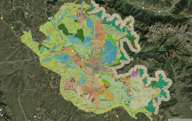
Srinagar Masterplan
View Srinagar Masterplan as a live map overlay – check any plot's land use zone for free on 1acre.in. Srinagar Master Pl...
More Layers in Jammu And Kashmir
Jammu Satwari Air Funnel Zone: Height Restriction Guide 2026
The Jammu Satwari Air Funnel Zone covers the construction height restrictions around Jammu Airport, officially the Jammu...
Jammu Master Plan 2032 Zone Check
The Jammu Master Plan 2032 zone check starts with a number that's still moving: the plan area has grown from 652.33 sq k...
Srinagar Masterplan
View Srinagar Masterplan as a live map overlay – check any plot's land use zone for free on 1acre.in. Srinagar Master Pl...