
How to Resolve Land Boundary Disputes Using Survey Records
Learn how to resolve land boundary disputes using survey records, cadastral maps, and the right legal escalation steps in India.
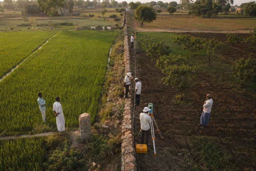
- Most boundary disputes trace back to outdated surveys, vague sale deeds, or ancestral land never formally demarcated.
- Cadastral maps and field measurement books carry more legal weight than any other evidence in a boundary conflict.
- Requesting a fresh official survey from the DILR is your first move, not a last resort.
- Delay can cost you the land. Twelve years of open hostile possession can mature into adverse possession.
- In some states, once an official boundary survey becomes final under applicable land survey laws, challenging it later can become difficult.
Why These Disputes Keep Happening
Land boundary disputes in India often arise from outdated or inconsistent land records, ambiguous boundary descriptions in older sale deeds, informal subdivision of inherited property without fresh surveys, and delayed mutation of ownership records.
While many land records originated during the colonial period, the persistence of disputes today also reflects uneven record maintenance and varying levels of land record modernization across states.
Although the Digital India Land Records Modernization Programme (DILRMP) has improved digitization and surveying in many regions, progress remains uneven, leaving some areas dependent on decades-old records.
Survey Records: Where Every Resolution Starts
Survey records are among the most important pieces of evidence in an Indian boundary dispute, often carrying greater evidentiary value than personal recollections or informal landmark descriptions found in older sale deeds.
Cadastral maps identify each survey parcel and its adjoining properties, while Field Measurement Books (FMBs) record the measurements and details collected during official land surveys.
Along with title documents and other revenue records, these state-maintained records help authorities and courts determine where one property's legal boundary ends and the next begins.
Step-by-Step: Resolving a Boundary Dispute
Step 1: Pull Together Everything You Have
Start with your sale deed, mutation entries, tax receipts, and old photographs. Most states now allow land records and ownership details to be downloaded through their official state land records portals.
Then check the survey number on your deed against the Record of Rights. If they disagree, fix that first.
Step 2: Apply for an Official Government Survey
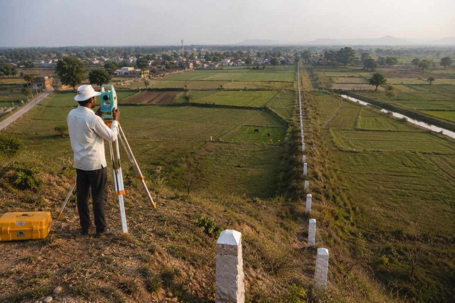
A fresh survey puts a certified surveyor on site to measure and mark the actual boundary. Under the applicable state land revenue laws, the competent revenue authority conducts official land surveys and boundary demarcation.
The survey report becomes an important piece of evidence in any subsequent revenue or civil proceedings, though courts consider it alongside other documentary and oral evidence.
Step 3: Try Talking It Through First
Holding a government survey report changes the conversation. It is no longer your word against theirs. Direct dialogue backed by a neutral document resolves more disputes than people expect, and several states run mediation services for land.
Step 4: Send a Legal Notice
If the survey supports you, a legal notice puts your position on record and signals you will escalate.
Step 5: Go to the Revenue Authority or Civil Court
A permanent injunction under Section 38 of the Specific Relief Act stops ongoing encroachment. A declaratory suit under Section 34 establishes ownership and fixes the boundary. A possession suit applies where someone has taken your land.
The court may appoint a local commissioner under Order XXVI Rule 9 of the Code of Civil Procedure to inspect, measure, and report on the disputed boundary. The commissioner's report is often influential, but the court decides the case after considering it together with the title documents, revenue records, and other evidence.
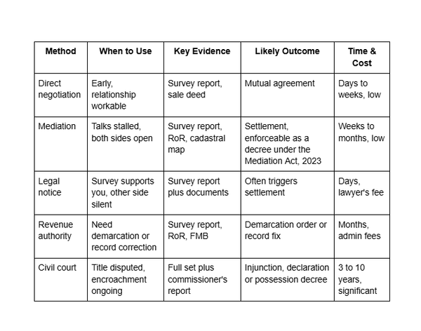
Resolution Pathways Compared
The table sets each route against what it needs, produces, and costs in time.
What Digitisation Has Changed
Less than the headline numbers suggest, and the gap matters to you specifically.
Under DILRMP, the Department of Land Resources reports Records of Rights computerised in about 97% of villages and cadastral maps digitised for about 97% of the country, but only about 85% of villages have linked the textual record to the digitised map. ULPIN had been assigned to over 36 crore land parcels across 29 States and Union Territories by November 2025, though rollout still varies by state. The textual record is usually a download.
Many states now provide online access to land ownership records, survey details, and cadastral maps through their official revenue department portals.
Although digitisation has improved transparency, many cadastral maps and historical survey records still require verification through the local revenue authority. Digital records should always be cross-checked with official survey records before relying on them in a boundary dispute.

1acre.in overlays survey number maps, master plan zones and satellite imagery on its listings, which lets you see whether a parcel's recorded boundary matches the ground, and whether it sits in a restricted zone or government restrictions or land-use limitations, before you are committed.
It does not put a surveyor on site, produces nothing admissible, and does not replace your advocate once a dispute starts.
What to Do Next
The order below is the plan.
Pull your Record of Rights and cadastral map, and confirm the survey number matches your deed.
File for an official survey at the Tehsildar's office before doing anything else.
Use the report to negotiate, then mediate, then send a legal notice.
Save court for cases where title is genuinely in question, and ask for a commissioner when you get there.
Twelve years of open, hostile possession can extinguish your title through adverse possession, and a suit for possession on title carries a twelve-year limitation under Article 65 of the Limitation Act.
Conclusion
Boundary disputes are resolved through accurate survey records, not assumptions or informal boundary markers. Start with an official government survey, verify your land records, and attempt negotiation before pursuing legal remedies. Acting promptly and relying on certified survey evidence gives you the strongest chance of protecting your property rights.


-900x600.jpg)
-900x600.jpg)
-900x600.jpg)
-900x600.jpg)