Atal Progressway
Atal Progressway Preview
Try the Atal Progressway on the map
Sign in once and explore the layer for a full day.
- No card details needed
- Find nearby verified lands for sale
Overview
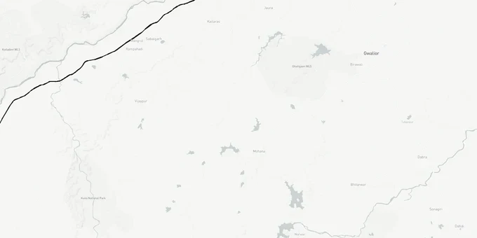
The Kota Atal Progressway land buying opportunity sits at the start point of one of India's largest greenfield expressways: a 408.77 km access-controlled corridor (some sources cite 404 km under the original alignment) connecting Seemalya village in Kota district, Rajasthan, to Etawah in Uttar Pradesh, via Madhya Pradesh's Sheopur, Morena and Bhind districts. Developed by NHAI (National Highways Authority of India) under Bharatmala Pariyojana Phase-I at an estimated cost of ₹23,645 crore, the project has an approved DPR and active land acquisition underway. This page maps the expressway's Kota entry point, explains the 90A conversion rules that determine legal buildability and flags the acquisition delays investors must price into their decisions.
The project is being built under the Hybrid Annuity Model (HAM), under which NHAI pays annuities to the concessionaire — distinct from toll-operate-transfer (BOT) or pure engineering-procurement-construction (EPC) contracts. HAM projects are funded partly by NHAI and partly by the concessionaire, which affects construction timelines and financial risk.
In March 2026, NHAI reverted to the original alignment, away from the revised route through 214 villages. Also known as the Chambal Expressway, this corridor is now back on the older alignment, which carries approximately 75% government land — materially lower acquisition risk than the revised alignment. NHAI is re-verifying land in 90 villages in Morena, 48 in Sheopur, and 23 in Bhind. Landowners in these districts on the original alignment will receive double compensation. The acquisition risk profile has shifted materially — verify your khasra number against the current alignment before any transaction.
NHAI Tender Cancellations and Land Acquisition Risk: What Kota Buyers Are Not Being Told
The Atal Progressway carries one of the most significant acquisition complications of any current NHAI project, and it directly affects land near Kota's Seemalya interchange.
After NHAI applied for environmental clearance in June 2022 and floated construction tenders in December 2022, the National Green Tribunal raised concerns about the original alignment through the Chambal ravines and Kuno National Park. NHAI changed the route. The revised alignment now passes through 214 villages instead of the originally planned 162, and around 90% of the land on the new route is private agricultural land, up from 75% on the old alignment. Tenders for Packages 3-6 were cancelled in January 2024 due to unresolved land acquisition disputes. NHAI has indicated fresh bids are planned, but as of mid-2025, approximately 50% of required land has been acquired across the full corridor.
The table below summarises the current project status across states.
State
Length in Corridor
Right of Way Width
Land Acquisition Status
Rajasthan (Kota entry)
72 km
60 m
Earthwork tenders awarded; full possession pending
Madhya Pradesh
~313 km
100 m
~50% land acquired as of mid-2025
Uttar Pradesh (Etawah end)
~23 km
60 m
Near complete
State
Length in Corridor
Right of Way Width
Land Acquisition Status
Rajasthan (Kota entry)
72 km
60 m
Earthwork tenders awarded; full possession pending
Madhya Pradesh
~313 km
100 m
~50% land acquired as of mid-2025
Uttar Pradesh (Etawah end)
~23 km
60 m
Near complete
If a broker is showing you land priced on the assumption that this expressway is under active construction, ask them to produce the NHAI land possession certificate for that specific khasra number.
Seemalya Interchange and the Kota Corridors Worth Tracking
Land near the Kota Atal Progressway entry gains value from two stacked infrastructure plays, not one.
The expressway's western terminus sits at Seemalya village, Kota district, where it connects directly to the Delhi-Mumbai Expressway interchange. This dual-interchange node makes the Seemalya-Borkhera belt the most analytically defensible corridor in the Kota market. The Delhi-Mumbai Expressway is already operational through Rajasthan, so that connectivity is not speculative. The Atal Progressway adds a second vector eastward toward Gwalior and the Agra-Lucknow Expressway, positioning Kota as a freight and logistics node for three-state movement.
The table below lists the corridors most directly affected and the investment thesis for each.
Corridor / Locality
Connection
Growth Driver
Key Risk
Seemalya village and surrounds
Atal Progressway start + Delhi-Mumbai Expressway interchange
Dual-expressway node; logistics and warehousing demand
NHAI land acquisition still active; boundary uncertainty
Borkhera
NH-27 access, proximity to Seemalya
Established residential market; expressway adjacency
Land already partly urbanised; Section 90A conversion mandatory for new layouts
Kaithoon, Kota district
Within Rajasthan corridor stretch
Agricultural land with conversion potential
90% private agricultural land in revised alignment; society patta risk high
Kunhari and Baran Road fringe
Secondary corridor feeding NH-27
Education-hub demand spillover from Kota city
Further from interchange; value dependent on Atal Progressway completion
The most misread corridor is Kaithoon. Brokers position it as corridor-adjacent land at pre-appreciation prices. What they underplay is that the NHAI's revised alignment specifically concentrated in areas with heavy private agricultural land, and Kaithoon sits in exactly that profile. Buying here without a clean Jamabandi and a confirmed 90A conversion order is a way to own land that cannot be registered, built upon or bank-financed.
Was this layer helpful?
Anything wrong, outdated, or missing we want to hear it.
For Land Owners & Agents
Looking to sell your land in Rajasthan?
I want to sell my land in Rajasthan
10:32
Plz share your Land's location - We will list it on 1acre map, for Free.
10:32

For Land Buyers
Browse all verified lands & plots in Rajasthan
Every listing goes through our Preliminary Verification Process.
More Layers in Rajasthan
See all 8 layers
Alwar UIT Masterplan 2031: Zone Check and Land Use Guide
View Alwar Masterplan as a live map overlay – check any plot's land use zone for free on 1acre.in. Alwar Master Plan 205...
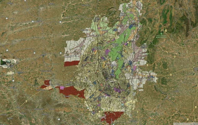
Jaipur JDA Masterplan: Zone Check and Land Use Guide
View Jaipur Masterplan as a live map overlay – check any plot's land use zone for free on 1acre.in. Jaipur masterplan zo...
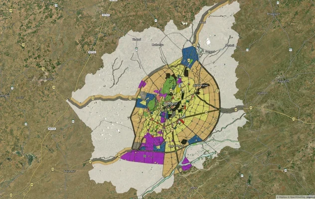
Jodhpur JODA Masterplan 2031: Zone Check and Land Use Guide
View Jodhpur Masterplan as a live map overlay – check any plot's land use zone for free on 1acre.in. Jodhpur masterplan ...
More Layers in Rajasthan
Alwar UIT Masterplan 2031: Zone Check and Land Use Guide
View Alwar Masterplan as a live map overlay – check any plot's land use zone for free on 1acre.in. Alwar Master Plan 205...
Jaipur JDA Masterplan: Zone Check and Land Use Guide
View Jaipur Masterplan as a live map overlay – check any plot's land use zone for free on 1acre.in. Jaipur masterplan zo...
Jodhpur JODA Masterplan 2031: Zone Check and Land Use Guide
View Jodhpur Masterplan as a live map overlay – check any plot's land use zone for free on 1acre.in. Jodhpur masterplan ...