
Jodhpur JODA Masterplan 2031: Zone Check and Land Use Guide
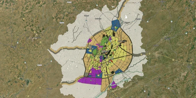

Jodhpur Masterplan Preview
Try the Jodhpur JODA Masterplan 2031 on the map
Sign in once and explore the layer for a full day.
- No card details needed
- Find nearby verified lands for sale
Overview
The Jodhpur masterplan 2031, formally the Master Development Plan prepared by the Jodhpur Development Authority (JDA Jodhpur), covers 446,733 hectares across 395 revenue villages and was implemented in February 2021 with a planning horizon to 2031. It divides the Jodhpur region into planning zones, U1, U2, industrial, and specialised corridors, and directly determines what you can build, convert, or sell on any parcel within that boundary. This page explains what each zone means, which corridors carry real growth logic, and how to use the 1acre map layer to verify a survey number before you sign anything.
Zone fraud and encroachment traps in Jodhpur's JDA Jodhpur boundary
The single most costly mistake buyers make in Jodhpur is purchasing land in an unlisted or encroached layout without verifying the JDA land zone check. The State Consumer Commission, Jodhpur Bench, has already ruled against JDA Jodhpur itself for allotting encroached plots and charging inflated prices on replacement parcels, a pattern that also plays out in private sales. The Rajasthan High Court, in its 2017 order covering JDA Jodhpur and other Rajasthan development authorities, directed that no registration should proceed contrary to the masterplan, and that land use changes declared void are void from inception.
The table below shows the core zone classifications in the Jodhpur masterplan 2031 and the conversion requirement for each.
Zone / Code
Permitted Use
Requires Conversion Before Build?
Commonly Misrepresented As
Urban Area U1
Dense residential, commercial, mixed use; existing built fabric
No, but building plan approval required from JDA Jodhpur
Already "approved" plots with no JDA Patta
Urban Area U2
Mixed residential-rural transition; lower-density development
Yes: conversion and JDA layout approval needed
Residential plot ready to register
Land Pooling and Redistribution Zone
Owners pool land; development rights shared with authority or developer
No individual construction without scheme notification
Investment plot with immediate construction rights
Industrial Zone (Boranada, Salawas Road, Basni)
Manufacturing, agro-processing, logistics
Change of land use (CLU) needed for residential conversion
Industrial land "convertible" on payment of a fee
Plantation Corridor / Highway Corridor
Limited uses per notification; buffers along NH-65, Barmer Road
No construction rights without specific gazette sanction
Roadside commercial land
The U2 zone is the trap most buyers walk into. A parcel in U2 zone Jodhpur land use is not equivalent to a residential plot: it needs a JDA-approved layout, mutation, and scheme notification before any structure is legally permissible. Sellers and some brokers routinely omit this step. If a seller cannot show you the JDA Jodhpur Patta or the layout approval number for a U2 parcel, do not register.
Corridor and micro-market characteristics under the JDA Jodhpur Masterplan
The masterplan creates distinct land-use categories across the Jodhpur region, and they do not all behave the same way.
The table below maps corridors to their zone classification, growth driver, and the principal risk buyers should watch for.
Corridor / Locality
Zone per MDP-2031
Primary Growth Driver
Key Risk
Boranada (industrial area)
Industrial
318 plots in 259.78 acres; agro-food and export processing park established; RIICO (Rajasthan State Industrial Development and Investment Corporation)-developed
Residential use requires CLU from state authority; conversion disputes between JDA and RIICO jurisdiction
Salawas Road / Narnadi
Industrial + U2 transition
Handicraft cluster (durry weaving), ring road connectivity from Barmer Road to Pali Road via S2 zone
Industrial land marketed as residential; confirm CLU before buying
Jhalamand
U2 + transport hub designation
Proposed transportation hub in MDP-2031; East Zone E2 plan shows hub toward Jhalamand; Barmer Road industrial activities nearby
U2 land without layout approval; speculative pricing ahead of hub construction
North Zone N1/N2 (Nagaur bypass corridor)
U2 + Army Cantonment boundary
Connectivity to national highway; 16,598 ha of residential + U2 area in plan
Cantonment proximity limits development rights; confirm no cantonment NOC needed
Barmer Road corridor (NH-112 alignment)
Industrial + corporate park zone
Pachpadra Refinery (₹72,000 crore HPCL-GoR project) and DMIC influence; transport hub on prime location, 751.78 ha in MDP-2031
Long time horizon; petrochemical impact is regional, not local, land 40+ km from Jodhpur city may sit in speculative limbo for years
The most misunderstood corridor is Jhalamand. Buyers are paying U1-adjacent prices for U2 parcels banking on the transport hub designation, but no gazette notification for the hub site has been cited in public documents. Until JDA notifies the scheme, those parcels carry full U2 conversion requirements and no infrastructure guarantee.
For Land Owners & Agents
Looking to sell your land in Rajasthan?
I want to sell my land in Rajasthan
10:32
Plz share your Land's location - We will list it on 1acre map, for Free.
10:32

For Land Buyers
Browse all verified lands & plots in Rajasthan
Every listing goes through our Preliminary Verification Process.
More Layers in Rajasthan
See all 16 layers
Ajmer Masterplan Land: ADA Zones, 90A Rules | 1acre.in
Ajmer masterplan land zone: what every buyer must verify before signing
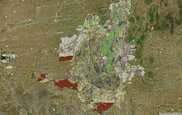
JDA Master Plan 2025 Jaipur: Zone Map and 2047 Status
JDA Master Plan 2025 is valid to 2027: see the Jaipur zone map, U2 HIZ meaning, zone-wise list, official PDFs and 2047 s...
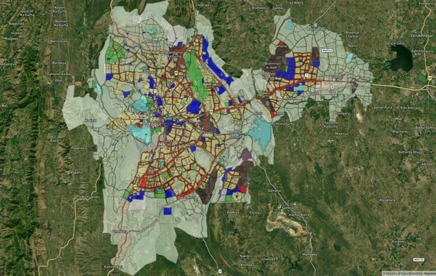
Udaipur Masterplan 2031: Zone Check and Land Use Guide
View Udaipur Masterplan as a live map overlay – check any plot's land use zone for free on 1acre.in. Udaipur Master Plan...
More Layers in Rajasthan
Ajmer Masterplan Land: ADA Zones, 90A Rules | 1acre.in
Ajmer masterplan land zone: what every buyer must verify before signing
JDA Master Plan 2025 Jaipur: Zone Map and 2047 Status
JDA Master Plan 2025 is valid to 2027: see the Jaipur zone map, U2 HIZ meaning, zone-wise list, official PDFs and 2047 s...
Udaipur Masterplan 2031: Zone Check and Land Use Guide
View Udaipur Masterplan as a live map overlay – check any plot's land use zone for free on 1acre.in. Udaipur Master Plan...
Frequently Asked Questions
The Master Development Plan (MDP-2031) was prepared by the Jodhpur Development Authority (JDA Jodhpur), covering 446,733 hectares across 395 revenue villages. Implemented in February 2021, it governs all land use, construction, and zone conversion decisions until 2031.
U1 is the existing dense urban area where approved construction can proceed directly. U2 is a transition zone requiring a JDA-sanctioned layout before any construction is permitted. Buying U2 land as a ready residential plot is the most common costly mistake.
Use the 1acre Premium Jodhpur Masterplan layer (https://1acre.in/subscribe) to see zone classification at your survey number. Cross-reference with the official MDP-2031 land use map on jdajodhpur.org (https://jdajodhpur.org) or lsg.urban.rajasthan.gov.in, and verify your khasra at apnakhata.rajasthan.gov.in.
Yes, but a formal change of land use (CLU) application to JDA Jodhpur is mandatory first. Building without CLU is illegal under the Rajasthan Development Act and can result in demolition notices or the registration being voided.
Boranada is an established industrial zone with 259.78 acres of developed agro-food estate (RIICO-notified). Residential use requires a change of land use (CLU) approved by both JDA Jodhpur and RIICO. The Rajasthan High Court has flagged disputes over which authority holds conversion rights; verify jurisdiction before purchasing.
It means your land is pooled into a JDA scheme; you receive developed plots or shares in return. Individual construction rights do not vest until the scheme is formally notified. Do not treat this zone as a standalone plot purchase.
Indirectly. The ₹72,000 crore HPCL refinery at Pachpadra influences the Barmer Road corridor in the MDP-2031. However, Pachpadra is roughly 100 km from Jodhpur city, so treat refinery-driven appreciation as a long-horizon, not near-term, catalyst.
Source
Official Jodhpur Development Authority (JDA Jodhpur) documents
Official Website
https://jdajodhpur.orgCoordinate Reference System
EPSG:4326 (WGS 84)
Geometry Type
Polygon / MultiPolygon
Data Format
Vector (GeoJSON) + Raster Tiles
Last Verified
April 2026
Status
Active
Was this layer helpful?
Anything wrong, outdated, or missing we want to hear it.