
UIT Alwar master plan 2031: zone check and land use guide
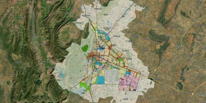

Alwar Masterplan Preview
Try the UIT Alwar master plan 2031 on the map
Sign in once and explore the layer for a full day.
- No card details needed
- Find nearby verified lands for sale
Overview
The Alwar master plan is the development blueprint prepared by the Urban Improvement Trust (UIT) Alwar under the Government of Rajasthan. The plan buyers use for zone checks is the UIT Alwar Masterplan 2031, which sets the five planning zones described below. A longer-range Alwar Master Plan 2051 was reported in March 2025: it covers the city's current urban area of 48.14 sq km and absorbs 86 surrounding villages in phases through 2051, with a projected population of over 12 lakh.
This page covers what UIT Alwar is and what it approves, how the 2031 and 2051 plans relate, where to get the official UIT Alwar map, the five planning zones, the Aravalli Notification restrictions that govern large parts of Alwar district, and the growth corridors where the plan directly shapes land value.
Alwar master plan 2031 vs 2051
Many searchers find both years on the same page. This is how they fit together.
Plan
What it is
Status, October 2026
Use it for
Alwar Master Plan 2031
The UIT Alwar Masterplan 2031, the source of the five planning zones on this page
The plan used for current zone checks; confirm the notified version with UIT Alwar
Checking what a khasra can be used for today
Alwar Master Plan 2051
Long-range plan for the UIT area reported in March 2025
Not listed by name on the UDH master plans page; confirm its notification with UIT Alwar
Judging where the city will grow, not current building rights
Plan
What it is
Status, October 2026
Use it for
Alwar Master Plan 2031
The UIT Alwar Masterplan 2031, the source of the five planning zones on this page
The plan used for current zone checks; confirm the notified version with UIT Alwar
Checking what a khasra can be used for today
Alwar Master Plan 2051
Long-range plan for the UIT area reported in March 2025
Not listed by name on the UDH master plans page; confirm its notification with UIT Alwar
Judging where the city will grow, not current building rights
As reported in March 2025, the 2051 plan counts 86 villages in the UIT area. Nine of them may join the municipal corporation after the next delimitation, and the remaining 77 over about 26 years, with delimitation every five years at municipal elections. The report names Nangla Samadi, Diwakri, Belaka, Berka, Liwari and Bakheda among the villages notified in 2011, and lists Ramgarh tehsil villages to be included: Dhooninath, Sankhla, Bahala, Dhadholi, Kamalpur, Goleta, Batesra, Kesroli, Chorotee Pahad, Agyara and Loharwadi. The full village list is held by UIT Alwar.
A practical rule: if a seller says a plot is "residential under the 2051 plan", ask for its land use under the 2031 plan and an approved layout. A future plan does not give construction rights today.
UIT plots and patta in Alwar
UIT Alwar develops its own residential schemes and sells plots in them by auction or lottery. If you are looking at UIT plots in Alwar city, these are the schemes and colonies named in recent reports:
Scheme or colony
What the record shows
Report date
Shalimar and Vigyan Nagar
Residential schemes on acquired farmland, sold through UIT open auctions; buyers then reported missing roads, drains and power
February 2020
Buddh Vihar, Hasan Khan, Ambedkar Nagar
UIT colonies developed with NCR loans, which were repaid
October 2017
Vijay Nagar, Buddh Vihar, Scheme No. 10, Scheme No. 5 (Panchvati Colony)
Built on land UIT acquired in 1978; about 50 bigha of that acquisition is still vacant because compensation is unresolved
June 2026
Rohini and Saket colonies
Scheme proposed since 1998 on about 1,200 bigha; compensation not fixed and the proposal not approved by the state
June 2026
Scheme or colony
What the record shows
Report date
Shalimar and Vigyan Nagar
Residential schemes on acquired farmland, sold through UIT open auctions; buyers then reported missing roads, drains and power
February 2020
Buddh Vihar, Hasan Khan, Ambedkar Nagar
UIT colonies developed with NCR loans, which were repaid
October 2017
Vijay Nagar, Buddh Vihar, Scheme No. 10, Scheme No. 5 (Panchvati Colony)
Built on land UIT acquired in 1978; about 50 bigha of that acquisition is still vacant because compensation is unresolved
June 2026
Rohini and Saket colonies
Scheme proposed since 1998 on about 1,200 bigha; compensation not fixed and the proposal not approved by the state
June 2026
UIT patta. The patta is the document UIT Alwar issues for a plot in its area. It comes from UIT, not from a developer or broker. Before paying an advance, ask for the patta in the seller's name, the scheme name and the approved layout plan number, and check all three at the UIT office. Where compensation for the scheme land is still disputed, as in the Rohini and Saket proposal, wait for the dispute to be settled before you buy.
UIT Alwar master plan map and PDF download
Searches for a UIT Alwar master plan 2031 PDF download or a UIT Alwar map PDF download are common. 1acre does not host the official PDF. The official places to look are:
- UIT Alwar's website, uit.rajasthan.gov.in/uitalwar, which the UDH department lists as the trust's official site.
- The UDH department's Master Plans page, which links to the state Town Planning department's master plan listings.
- The UIT Alwar office, where you can ask for a certified copy of the land use plan sheet that covers your khasra.
A master plan map shows the proposed land use for each area and the planned road network. It is not a layout plan: maps of individual UIT colonies, such as Ambedkar Nagar or Shalimar, are scheme layouts, and you need to ask UIT for the approved layout of that scheme.
To use the map with a plot, match the khasra number on the revenue record (Jamabandi) to the plan sheet, then check the zone and the nearest planned road. For a first check, view the khasra against the zones on the 1acre Alwar masterplan layer, then confirm it with the certified UIT sheet before you pay.
Aravalli Notification: the single biggest risk in Alwar plot zone checks
Land buyers in Alwar face a regulatory trap that exists nowhere else in India at this scale: the MoEF&CC Notification dated 7 May 1992 prohibits specified construction and mining activities across Alwar district without prior environmental clearance. The Supreme Court and the National Green Tribunal have both issued active orders against illegal construction in the gair mumkin pahar (uncultivable hill) areas of Alwar, including a 2021 NGT direction to the Rajasthan Chief Secretary to nominate a senior officer to monitor demolitions. In December 2025, the Supreme Court again ordered a complete ban on new mining leases across the Aravalli range, with Alwar district collector Artika Shukla launching a joint enforcement operation as recently as January 2026.
For the buyer, this has one practical consequence: any plot touching an Aravalli hill, supporting slope, or forest block in Alwar must have explicit MoEF&CC clearance before construction begins. A UIT patta or a revenue department Khata alone is not enough.
Five Planning Zones Under UIT Alwar Masterplan 2031
The table below shows the five planning zones UIT Alwar uses in its master plans, drawn from the plan's documented structure:
Zone
Primary Use
Construction Permitted?
Key Risk
Old City Zone
Mixed residential-commercial
Yes, with UIT sanction
High congestion, narrow roads
Moti Dungri Zone
Residential expansion
Yes, with UIT layout approval
Aravalli buffer overlaps
Industrial Zone
MIA, OIA and extensions
Industrial only
Residential use strictly prohibited
Dayanand Nagar Zone
Planned residential
Yes, with UIT patta
Verify UIT vs municipal limits
Peripheral Control Zone
Agricultural/green buffer
Restricted
Most fraud happens here
Zone
Primary Use
Construction Permitted?
Key Risk
Old City Zone
Mixed residential-commercial
Yes, with UIT sanction
High congestion, narrow roads
Moti Dungri Zone
Residential expansion
Yes, with UIT layout approval
Aravalli buffer overlaps
Industrial Zone
MIA, OIA and extensions
Industrial only
Residential use strictly prohibited
Dayanand Nagar Zone
Planned residential
Yes, with UIT patta
Verify UIT vs municipal limits
Peripheral Control Zone
Agricultural/green buffer
Restricted
Most fraud happens here
The Peripheral Control Zone is where most plot fraud occurs. Brokers routinely show agricultural land in this zone as "master plan-approved residential" without UIT layout sanction. If a seller cannot show you the UIT-issued layout approval number for a peripheral plot, stop the transaction.
Alwar Growth Corridors Under Master Plan 2051: Where the Plan Changes Land Value
Alwar sits at the intersection of three of India's most significant infrastructure programs, and the Master Plan 2051 is explicitly designed to absorb their population and economic spillover.
The table below maps the corridors with confirmed infrastructure notifications:
Corridor / Locality
Infrastructure Driver
Land Use Context
Risk Flag
Bhiwadi-Neemrana-Khushkhera
DMIC Investment Region (165 sq km, 42 villages, notified 2013)
Industrial + mixed residential
Verify Bhiwadi Integrated Development Authority (BIDA) zone
Naugaon-Ramgarh
Delhi-Mumbai Expressway entry into Rajasthan at Alwar district
Farmland to urban transition
No UIT layout yet on most parcels
Neemrana-Behror
Delhi-Alwar RRTS (single phase, construction was expected in August 2026, commercial launch November 2031)
Residential corridor at 160 km/hr train access
RRTS not operational, timeline unconfirmed
Baroda Meo-Tijara
Paniyala-Alwar-Barodameo Highway (86 km, construction started March 2024)
Notified ULB, master plan in place
—
Alwar city fringe (77 villages)
Master Plan 2051 periodic village absorption every 5 years
Agricultural to residential in phases
Current zone is agricultural; conversion requires government gazette
Corridor / Locality
Infrastructure Driver
Land Use Context
Risk Flag
Bhiwadi-Neemrana-Khushkhera
DMIC Investment Region (165 sq km, 42 villages, notified 2013)
Industrial + mixed residential
Verify Bhiwadi Integrated Development Authority (BIDA) zone
Naugaon-Ramgarh
Delhi-Mumbai Expressway entry into Rajasthan at Alwar district
Farmland to urban transition
No UIT layout yet on most parcels
Neemrana-Behror
Delhi-Alwar RRTS (single phase, construction was expected in August 2026, commercial launch November 2031)
Residential corridor at 160 km/hr train access
RRTS not operational, timeline unconfirmed
Baroda Meo-Tijara
Paniyala-Alwar-Barodameo Highway (86 km, construction started March 2024)
Notified ULB, master plan in place
—
Alwar city fringe (77 villages)
Master Plan 2051 periodic village absorption every 5 years
Agricultural to residential in phases
Current zone is agricultural; conversion requires government gazette
The most misunderstood corridor is Naugaon. The Delhi-Mumbai Expressway enters Rajasthan at Munpur Karmala village in Alwar district, and developers are actively selling farm parcels here as "expressway-adjacent investment." Most of these parcels are still in agricultural use with no pending zone conversion under the Master Plan 2051. Buy land here only if you can wait for a long-horizon conversion; do not purchase expecting near-term construction rights.
For Land Owners & Agents
Looking to sell your land in Rajasthan?
I want to sell my land in Rajasthan
10:32
Plz share your Land's location - We will list it on 1acre map, for Free.
10:32

For Land Buyers
Browse all verified lands & plots in Rajasthan
Every listing goes through our Preliminary Verification Process.
More Layers in Rajasthan
See all 16 layers
Ajmer Masterplan Land: ADA Zones, 90A Rules | 1acre.in
Ajmer masterplan land zone: what every buyer must verify before signing
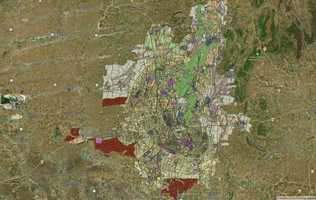
JDA Master Plan 2025 Jaipur: Zone Map and 2047 Status
JDA Master Plan 2025 is valid to 2027: see the Jaipur zone map, U2 HIZ meaning, zone-wise list, official PDFs and 2047 s...
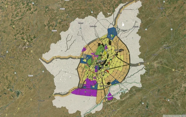
Jodhpur JODA Masterplan 2031: Zone Check and Land Use Guide
View Jodhpur Masterplan as a live map overlay – check any plot's land use zone for free on 1acre.in. Jodhpur masterplan ...
More Layers in Rajasthan
Ajmer Masterplan Land: ADA Zones, 90A Rules | 1acre.in
Ajmer masterplan land zone: what every buyer must verify before signing
JDA Master Plan 2025 Jaipur: Zone Map and 2047 Status
JDA Master Plan 2025 is valid to 2027: see the Jaipur zone map, U2 HIZ meaning, zone-wise list, official PDFs and 2047 s...
Jodhpur JODA Masterplan 2031: Zone Check and Land Use Guide
View Jodhpur Masterplan as a live map overlay – check any plot's land use zone for free on 1acre.in. Jodhpur masterplan ...
Frequently Asked Questions
Verify the zone classification on the UIT Alwar master plan map, confirm whether an approved layout plan exists, check for Aravalli Notification applicability on the specific survey number, and obtain a certified copy of the Khata and Jamabandi. Never rely on a broker's zone description alone. Use the 1acre Premium Alwar Masterplan layer to verify zone classification and Aravalli overlap for your specific khasra number before transacting.
Yes, potentially. The notification prohibits certain construction activities in Alwar district without MoEF&CC clearance. In November 2025, the Supreme Court adopted a new definition of Aravalli Hills (elevation ≥100m from local relief). MoEFCC confirmed no new mining leases until a management plan is approved, but the definition is contested — critics argue it narrows protections for lower hills. If your plot touches any hill or supporting slope area, confirm whether it falls within the updated definition and whether MoEF&CC clearance applies before proceeding.
It is the buffer zone at the city's edge where construction is restricted to preserve agricultural and green land. Brokers frequently misrepresent plots here as residential. Demand the UIT layout sanction number before paying any advance on peripheral land.
Alwar district is in the National Capital Region. Villages like Shahjahanpur, Neemrana, and Ghiloth already carry NCR status. The NCR Planning Board's regional plan has designated Alwar city as a magnet centre. NCR membership does not override local UIT zoning rules.
The 164 km Delhi-SNB-Alwar RRTS is an approved semi-high-speed rail corridor. As of November 2024, the entire corridor has been redesignated as a single phase. Construction was expected to start in August 2026, with commercial launch targeted for November 2031. Land near confirmed SNB stations in Neemrana, Behror and Shahjahanpur has seen price movement; Alwar city land linked to RRTS remains speculative until construction commences.
No. The Industrial Zone covering Matsya Industrial Area and Old Industrial Area permits only industrial use. Constructing residential units on industrial land without conversion approval is a violation and subject to demolition orders by UIT.
UIT Alwar is the Urban Improvement Trust, Alwar. It is the planning and development body for Alwar city and its surrounding planning area, set up under the Rajasthan Urban Improvement Act, 1959. It prepares the master plan, runs residential schemes, approves layouts and issues pattas. The state UDH department lists it as a UIT; Alwar has no development authority as of October 2026.
A UIT patta comes only from UIT Alwar. If you were allotted a plot in a UIT scheme, the patta follows allotment and payment. For other land in the UIT area, the owner applies to UIT, which checks title, master plan land use and the layout before issuing it. Ask UIT Alwar for the current process and fees, and never accept a photocopy patta without checking it at the UIT office.
No, not as of October 2026. The Rajasthan UDH department lists seven development authorities (Jaipur, Ajmer, Bharatpur, Bikaner, Jodhpur, Udaipur and Kota) and lists Alwar as an Urban Improvement Trust. A UIT becomes a development authority only through its own Act, as Udaipur did in 2023. Until then, approvals in Alwar's planning area come from UIT Alwar.
As reported in March 2025, 86 villages fall in the UIT area: nine may join the municipal corporation after the next delimitation and 77 later. Named villages include Nangla Samadi, Diwakri, Belaka, Berka, Liwari and Bakheda, and Ramgarh tehsil villages such as Bahala, Dhadholi, Kamalpur, Goleta and Loharwadi. Ask UIT Alwar for the full official list.
The official PDF is published by the government, not on this page. Check UIT Alwar's website (uit.rajasthan.gov.in/uitalwar) and the Rajasthan UDH department's Master Plans page, which links to the Town Planning department's listings. For a plot decision, ask the UIT office for a certified copy of the plan sheet covering your khasra, and compare it with the zones shown on this map layer.
Source
Official Urban Improvement Trust (UIT), Alwar documents
Official Website
urban.rajasthan.gov.in
Coordinate Reference System
EPSG:4326 (WGS 84)
Geometry Type
Polygon / MultiPolygon
Data Format
Vector (GeoJSON) + Raster Tiles
Last Verified
April 2026
Status
Active
Was this layer helpful?
Anything wrong, outdated, or missing we want to hear it.