Udaipur Masterplan 2031: Zone Check and Land Use Guide
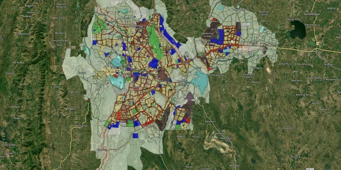
Udaipur Masterplan Preview
Try the Udaipur Masterplan 2031 on the map
Sign in once and explore the layer for a full day.
- No card details needed
- Find nearby verified lands for sale
Overview
The Udaipur Master Plan 2031 governs land use across Udaipur's planning area under the Rajasthan Urban Improvement Act, 1959. Prepared by the Department of Town Planning, Rajasthan, and approved on 24 September 2013 under notification p-10(18) naviyo/3/2012, the plan divides the city into named planning zones: Shahkot, Ashok Nagar, Bhuwana, Hiran Magri, Govardhan Vilas, Ambamata, Highway Development Control, Gudli-Dabok Growth Centre, Umarda Growth Centre, and Fringe Area. This page maps the zone codes that determine what you can and cannot build, identifies the corridors where the plan directly moves land prices, and shows how to use 1acre's masterplan layer to verify any plot before you commit.
Why zone misrepresentation is the single biggest fraud risk in Udaipur land transactions
The UDA zonal plan divides Udaipur into more than 15 named zones across directions N1 to N4, S1 to S4, E1 to E3, W1 to W5, and SE1 to SE3. Each zone map is publicly available on the Udaipur Development Authority (UDA) website. Despite this, brokers routinely describe parcels using the previous Master Plan 1997–2022 classifications, which have different boundary lines. A plot that fell inside a residential zone under the 1997 plan may now sit in a Green Zone, Lake Conservation Zone, or Fringe Area under the 2031 plan, where construction is prohibited or sharply restricted.
The most consequential trap is agricultural land sold on the assumption that Section 90-A conversion to non-agricultural use is straightforward. It is not. Under the Udaipur Development Authority framework, an applicant must submit the revenue Jamabandi and Khasra map, the current Master Plan (2011–2025) with the applied land superimposed, and pay conversion fees before any building permission is issued. If a plot is within a Green Zone (covering lake catchments and hill slopes around Fateh Sagar, Pichola, and Badi lakes) or within the Fringe Area, the 90-A application will be refused, regardless of how long the seller has held the land or what the previous plan showed.
This table covers the zone categories with the highest misrepresentation rate, sourced from the UDA zonal plan structure and the Master Plan 2031 document.
Zone Type
Permitted Use
Construction Without Conversion?
Commonly Misrepresented As
Residential (R)
Housing, small shops, schools
Yes, if UDA building plan approved
Universally mis-sold as ready to build
Green Zone-1 (lake conservation)
No construction; plantation only
No
Sold as "farmhouse land"
Green Zone-2
Very limited, subject to environment norms
No without special clearance
Described as residential periphery
Fringe Area
Low-density rural; limited urbanisation
No without CLU
Sold as "on the master plan"
Gudli-Dabok Growth Centre
Industrial and mixed-use development
CLU plus UDA building plan needed
Listed as plain residential
Umarda Growth Centre
Mixed residential and service industries
Requires zone-specific approval
Sold as regular residential plot
If a broker hands you a master plan printout and you cannot identify which of the named zone maps (N1–N4, S1–S4, E1–E3, W1–W5, SE1–SE3) the plot falls under, do not proceed. The zone name on the map is the only document that matters, not the broker's description.
Debari, Bhuwana, Sukher, and the Kaya–Kavita ring road: where the plan moves money
The 2031 plan concentrates urban growth along three corridors. Understanding which prevents buying speculative land at investable prices.
The first is the established urban fringe: Hiran Magri sectors, Bhuwana, and Pratap Nagar. These fall within notified residential and mixed-use zones with UDA-approved layouts available. Plots here carry UDA building permissions and patta documents. Values are high because the regulatory risk is low. These are not where buyers find yield; they find safety.
The second is the emerging industrial and service corridor: Debari, Sukher, and the NH-48 alignment. The Gudli-Dabok Growth Centre, directly designated in the Master Plan with its own chapter (chapter 7), is positioned to capture spillover industrial activity from the city's zinc and zinc-alloy processing base. Sukher and Pratap Nagar sit at the intersection of this corridor and planned road-widening routes in the circulation plan. IT-linked commercial demand is already moving into these pockets.
The third is the Kaya–Kavita Ring Road alignment. As of April 2026, the sitting MP had formally written to the Union Minister for Road Transport requesting expedited construction of this ring road connecting NH-48 (Ahmedabad route) to NH-76 (Pindwara route), with Debari as the current transit node this road would bypass. This project is still in the proposal stage with no awarded contract, but the corridor through Balicha, Eklingpura, and Debari is already attracting early-stage buyers.
Corridor
Plan Zone
Infrastructure Drivers
Key Risk
Hiran Magri sectors 3, 7, 8, 14
Residential (UIT-notified)
Schools, hospitals, established demand
Established area; limited undeveloped inventory
Bhuwana / Pratap Nagar
Residential, mixed-use
IT demand, 200ft link road connectivity
Limited undeveloped inventory
Debari / Sukher
Industrial, mixed-use (Gudli-Dabok zone)
Industrial spillover, NH-48 proximity
Zoning can shift; verify zonal map
Balicha / Eklingpura
Fringe Area, Umarda Growth Centre
Kaya–Kavita ring road proposal
Road not yet awarded; speculative
Dabok / Umarda
Umarda Growth Centre (chapter 8, MP 2031)
Airport proximity, growth centre designation
Agricultural land conversion required
The most misunderstood corridor is Dabok. Buyers assume airport adjacency translates directly into residential development rights. Dabok falls within the Umarda Growth Centre zone, which has its own development control regulations separate from standard residential zones. Building permission there requires compliance with those specific regulations, not the general UDA residential rules.
Was this layer helpful?
Anything wrong, outdated, or missing we want to hear it.
For Land Owners & Agents
Looking to sell your land in Rajasthan?
I want to sell my land in Rajasthan
10:32
Plz share your Land's location - We will list it on 1acre map, for Free.
10:32

For Land Buyers
Browse all verified lands & plots in Rajasthan
Every listing goes through our Preliminary Verification Process.
More Layers in Rajasthan
See all 8 layers
Alwar UIT Masterplan 2031: Zone Check and Land Use Guide
View Alwar Masterplan as a live map overlay – check any plot's land use zone for free on 1acre.in. Alwar Master Plan 205...
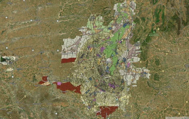
Jaipur JDA Masterplan: Zone Check and Land Use Guide
View Jaipur Masterplan as a live map overlay – check any plot's land use zone for free on 1acre.in. Jaipur masterplan zo...
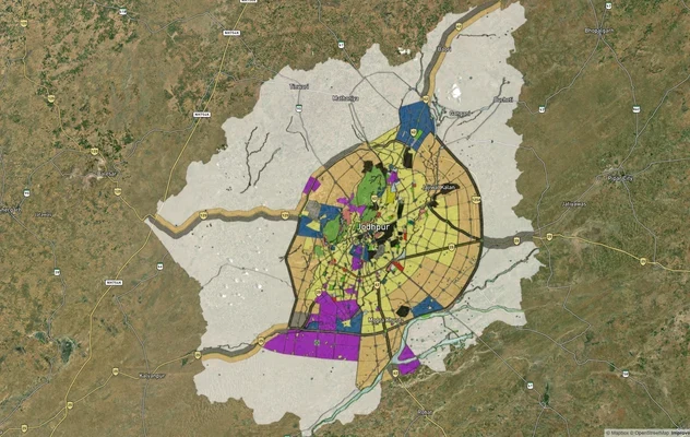
Jodhpur JODA Masterplan 2031: Zone Check and Land Use Guide
View Jodhpur Masterplan as a live map overlay – check any plot's land use zone for free on 1acre.in. Jodhpur masterplan ...
More Layers in Rajasthan
Alwar UIT Masterplan 2031: Zone Check and Land Use Guide
View Alwar Masterplan as a live map overlay – check any plot's land use zone for free on 1acre.in. Alwar Master Plan 205...
Jaipur JDA Masterplan: Zone Check and Land Use Guide
View Jaipur Masterplan as a live map overlay – check any plot's land use zone for free on 1acre.in. Jaipur masterplan zo...
Jodhpur JODA Masterplan 2031: Zone Check and Land Use Guide
View Jodhpur Masterplan as a live map overlay – check any plot's land use zone for free on 1acre.in. Jodhpur masterplan ...