
Sardar Patel Ring Road


Sardar Patel Ring Road Preview
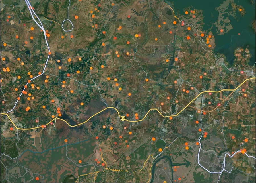
Try the Sardar Patel Ring Road on the map
Sign in once and explore the layer for a full day.
- No card details needed
- Find nearby verified lands for sale
Overview
Sardar Patel Ring Road (SP Ring Road) is the 76-kilometre, 60-metre-wide ring road encircling Ahmedabad, built by AUDA (Ahmedabad Urban Development Authority) and opened in 2004. For land buyers, its defining feature is the R-AH (Residential Affordable Housing) zone that AUDA marked out along the road, reported in 2013 as a belt of about 1 km around it. The entire stretch falls under AUDA's Revised Development Plan 2021 (RDP-2021) covering 1,866 sq km across Ahmedabad and 169 surrounding villages. Under AUDA's building regulations (CGDCR 2017) the R-AH zone has a maximum FSI of 2.7, the same ceiling as R-1; the FSI of 4 in AUDA's plan applies only within 200 m of BRTS and metro corridors and on the high-density corridor between the national highway and the 132 ft ring road, not across the ring road belt. Even so, the zoning drove heavy speculation on adjacent land. As of October 2026, AUDA is widening the road from four to six lanes. Prices swing from ₹8,000 per square yard in outer Sanand to ₹28,000 near Bopal-Ghuma, but none of that matters if your plot sits outside a sanctioned TP (Town Planning) Scheme or on agricultural land without NA (Non-Agricultural) conversion. This page covers the SP Ring Road map and route, its length and key facts, the six-laning status, what R-1, R-AH and the other zones permit, why TP scheme sanction comes first, the NA conversion trap catching buyers in Sanand and Changodar, and why Bopal-Ghuma commands triple what Sanand does despite both sitting on the same Ring Road.
SP Ring Road route and map
SP Ring Road is a 60-metre-wide outer ring road that encircles Ahmedabad. AUDA built it in four links between the national highways that radiate from the city, and the four links add up to about 76.3 km.
SP Ring Road route and map
Link
From
To
Length
Link 1
Rajkot Highway junction
Vadodara Highway junction
14.1 km
Link 2
Vadodara Highway junction
Himatnagar Highway junction
25.5 km
Link 3
Gandhinagar Highway junction
Rajkot Highway junction
22.9 km
Link 4
Himatnagar Highway junction
Gandhinagar Highway junction
13.8 km
Link
From
To
Length
Link 1
Rajkot Highway junction
Vadodara Highway junction
14.1 km
Link 2
Vadodara Highway junction
Himatnagar Highway junction
25.5 km
Link 3
Gandhinagar Highway junction
Rajkot Highway junction
22.9 km
Link 4
Himatnagar Highway junction
Gandhinagar Highway junction
13.8 km
Areas and junctions along the ring include Sarkhej, Bopal and Ghuma in the west; Science City, Bhat Circle and the Gandhinagar Highway junction in the north; Naroda, Nikol, Odhav, Vastral and Ramol in the east; and Narol, Vatwa, Hathijan and Sanathal in the south. The road meets the Ahmedabad-Vadodara Expressway and the Ahmedabad-Dholera Expressway, crosses the Sabarmati, and is crossed by the Shivranjani-Bopal BRTS line at Ghuma. Searches for the "new ring road" or "outer ring road" map of Ahmedabad usually mean this road, as opposed to the 132 Feet Ring Road inside the city. AUDA publishes the Revised Development Plan 2021 map, and a 2022 map, on its website under Planning, Revised Development Plan 2021; these show the ring road with the zones around it. 1acre does not host these files. To check a survey number against the alignment, view the SP Ring Road layer on the 1acre map.
SP Ring Road length and key facts
The table below gives the basic facts about SP Ring Road from AUDA's own records and reports up to October 2026.
SP Ring Road length and key facts
Fact
Detail
Full name
Sardar Patel Ring Road (SP Ring Road, SPRR)
Total length
About 76 km (76.3 km across four links)
Width
60 metre right of way
Lanes
Four lanes, with service roads; six-laning approved
Built by
Ahmedabad Urban Development Authority (AUDA)
Opened
2004
How land was assembled
Mostly through town planning schemes; only 13.1 km of 76.3 km needed conventional acquisition
Plan it sits in
AUDA Revised Development Plan 2021, covering 1,866 sq km
Zone along the road
Residential Affordable Housing (R-AH) belt, reported in 2013 as about 1 km around the road; maximum FSI 2.7
Toll plazas named in reports
Narol, Ramol and Ranasan, among others
Fact
Detail
Full name
Sardar Patel Ring Road (SP Ring Road, SPRR)
Total length
About 76 km (76.3 km across four links)
Width
60 metre right of way
Lanes
Four lanes, with service roads; six-laning approved
Built by
Ahmedabad Urban Development Authority (AUDA)
Opened
2004
How land was assembled
Mostly through town planning schemes; only 13.1 km of 76.3 km needed conventional acquisition
Plan it sits in
AUDA Revised Development Plan 2021, covering 1,866 sq km
Zone along the road
Residential Affordable Housing (R-AH) belt, reported in 2013 as about 1 km around the road; maximum FSI 2.7
Toll plazas named in reports
Narol, Ramol and Ranasan, among others
The way the road was built matters for buyers. Because most of the land came through TP schemes, landowners along the road were given final plots in return. That is why a sanctioned TP scheme, and a final plot number inside it, is the first document to check on this corridor.
SP Ring Road six-lane widening: latest update
AUDA is widening SP Ring Road from four to six lanes. As of October 2026, the latest published update, in July 2026, said tenders had been approved for both the eastern and western stretches of the Rs 2,200 crore project.
SP Ring Road six-lane widening: latest update
Date
Update
April 2024
AUDA asked a consultant to prepare the detailed project report for six-laning, new junction flyovers and the Bhat and Kamod river bridges
February 2025
AUDA invited bids in two packages: about 37 km in the east (about Rs 848 crore) and about 39 km in the west (about Rs 893 crore); service roads to widen to four lanes; target 2026
December 2025
AUDA invited bids for a DPR to widen the six-lane road from SP Ring Road to Sanskardham into an 8-lane link towards Sanand
5 July 2026
Gujarat's first urban cable-stayed flyover, 1.48 km, opened at Bhat Circle, where the Gandhinagar-Airport road crosses SP Ring Road
July 2026
Tenders approved for the eastern and western stretches; the Bhat Circle underpass to be built as part of the six-laning
September 2026
NHAI invited bids for an interchange where the Ahmedabad-Dholera Expressway meets SP Ring Road, with an 18-month build period; bids open on 23 October 2026
Date
Update
April 2024
AUDA asked a consultant to prepare the detailed project report for six-laning, new junction flyovers and the Bhat and Kamod river bridges
February 2025
AUDA invited bids in two packages: about 37 km in the east (about Rs 848 crore) and about 39 km in the west (about Rs 893 crore); service roads to widen to four lanes; target 2026
December 2025
AUDA invited bids for a DPR to widen the six-lane road from SP Ring Road to Sanskardham into an 8-lane link towards Sanand
5 July 2026
Gujarat's first urban cable-stayed flyover, 1.48 km, opened at Bhat Circle, where the Gandhinagar-Airport road crosses SP Ring Road
July 2026
Tenders approved for the eastern and western stretches; the Bhat Circle underpass to be built as part of the six-laning
September 2026
NHAI invited bids for an interchange where the Ahmedabad-Dholera Expressway meets SP Ring Road, with an 18-month build period; bids open on 23 October 2026
There is no official "2027" ring road map. Searches for an Ahmedabad new ring road map 2027 most likely reflect the six-laning and junction works now under way, which change the road's width and junctions but not its alignment. For land near a junction, check the TP scheme plan for road-widening reservations before buying, because widened junctions and service roads take land from the edges of existing plots.
R-1, R-AH and other zones along SP Ring Road
AUDA's Revised Development Plan 2021 sets the zone of every plot along the ring road. The zone decides what you can build; the TP scheme decides whether you can build at all. The areas below are from AUDA's DP-2021 zone table.
R-1, R-AH and other zones along SP Ring Road
Zone
What it is for
Area in DP-2021
R-1 (Residential Zone I)
Main residential zone of the city and its growth areas
249.5 sq km
R-2 (Residential Zone II)
Residential zone at lower intensity than R-1
44.3 sq km
R-3 (Residential Zone III)
Low-density residential zone; AUDA's plan note links it to more greenery
45.0 sq km
R-AH (Residential Affordable Housing)
Belt along SP Ring Road (reported in 2013 as about 1 km around the road) for affordable homes of 36 to 80 sq m, with extra FSI at a concessional rate up to a maximum of 2.7
66.2 sq km (special zone)
R-AH-1
Second affordable housing zone
13.7 sq km (special zone)
Transit zone
FSI up to 4 within 200 m of BRTS and metro corridors and on the high-density corridor between the national highway and the 132 ft ring road
Special zone
Agricultural
No construction until NA conversion and TP scheme sanction
Rest of the rural area
Zone
What it is for
Area in DP-2021
R-1 (Residential Zone I)
Main residential zone of the city and its growth areas
249.5 sq km
R-2 (Residential Zone II)
Residential zone at lower intensity than R-1
44.3 sq km
R-3 (Residential Zone III)
Low-density residential zone; AUDA's plan note links it to more greenery
45.0 sq km
R-AH (Residential Affordable Housing)
Belt along SP Ring Road (reported in 2013 as about 1 km around the road) for affordable homes of 36 to 80 sq m, with extra FSI at a concessional rate up to a maximum of 2.7
66.2 sq km (special zone)
R-AH-1
Second affordable housing zone
13.7 sq km (special zone)
Transit zone
FSI up to 4 within 200 m of BRTS and metro corridors and on the high-density corridor between the national highway and the 132 ft ring road
Special zone
Agricultural
No construction until NA conversion and TP scheme sanction
Rest of the rural area
R-1 is the zone most buyers ask about. In Ahmedabad it is the general residential zone, where the base FSI is 1.8, purchasable up to 2.7. R-AH has the same maximum FSI of 2.7 under Table 6.5 of AUDA's CGDCR 2017; what it adds is extra FSI at a concessional rate for projects that meet the affordable housing norms. FSI 4 is limited to the transit zone within 200 m of BRTS and metro corridors and the high-density corridor between the national highway and the 132 ft ring road, so a plot in the ring road R-AH belt does not get FSI 4 unless it also falls in one of those. In every zone, the FSI applies only once the plot has a final plot number in a sanctioned TP scheme.
Plots Outside TP Schemes Won't Get Building Permissions or Financed
AUDA's Revised Development Plan 2021 divides land into zones: Residential (R-1, R-2, R-AH), Commercial (C), Industrial (I), Public/Semi-Public, Open Space, and Agricultural. If your plot shows Agricultural classification on the masterplan, construction is prohibited until you get NA conversion from the Mamlatdar (revenue officer) confirming the land became non-agricultural. But NA conversion alone isn't enough. Your plot must also sit inside a sanctioned TP Scheme before AUDA issues building permissions. TP Schemes are detailed layout plans showing roads, plots, parks, and reservations. AUDA approves these schemes village-by-village, and only plots within sanctioned schemes qualify for construction. Here's how the trap works. Developer buys 100 acres of agricultural land along SP Ring Road. Gets NA conversion done showing farmland became non-agricultural. Files a TP Scheme application with AUDA showing proposed layout with roads and amenities. Starts selling plots before TP Scheme gets sanctioned, telling buyers "AUDA approval is in process." Three to five years pass. TP Scheme either gets rejected because road widths don't meet standards, or sits pending because AUDA wants revisions, or gets approved with major changes that alter original plot boundaries. Buyers holding sale deeds discover they can't get building sanctions from AUDA. Banks reject home loan applications. Khata doesn't get issued because the TP Scheme itself isn't finalized. The table below shows what separates buildable plots from frozen investments on Sardar Patel Ring Road.
Plots Outside TP Schemes Won't Get Building Permissions or Financed
Document You Need
What It Proves
Where to Verify
What Happens Without It
TP Scheme Sanction
Layout approved by AUDA
AUDA office, RDP 2021 map
Building permission impossible
NA Conversion Order
Agricultural land converted
Mamlatdar office
Construction prohibited by law
Final Plot Number
Plot legally demarcated
TP Scheme final plan
Boundaries not established
7/12 Extract
Land ownership record
Revenue office
Can't prove ownership
Document You Need
What It Proves
Where to Verify
What Happens Without It
TP Scheme Sanction
Layout approved by AUDA
AUDA office, RDP 2021 map
Building permission impossible
NA Conversion Order
Agricultural land converted
Mamlatdar office
Construction prohibited by law
Final Plot Number
Plot legally demarcated
TP Scheme final plan
Boundaries not established
7/12 Extract
Land ownership record
Revenue office
Can't prove ownership
Sanand and Changodar are where the TP Scheme trap springs most often. In October 2025, AUDA's 307th board meeting approved seven new TP schemes covering Sanand, Godhavi, Kaneti, Nindrada, and Matnuru villages, adding approximately 1,000 hectares to planned development. That sounds positive until you realize these are NEW schemes just getting approved in 2025. Dozens of layouts in these villages had been selling plots since 2018-2020 claiming "TP Scheme under process" or "AUDA approval coming soon." Buyers who purchased in 2019-2020 are still waiting for final TP sanction in 2026 while watching sanctioned schemes nearby appreciate another 30-40%. The process is still moving village by village. In August 2026, AUDA's 311th board meeting cleared revisions to 14 existing TP schemes for final sanction, including Chekhla-Godhavi-Garodia-Vansajada-Dhediya-Unali, Sanathal-Telav and Santej-Rakanpur, and declared its intention to make four new schemes over about 500 hectares in Dehgam, Godhavi, Kaneti, Sanand and Nidhrad. In September 2026, the state sanctioned preliminary TP Scheme No. 457 for Godhavi, with changes to several final plots. A preliminary sanction can still move plot boundaries, so check the latest plan at the AUDA office before buying. Now layer the R-AH zone complication on top. AUDA marked out an R-AH Affordable Housing Zone along SP Ring Road, but under Table 6.5 of AUDA's CGDCR 2017 its maximum FSI is 2.7, the same ceiling as R-1 (base 1.8, purchasable to 2.7). AUDA's FSI of 4 applies only within 200 m of BRTS and metro corridors and on the high-density corridor between the national highway and the 132 ft ring road, not across the ring road belt. Plots marketed as "R-AH zone, FSI 4.0 available" should be checked against the CGDCR and the AUDA zoning certificate before you pay. And whatever the zone, the FSI only applies inside a sanctioned TP Scheme. Plots outside TP schemes get zero FSI regardless of zone classification. A plot bought at ₹20,000 per square yard on the promise of extra development rights sits unbuildable if the TP Scheme never gets sanctioned.
Bopal-Ghuma Fetches Triple What Sanand Does For One Simple Reason
The corridor breaks into three completely different markets depending on whether sanctioned TP Schemes, completed infrastructure, and Metro connectivity actually exist or developers just kept promising they'd show up eventually. Bopal to Ghuma runs 12 kilometers and commands ₹22,000 to ₹28,000 per square yard. Why? Multiple TP Schemes got sanctioned and completed from 2015-2022. Roads are paved. Drainage systems work. Water supply connected through AUDA's trunk infrastructure. The Shivranjani-Bopal BRTS (Bus Rapid Transit System) Janmarg line crosses Ring Road at Ghuma providing public transport. AUDA's affordable housing developments in TP Scheme areas created residential demand. Banks approve loans here because TP sanction exists, plots have final numbers, and infrastructure is operational not promised. Ghuma to Sanand covers the next 35 kilometers at ₹12,000 to ₹18,000 per square yard. You'll find some sanctioned TP Schemes here, but a huge chunk sits in schemes that are "under process" or "draft stage" with AUDA. These areas got NA conversion done showing agricultural land became non-agricultural, but TP Scheme sanction never came through or got approved with major modifications changing plot boundaries. Roads might be partially laid. Water supply depends on borewells not AUDA connections. Power infrastructure is incomplete. Banks treat these plots completely differently. Either outright rejection or 50-60% down payment required with interest rates 2-3% higher because risk jumped. Sanand to outer Changodar is the final 29 kilometers running ₹7,000 to ₹12,000 per square yard. Pure speculation on Micron semiconductor plant spillover, automotive corridor expansion (Ford, Tata Motors facilities nearby), and eventual Metro extension under Phase 2 plans. Developers grabbed agricultural land betting industrial growth drives residential demand. Here's the bet: Micron plant construction accelerates, automotive suppliers expand, new TP Schemes get approved by 2027-2028, early buyers double money. TP approvals delay, schemes get rejected or modified heavily, plots sit frozen. Most plots out here don't have TP Scheme sanctions, sit on agricultural land with questionable NA conversion, and banks won't finance them on standard terms. Here's how the three zones break down by TP Scheme status and infrastructure completion.
Bopal-Ghuma Fetches Triple What Sanand Does For One Simple Reason
Stretch
Distance from Bopal
TP Scheme Status
Price Per Sq Yard
Main Risk
Bopal-Ghuma
0-12 km
Sanctioned, infrastructure complete
₹22,000-₹28,000
Premium locked in, limited inventory
Ghuma-Sanand
12-47 km
Mixed sanctioned and pending
₹12,000-₹18,000
Banks reject pending schemes
Sanand-Changodar
47-76 km
Mostly draft or no TP scheme
₹7,000-₹12,000
No bank loans, TP rejection risk
Stretch
Distance from Bopal
TP Scheme Status
Price Per Sq Yard
Main Risk
Bopal-Ghuma
0-12 km
Sanctioned, infrastructure complete
₹22,000-₹28,000
Premium locked in, limited inventory
Ghuma-Sanand
12-47 km
Mixed sanctioned and pending
₹12,000-₹18,000
Banks reject pending schemes
Sanand-Changodar
47-76 km
Mostly draft or no TP scheme
₹7,000-₹12,000
No bank loans, TP rejection risk
The Bopal-Ghuma zone is the established winner. It appreciated 35-45% from 2020 to 2026 because TP Schemes got completed and BRTS connectivity made commuting viable. Banks finance sanctioned schemes here. Ghuma to Sanand followed at 20-30% but only in TP-sanctioned pockets. Areas without final TP sanction barely moved or dropped 10-15% once buyers realized approvals weren't coming. Sanand and Changodar are wild cards. The seven new TP Schemes approved in October 2025 will take 2-3 years to reach final sanction stage. Plots in those schemes might see 25-35% appreciation if sanctions come through smoothly. Plots outside those schemes sitting on agricultural land without proper NA conversion haven't moved in 5 years. The R-AH zone is often sold as an "FSI 4.0" benefit, and that claim does not hold for most plots. Under CGDCR 2017 (Table 6.5), the R-AH zone has a maximum FSI of 2.7. AUDA's note on the Revised Development Plan 2021 allows FSI 4 only within 200 m of BRTS and metro corridors and on the high-density corridor between the national highway and the 132 ft ring road. R-AH projects must also meet affordable housing norms (36 sq m and 80 sq m unit sizes, density requirements), and no FSI applies until AUDA has sanctioned the TP scheme. Check any plot marketed as "R-AH zone, FSI 4.0" against the zone map and the scheme's sanction status before you pay a token. The Micron semiconductor plant impact zone near Sanand shows classic speculation patterns. Micron announced a ₹22,500 crore fabrication plant in Sanand in 2023. Land prices in 5-kilometer radius jumped 40-60% within 6 months. Then reality set in. Micron's construction timeline is 5-7 years. Employee housing demand won't materialize until 2028-2030. TP Schemes in Sanand villages are mostly in draft stage. Prices corrected 15-25% in 2024-2025 as speculative buyers realized infrastructure wouldn't arrive for another 3-5 years minimum.
Data Sources & Verification
This page is based on AUDA's own planning and project records, read in October 2026, with news reports used for tenders, approvals and openings that AUDA does not publish as notices. Where a fact could not be confirmed from an official or established source, it was left out.
* AUDA, Engineering projects page: 60 m width, 76 km length and the four link lengths, planned six-laning, junction works * AUDA, Development page: DP-2021 zone areas (R-1, R-2, R-3, R-AH, R-AH-1) and the 1,866 sq km plan area * AUDA, Revised Development Plan 2021 page: list of published plan maps (2021 and 2022), GDCR and notifications * AUDA, CGDCR 2017 Part 2, Table 6.5: base, chargeable and maximum FSI for R-1, R-2, R-3 and R-AH (R-AH maximum 2.7) * AUDA, Note on Revised Development Plan 2021 and Affordable Housing note: affordable housing unit sizes, concessional FSI, FSI 4 within 200 m of BRTS and metro corridors and on the high-density corridor * Dainik Bhaskar (March 2013), as cited in standard references: R-AH belt of about 1 km around the road * AUDA, TP Scheme page: draft, preliminary and final sanction dates of TP schemes * HUDCO-HSMI Shelter (April 2021): 76.3 km length, land assembled through TP schemes, 13.1 km acquired * NBM&CW (April 2024), Biltrax Media (February 2025) and DeshGujarat (July 2026): six-laning DPR, tenders and status * Swarajya (July 2026): Bhat Circle cable-stayed flyover * DeshGujarat (December 2025, August 2026, September 2026): Sanand 8-lane link DPR, AUDA 311th board meeting, TP Scheme 457, NHAI interchange at the Dholera Expressway junction
For Land Owners & Agents
Looking to sell your land in Gujarat?
I want to sell my land in Gujarat
10:32
Plz share your Land's location - We will list it on 1acre map, for Free.
10:32

For Land Buyers
Browse all verified lands & plots in Gujarat
Every listing goes through our Preliminary Verification Process.
More Layers in Gujarat
See all 19 layers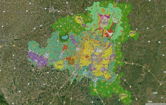
AUDA TP Scheme Map and Ahmedabad Masterplan Zones
AUDA TP scheme list with stages, where to get TP scheme and village PDFs, R1, R2 and R3 FSI and DP-2041 status, then che...
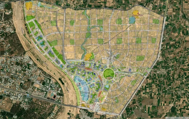
GIFT City Masterplan: GIFT UDA and GUDA Zone Check
View GIFT City Masterplan as a live map overlay – check any plot's land use zone for free on 1acre.in. GIFT City Master ...
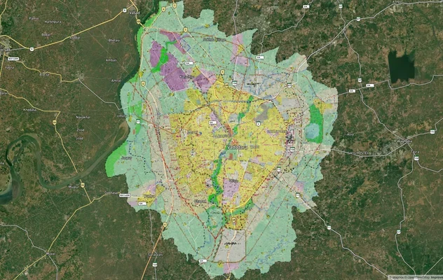
Vadodara VUDA Masterplan 2031: TP Scheme Map, Ring Road
See the VUDA TP scheme list and status, the 75 m ring road route and where VUDA maps are published, then check your Vado...
More Layers in Gujarat
AUDA TP Scheme Map and Ahmedabad Masterplan Zones
AUDA TP scheme list with stages, where to get TP scheme and village PDFs, R1, R2 and R3 FSI and DP-2041 status, then che...
GIFT City Masterplan: GIFT UDA and GUDA Zone Check
View GIFT City Masterplan as a live map overlay – check any plot's land use zone for free on 1acre.in. GIFT City Master ...
Vadodara VUDA Masterplan 2031: TP Scheme Map, Ring Road
See the VUDA TP scheme list and status, the 75 m ring road route and where VUDA maps are published, then check your Vado...
Frequently Asked Questions
Yes, in sanctioned TP Schemes from Bopal to Ghuma with completed infrastructure and BRTS connectivity. No, in pending or draft TP Schemes or agricultural land without NA conversion in Sanand and Changodar. AUDA's TP sanction requirement catches buyers quarterly, making scheme verification mandatory before signing.
AUDA TP (Town Planning) Scheme is a detailed layout plan showing roads, plots, parks, and infrastructure approved under Revised Development Plan 2021. Sanctioned schemes qualify for building permissions, final plot demarcation, and bank financing. Plots outside sanctioned TP Schemes cannot get building sanctions regardless of NA conversion or zone classification.
NA (Non-Agricultural) conversion is the Mamlatdar's order permitting agricultural land to be used for non-agricultural purposes. NA conversion alone doesn't authorize construction. AUDA TP Scheme sanction is separately required. Plots with NA but no TP sanction remain legally unbuildable despite non-agricultural classification. Process takes 6-12 months minimum.
Bopal to Ghuma grew 35-45% from 2020 to 2026 driven by sanctioned TP Schemes and BRTS Janmarg connectivity. Ghuma to Sanand TP-sanctioned pockets ran 20-30% appreciation. Sanand seven new TP schemes approved October 2025 may see 25-35% if sanctions complete smoothly. Plots outside sanctioned schemes stagnated or dropped 10-25%.
Yes, but only for sanctioned TP Schemes with final plot numbers and NA conversion done. Draft or pending TP Schemes, agricultural land without NA, and plots outside any scheme face loan rejection or require 50-60% down with 2-3% higher interest. Most Sanand-Changodar plots don't qualify for standard financing.
R-AH (affordable housing) zones have a maximum FSI of 2.7 under CGDCR 2017 Table 6.5, the same ceiling as R-1, where base FSI is 1.8 and up to 2.7 can be purchased. FSI 4 applies only within 200 m of BRTS and metro corridors and on AUDA's high-density corridor. R-AH projects must also meet affordable housing norms (36 to 80 sq m units, density standards). Both zones need a sanctioned TP scheme before any FSI applies.
Visit AUDA office in Ahmedabad with survey number and village name. Request TP Scheme status certificate and final layout plan. Cross-check plot location against RDP 2021 zone map. Verify NA conversion exists if land was agricultural. Confirm final plot number got assigned in sanctioned TP Scheme before signing.
Bopal to Ghuma climbed from ₹14,000-₹16,000 per square yard in 2020 to ₹22,000-₹28,000 in 2026. Ghuma-Sanand sanctioned schemes ran ₹10,000-₹12,000 to ₹12,000-₹18,000. Sanand-Changodar stayed flat at ₹7,000-₹12,000 for plots outside sanctioned schemes. R-AH zone and TP sanctions drove premiums in approved areas only.
SP Ring Road is about 76 km long. AUDA built it in four links between the Rajkot, Vadodara, Himatnagar and Gandhinagar highway junctions, measuring 14.1 km, 25.5 km, 22.9 km and 13.8 km, or about 76.3 km in all. The road has a 60-metre right of way and four lanes, and AUDA has approved widening it to six lanes.
In most searches, yes. Ahmedabad has the 132 Feet Ring Road inside the city and the 76 km Sardar Patel Ring Road on its outskirts, which people often call the new ring road or outer ring road. AUDA's published plans do not show a separate second outer ring road. The six-lane widening and new junctions now under way are changes to SP Ring Road itself.
AUDA publishes the Revised Development Plan 2021 map, and a 2022 map, on its website under Planning, Revised Development Plan 2021. These show SP Ring Road with the zones around it. TP scheme plans are listed on AUDA's TP Scheme page, and part-plans can be requested from AUDA's Drawing Branch. There is no separate official 2027 map.
Yes. AUDA approved a Rs 2,200 crore project to widen SP Ring Road from four to six lanes and expand its service roads. Bids were invited in February 2025 in two packages, about 37 km in the east and 39 km in the west, and by July 2026 the tenders for both stretches had been approved. Junction works such as the Bhat Circle flyover are part of the same upgrade.
R-1, or Residential Zone I, is the main residential zone in AUDA's Revised Development Plan 2021, covering about 249.5 sq km. It allows housing and related uses, with a base FSI of 1.8 that can be raised to 2.7 by paying for extra FSI. Along SP Ring Road, the R-AH affordable housing belt sits alongside R-1. In both, building needs a final plot in a sanctioned TP scheme.
Source
Official Ahmedabad Urban Development Authority (AUDA) documents
Coordinate Reference System
EPSG:4326 (WGS 84)
Geometry Type
LineString / MultiLineString
Data Format
Vector (GeoJSON) + Raster Tiles
Last Verified
2026
Status
Active
Was this layer helpful?
Anything wrong, outdated, or missing we want to hear it.