
Ahmedabad-Dholera Expressway
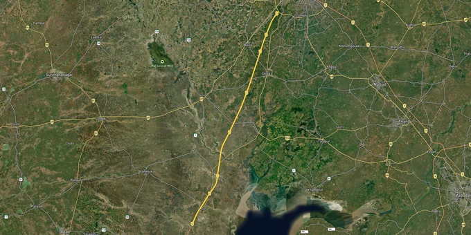

Ahmedabad Dholera Expressway Preview
Try the Ahmedabad-Dholera Expressway on the map
Sign in once and explore the layer for a full day.
- No card details needed
- Find nearby verified lands for sale
Overview
The Ahmedabad Dholera Expressway is a 109-km, four-lane access-controlled greenfield highway (expandable to eight lanes) forming the spine of the Dholera Special Investment Region (DSIR), India's first planned smart city on the Delhi-Mumbai Industrial Corridor (DMIC). Inaugurated on 31 March 2026 by the Prime Minister, the expressway connects Sardar Patel Ring Road near Sarkhej to Adhelai village in Bhavnagar district, passing through eight major interchanges. The DSIR spans 920 sq km across 22 villages, with six Town Planning Schemes (TP1 to TP6) governing all land use. This page covers what to verify before any Ahmedabad-Dholera Expressway land-buying decision, from TP scheme status to the fraud patterns that have cost investors thousands of crores.
Outside-SIR Plots and the ₹2,676 Crore Fraud Pattern Every Buyer Must Know
The biggest single risk in Ahmedabad-Dholera Expressway land buying is not the project itself. It is the secondary market of agricultural land sold outside the official DSIR boundary using the Dholera Smart City brand. The Nexa Evergreen case, in which the Enforcement Directorate (ED) conducted raids at 25 locations across Jaipur, Sikar, Jhunjhunu, and Ahmedabad in June 2025, exposed how two brothers allegedly defrauded approximately 70,000 investors of ₹2,676 crore through fake plot promises in Dholera. Authorities confirmed that Nexa Evergreen had no connection whatsoever to the official government project.
The structural traps that make outside-SIR plots dangerous are mapped in the table below:
Risk Type
What to Check
Why It Matters
Plot outside official 22-village DSIR boundary
Verify village name against DSIRDA's official list
Only inside-SIR land is governed by DSIRDA and the SIR Act 2009
Agricultural land without NA order
Demand NA (Non-Agricultural) conversion certificate from the District Collector
NRIs cannot legally buy agricultural land; construction is prohibited without it
No GujRERA registration
Check the project on gujrera.gujarat.gov.in before paying
Unregistered projects have no buyer protection under RERA
No Final Plot (FP) number from DSIRDA
Ask for the TP Scheme and FP number and cross-verify with DICDL
Only DICDL-allocated Final Plot numbers confirm government-approved land
Ponzi-style "guaranteed returns" offers
Any promise of fixed high returns from a land plot is a fraud signal
The Nexa Evergreen scheme used MLM commissions and gift incentives to recruit investors
Risk Type
What to Check
Why It Matters
Plot outside official 22-village DSIR boundary
Verify village name against DSIRDA's official list
Only inside-SIR land is governed by DSIRDA and the SIR Act 2009
Agricultural land without NA order
Demand NA (Non-Agricultural) conversion certificate from the District Collector
NRIs cannot legally buy agricultural land; construction is prohibited without it
No GujRERA registration
Check the project on gujrera.gujarat.gov.in before paying
Unregistered projects have no buyer protection under RERA
No Final Plot (FP) number from DSIRDA
Ask for the TP Scheme and FP number and cross-verify with DICDL
Only DICDL-allocated Final Plot numbers confirm government-approved land
Ponzi-style "guaranteed returns" offers
Any promise of fixed high returns from a land plot is a fraud signal
The Nexa Evergreen scheme used MLM commissions and gift incentives to recruit investors
A GujRERA registration number and a DICDL-issued FP number together are your two non-negotiable checks. If a seller cannot produce both within the first conversation, the plot is not inside the official DSIR development framework, regardless of what the marketing material shows.
TP1, TP2, and the PipliAirport Corridor: Where Development Is Real and Where It Remains Speculative
The DSIR development plan divides 920 sq km into six Town Planning Schemes. Phase 1 (153 sq km) covers TP1 and TP2, which contain the 22.5 sq km Activation Area, 72 km of completed internal roads, and the expressway's Ambli Interchange, connecting directly to the core smart city zone. This is where GIDB has confirmed completed trunk infrastructure. Everything outside TP1 and TP2 is in progressive phases with no confirmed completion timeline.
The table below maps the major TP zones against development confidence and buyer profile:
Zone / Corridor
Development Status
Primary Use
Buyer Profile
Key Risk
TP2 Activation Area (22.5 sq km)
Infrastructure built, first residential auction done
Industrial, mixed-use, residential
Institutional and commercial buyers
High entry prices; demand FP number
TP1 Residential Belt (near ABCD Building)
Roads and utilities planned, partial delivery
Residential, public facilities
Long-term investors, NRIs
Verify NA order and GujRERA number
Pipli Diamond Interchange / Airport Corridor
The interchange is 100% complete, and the airport under Phase 1
Logistics, commercial, residential
Mid-to-long horizon investors
Airport Phase 1 needs AAI clearance before operations
TP3 / TP4 Residential Zones
Early planning stage
Affordable residential
Long-horizon individual buyers
No infrastructure timeline confirmed
TP5 / TP6 (IT / Long-term expansion)
Blueprint stage only
IT parks, future expansion
Not specified
Highly speculative; decade-plus horizon
Zone / Corridor
Development Status
Primary Use
Buyer Profile
Key Risk
TP2 Activation Area (22.5 sq km)
Infrastructure built, first residential auction done
Industrial, mixed-use, residential
Institutional and commercial buyers
High entry prices; demand FP number
TP1 Residential Belt (near ABCD Building)
Roads and utilities planned, partial delivery
Residential, public facilities
Long-term investors, NRIs
Verify NA order and GujRERA number
Pipli Diamond Interchange / Airport Corridor
The interchange is 100% complete, and the airport under Phase 1
Logistics, commercial, residential
Mid-to-long horizon investors
Airport Phase 1 needs AAI clearance before operations
TP3 / TP4 Residential Zones
Early planning stage
Affordable residential
Long-horizon individual buyers
No infrastructure timeline confirmed
TP5 / TP6 (IT / Long-term expansion)
Blueprint stage only
IT parks, future expansion
Not specified
Highly speculative; decade-plus horizon
The most misunderstood corridor is the Pipli-Airport belt. The diamond interchange at Pipli is fully complete and provides direct access to the Dholera International Airport via a 9.56 km link road. But the airport itself remains in Phase 1 construction, pending AAI commercial approval. Price land on confirmed expressway access and the operational activation area, not on airport operational timelines that are still subject to regulatory approvals.
Was this layer helpful?
Anything wrong, outdated, or missing we want to hear it.
For Land Owners & Agents
Looking to sell your land in Gujarat?
I want to sell my land in Gujarat
10:32
Plz share your Land's location - We will list it on 1acre map, for Free.
10:32


For Land Buyers
Browse all verified lands & plots in Gujarat
Every listing goes through our Preliminary Verification Process.
More Layers in Gujarat
See all 19 layers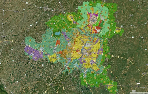
Ahmedabad - Gandhinagar Masterplan
View Ahmedabad - Gandhinagar Masterplan as a live map overlay – check any plot's land use zone for free on 1acre.in. Ahm...
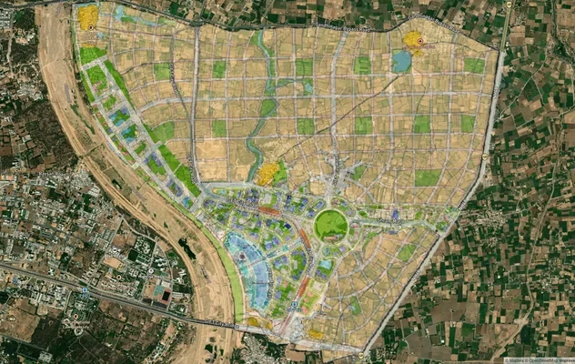
GIFT City Masterplan: GIFT UDA and GUDA Zone Check
View GIFT City Masterplan as a live map overlay – check any plot's land use zone for free on 1acre.in. GIFT City Master ...
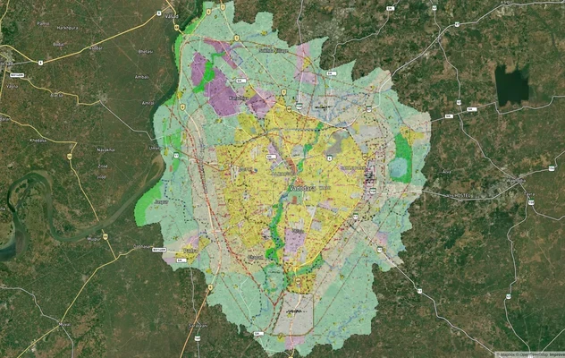
Vadodara VUDA Masterplan 2031: Zone Check and Land Use Guide
View Vadodara Masterplan as a live map overlay – check any plot's land use zone for free on 1acre.in. Vadodara VUDA Mast...
More Layers in Gujarat
Ahmedabad - Gandhinagar Masterplan
View Ahmedabad - Gandhinagar Masterplan as a live map overlay – check any plot's land use zone for free on 1acre.in. Ahm...
GIFT City Masterplan: GIFT UDA and GUDA Zone Check
View GIFT City Masterplan as a live map overlay – check any plot's land use zone for free on 1acre.in. GIFT City Master ...
Vadodara VUDA Masterplan 2031: Zone Check and Land Use Guide
View Vadodara Masterplan as a live map overlay – check any plot's land use zone for free on 1acre.in. Vadodara VUDA Mast...