
FMB Sketch Download: AP, Telangana and Karnataka
Andhra Pradesh, Telangana and Karnataka each use a different portal for the FMB sketch, and unsigned copies are not accepted for loans or court filings.
What Is a Field Measurement Book?
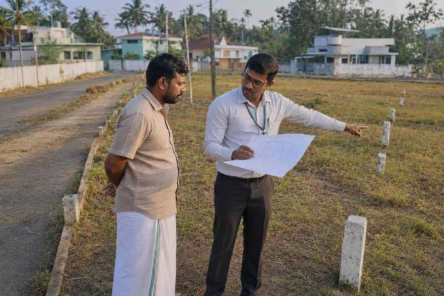
A field measurement book is the government's record of how land was physically measured during a survey. Every survey number in a village has its own page inside it, showing that parcel's exact shape, boundary lines, and subdivisions.
The record sits with the state survey or revenue department, usually at the Tahsildar's office, the mandal-level revenue office headed by a Tahsildar. It forms the base layer for almost everything downstream: mutation, taxation, loan approval, and boundary litigation. When someone asks for an "FMB copy," they mean this drawing plus the measurements tied to one survey number.
Think of it as the land's original blueprint. A sale deed or pattadar passbook tells you who owns the land. The FMB tells you whether the shape and size on paper match what's actually there.
If you don't know the survey number yet, you can find it from the location on a map before applying anywhere.
Why the FMB Sketch Matters
It is the strongest documentary evidence of where a plot's boundaries actually run, which is why it surfaces at nearly every stage of a land transaction.
Buyers use it to confirm that the parcel being sold matches the survey number in the deed. Owners reach for it when a neighbor shifts a boundary stone or when part of the plot gets sold and subdivided. Banks want it before sanctioning agricultural or construction loans.
Municipal offices ask for it before approving construction or releasing water and electricity connections. Courts accept it in boundary disputes, though a certified or digitally signed copy carries considerably more weight than a plain printout.
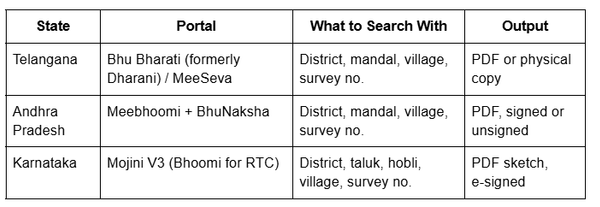
Telangana issues the FMB copy through the Bhu Bharati portal or any MeeSeva center, with the Tahsildar's office as the offline route.
Through Bhu Bharati or MeeSeva
Land services moved from Dharani to Bhu Bharati in 2025, with the same underlying data and a new platform.
Visit the Bhu Bharati portal or a nearby MeeSeva center.
Select the FMB (Field Measurement Book). Copy service under land applications
Enter district, mandal, village, and survey number.
Submit with basic identification.
Track using the reference number issued.
If the FMB or Tippon option shows as disabled for your village, that generally means the data hasn't migrated yet, not that the record is missing. The offline route applies. You can also check the survey number boundary on the Telangana map to confirm you're applying against the right parcel.
Offline at the Tahsildar Office
Submit a written request to the Tahsildar of the mandal where the land sits, stating the survey number, village, and purpose. The office verifies the record and issues the copy, sometimes after a field visit if there's a discrepancy. Collection is in person or via the MeeSeva centre where you filed.
How to Get Your FMB in Andhra Pradesh
AP issues FMB sketches free through Meebhoomi, with BhuNaksha as the map-based companion.
Steps on Meebhoomi
Open meebhoomi.ap.gov.in and go to the LP Map / FMB / Village Map section
Select district, mandal and village
Enter the survey number and captcha
The sketch opens showing boundary lines and sub-divisions
Download or print as PDF
Digitally signed sketches are legally valid. Unsigned ones need to be certified at the Tahsildar's office before they can be used for any official purpose. Check for the signature mark rather than relying on colour.
Cross-read the sketch against the Adangal and the Pahani ROR 1-B. If the extent on the FMB and the extent on the 1-B disagree, resolve it before money changes hands.
Using BhuNaksha for Geo-Referenced Maps
Select the district, mandal, and village, then pick the survey number by clicking the map or typing it. Choose Map Report to generate a document showing the plot alongside its neighbours, and download it as a PDF.
Meebhoomi gives you a parcel's sketch. BhuNaksha shows that a parcel in context against its neighbours is a more useful view when a dispute involves an adjoining plot.
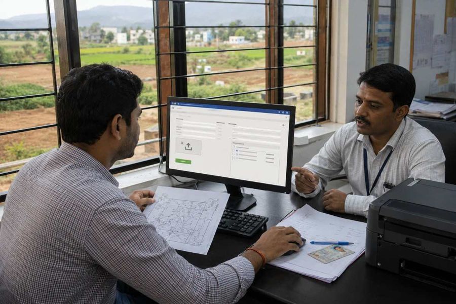
Karnataka doesn't use "FMB" as its working term, and this trips up buyers coming from AP or Telangana. Three different documents get confused:
Tippani, Atlas, and Pakka Book, the survey sketches and field measurement records for an existing parcel. These are the true FMB equivalents.
Akarband, the settlement register recording survey-wise extent and assessment.
11E sketch, a pre-mutation sketch, is needed only when part of a survey number is being sold. The Sub-Registrar cannot register a partial transfer without one.
Buying a whole parcel? You need the Tippani. Buying a portion? You need the 11E as well.
Applying Through Mojini V3
Mojini V3 is run by the Survey, Settlement and Land Records Department and handles all sketch requests.
Go to bhoomojini.karnataka.gov.in
Register with your mobile number and verify by OTP
Select the document type, Tippani, Akarband, 11E, or Pakka Book
Enter district, taluk, hobli (a cluster of villages within a taluk), village, and survey number
Pay the fee online and submit
Track status and download once processed
A "no result" response is possible where a parcel's sketch has not been digitised. That calls for a field survey request through SSLR rather than a second attempt online. The survey sketch and Mojini guide cover the application flow in detail, and the Karnataka survey number map helps locate a parcel first.
FMB Access at a Glance
"Data not found." The survey number hasn't been digitised for that village. The record still exists on paper. File a written request at the revenue office.
AP resurvey mismatch. Andhra Pradesh has been resurveying land since 2020 and assigning new survey numbers. An older FMB may quote a number that no longer matches the current record. Check the mutation status on the 1-B to see which number is current.
Unsigned sketches. Fine for reference, rejected for loans and court filings. Get the certified version.
Assigned or Inam land. Inam land was historically granted rent-free by rulers or governments; assigned land was allotted to landless cultivators. Both carry transfer restrictions and are often excluded from standard digital records. Manual application only, and check transferability before anything else.
Subdivision mismatch. Splits made after the original survey don't always reflect online. The revenue office can confirm the current number.
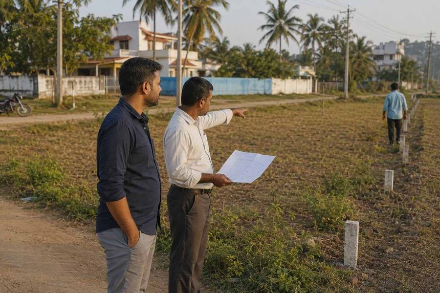
An FMB tells you what a parcel's boundary should look like. It doesn't tell you where that boundary sits relative to the road, the neighbouring plots, or the land a seller actually walked you across.
The 1-acre map layer works in the opposite direction to a state portal. Rather than entering a survey number to get a sketch, you zoom to the land, and the survey-number boundary appears over satellite imagery. That helps in two situations: sanity-checking a survey number a seller has quoted before you apply, and finding the number when all you have is a location.
Two limits worth stating plainly. Coverage comes from revenue records, which map agricultural and peri-urban land; parcels inside municipal limits may not appear. And the map is a reference layer, not a certified record. For registration, a loan, or any legal filing, the signed FMB from the state portal or the Tahsildar's office is the document that counts.
Conclusion
Getting an FMB rarely requires multiple office trips anymore. What it does require is knowing which portal your state uses, which document that state actually calls the FMB, and what details to have ready before you start. The goal is the same in all three states: confirming the land's real shape matches what the paperwork claims.
Before you begin, have your district, mandal or taluk, village, and survey number to hand. Use Bhu Bharati or MeeSeva for Telangana, Meebhoomi and BhuNaksha for Andhra Pradesh, and Mojini V3 for Karnataka. Confirm the sketch is digitally signed before relying on it for a loan or legal matter. And always cross-check the FMB against the sale deed and a physical site visit before finalising a purchase. If you're at the start of a transaction, the Andhra Pradesh land-buying guide covers the full document trail.
Working in a neighboring state?
The Tamil Nadu FMB guide and Kerala FMB guide follow the same structure.
-900x600.jpg)
-900x600.jpg)
-900x600.jpg)