
Dwarka Expressway


Dwarka Expressway Preview
Try the Dwarka Expressway on the map
Sign in once and explore the layer for a full day.
- No card details needed
- Find nearby verified lands for sale
Overview
Dwarka Expressway land buying is being marketed as the easiest investment win in the National Capital Region, yet the rules that genuinely shape what is buildable, saleable or bankable here trace back to a single statutory document: the Gurugram Master Plan 2031, notified formally as the GMUC Development Plan 2031. Drafted by the Haryana Town and Country Planning Department, the plan classifies the corridor as the northern ring road of the wider Gurgaon-Manesar Urban Complex. The route, designated NH-248BB, covers a built length of about 27.6 km from Shiv Murti at the Delhi end to Kherki Daula in Gurgaon. The sections below explain the licence traps, the sector grid, and the questions that matter before a buyer commits.
Sector Zoning Traps and the CLU Licence That Decides Everything
There are really only two ways a Dwarka Expressway purchase quietly turns into a mistake. One is handing money to a coloniser whose project never received a Haryana TCP licence in the first place. The other is treating a commercial pocket as residential because a billboard a kilometre away used the word "luxury".
Before anyone trusts a brochure, the smarter move is to anchor every conversation in what the master plan actually allows. The grid below sets out the corridor's main clusters and the use the GMUC Development Plan 2031 assigns to each.
Sector Cluster
Zone Type (GMUC 2031)
Allowed Use
Watch Out
99, 99A, 100, 101, 102, 102A, 103, 104 (Cluster C, Gurgaon side)
Residential nodes flanking the de-notified SEZ patch
Licensed group housing and plotted colonies
Pockets in 100, 101 and 107 are reserved for public utilities
105, 106, 109, 110, 110A, 111, 112, 113 (Clusters A and B)
Hybrid: residential layered with a commercial belt
Group housing alongside office and retail formats
Adjacent sectors 88 and 114 are exclusively commercial
83, 84, 85, 86 (southern catchment feeding the New Gurgaon plot investment belt)
Residential
Licensed townships and plotted floor schemes
Ask for the licence number first, talk numbers later
37D, 36A, 36B, 88B
Mixed residential-commercial nodes
Licensed group housing
A few patches are held back for road-alignment revisions
Sector Cluster
Zone Type (GMUC 2031)
Allowed Use
Watch Out
99, 99A, 100, 101, 102, 102A, 103, 104 (Cluster C, Gurgaon side)
Residential nodes flanking the de-notified SEZ patch
Licensed group housing and plotted colonies
Pockets in 100, 101 and 107 are reserved for public utilities
105, 106, 109, 110, 110A, 111, 112, 113 (Clusters A and B)
Hybrid: residential layered with a commercial belt
Group housing alongside office and retail formats
Adjacent sectors 88 and 114 are exclusively commercial
83, 84, 85, 86 (southern catchment feeding the New Gurgaon plot investment belt)
Residential
Licensed townships and plotted floor schemes
Ask for the licence number first, talk numbers later
37D, 36A, 36B, 88B
Mixed residential-commercial nodes
Licensed group housing
A few patches are held back for road-alignment revisions
The plan, on its own, does not legalise a single brick. Every legitimate township strung along this corridor depends on a CLU licence Haryana TCP grants under the Haryana Development and Regulation of Urban Areas Act, 1975. Without that number, there is no project, period. When a coloniser cannot produce the licence on demand, the plot in question is either agricultural land still queueing for change-of-use approval, or it falls within an unauthorised colony Gurugram TCP has not regularised. The state has begun tightening enforcement in visible ways. Around May 2025, the Haryana State Pollution Control Board served notices on roughly 58 construction sites along the corridor over compliance failures, with named locations such as the Lotus Homz Affordable Group Housing Colony at Sector 111 and an industrial unit operating off Pataudi Road. The lesson is uncomfortable but useful: an active construction site is not proof of legal sanction. Insist on the licence, verify the number directly on the TCP Haryana portal, and only after the documentation holds up should anyone reach for a pen.
Growth Corridors: Where Sector Numbers Decide Returns
The corridor refuses to behave as a single market. It separates into three identifiable clusters, each with its own pricing rhythm, end-buyer profile and risk skew. The Gurgaon-facing side carries the deepest mid-segment supply and the fastest velocity. The central stretch tilts firmly into premium luxury territory. The Delhi-facing sectors charge a premium tied to airport proximity and the proposed Diplomatic Enclave, though resale movement here is noticeably thinner.
The table that follows compares the principal residential clusters along the route with their commercial and mixed-use neighbours, alongside the drivers and risks that any serious buyer needs to weigh.
Cluster
Sectors
Growth Driver
Risk
Cluster C: Gurgaon side
99, 99A, 100, 101, 102, 102A, 103, 104
Access via Hero Honda Chowk; flagship projects from M3M, Adani and Shapoorji
A handful of parcels carry SEZ-conversion legacy notifications
Cluster B: Centre
105, 106, 107, 108, 109, 110
Direct expressway frontage; anchor developments including Conscient One and Sobha City
Commercial-belt overlap muddies the residential layout
Cluster A: Delhi side
110A, 111, 112, 113, 114
T3 airport tunnel commissioned in March 2025; the 10.1 km Delhi section opened to traffic in August 2025; proximity to the planned Diplomatic Enclave
Sharply premium pricing with limited resale depth
Cluster
Sectors
Growth Driver
Risk
Cluster C: Gurgaon side
99, 99A, 100, 101, 102, 102A, 103, 104
Access via Hero Honda Chowk; flagship projects from M3M, Adani and Shapoorji
A handful of parcels carry SEZ-conversion legacy notifications
Cluster B: Centre
105, 106, 107, 108, 109, 110
Direct expressway frontage; anchor developments including Conscient One and Sobha City
Commercial-belt overlap muddies the residential layout
Cluster A: Delhi side
110A, 111, 112, 113, 114
T3 airport tunnel commissioned in March 2025; the 10.1 km Delhi section opened to traffic in August 2025; proximity to the planned Diplomatic Enclave
Sharply premium pricing with limited resale depth
Pricing across the corridor currently sits in the ₹7,000 to ₹16,000 per sq ft band, with the exact number driven by sector, developer pedigree and floor positioning. The shift in fundamentals is hard to miss. Unsold stock across these sectors has tightened sharply, sliding from a 25 to 30% overhang a decade back to roughly 7 to 8% today. Of all the addresses along the route, Sector 102 collects the most misreading. It gets pitched as a luxury residential anchor on the strength of Emaar Imperial Gardens, Adani M2K and Shapoorji Joyville, but adjoining pockets in Sectors 100 and 101 carry public-utility reservations rather than group-housing rights. The safe practice is to match the specific khasra and sector boundary against the GMUC Development Plan 2031 sheet before accepting that any "Sector 102 plot" is genuinely residential. For someone buying their first home on this corridor, the steadier band runs from Sectors 109 through 113. Licensing density is thickest in that stretch, RERA records are easy to track, and resale liquidity is genuine because actual residents are already living there.
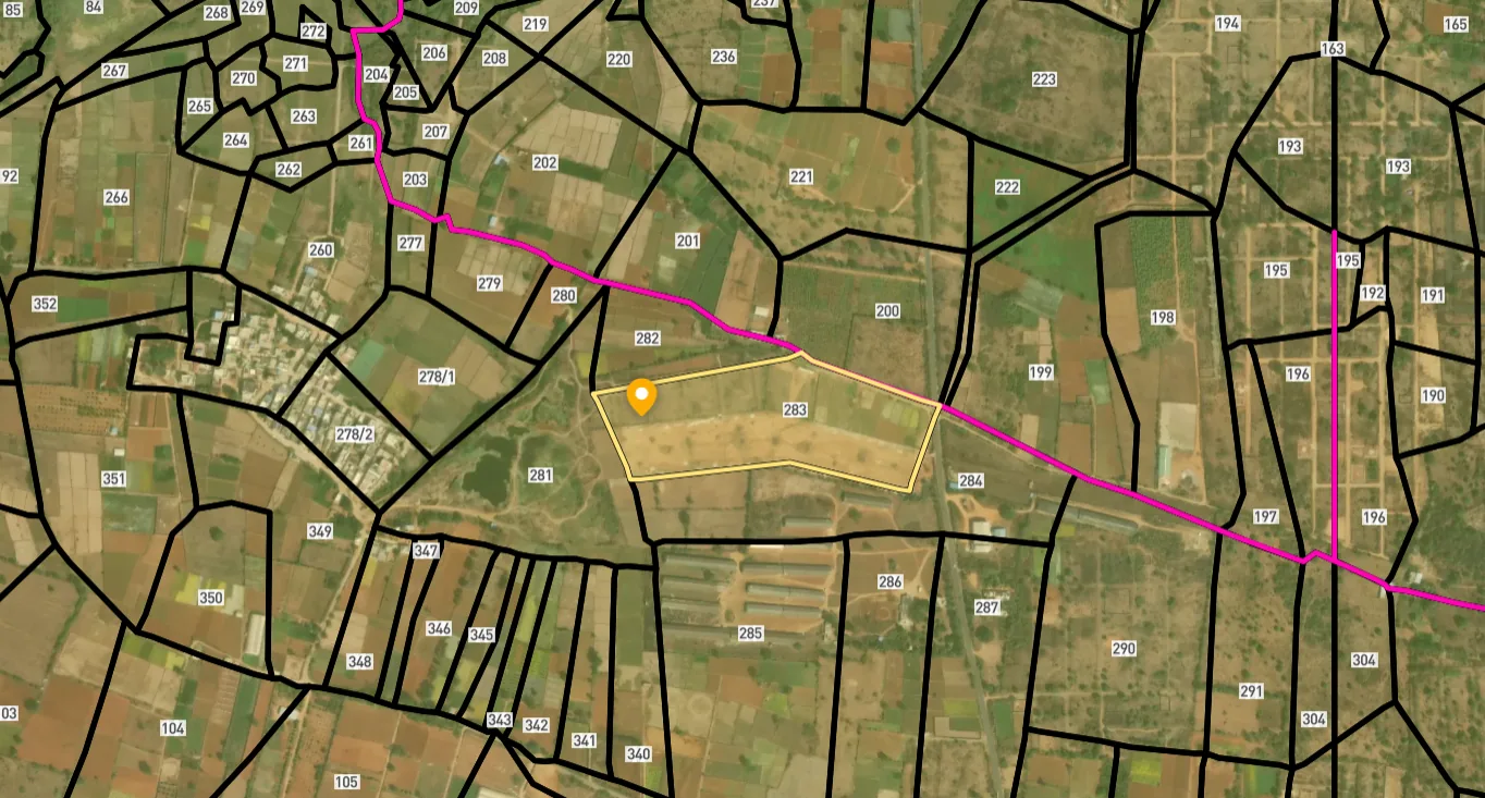
Access Survey NumbersAccess Haryana
Survey Numbers
Boundaries and numbers come from published state cadastral records. See all map layers.
Looking to sell your land in Haryana?

Browse all verified lands & plots in Haryana
More Layers in Haryana
See all 17 layers
Hodal Masterplan 2031: DTCP Zone Check and Land Use Guide
View Hodal Masterplan as a live map overlay – check any plot's land use zone for free on 1acre.in. Hodal Masterplan 2031...

Kot - Behla Masterplan
View Kot - Behla Masterplan as a live map overlay – check any plot's land use zone for free on 1acre.in. Panchkula Kot B...

Mansa Devi Complex (MDC) Panchkula: HSVP Zone Check and Plot Guide
View Mansa Devi Complex Masterplan as a live map overlay – check any plot's land use zone for free on 1acre.in. Mansa De...
More Layers in Haryana
Hodal Masterplan 2031: DTCP Zone Check and Land Use Guide
View Hodal Masterplan as a live map overlay – check any plot's land use zone for free on 1acre.in. Hodal Masterplan 2031...
Kot - Behla Masterplan
View Kot - Behla Masterplan as a live map overlay – check any plot's land use zone for free on 1acre.in. Panchkula Kot B...
Mansa Devi Complex (MDC) Panchkula: HSVP Zone Check and Plot Guide
View Mansa Devi Complex Masterplan as a live map overlay – check any plot's land use zone for free on 1acre.in. Mansa De...
Frequently Asked Questions
Yes. The GMUC Development Plan 2031, issued by Haryana TCP, controls licensing and zoning across the entire corridor. It overrides the earlier 2021 and 2025 plan iterations for Sectors 99 through 115 and remains the working reference for any change-of-land-use or CLU application.
Sectors 99, 99A, 100, 101, 102, 102A, 103, 104, 110A, 111, 112 and 113 carry residential classification under the 2031 plan and form the bulk of the Dwarka Expressway sectors residential band. Sectors 88 and 114 are exclusively commercial. The 105 to 110 stretch is the mixed commercial-residential belt.
The Northern Peripheral Road NPR alignment is essentially the same corridor that now functions as NH-248BB. The road stretches roughly 27.6 km between Shiv Murti in Delhi and the Kherki Daula toll plaza, and the package includes a 10.1 km Delhi section plus a 5 km tunnel link to Terminal 3 that became operational in March 2025.
Only when the seller can produce a valid CLU licence number paired with a registered sale deed that ties cleanly to a licensed coloniser or HSVP. A direct village agricultural sale without conversion is not legally buildable, however appealing the asking rate looks on paper.
Dwarka Expressway property rates currently fall in the ₹7,000 to ₹16,000 per sq ft range, with cluster, developer reputation and floor band setting the final number. Cluster A on the Delhi end attracts the steepest premiums, while Cluster C on the Gurgaon side carries the broadest mid-segment supply for salaried buyers.
HSVP allotted plot verification calls for the original allotment letter, the executed lease deed and a matching mutation entry at the Tehsil office. After that, reconcile the plot number against the HSVP sector layout sheet and confirm there are no outstanding dues, sector-realignment notices or pending freezes on the file.
Yes. Under the GMUC 2031 plan, Sectors 88 and 114 are categorised as fully commercial. Sectors 105, 106, 109, 110, 110A, 111, 112 and 113 together make up a part-commercial belt where licensed office and retail builds run alongside sanctioned group-housing projects.
Source
Official National Highways Authority of India (NHAI) documents
Official Website
nhai.gov.in
Coordinate Reference System
EPSG:4326 (WGS 84)
Geometry Type
LineString / MultiLineString
Data Format
Vector (GeoJSON) + Raster Tiles
Last Verified
2026
Status
Active
Was this layer helpful?
Anything wrong, outdated, or missing we want to hear it.