
IAF Air Funnel Zones - Ambala & Chandigarh


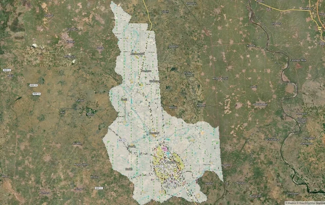
Iaf Air Funnel Zones Ambala Chandigarh Preview
Try the IAF Air Funnel Zones - Ambala & Chandigarh on the map
Sign in once and explore the layer for a full day.
- No card details needed
- Find nearby verified lands for sale
Overview
The Ambala Chandigarh Air Funnel Zones cover the construction height restrictions radiating from Ambala Air Force Station, home to the Indian Air Force's Rafale squadron, and Chandigarh's joint civil-military airport, which together shape what can legally be built across Ambala Cantt, Mohali, Panchkula, and Zirakpur. Every structure within 20 km of either aerodrome's Aerodrome Reference Point needs a No Objection Certificate under the Ministry of Civil Aviation's 2015 height rules, and Ambala carries a second, older restriction layer under a 2007 gazette notification specific to Indian Air Force aerodromes. This page maps which zone applies where, what height each grid actually permits, and which localities carry the tightest ceilings before you sign anything.
Regulatory Red Flags Around the Ambala Chandigarh Air Funnel Zones
Two separate rulebooks govern height here, and mixing them up is the single most expensive mistake a buyer can make. Ambala Air Force Station is an active military installation flying Rafale jets under 7 Wing's No. 17 Squadron, and it falls under a 2007 Gazette of India notification that specifically restricts construction around Indian Air Force aerodromes and installations, separate from ordinary civil aviation rules. Chandigarh's airport, by contrast, is a joint civil-military facility governed primarily through AAI's standard Colour Coded Zoning Map process. A plot near Ambala can face both regimes at once; a plot near Chandigarh typically faces one.
Zone Type
Location Relative to the Airbase
Height Formula or Cap
Requires
Commonly Misrepresented?
Red Zone (within roughly 4 km of the ARP)
Immediate vicinity of Ambala AFS or Chandigarh airport
Near-zero without dedicated clearance; effectively single-storey in most grids
AAI NOC, plus a separate Air Headquarters and local Board of Officers clearance for Ambala
Yes, sold as ordinary residential plots without disclosing the Red Zone status
Funnel Zone (runway approach and departure path)
Extended cone along the runway centreline, both ends
Height equals 2 percent of distance from the runway edge on approach, roughly a 1:50 slope; 1:15 sideways from the runway
AAI NOC through NOCAS; Ambala additionally falls under the Air Force's own restricted zone identification process
Yes, plots pitched as "funnel view" or "airport facing" without disclosing the height ceiling
Conical and Horizontal Surface (mid-radius, up to 20 km)
Wider ring around each aerodrome
More flexible, generally 45 to 100 metres depending on distance and CCZM grid
AAI NOC is still mandatory regardless of the requested height
Sometimes assumed exempt because the plot is "far enough," which is incorrect
Beyond 20 km VFR radius (56 km for instrument-rated airports)
Outside AAI's mandatory NOC jurisdiction
Generally exempt if height stays under 150 metres AGL
Auto-settled by the NOCAS system without a manual application
Rarely misrepresented, but confirm through NOCAS regardless
Zone Type
Location Relative to the Airbase
Height Formula or Cap
Requires
Commonly Misrepresented?
Red Zone (within roughly 4 km of the ARP)
Immediate vicinity of Ambala AFS or Chandigarh airport
Near-zero without dedicated clearance; effectively single-storey in most grids
AAI NOC, plus a separate Air Headquarters and local Board of Officers clearance for Ambala
Yes, sold as ordinary residential plots without disclosing the Red Zone status
Funnel Zone (runway approach and departure path)
Extended cone along the runway centreline, both ends
Height equals 2 percent of distance from the runway edge on approach, roughly a 1:50 slope; 1:15 sideways from the runway
AAI NOC through NOCAS; Ambala additionally falls under the Air Force's own restricted zone identification process
Yes, plots pitched as "funnel view" or "airport facing" without disclosing the height ceiling
Conical and Horizontal Surface (mid-radius, up to 20 km)
Wider ring around each aerodrome
More flexible, generally 45 to 100 metres depending on distance and CCZM grid
AAI NOC is still mandatory regardless of the requested height
Sometimes assumed exempt because the plot is "far enough," which is incorrect
Beyond 20 km VFR radius (56 km for instrument-rated airports)
Outside AAI's mandatory NOC jurisdiction
Generally exempt if height stays under 150 metres AGL
Auto-settled by the NOCAS system without a manual application
Rarely misrepresented, but confirm through NOCAS regardless
The formula matters more than the map color. Under the standard approach-path calculation, a structure gets one metre of permitted height for every 50 metres it sits back from the airport boundary along the flight path, and one metre for every 15 metres sideways from that path. That means two plots an equal straight-line distance from the runway can carry very different height caps depending on whether they sit under the flight path or off to the side.
AAI's own enforcement record backs this up: nationwide, roughly 40 percent of height clearance NOC applications get rejected outright, and buildings that go up without one have faced court-ordered demolition of the offending floors in cities including Lucknow. Always confirm the exact Permissible Top Elevation for a specific survey number through NOCAS before signing any agreement, since CCZM grid boundaries can shift with each AAI revision.
Growth Corridors and Micro Markets Around the Ambala Chandigarh Air Funnel Zones
Not every locality inside the 20 km radius carries the same restriction. Some sectors sit directly under a flight path and stay capped for the foreseeable future. Others sit just off to the side and have already been cleared for much taller construction.
Corridor / Locality
Zone Status
Growth Driver
Known Risk
Ambala Cantt core, near Ambala AFS
Red Zone and IAF-notified restricted zone
Adjacent to the new Ambala Domestic Airport civil enclave under the UDAN scheme
Dual clearance applies here: both an AAI NOC and a separate Air Force restricted-zone process, not just one
Ambala civil enclave periphery, beyond the immediate funnel
Conical or Horizontal Surface
Future UDAN connectivity once commercial flights begin, with proposed routes to Ayodhya, Jammu, Lucknow, and Srinagar
The terminal was substantially complete by 2025, but scheduled flights had still not begun as of May 2026
Mohali's traditional sectors, within the Chandigarh airport funnel
Historically capped near 45 metres
Established Tricity residential and commercial demand
Newer Mohali sectors outside the flight path have separately been cleared for buildings up to 100 metres, so two similar-looking sectors can carry very different caps
Areas north of the Chandigarh Capitol Complex, toward Zirakpur
Contested between UT Chandigarh and Punjab's local government over height relaxation
High commercial growth pressure and past state-level disputes over easing the caps
A separate 1 km no-high-rise buffer around the Capitol Complex heritage zone stacks on top of, and is distinct from, the airport funnel restriction
Corridor / Locality
Zone Status
Growth Driver
Known Risk
Ambala Cantt core, near Ambala AFS
Red Zone and IAF-notified restricted zone
Adjacent to the new Ambala Domestic Airport civil enclave under the UDAN scheme
Dual clearance applies here: both an AAI NOC and a separate Air Force restricted-zone process, not just one
Ambala civil enclave periphery, beyond the immediate funnel
Conical or Horizontal Surface
Future UDAN connectivity once commercial flights begin, with proposed routes to Ayodhya, Jammu, Lucknow, and Srinagar
The terminal was substantially complete by 2025, but scheduled flights had still not begun as of May 2026
Mohali's traditional sectors, within the Chandigarh airport funnel
Historically capped near 45 metres
Established Tricity residential and commercial demand
Newer Mohali sectors outside the flight path have separately been cleared for buildings up to 100 metres, so two similar-looking sectors can carry very different caps
Areas north of the Chandigarh Capitol Complex, toward Zirakpur
Contested between UT Chandigarh and Punjab's local government over height relaxation
High commercial growth pressure and past state-level disputes over easing the caps
A separate 1 km no-high-rise buffer around the Capitol Complex heritage zone stacks on top of, and is distinct from, the airport funnel restriction
Mohali is the clearest illustration of how much this variance matters in practice. A master plan revision by the Punjab government allowed towers up to 100 metres, more than double the old limit, in sectors positioned away from the runway's landing and takeoff path, while sectors still sitting under that path stayed capped around 45 metres. A buyer comparing two plots on a map without checking which side of the flight path each one sits on can end up paying tower-scale prices for a plot that will never legally clear more than a handful of floors. The dispute over relaxing height limits near Chandigarh's Capitol Complex adds a further wrinkle for anyone buying toward Zirakpur: that restriction exists to protect a UNESCO-recognised heritage precinct, and it operates independently of whatever the airport's CCZM grid says for the same plot.

Access Survey NumbersAccess Haryana
Survey Numbers
Boundaries and numbers come from published state cadastral records. See all map layers.
Looking to sell your land in Haryana?

Browse all verified lands & plots in Haryana
More Layers in Haryana
See all 16 layers
Sirsa Air Force Station Land Height Restriction Guide
The Sirsa Air Force Station land height restriction question begins with understanding why this base exists in the first...
Hodal Masterplan 2031: DTCP Zone Check and Land Use Guide
View Hodal Masterplan as a live map overlay – check any plot's land use zone for free on 1acre.in. Hodal Masterplan 2031...

Kot - Behla Masterplan
View Kot - Behla Masterplan as a live map overlay – check any plot's land use zone for free on 1acre.in. Panchkula Kot B...
More Layers in Haryana
Sirsa Air Force Station Land Height Restriction Guide
The Sirsa Air Force Station land height restriction question begins with understanding why this base exists in the first...
Hodal Masterplan 2031: DTCP Zone Check and Land Use Guide
View Hodal Masterplan as a live map overlay – check any plot's land use zone for free on 1acre.in. Hodal Masterplan 2031...
Kot - Behla Masterplan
View Kot - Behla Masterplan as a live map overlay – check any plot's land use zone for free on 1acre.in. Panchkula Kot B...
Frequently Asked Questions
They are height-restricted corridors aligned with runway approach and departure paths at Ambala Air Force Station and Chandigarh's joint airport, designed to keep buildings from becoming obstacles to aircraft during takeoff and landing.
AAI's mandatory NOC requirement extends 20 km from the Aerodrome Reference Point, and Ambala's status as an active IAF base adds a separate restricted-zone process under a 2007 gazette notification within that same radius.
The Red Zone is the tightest ring, generally within about 4 km of the airport, with near-zero height allowance. The Funnel Zone extends further along the runway's flight path, with height scaling gradually by distance.
Yes, if the plot sits within 20 km for a civil airport or 56 km for an instrument-rated one and exceeds 150 metres AGL. Below that height and distance, NOCAS can auto-settle the application without manual review.
Not yet. The terminal building was substantially complete by 2025 and is awaiting inauguration, with proposed UDAN routes to Ayodhya, Jammu, Lucknow, and Srinagar, but no scheduled commercial flights had begun as of May 2026.
Sectors positioned away from Chandigarh airport's landing and takeoff path were cleared for buildings up to 100 metres under a master plan revision, while sectors still under the flight path remain capped closer to 45 metres.
Yes. A 1 km no-high-rise buffer protects the Capitol Complex heritage precinct, and it applies independently of the airport's Colour Coded Zoning Map, meaning a plot can clear one restriction and still fail the other.
The structure can be flagged as an aviation safety violation, and authorities have ordered demolition of unauthorised floors in comparable cases elsewhere in India. Nationwide, roughly 40 percent of height NOC applications are rejected outright.
Source
Official Airports Authority of India (AAI) NOCAS guidelines under the Ministry of Civil Aviation's 2015 height rules; 2007 Gazette of India notification on construction around Indian Air Force aerodromes and installations
Official Website
aai.aero
Coordinate Reference System
EPSG:4326 (WGS 84)
Geometry Type
Polygon / MultiPolygon
Data Format
Vector (GeoJSON) + Raster Tiles
Last Verified
2026
Status
Active
Was this layer helpful?
Anything wrong, outdated, or missing we want to hear it.