
Ujjain-Garoth Spur
Overview
The Ujjain Garoth Spur expressway is a 4-lane, 136 km spur of the 1,350 km Delhi-Mumbai Expressway (NE-4) connecting Garoth on the main DME alignment in Mandsaur district to Ujjain city in Madhya Pradesh.
NHAI awarded the ₹2,906 crore project across three civil packages in February 2022, with a 17-year toll concession post-commissioning. This overlay maps the notified alignment across Mandsaur, Agar Malwa, and Ujjain districts.
This page covers how the spur links Ujjain to the Delhi-Mumbai Expressway spur MP network, why MP diversion orders matter, and the exact checks buyers must complete before signing anything along the route.
NHAI 3(A) Notification Madhya Pradesh and the MP Bhulekh Khasra Diversion Order
Two documents decide every buyer transaction on this corridor. The NHAI 3(A) and 3(D) notifications under the National Highways Act cover the 45-metre right of way strip. Once a khasra sits inside that strip, no private sale is enforceable and compensation follows the Land Acquisition Collector's rate, not the seller's quote.
Alongside that, MP's own land record system on MP Bhulekh at mpbhulekh.gov.in shows whether the plot is krishi (agriculture) or has an active bhu-parivartan (diversion) order under the MP Bhu Rajaswa Sanhita 1959.
The table below shows the document stack for any Ujjain Garoth Spur expressway parcel.
NHAI 3(A) Notification Madhya Pradesh and the MP Bhulekh Khasra Diversion Order
Document / Register
What It Confirms
Where to Verify
Common Trap
NHAI 3(A) / 3(D) notification
Highway acquisition strip
Tehsildar / SDM file + MP e-Uparjan
Sold as farmland already notified
Khasra / khatauni
Land record entry, ownership
MP Bhulekh portal
Old khasra not matching current bandobast
Bhu-parivartan (diversion) order
Change from krishi to residential/commercial
SDM or Collector office
Application pending shown as approved
CLU / Nazul entry
Non-agricultural land right
MP Town and Country Planning
Missing on periphery plots
Naksha (map extract)
Plot boundary and access
MP Bhulekh + Patwari
Phantom road access sold as connected
Ujjain Master Plan zone
Buildable use per T&CP Adhiniyam 1973
Ujjain UDA / T&CP office
Green belt marketed as residential
If the seller cannot produce a current MP Bhulekh khasra extract, a sanctioned diversion order, and a written confirmation the khasra falls outside the NHAI 3(A) notification, treat the plot as unbuyable. No patwari receipt or colonizer brochure covers a missing bhu-parivartan.
Growth Corridors Across Mandsaur Agar Malwa Ujjain Districts
The 136 km alignment starts at Garoth interchange on the main Delhi-Mumbai Expressway in Mandsaur district and terminates near Ujjain, integrating with the Ujjain-Dewas package (41.42 km) further east. That combined 190 km Garoth-Indore Expressway 190 km corridor via Barod, Ghatiya, Ujjain, and Dewas is what most buyers are actually being pitched, even when brokers say "spur." Sort the corridors carefully.
The table below sorts the notable localities along the Barod Ghatiya Nagda alignment.
Growth Corridors Across Mandsaur Agar Malwa Ujjain Districts
Corridor / Locality
District
Growth Driver
Known Risk
Garoth interchange
Mandsaur
Direct DME access
Notified strip, no private transfer
Bhanpura, Manasa
Mandsaur
DME feeder connectivity
Agricultural without diversion
Susner, Agar
Agar Malwa
Mid-corridor freight logistics
Rural khasra without CLU
Ghatia, Nagda
Ujjain (rural)
Industrial and freight belt
Simhastha 2028 buffer restrictions
Ujjain city outskirts
Ujjain
Simhastha economy, temple tourism
Green belt marketed as residential
Dewas (extension)
Dewas
Industrial hub, Indore link
Separate package, not the spur itself
The most misread pocket is Ujjain city outskirts. Buyers assume proximity to Simhastha 2028 preparation zones plus the DME spur creates automatic uplift. In reality, large tracts near Ujjain fall inside notified green belts and Simhastha Kumbh Mela infrastructure buffers under the Ujjain Master Plan. Confirm the plot's zone under the T&CP Adhiniyam 1973 before treating any Ujjain periphery parcel as expressway land.
For Land Owners & Agents
Looking to sell your land in Madhya Pradesh?
I want to sell my land in Madhya Pradesh
10:32
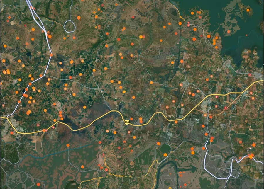
Plz share your Land's location - We will list it on 1acre map, for Free.
10:32

For Land Buyers
Browse all verified lands & plots in Madhya Pradesh
Every listing goes through our Preliminary Verification Process.
More Layers in Madhya Pradesh
See all 10 layers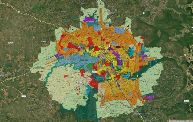
Bhopal Master Plan 2031 and 2047 Draft: TNCP Zone Check
TNCP Bhopal land use map, master plan status as of October 2026, the 2047 draft and where the official PDF is published....
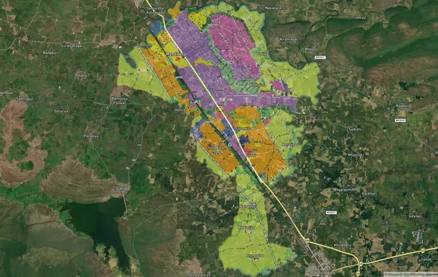
Mandideep Masterplan 2031: Zone Check and Land Use Guide
View Mandideep Masterplan as a live map overlay – check any plot's land use zone for free on 1acre.in. Mandideep Master ...
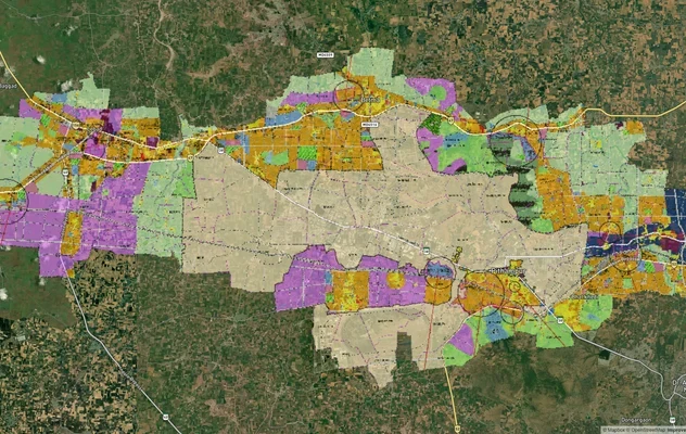
Pithampur Development Plan 2035: DMIC Zone Check and Land Use Guide
View Pithampur Masterplan as a live map overlay – check any plot's land use zone for free on 1acre.in. Pithampur masterp...
More Layers in Madhya Pradesh
Bhopal Master Plan 2031 and 2047 Draft: TNCP Zone Check
TNCP Bhopal land use map, master plan status as of October 2026, the 2047 draft and where the official PDF is published....
Mandideep Masterplan 2031: Zone Check and Land Use Guide
View Mandideep Masterplan as a live map overlay – check any plot's land use zone for free on 1acre.in. Mandideep Master ...
Pithampur Development Plan 2035: DMIC Zone Check and Land Use Guide
View Pithampur Masterplan as a live map overlay – check any plot's land use zone for free on 1acre.in. Pithampur masterp...
Frequently Asked Questions
The alignment is officially fixed by NHAI. It starts at Garoth on the main Delhi-Mumbai Expressway in Mandsaur district and terminates near Ujjain, running roughly 136 km through Mandsaur, Agar Malwa, and Ujjain districts as a 4-lane access-controlled corridor.
The estimated project cost is ₹2,906 crore, awarded across three civil packages in February 2022 to GHV India (Package 1), Ravi Infrabuild Projects (Package 2), and MKC Infrastructures (Package 3). Toll concession runs for 17 years post-commissioning.
The spur crosses Mandsaur (Garoth, Bhanpura, Manasa area), Agar Malwa (Susner, Agar), and Ujjain (Ghatia, Nagda, Ujjain rural). Exact village and khasra lists appear in the NHAI 3(A) notification held with each district Tehsildar and Land Acquisition Collector.
Yes, through this spur. Ujjain is linked to the DME via the Garoth interchange in Mandsaur. Beyond Ujjain, the corridor extends 41.42 km to Dewas, together forming the roughly 190 km Garoth-Indore Expressway link to the Indore metropolitan area.
Bhu-parivartan is the land-use diversion order issued by the SDM or Collector under the MP Bhu Rajaswa Sanhita 1959, changing krishi land to residential, commercial, or industrial use. Without it, agricultural plots near the spur cannot be built on legally.
The 190 km Garoth-Indore Expressway is the combined route: Garoth to Ujjain (roughly 136 km spur) plus Ujjain to Dewas (41.42 km) and onward to Indore. NHAI treats these as separate packages, though brokers often bundle them in listings.
Yes. Once NHAI notifies land under Section 3(A) of the National Highways Act, the owner cannot transfer clean title, and compensation moves to Land Acquisition Collector rates. Any agreement to sell after 3(A) is unenforceable and typically leaves the buyer's advance stranded.
The spur runs 136 km as a 4-lane corridor off the 1,350 km Delhi-Mumbai Expressway (NE-4), connecting Garoth on the main DME alignment in Mandsaur district to Ujjain city. NHAI awarded it across three civil packages at Rs 2,906 crore.
Source
Official government land and infrastructure records
Official Website
nhai.gov.in
Coordinate Reference System
EPSG:4326 (WGS 84)
Geometry Type
LineString / MultiLineString
Data Format
Vector (GeoJSON) + Raster Tiles
Last Verified
2026
Status
Active
Was this layer helpful?
Anything wrong, outdated, or missing we want to hear it.