Bengaluru ASI Heritage Sites – AMASR Zone and Buffer Rules
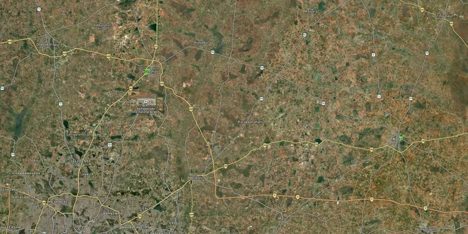
Bengaluru Heritage Sites Preview
Try the Bengaluru ASI Heritage Sites – AMASR Zone and Buffer Rules on the map
Sign in once and explore the layer for a full day.
- No card details needed
- Find nearby verified lands for sale
Overview
Bengaluru has two ASI-protected monuments directly within its urban core, the Bangalore Fort (Tipu’s Fort) and Tipu Sultan's Palace, plus several more in the wider Bengaluru region: Devanahalli Fort and Tipu Sultan’s Birth Place at Devanahalli, the prehistoric site at Chikajala, the Managondanahalli prehistoric site (all Bangalore Rural district), and the Hejjala prehistoric site (Ramanagara district, carved from Bangalore Rural in August 2007). Any plot within 300 metres of these centrally protected monuments falls under the Ancient Monuments and Archaeological Sites and Remains (AMASR) Act, 1958. The act creates two hard zones: a prohibited area (0-100 m) where no construction is permitted, and a regulated area (100-300 m) where construction requires National Monuments Authority (NMA) / Competent Authority clearance. This layer maps every ASI-designated heritage site across the Bengaluru region.
Bengaluru heritage site restrictions that will kill your building plan
Most brokers selling plots near Bengaluru's forts, temples, and archaeological sites will not mention the ASI buffer rules, because most brokers do not know them.
The AMASR Act is absolute. Within 100 metres of any centrally protected monument, no construction of any kind is permitted. Not residential, not commercial, not a boundary wall. Beyond that, from 100 to 300 metres, every construction requires approval from the National Monuments Authority (NMA) via the Competent Authority. This is the regulated area. Repair of an existing structure in the prohibited zone requires separate permission from the National Monuments Authority (NMA).
ASI Monument Buffer Zone Rules in Bengaluru
The table below shows the key zone rules applicable to any plot near an ASI monument in Bengaluru.
Zone
Distance from Monument
Construction Rule
Authority for Permission
Prohibited
0-100 m
No construction permitted
Not applicable, prohibited
Regulated
100-300 m
Permitted only with NMA approval
National Monuments Authority (NMA) / Competent Authority
Height restriction zone
Up to 500 m
Height restrictions apply
BDA / local planning authority
One more rule most buyers miss: any plot within 500 metres of an ASI-designated monument in Bengaluru is subject to height restrictions per BDA's buildability rules referenced in the Bengaluru Building Bye-Laws (Section 20A, AMASR Act, 1958), even if it sits fully outside the regulated area. If a broker cannot show you the ASI monument boundary and the survey number's distance from it, stop the conversation there.
A second risk specific to Bengaluru: the city has over 3,000 informal/unauthorised layouts: BDA jurisdiction has 172 unauthorised layouts on 3,109 acres, BMRDA jurisdiction has approximately 1,500, plus more in Hoskote, Anekal, Nelamangala, STRR, and BIAAPA areas (BDA notification + The Hans India, Sep 2024). Revenue sites near Devanahalli Fort and the Chikajala prehistoric site are especially common because brokers market them at a discount precisely because they cannot get BDA or BMRDA approval. A B-Khata address near a protected monument almost certainly signals a layout that has bypassed both the planning authority and the ASI buffer check.
Investment corridors where heritage meets growth: Devanahalli, IVC Road and North Bengaluru
Not every plot near a Bengaluru heritage site is a risk. Many of the city's strongest appreciation corridors run directly through heritage-rich North Bengaluru, and understanding the buffer rules helps you identify which plots inside those corridors are actually buildable.
Devanahalli is the clearest example. The ASI-protected Devanahalli Fort and Tipu Sultan's birthplace site sit within the town, but most of the high-growth residential layouts are laid out along IVC Road, NH-44, and the Satellite Town Ring Road (STRR), all well beyond the 500-metre height restriction zone. Plots in this corridor have appreciated from roughly ₹2,800 per sq ft in 2022 to around ₹3,900 per sq ft by 2025, with the Kempegowda International Airport, Aerospace SEZ, and Devanahalli Business Park driving demand.
The table below maps the key corridors in North Bengaluru relative to heritage proximity and growth status.
Corridor
Key Heritage Site Nearby
Distance from ASI Monument
Growth Driver
Risk Level
IVC Road / Devanahalli town
Devanahalli Fort (ASI)
Varies, check survey no.
Airport, STRR, Aerospace SEZ
Low-medium (confirm buffer)
Chikkaballapur Road
Chikajala prehistoric site (ASI)
Varies, check survey no.
NH-44 connectivity, airport corridor
Medium (revenue site risk high here)
Yelahanka-Hebbal
Nil centrally protected in immediate zone
N/A
Outer Ring Road, metro, IT parks
Low
Central Bengaluru
Tipu Sultan's Palace, Bangalore Fort (Tipu’s Fort)
Urban core, dense proximity risk
Mature city zone, no growth play
High (buildability severely constrained)
The most misread corridor is Chikkaballapur Road north of the city. Multiple revenue site layouts are sold here with no disclosure that the ASI's prehistoric site at Chikajala sits within or near their boundary. Demand in this belt is real, but every plot must be cross-checked against the ASI monument boundary before any purchase decision.
Was this layer helpful?
Anything wrong, outdated, or missing we want to hear it.
For Land Owners & Agents
Looking to sell your land in Karnataka?
I want to sell my land in Bengaluru
10:32
Plz share your Land's location - We will list it on 1acre map, for Free.
10:32

For Land Buyers
Browse all verified lands & plots in Karnataka
Every listing goes through our Preliminary Verification Process.
More Layers in Karnataka
See all 22 layers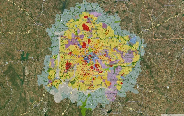
Bengaluru BDA Masterplan 2015
View Bengaluru Masterplan as a live map overlay – check any plot's land use zone for free on 1acre.in. Bengaluru BDA mas...

Bengaluru BDA Masterplan Roads: RMP 2015 Road Zones
View Bengaluru Masterplan - Roads alignment as a live map overlay – check road corridor and land impact free on 1acre.in...
Bengaluru STRR (Satellite Town Ring Road): Route Map and Land Impact
View STRR alignment as a live map overlay – check road corridor and land impact free on 1acre.in. Bengaluru STRR land bu...
More Layers in Karnataka
Bengaluru BDA Masterplan 2015
View Bengaluru Masterplan as a live map overlay – check any plot's land use zone for free on 1acre.in. Bengaluru BDA mas...
Bengaluru BDA Masterplan Roads: RMP 2015 Road Zones
View Bengaluru Masterplan - Roads alignment as a live map overlay – check road corridor and land impact free on 1acre.in...
Bengaluru STRR (Satellite Town Ring Road): Route Map and Land Impact
View STRR alignment as a live map overlay – check road corridor and land impact free on 1acre.in. Bengaluru STRR land bu...