Bengaluru Air Funnel Zones: Building Height Restrictions
Bengaluru Air Funnel Zones Preview
Try the Bengaluru Air Funnel Zones on the map
Sign in once and explore the layer for a full day.
- No card details needed
- Find nearby verified lands for sale
Overview
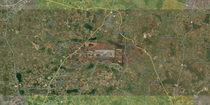
Bengaluru's airport height restriction zones are not zoning notations on a BDA or BIAAPA map. They are federal airspace rules enforced under Aircraft Act 1934, with real demolition orders behind them. AAI's Colour Coded Zoning Map (CCZM) for Bengaluru covers four aerodromes: Kempegowda International Airport (KIAL) at Devanahalli, HAL Airport in Koramangala, Jakkur Government Flying Training School (GFTS), and Yelahanka Defence Aerodrome. Any construction within 20 km of each aerodrome's Aerodrome Reference Point (ARP) requires a height NOC from AAI via NOCAS.
Wrong AMSL Figures Have Already Cost Bengaluru Buyers Crores
The most dangerous mistake in Bengaluru's airport zone is not building too tall. It is submitting a wrong site elevation Above Mean Sea Level (AMSL) to get permission to build tall.
In the Raheja Vivarea case, the builder submitted an AMSL of 870 metres for a Koramangala site. Karnataka State Remote Sensing Application Centre (KSRSAC), ordered by the Karnataka High Court, measured the actual elevation at 892.41 metres AMSL. The difference of just 22 metres cost seven floors: in October 2021 the court ordered Chalet Hotels to demolish all construction above 932 metres AMSL, wiping out floors 11 to 17 across completed blocks. The 162 buyers who had invested approximately Rs 135 crore had no recourse. HAL's NOC, which had named the builder's own AMSL figure as the basis for clearance, was rendered void the moment an independent survey disproved it.
Obstacle Limitation Surfaces Around Bengaluru Airports
The table below shows the three Obstacle Limitation Surfaces that govern height around every Bengaluru aerodrome.
Surface
Distance from ARP
Max Permitted Height
NOC Required?
Inner Horizontal Surface
Up to 5 km radius
45 m AGL
Yes, from AAI/HAL/GFTS
Outer Conical Surface
5 km to 20 km radius
1 m height per 20 m distance from 5 km edge; max 150 m (defence)
Yes
Approach/Funnel Surface
Aligned with runway ends
2% gradient rule: 20 m at 1,000 m from runway edge
Yes; aeronautical study not permitted here
Outer Transitional Surface
20 km to 56 km
Structures above 150 m require NOC
Yes if above 150 m
Before signing any sale agreement for a plot or apartment in Bengaluru's airport corridors, demand the NOCAS-issued NOC, not just the builder's elevation certificate. The AAI's own NOC letter states plainly that it does not authenticate the site coordinates and AMSL figures provided by the applicant; if those figures are later proved wrong, the NOC is cancelled and the structure faces demolition at the owner's cost.
Devanahalli, Yelahanka and Jakkur: Where the Zone Changes Every Street
Not all of North Bengaluru's hottest corridors sit inside the same restriction surface, and that distinction drives real differences in what you can build and at what price.
Devanahalli, the closest locality to KIAL's runway, is largely within the Outer Conical Surface. Plot rates in 2026 range between Rs 6,000 and Rs 10,000 per sq ft, driven by airport expansion, Special Investment Region status, and STRR connectivity. Heights here are manageable for low-rise and villa developments, but any multi-storey project needs BIAAPA approval plus an AAI NOC. The Yelahanka belt sits roughly 16 km from KIAL but within 5 km of Yelahanka Defence Aerodrome, which imposes its own NOC radius of 9.26 km (5 nautical miles). Buildings in Yelahanka that appear to be outside KIAL's Inner Horizontal Surface can still fall inside Yelahanka aerodrome's Inner Horizontal Surface.
Corridor
Distance from KIAL
Primary Governing Aerodrome
Zone Type
Typical Max Floor Count
Devanahalli
7 km
KIAL (BIAL)
Outer Conical Surface
4–6 floors (site-specific)
Yelahanka
16 km
Yelahanka Defence Aerodrome + KIAL
Inner Horizontal / Conical
Max 14 floors within 5 km of Yelahanka ARP
Jakkur
18 km
GFTS Jakkur + KIAL
Multiple overlapping surfaces
Requires multiple NOCs
Hebbal
22 km
KIAL (outer)
Outer Transitional
Less restricted; verify HAL radius
The corridor most consistently misread is Yelahanka-Jakkur. Buyers and developers focus on KIAL's distance and miss that structures in this belt may need separate NOCs from GFTS Jakkur and Yelahanka Defence Aerodrome in addition to AAI. Each aerodrome has a different ARP elevation and a different NOC-issuing authority. Bundling them into a single NOCAS application without checking each surface is the most common approval error in this belt.
Was this layer helpful?
Anything wrong, outdated, or missing we want to hear it.
For Land Owners & Agents
Looking to sell your land in Karnataka?
I want to sell my land in Bengaluru
10:32
Plz share your Land's location - We will list it on 1acre map, for Free.
10:32

For Land Buyers
Browse all verified lands & plots in Karnataka
Every listing goes through our Preliminary Verification Process.
More Layers in Karnataka
See all 22 layers
Bengaluru BDA Masterplan 2015
View Bengaluru Masterplan as a live map overlay – check any plot's land use zone for free on 1acre.in. Bengaluru BDA mas...

Bengaluru BDA Masterplan Roads: RMP 2015 Road Zones
View Bengaluru Masterplan - Roads alignment as a live map overlay – check road corridor and land impact free on 1acre.in...
Bengaluru STRR (Satellite Town Ring Road): Route Map and Land Impact
View STRR alignment as a live map overlay – check road corridor and land impact free on 1acre.in. Bengaluru STRR land bu...
More Layers in Karnataka
Bengaluru BDA Masterplan 2015
View Bengaluru Masterplan as a live map overlay – check any plot's land use zone for free on 1acre.in. Bengaluru BDA mas...
Bengaluru BDA Masterplan Roads: RMP 2015 Road Zones
View Bengaluru Masterplan - Roads alignment as a live map overlay – check road corridor and land impact free on 1acre.in...
Bengaluru STRR (Satellite Town Ring Road): Route Map and Land Impact
View STRR alignment as a live map overlay – check road corridor and land impact free on 1acre.in. Bengaluru STRR land bu...