Chikkaballapura Masterplan 2031: CUDA Zone Check and Land Use Guide
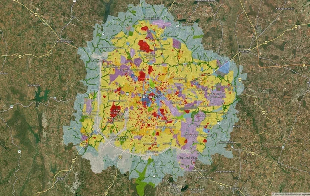
Chikkaballapura Masterplan Preview
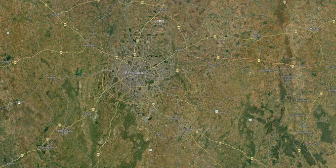
Try the Chikkaballapura Masterplan 2031 on the map
Sign in once and explore the layer for a full day.
- No card details needed
- Find nearby verified lands for sale
Overview
The Chikkaballapura LPA Master Plan 2031 governs land use across Chikkaballapura district, north of Bengaluru, under the Chikkaballapura Urban Development Authority (CUDA) and BMRDA. It divides the LPA into Residential, Commercial, Industrial, Agricultural, and Green Belt zones under the Karnataka Town and Country Planning Act, 1961. Every survey number in the LPA carries a zone classification that determines what can be built and whether agricultural conversion is required. This page covers what that zone classification means for buyers in the Chikkaballapura LPA and where the real legal risks sit.
Buyers in the north Bengaluru airport corridor often confuse CUDA and BIAAPA jurisdiction. For plots closer to Kempegowda International Airport, see the BIAAPA Masterplan 2021 layer to verify which authority governs your survey number.
"CUDA Approved" labels and the 11E map trap that has cost Karnataka buyers crores
Chikkaballapura sits in the middle of Karnataka's most active illegal layout crackdown. In 2025, the Revenue Department identified approximately 30,340 suspected illegal layout cases statewide, with Revenue Minister Krishna Byre Gowda directing all Deputy Commissioners to verify each case and pursue land seizures where violations are confirmed. At least 117 cases investigated involved land partitioned and sold without agricultural conversion or layout sanction. Multiple officials were suspended for facilitating the process.
The specific mechanism used in Chikkaballapura and surrounding districts is the "Swavalambi" scheme combined with 11E maps. Under this method, agricultural land is divided into small residential-sized parcels using 11E sketch maps, with phodi durasthi (land record correction) used to clean up the revenue entries, all without DC Conversion or CUDA layout approval. Sellers then market these plots as "legal" using the cleaned-up revenue records. The plots look legitimate in the RTC and mutation documents. They are not.
The table below shows the three documents that must all be present and verified independently for a plot in the Chikkaballapura LPA to have legal standing.
Document
Issuing Authority
What It Confirms
Common Fraud Pattern
DC Conversion Order
District Commissioner, Chikkaballapura
Agricultural land legally converted to residential or non-agricultural use
11E map + phodi durasthi used to simulate conversion in revenue records without actual DC order
CUDA / DTCP Layout Approval
Chikkaballapura Urban Development Authority or DTCP
Layout complies with Chikkaballapura LPA Master Plan 2031 zone
Plots sold as "CUDA Approved" without an actual approval order number
E-Khata (Individual Plot)
Local body (CMC, TMC, or Gram Panchayat)
Property registered in revenue records
B-Khata issued for plots in unapproved layouts; Karnataka Cabinet's B-to-A conversion process does not retrospectively validate layout approval
Encumbrance Certificate
Sub-Registrar, Chikkaballapura
No loans or encumbrances on title
Buyer must verify at the Sub-Registrar office; seller-provided copies are not acceptable
The Karnataka Cabinet cleared a B-Khata to A-Khata conversion policy in January 2026 for structures in unauthorised layouts under Urban Local Bodies. This does not apply to agricultural land sold without DC conversion. It also does not grant building plan approval, which requires CUDA sanction regardless of Khata status. If a broker's sole legal assurance is a clean Khata, the layout remains unsanctioned.
Nandi Hills, Gauribidanur, and the NH-44 corridor: zone character and investment profile
Chikkaballapura LPA covers a large and varied geography, from the urban cluster around Chikkaballapura town to the hill and valley zones around Nandi Hills, and the agricultural flatlands toward Gauribidanur and Bagepalli in the north. Understanding which part of the LPA your plot sits in determines both the permitted use and the realistic value trajectory.
The NH-44 corridor from Bengaluru through Devanahalli to Chikkaballapura town is the primary growth spine. Proximity to Kempegowda International Airport (approximately 30 minutes from Chikkaballapura town) makes this corridor the most active for both residential and commercial demand. KIADB has identified Chikkaballapura district for SEZ and industrial zone designations, which concentrates industrial land use along specific corridors rather than across the LPA.
The table below summarises the four distinct corridors within the Chikkaballapura LPA and their zone character.
Corridor / Locality
Zone Character (Chikkaballapura LPA Master Plan 2031)
Infrastructure & Economic Drivers
Key Risk
Chikkaballapura Town and NH-44 fringe
Residential + Commercial
Airport proximity, NH-44 access, institutional growth (hospitals, colleges)
Unapproved plots sold using 11E maps along arterial road frontage
Nandi Hills foothills and Bhoga Nandeeshwara area
Residential + Agricultural
Tourism, lifestyle demand, altitude premium, airport-side weekend home market
Forest and eco-sensitive buffer restrictions around Nandi Hills limit construction; confirm zone before purchase
Gauribidanur and Madhugiri Road belt
Predominantly Agricultural
KIADB 5,000-acre industrial area, KSSIDC, NIFCO South India (Rs 288 crore MoU, Nov 2023), regional connectivity to Tumkur
Largely Agricultural zone with scattered residential nodes; DC conversion essential before any layout
Bagepalli and northern LPA fringe
Agricultural / Green Belt
Long-term speculative land; proximity to Andhra Pradesh border
Minimal infrastructure; speculative agricultural land with no near-term development rights
The most misunderstood corridor is the Nandi Hills foothills. Buyers pay a significant premium for hill-view plots near Bhoga Nandeeshwara Temple and Isha Foundation, but many of the parcels in the immediate hill catchment fall within eco-sensitive or forest buffer zones under the Karnataka Forest Department's notifications. Construction is prohibited entirely in these zones. Overlaying the Chikkaballapura LPA Master Plan 2031 zone map against the survey number is the only way to confirm whether a specific plot is in a buildable Residential zone or a restricted buffer. Seller proximity claims to a landmark do not substitute for zone verification.
Was this layer helpful?
Anything wrong, outdated, or missing we want to hear it.
For Land Owners & Agents
Looking to sell your land in Karnataka?
I want to sell my land in Bengaluru
10:32
Plz share your Land's location - We will list it on 1acre map, for Free.
10:32

For Land Buyers
Browse all verified lands & plots in Karnataka
Every listing goes through our Preliminary Verification Process.
More Layers in Karnataka
See all 22 layers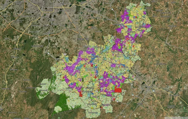
Anekal Masterplan: Zone Check and Land Use Guide
View Anekal Masterplan as a live map overlay – check any plot's land use zone for free on 1acre.in. Anekal masterplan zo...
Bengaluru BDA Masterplan 2015
View Bengaluru Masterplan as a live map overlay – check any plot's land use zone for free on 1acre.in. Bengaluru BDA mas...

Bengaluru BDA Masterplan Roads: RMP 2015 Road Zones
View Bengaluru Masterplan - Roads alignment as a live map overlay – check road corridor and land impact free on 1acre.in...
More Layers in Karnataka
Anekal Masterplan: Zone Check and Land Use Guide
View Anekal Masterplan as a live map overlay – check any plot's land use zone for free on 1acre.in. Anekal masterplan zo...
Bengaluru BDA Masterplan 2015
View Bengaluru Masterplan as a live map overlay – check any plot's land use zone for free on 1acre.in. Bengaluru BDA mas...
Bengaluru BDA Masterplan Roads: RMP 2015 Road Zones
View Bengaluru Masterplan - Roads alignment as a live map overlay – check road corridor and land impact free on 1acre.in...