
IAF Air Funnel Zones - Jamnagar


Iaf Air Funnel Zones Jamnagar Preview
Try the IAF Air Funnel Zones - Jamnagar on the map
एक बार साइन इन करें और पूरे दिन लेयर एक्सप्लोर करें।
- No card details needed
- Find nearby verified lands for sale
Overview
The Jamnagar Air Force Station land height restriction picture carries a complication most single-runway bases do not: this is the only airport in Gujarat with two runways, and both generate their own approach and departure funnels. Officially known as Civil Enclave Jamnagar, the aerodrome is owned by the Indian Air Force and operated on the civil side by the Airports Authority of India, sitting inside a cantonment area roughly 7 kilometres from Jamnagar city centre in Gujarat's Saurashtra region. Its civil terminal is deliberately compact, spread over 35 acres with capacity for just 150 passengers at a time. This layer is available on 1acre's Premium plan. It covers why the two-runway layout changes the height-restriction math, why this base's flight pattern looks more industrial than touristic, and which nearby zones carry genuine regulatory exposure versus general economic proximity.
Jamnagar Air Force Station Land: Regulatory Red Flags You Cannot Ignore
The first red flag is structural. Because Jamnagar operates two runways rather than one, it generates two separate approach and departure funnel corridors instead of a single alignment. At most Indian dual-use airbases, a buyer needs to check a plot's position relative to one runway's extended centreline. At Jamnagar, that same check needs to be done twice, since a location that sits comfortably outside one runway's funnel zone can still fall directly inside the second runway's approach or departure path. Treating Jamnagar like a standard single-runway base and checking only one alignment is a genuine, structural way to miss real restriction exposure here.
The second red flag concerns the underlying legal formula that governs height limits near any Indian aerodrome, civil or military, under Civil Aviation Requirements Section 3, Series C, Part II. This framework defines several layered surfaces around a runway. The Horizontal Surface typically caps height at 45 metres within a 4 kilometre radius of the runway ends, forming a flat imaginary ceiling. The Conical Surface then slopes upward from the edge of that horizontal surface at a 5 percent gradient, extending protection further out and higher up. The Approach Surface, described as the most critical for height restrictions, begins at each runway end and slopes upward along the approach path at a 2 percent gradient. A Transitional Surface connects the horizontal and approach surfaces along the lateral boundaries at a steeper 14.3 percent slope, roughly a 1:7 ratio. These are the generic national defaults; Jamnagar's own officially published height restriction map, reflecting its two-runway configuration, is the only authoritative source for the exact figures that apply to a specific plot.
The table below sets out this layered national framework as it applies to any Indian aerodrome, including Jamnagar.
Surface Type
Coverage
Height Rule
Horizontal Surface
Within approximately 4 km of runway ends
Flat cap, typically 45 metres
Conical Surface
Extends outward from the horizontal surface edge
Rises at a 5% gradient
Approach Surface
Begins at each runway end, along the approach path
Rises at a 2% gradient; most critical for restrictions
Transitional Surface
Connects horizontal and approach surfaces at lateral boundaries
Rises at a 14.3% (1:7) slope
Surface Type
Coverage
Height Rule
Horizontal Surface
Within approximately 4 km of runway ends
Flat cap, typically 45 metres
Conical Surface
Extends outward from the horizontal surface edge
Rises at a 5% gradient
Approach Surface
Begins at each runway end, along the approach path
Rises at a 2% gradient; most critical for restrictions
Transitional Surface
Connects horizontal and approach surfaces at lateral boundaries
Rises at a 14.3% (1:7) slope
The third red flag is the character of Jamnagar's air traffic itself, which shapes how the surrounding land market actually behaves. This is not a leisure destination airport. Its catchment is dominated by Reliance Industries' Jamnagar Refinery at Motikhavdi, roughly 35 to 45 kilometres away, described by the company as the world's largest single-location refining complex, alongside brass, edible oil, and engineering clusters. That produces a flight pattern that resembles an oilfield rotation schedule far more than a typical tourist or business travel pattern. Buyers evaluating land near this base should understand that demand growth here tracks the refinery and associated Special Economic Zones' industrial cycles, not general tourism or urban commuter trends the way it might near a metro-adjacent airport.
The fourth consideration is that Jamnagar's operational classification is not entirely fixed. In 2023, the airport was granted temporary international status for a 10-day period specifically to host a major private pre-wedding celebration. While this was a one-off event rather than a permanent change, it demonstrates that Jamnagar's classification and associated operational parameters can, in principle, be adjusted for specific circumstances, adding a layer of unpredictability that a purely domestic, single-purpose airbase would not have.
Areas and Micro-Markets Affected by the Jamnagar Restricted Zone
Land exposure near Jamnagar concentrates around the cantonment area itself, while the broader region's economic pull comes overwhelmingly from Reliance's industrial footprint rather than the airport's own passenger growth.
Locality
Position Relative to the Base
Character
Restriction Exposure
Jamnagar cantonment area
Immediate vicinity, approximately 7 km from city centre
Military-civil shared aerodrome zone
Highest exposure; must be checked against both runways' funnel zones separately
Jamnagar city core (Bedi Gate, Lakhota Lake)
15-25 minute drive from the airport
Established Saurashtra regional city
Moderate exposure, tapering with distance and direction from each runway
Reliance Refinery / Motikhavdi SEZ belt
35-45 km from the airport
World's largest single-location refining complex, plus Reliance and Essar SEZs
Not itself subject to aerodrome height restriction, but the primary economic driver behind Jamnagar's flight demand
Khambhalia
Approximately 55 km from the airport
Smaller regional town
Outside direct funnel zone exposure, benefits indirectly from regional connectivity
Locality
Position Relative to the Base
Character
Restriction Exposure
Jamnagar cantonment area
Immediate vicinity, approximately 7 km from city centre
Military-civil shared aerodrome zone
Highest exposure; must be checked against both runways' funnel zones separately
Jamnagar city core (Bedi Gate, Lakhota Lake)
15-25 minute drive from the airport
Established Saurashtra regional city
Moderate exposure, tapering with distance and direction from each runway
Reliance Refinery / Motikhavdi SEZ belt
35-45 km from the airport
World's largest single-location refining complex, plus Reliance and Essar SEZs
Not itself subject to aerodrome height restriction, but the primary economic driver behind Jamnagar's flight demand
Khambhalia
Approximately 55 km from the airport
Smaller regional town
Outside direct funnel zone exposure, benefits indirectly from regional connectivity
The Reliance Refinery and SEZ belt deserves particular attention, precisely because it is easy to conflate economic proximity with regulatory exposure. This zone, spanning roughly 4,545 hectares for the Reliance SEZ alone plus a further 1,125 hectares for the adjacent Essar Jamnagar SEZ, is what actually drives Jamnagar Airport's traffic and, by extension, its long-term relevance. But this industrial belt sits well outside any funnel zone generated by the airport's own runways. Land here is governed by an entirely separate regulatory framework tied to SEZ status and industrial environmental clearances, not aerodrome height restrictions. A buyer should evaluate refinery-belt land on its own industrial and SEZ-specific merits, completely separate from any funnel zone analysis relevant to land actually near the airport itself.
The Jamnagar cantonment area, by contrast, is where the two-runway complexity described earlier actually bites. Because this location sits at the convergence of both runway configurations, any construction plan here needs a more thorough check than a single-runway base would require, confirming position against both approach and departure corridors independently before assuming a plot falls outside restricted airspace.
क्या यह लेयर सहायक थी?
Anything wrong, outdated, or missing we want to hear it.
ज़मीन मालिकों और एजेंटों के लिए
Gujarat में अपनी ज़मीन बेचना चाहते हैं?
मैं Gujarat में अपनी ज़मीन बेचना चाहता हूँ
10:32
कृपया अपनी ज़मीन का स्थान साझा करें - हम इसे 1acre मैप पर सूचीबद्ध करेंगे, मुफ़्त.
10:32


ज़मीन खरीदारों के लिए
Gujarat में सभी सत्यापित ज़मीन और प्लॉट ब्राउज़ करें
प्रत्येक लिस्टिंग हमारी प्रारंभिक सत्यापन प्रक्रिया से गुज़रती है।
Gujarat में और लेयर्स
सभी 19 लेयर्स देखें
Bhuj Air Force Station Land Height Restriction Guide
View Bhuj Air Force Station air funnel zones on a live map – check height clearance restrictions on any plot for free on...

Naliya Air Force Station Height Restriction Zone
The Naliya Bhuj air force station height restriction land buying process is shaped by two things most Indian airport pag...
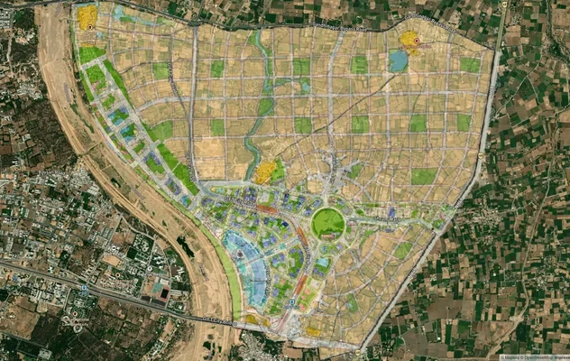
GIFT City मास्टरप्लान: GIFT UDA और GUDA ज़ोन चेक
GIFT City मास्टरप्लान को लाइव मैप ओवरले के रूप में देखें – 1acre.in पर किसी भी प्लॉट का लैंड यूज़ ज़ोन मुफ़्त में चेक कर...
Gujarat में और लेयर्स
Bhuj Air Force Station Land Height Restriction Guide
View Bhuj Air Force Station air funnel zones on a live map – check height clearance restrictions on any plot for free on...
Naliya Air Force Station Height Restriction Zone
The Naliya Bhuj air force station height restriction land buying process is shaped by two things most Indian airport pag...
GIFT City मास्टरप्लान: GIFT UDA और GUDA ज़ोन चेक
GIFT City मास्टरप्लान को लाइव मैप ओवरले के रूप में देखें – 1acre.in पर किसी भी प्लॉट का लैंड यूज़ ज़ोन मुफ़्त में चेक कर...