
Mumbai-Ahmedabad Bullet Train High Speed Rail Project
Overview
The Mumbai-Ahmedabad Bullet Train land records question comes at an unusual moment for this corridor, one worth pausing on before looking at anything else. Land acquisition for the entire 508-kilometre project is finally complete, after years of the kind of delay that has stalled almost every other high-speed rail line in this series, and construction has moved well past its early groundwork stage into visible, advanced structural work you can actually see from the road in several stretches. The National High Speed Rail Corporation Limited is executing the project with technical and financial support from Japan, running from Bandra-Kurla Complex in Mumbai to Sabarmati on the edge of Ahmedabad, with twelve stations planned along the way, eight of them sitting inside Gujarat itself. Land here is checked through AnyROR, the same portal that covers land verification across the rest of the state, but Ahmedabad and Gandhinagar's urban and peri-urban stretches carry an additional layer that most other Gujarat corridors covered elsewhere in this series simply do not have to deal with: Town Planning Schemes, the state's own distinctive mechanism for reshaping and reallocating urban plots, one that can quietly change a parcel's shape, its size, and even its exact physical location on the ground without changing the owner's name on the record at all. This guide walks through both the ownership checks that genuinely apply here and what this project's unusually advanced progress actually means for land nearby.
Regulatory Red Flags Around the Bullet Train Corridor
Start with the one fact that changes what this specific corridor's land history actually means for a buyer standing in front of a plot today: all 1,389.5 hectares required for the entire project have now been acquired, spanning Gujarat, Maharashtra, and the Union Territory of Dadra and Nagar Haveli. Within Gujarat specifically, that acquisition ran across eight districts, taking in roughly 133 hectares in Ahmedabad, 110 hectares in Kheda, 53 hectares in Anand, 142 hectares in Vadodara, 140 hectares in Bharuch, 161 hectares in Surat, and 89 hectares in Valsad. This means the formal acquisition phase along the entire Gujarat stretch sits behind the project now, rather than still unfolding somewhere ahead of it, and that distinction matters enormously for a buyer. A plot's history inside or outside that acquisition footprint has become a settled, checkable fact rather than an open question hanging on some uncertain future notification that might or might not ever arrive.
For land that was formally acquired, compensation followed the framework set out under India's national land acquisition law, which combines a market-value-based cash payment with a separate resettlement and rehabilitation package for anyone actually displaced by the project. But for land sitting just outside that acquired footprint, and this matters especially around the Sabarmati and Ahmedabad station areas, a different and distinctly Gujarat-specific mechanism kicks in instead: the Town Planning Scheme. Under this system, the state has the power to take a whole set of original, irregularly shaped plots across an entire neighbourhood, replan the area as a single connected unit, and hand each owner back a smaller, reconfigured "final plot" sitting in a somewhat different position within that same scheme, in exchange for a share of land contributed toward new roads, public open space, and shared infrastructure. What this means in practice is unsettling for anyone who has not encountered it before: a property's 7/12 extract or Property Card can still show the correct owner's name, accurately and without any fraud involved, while the actual usable plot, its shape, its boundary, and even its physical footprint within a Town Planning Scheme area, has genuinely shifted from whatever an older record or a casual site visit would lead you to expect. Anyone buying land near a station area currently going through this kind of urban reorganisation should specifically ask whether the parcel sits inside an active or draft Town Planning Scheme, and should insist on confirming the final plot number rather than relying on the original plot number, which may simply no longer correspond to anything real on the ground.
Ordinary agricultural land eligibility rules still apply everywhere else along this corridor too, exactly as they do across the rest of Gujarat covered elsewhere in this series. Section 63 of the Gujarat Tenancy and Agricultural Lands Act bars selling agricultural land to a non-agriculturist without prior Collector permission, and the narrower Section 63AA route allows a purchase specifically for industrial purposes, with a Collector notice required and, above ten hectares, formal Industries Commissioner clearance on top of that. A corridor connecting two of India's largest cities through a genuinely high-speed transit link is exactly the kind of project that draws industrial and logistics buyers hoping to capture value near a future station, and any such purchase still needs that underlying eligibility question settled correctly and on paper, not simply assumed because the seller sounded confident.
Regulatory Red Flags Around the Bullet Train Corridor
Land Record Term
What It Proves
Needs Separate Approval?
Blocks Registration or Construction Without It?
Commonly Misused?
7/12 Utara / 8A khata
Ownership, area, and land classification
No
Yes
The free AnyROR copy is often mistaken for the legally valid signed version
Town Planning Scheme final plot number
The actual, reconfigured plot a buyer will legally receive
Yes, TP Scheme sanctioning authority
Yes, for construction matching the final layout
Buyers sometimes rely on the original plot number, which may no longer apply
NHSRCL land acquisition record
Confirms whether a specific parcel was formally acquired for the corridor
N/A
Determines compensation eligibility, not ordinary registration
A plot outside the acquired footprint may still sit inside a separate TP Scheme
Section 63 / 63AA clearance
Collector or Industries Commissioner approval for a non-agriculturist purchase
Yes
Yes
Frequently assumed unnecessary near a high-profile infrastructure project
Land Record Term
What It Proves
Needs Separate Approval?
Blocks Registration or Construction Without It?
Commonly Misused?
7/12 Utara / 8A khata
Ownership, area, and land classification
No
Yes
The free AnyROR copy is often mistaken for the legally valid signed version
Town Planning Scheme final plot number
The actual, reconfigured plot a buyer will legally receive
Yes, TP Scheme sanctioning authority
Yes, for construction matching the final layout
Buyers sometimes rely on the original plot number, which may no longer apply
NHSRCL land acquisition record
Confirms whether a specific parcel was formally acquired for the corridor
N/A
Determines compensation eligibility, not ordinary registration
A plot outside the acquired footprint may still sit inside a separate TP Scheme
Section 63 / 63AA clearance
Collector or Industries Commissioner approval for a non-agriculturist purchase
Yes
Yes
Frequently assumed unnecessary near a high-profile infrastructure project
Given that the acquisition phase for this corridor is now essentially finished, the practical question for a buyer has genuinely shifted, from "will my land be taken" to something closer to "has my land already been quietly reshaped by a Town Planning Scheme, and does my paperwork actually reflect that." Confirming the final plot number, not merely the original survey number a seller happens to hand over, is arguably the single most important check near any station area anywhere along this route.
Growth Corridors Around the Bullet Train Route
Gujarat's stretch of this corridor has moved noticeably faster than the Maharashtra side, and the numbers make that gap concrete rather than a matter of impression. As of a September 2026 RTI response, the overall project stood at roughly 62 percent physical progress, with more than 366 kilometres of viaduct girders already erected and about 209 kilometres of track bed laid down for the ballastless system that will eventually carry trains at 320 kilometres per hour. Officials told Parliament in March 2026 that 430 kilometres of piers and 341 kilometres of girder work had been completed by that point, and the Sabarmati river bridge had already finished all eight of its piers, with superstructure work underway on top of them. Gujarat's stations, including Surat and Vadodara, saw their foundation work finished well ahead of the equivalent Maharashtra sections, a direct and fairly simple consequence of Gujarat completing its land acquisition years before Maharashtra managed to resolve its own disputes, disputes that stalled progress there right up until around 2022.
That head start is exactly why the first operational segment of this entire corridor is expected to open somewhere inside Gujarat rather than anywhere near Mumbai. Current targets point to India's first indigenous bullet train service beginning around August 2027 on the Surat-Vapi stretch specifically, well before the full 508-kilometre corridor is anywhere close to complete. The full corridor's target completion date has itself moved more than once already, sliding from an original December 2023 deadline out to a currently projected window somewhere between 2028 and 2029, driven largely by the far more complex Maharashtra section, which includes a genuinely difficult 21-kilometre undersea tunnel beneath Thane Creek, only a small fraction of which had actually been excavated as of early 2026. The project's total cost has grown substantially over this same stretch of time too, moving from an original estimate near 1.1 lakh crore rupees to a current figure closer to 1.98 to 2 lakh crore rupees, reflecting both the accumulated delays and a deliberate shift toward more indigenous manufacturing for the programme's later phases.
For land specifically near Ahmedabad and Sabarmati, the operational control centre for the entire corridor will sit at Sabarmati, alongside one of the project's two depots, and the station itself is being planned as a genuine multimodal hub connecting to conventional rail, the local metro network, and bus rapid transit, rather than standing on its own as an isolated stop somewhere at the edge of the city.
Growth Corridors Around the Bullet Train Route
Location
Growth Driver
Known Consideration
Sabarmati station and depot area
Operational control centre plus multimodal integration with metro and BRT
Confirm Town Planning Scheme status before assuming a plot's current shape is final
Ahmedabad and Kheda districts
Established acquisition footprint, foundation work well advanced
Land eligibility rules under Section 63/63AA still apply for any agricultural purchase
Surat-Vapi stretch
Likely site of India's first operational bullet train segment, targeted August 2027
The earliest genuine service window on the entire corridor
Wider Gujarat stations (Anand, Bharuch, Vadodara)
Foundation and viaduct work substantially ahead of Maharashtra
Growth here is tied to a corridor already well into construction, not still speculative
Location
Growth Driver
Known Consideration
Sabarmati station and depot area
Operational control centre plus multimodal integration with metro and BRT
Confirm Town Planning Scheme status before assuming a plot's current shape is final
Ahmedabad and Kheda districts
Established acquisition footprint, foundation work well advanced
Land eligibility rules under Section 63/63AA still apply for any agricultural purchase
Surat-Vapi stretch
Likely site of India's first operational bullet train segment, targeted August 2027
The earliest genuine service window on the entire corridor
Wider Gujarat stations (Anand, Bharuch, Vadodara)
Foundation and viaduct work substantially ahead of Maharashtra
Growth here is tied to a corridor already well into construction, not still speculative
The overall picture for this corridor is more advanced and more concrete than most of the projects covered elsewhere in this series, particularly on the Gujarat side, where acquisition is genuinely finished and structural work is visibly progressing rather than sitting on a slide deck somewhere. That maturity counts as a real point in this corridor's favour for anyone assessing land value here today. It does not, however, remove the specific homework a Gujarat urban buyer still owes near any station area along this route: confirming a plot's Town Planning Scheme status and its actual final layout matters just as much here as confirming ordinary ownership does, since a corridor this far along in construction is exactly the kind of project that tends to accelerate surrounding urban replanning at roughly the same pace as its own physical progress.
Was this layer helpful?
Anything wrong, outdated, or missing we want to hear it.
For Land Owners & Agents
Looking to sell your land in Gujarat?
I want to sell my land in Gujarat
10:32
Plz share your Land's location - We will list it on 1acre map, for Free.
10:32


For Land Buyers
Browse all verified lands & plots in Gujarat
Every listing goes through our Preliminary Verification Process.
More Layers in Gujarat
See all 19 layers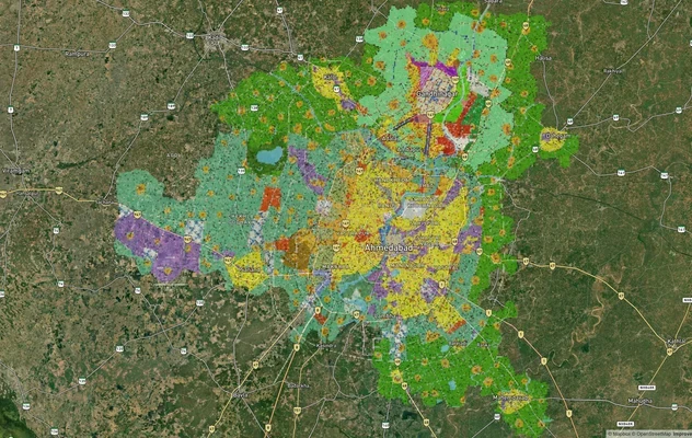
Ahmedabad - Gandhinagar Masterplan
View Ahmedabad - Gandhinagar Masterplan as a live map overlay – check any plot's land use zone for free on 1acre.in. Ahm...
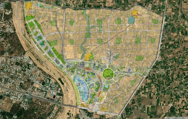
GIFT City Masterplan: GIFT UDA and GUDA Zone Check
View GIFT City Masterplan as a live map overlay – check any plot's land use zone for free on 1acre.in. GIFT City Master ...
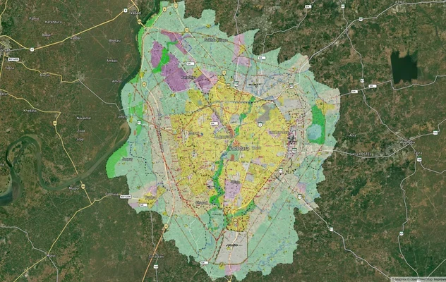
Vadodara VUDA Masterplan 2031: Zone Check and Land Use Guide
View Vadodara Masterplan as a live map overlay – check any plot's land use zone for free on 1acre.in. Vadodara VUDA Mast...
More Layers in Gujarat
Ahmedabad - Gandhinagar Masterplan
View Ahmedabad - Gandhinagar Masterplan as a live map overlay – check any plot's land use zone for free on 1acre.in. Ahm...
GIFT City Masterplan: GIFT UDA and GUDA Zone Check
View GIFT City Masterplan as a live map overlay – check any plot's land use zone for free on 1acre.in. GIFT City Master ...
Vadodara VUDA Masterplan 2031: Zone Check and Land Use Guide
View Vadodara Masterplan as a live map overlay – check any plot's land use zone for free on 1acre.in. Vadodara VUDA Mast...