Bhatapara Masterplan
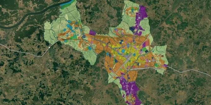
Bhatapara Masterplan Preview
Try the Bhatapara Masterplan on the map
Sign in once and explore the layer for a full day.
- No card details needed
- Find nearby verified lands for sale
Overview
The Bhatapara Master Plan 2031 is the operative land-use framework for Bhatapara city, administered by the Directorate of Town and Country Planning (TCP), Chhattisgarh under the CG Town and Country Planning Act, 1973. Bhatapara is a Nagar Palika Parishad in Baloda Bazar-Bhatapara district, sitting 85 km from Raipur on the NH-130 Raipur-Bilaspur corridor. Before you sign any sale deed here, your first job is a Bhatapara Master Plan 2031 zone check at tcp.cg.gov.in to confirm the plot's designated land use. This layer on 1acre requires a Premium subscription.
Illegal Layouts in Bhatapara: What the Nagar Palika Records Are Not Showing You
Bhatapara has a documented and active illegal layout problem inside its own Nagar Palika boundary. An RTI filed in May 2025 exposed a colony of 40 families in Ward 25, Patpar (Patwari Halka 39) that has no layout plan, no RERA registration, no TNC sanction, and no record in Nagar Palika files at all. When the RTI applicant asked for the layout, map, RERA or TNC approval, and regularization documents, the municipality's response was the same on every point: record not available.
That single case tells you something larger about Chhattisgarh TCP land use approval norms in Bhatapara: sellers routinely develop and sell plots in unauthorized colonies, register them at the sub-registrar, and rely on buyers not checking the Nagar Palika or TCP records before purchase.
This table shows the key verification steps and the document you are looking for at each stage.
Verification Step
Document to Check
Where to Check
Risk if Skipped
Layout sanction
TCP/Nagar Palika layout approval number
tcp.cg.gov.in or Nagar Palika Bhatapara office
Building permission refused; bank loan denied
RERA registration
RERA project number
RERA Chhattisgarh portal
No statutory buyer protection; no delivery obligation on builder
Land use zone
Master Plan zone classification
Bhatapara Master Plan 2031 layer on 1acre (Premium)
Buying agricultural land in a non-residential zone
CLU/TNC status
Change of land use certificate
TCP Chhattisgarh, Directorate office
Illegal conversion; demolition risk
A second red flag: the Collector's office issued notices in November 2024 to 12 colonizers in the Patpar area alone for developing unauthorized colonies. Additionally, Chhattisgarh's wider Bharatmala corridor fraud pattern, documented by the ED and ACB, involved back-dated land parcel splitting and illegal CLU conversions to inflate acquisition compensation in Raipur district. NH-130 passes directly through Bhatapara's influence zone, making Bhatapara TCP layout approval a check you cannot skip for any plot marketed as being "on" or "near" the highway.
If a broker cannot produce the TCP layout approval number from Nagar Palika Bhatapara records, treat the plot as unverified regardless of what the registry document says.
NH-130 Corridor and the Bhatapara Nipania Road: Where Land Demand Is Real and Where It Is Speculative
Bhatapara's location on the six-lane Raipur-Bilaspur Expressway (NH-130, completed 2019, Rs. 1,963.88 crore project) is its primary land-value driver. Active market transactions on the Bhatapara-Raipur-Bilaspur corridor plot belt confirm sustained buyer interest, particularly in the Gudeliya-Nipania Road stretch and in areas with NH-130 road frontage near Bhatapara.
The table below maps the three corridor types in the Bhatapara planning area against their realistic demand profile and known risks.
Corridor / Area
Demand Driver
Current Market Signal
Key Risk
Gudeliya-Nipania Road, Bhatapara
NH-130 connectivity; Bhatapara-Balodabazar road access
Active agricultural and commercial land market; sellers listing Rs. 6 lakh/acre
Majority of listings are agricultural land without CLU; verify the Bhatapara land zone classification before buying
Ward 25 / Patpar inner-city belt
Urban infill, affordable residential demand
Active but unauthorised colony development documented by RTI 2025
Illegal colony risk; no Nagar Palika record; bank loans blocked
Simga-Tilda Road belt (NH-130, Raipur side)
Industrial/commercial diversion; 6-lane highway frontage
Premium pricing; commercial-diverted land listings
Fraud risk: CLU conversion abuses documented by ED in the adjacent Raipur district
The most misunderstood corridor is the agricultural land belt near NH-130 in Bhatapara's outskirts. Brokers describe this land as "industrial use" or "commercial" based on proximity to the highway, but without a valid Bhatapara TCP land use change approval or Bhatapara Raipur-Bilaspur corridor plot zoning confirmation, that designation has no legal standing. Agricultural land within the Master Plan 2031 area can only be used for non-agricultural purposes after a formal Change of Land Use (CLU) order from the TCP Chhattisgarh Directorate. The presence of the highway does not convert agricultural land to commercial by default.
Was this layer helpful?
Anything wrong, outdated, or missing we want to hear it.
For Land Owners & Agents
Looking to sell your land in Chhattisgarh?
I want to sell my land in Chhattisgarh
10:32
Plz share your Land's location - We will list it on 1acre map, for Free.
10:32

For Land Buyers
Browse all verified lands & plots in Chhattisgarh
Every listing goes through our Preliminary Verification Process.
More Layers in Chhattisgarh
See all 12 layers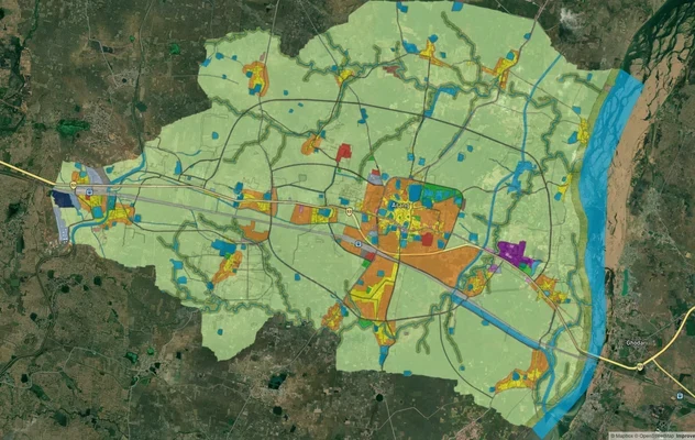
Arang Masterplan
View Arang Masterplan as a live map overlay – check any plot's land use zone for free on 1acre.in. Arang Master Plan 203...
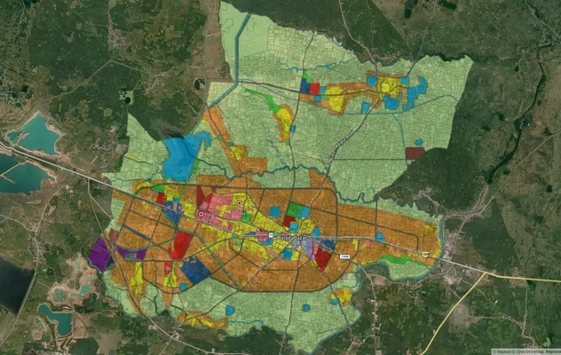
Balodabazaar Masterplan
View Balodabazaar Masterplan as a live map overlay – check any plot's land use zone for free on 1acre.in. Baloda Bazaar ...
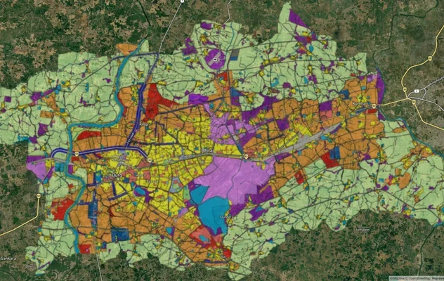
Durg-Bhilai Masterplan
View Durg-Bhilai Masterplan as a live map overlay – check any plot's land use zone for free on 1acre.in. Durg Bhilai mas...
More Layers in Chhattisgarh
Arang Masterplan
View Arang Masterplan as a live map overlay – check any plot's land use zone for free on 1acre.in. Arang Master Plan 203...
Balodabazaar Masterplan
View Balodabazaar Masterplan as a live map overlay – check any plot's land use zone for free on 1acre.in. Baloda Bazaar ...
Durg-Bhilai Masterplan
View Durg-Bhilai Masterplan as a live map overlay – check any plot's land use zone for free on 1acre.in. Durg Bhilai mas...