Mahasamund Masterplan
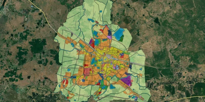
Mahasamund Masterplan Preview
Try the Mahasamund Masterplan on the map
Sign in once and explore the layer for a full day.
- No card details needed
- Find nearby verified lands for sale
Overview
Mahasamund sits 55 km from Raipur on NH-53, right where the Raipur-Visakhapatnam economic corridor cuts through central Chhattisgarh. That location has pushed land buying interest sharply upward in recent years. Before any plot changes hands here, the Mahasamund Master Plan 2031, prepared by TCPD Chhattisgarh, determines what that land can legally be used for. The 1acre premium map layer overlays this plan on live cadastral data so buyers can check any survey number against the zone before stepping onto a site.
Two Traps That Have Caught Mahasamund Land Buyers: Tribal Restrictions and Fake CLU Approvals
Most land disputes in Mahasamund trace back to one of two problems. Either the buyer did not know the land fell under tribal ownership rules, or someone had slipped in a forged Change of Land Use document. Both are avoidable if you know what to look for.
Start with the tribal land question. Mahasamund, Saraipali, and Basna tahsils are listed as scheduled tribal areas by the Chhattisgarh Scheduled Tribes Commission. In these tahsils, a non-tribal buyer cannot legally purchase land from a tribal seller without prior written sanction from the District Collector. No sanction means the registration is void, full stop. This is not a technicality that gets sorted out later. Courts treat such transfers as null from the date of execution. Brokers working these belts often present tribal-owned plots at attractive prices while staying quiet about the ownership classification. The Khasra Nakal will show you the caste entry; ask for it before any money moves.
The second trap involves fake CLU orders along the Bharatmala corridor. An active Enforcement Directorate investigation, with searches across nine premises in Raipur and Mahasamund districts in December 2025, found that brokers had bought agricultural land near the expressway alignment cheap and then pushed through forged CLU conversions to multi-use or commercial status. The EOW's findings alleged at least ₹32 crore was extracted this way. The fraud worked because buyers assumed a piece of paper showing commercial status was real. It often was not.
The table below covers what to demand before you pay anything.
Risk
What Gets Hidden
Document to Demand
Tribal land in scheduled tahsils
Tribal caste entry in Khasra
Khasra Nakal + Collector sanction letter
Fake CLU on agricultural land
Forged conversion order
Original CLU order directly from TCPD or Collector
Risk
What Gets Hidden
Document to Demand
Tribal land in scheduled tahsils
Tribal caste entry in Khasra
Khasra Nakal + Collector sanction letter
Fake CLU on agricultural land
Forged conversion order
Original CLU order directly from TCPD or Collector
If the seller cannot produce these within 48 hours, walk away. A genuine owner has nothing to hide.
Raipur-Visakhapatnam Corridor and the NH-353 Belt: Reading the Land Value Picture Around Mahasamund
Two corridors are driving most of the land interest in this district right now, and they carry very different risk profiles.
The Raipur-Visakhapatnam Expressway (NH-130CD) is a 464 km, six-lane greenfield corridor under Bharatmala Phase-I, connecting Raipur to Visakhapatnam through Chhattisgarh, Odisha, and Andhra Pradesh. PM Modi laid the foundation stone in November 2022. Construction is underway across most packages, with phased opening targeted by 2027. The expressway passes through the south-eastern districts of Chhattisgarh, placing Mahasamund directly along the growth spine. Enquiries for land near interchange points have been rising. The catch is that the same corridor is under an active ED probe for land acquisition fraud, which means any parcel close to the alignment needs extra document scrutiny before you commit.
The NH-353 Bagbahra road belt is the quieter, more straightforward option. Agricultural land with highway frontage on this road has been listed by owners directly at around ₹6 lakh per acre. Owner-direct transactions here tend to be cleaner to verify, though the tribal land rules in Mahasamund and Saraipali tahsils apply equally here.
Corridor
What Drives It
Price Signal
Primary Risk
Raipur-Visakhapatnam (NH-130CD)
Bharatmala 6-lane expressway, target 2027
No confirmed public price data available
Active ED probe on land acquisition fraud
NH-353 Bagbahra belt
Existing highway, close to Mahasamund city
~₹6L/acre highway frontage (owner listings, 2024)
Tribal ownership in Mahasamund, Saraipali tahsils
NH-53 Raipur-Mahasamund belt
55 km from Raipur, railway station, state capital proximity
Higher baseline demand
Check master plan zone before assuming residential use
One thing buyers consistently get wrong on the NH-130CD belt: they see acquisition activity around the expressway and assume nearby agricultural land will automatically shift to commercial zone. It does not work that way. The master plan controls zone classification. Highway proximity alone changes nothing without a formal TCPD reclassification. Cross-check the zone on the 1acre layer before treating any parcel as commercially convertible.
Was this layer helpful?
Anything wrong, outdated, or missing we want to hear it.
For Land Owners & Agents
Looking to sell your land in Chhattisgarh?
I want to sell my land in Chhattisgarh
10:32
Plz share your Land's location - We will list it on 1acre map, for Free.
10:32

For Land Buyers
Browse all verified lands & plots in Chhattisgarh
Every listing goes through our Preliminary Verification Process.
More Layers in Chhattisgarh
See all 12 layers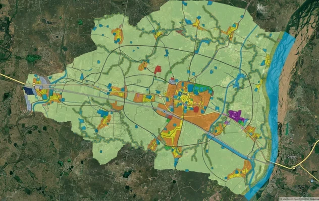
Arang Masterplan
View Arang Masterplan as a live map overlay – check any plot's land use zone for free on 1acre.in. Arang Master Plan 203...
Balodabazaar Masterplan
View Balodabazaar Masterplan as a live map overlay – check any plot's land use zone for free on 1acre.in. Baloda Bazaar ...
Bhatapara Masterplan
View Bhatapara Masterplan as a live map overlay – check any plot's land use zone for free on 1acre.in. Bhatapara Master ...
More Layers in Chhattisgarh
Arang Masterplan
View Arang Masterplan as a live map overlay – check any plot's land use zone for free on 1acre.in. Arang Master Plan 203...
Balodabazaar Masterplan
View Balodabazaar Masterplan as a live map overlay – check any plot's land use zone for free on 1acre.in. Baloda Bazaar ...
Bhatapara Masterplan
View Bhatapara Masterplan as a live map overlay – check any plot's land use zone for free on 1acre.in. Bhatapara Master ...