Raigarh Masterplan
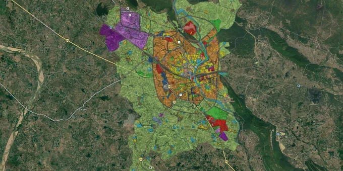
Raigarh Masterplan Preview
Try the Raigarh Masterplan on the map
Sign in once and explore the layer for a full day.
- No card details needed
- Find nearby verified lands for sale
Overview
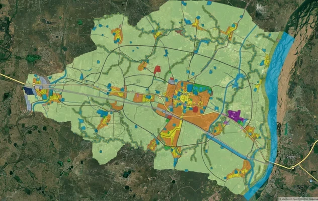
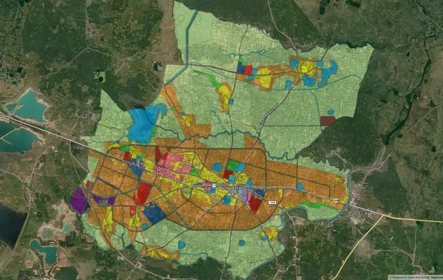
The Raigarh Master Plan 2021 is the operative land-use framework for one of Chhattisgarh's most active industrial districts, governed by the Directorate of Town and Country Planning (TCP), Chhattisgarh. Before you sign any sale deed in this district, your plot's zone classification under this plan determines what you can build, whether you need a conversion, and whether the seller's claims are even legal. This Raigarh plot buying guide covers the regulatory traps that trap buyers, the corridors worth watching, and how to use 1acre tools to verify before committing.
Raigarh Land Zone Classification: The Regulatory Red Flags Every Buyer Must Clear
Agricultural land sold as residential-ready is the most common fraud pattern in Raigarh. Sellers frequently market plots in agricultural zones as suitable for immediate construction, and buyers discover only after registration that a Change of Land Use (CLU) order is still required from the TCP Chhattisgarh authority. No CLU, no legal construction.
The table below shows the zone types that appear in Raigarh's planning area and the critical question every buyer must ask before proceeding.
Zone Type
Common Use
Conversion Required?
Highest Risk for Buyers
Residential (R Zone)
Housing, plotted development
No, if notified
Unlicensed layouts sold as authority-approved
Agricultural / Green
Farming, open land
Yes, CLU from TCP mandatory
Sold as "ready plots" without conversion
Industrial
Manufacturing, warehouses
No, within notified industrial area
Proximity buffer violations near habitation
Mixed Use
Commercial + residential
Partial, specific use requires approval
Dual claims on same survey number
A Raigarh master plan zone check via the TCP Chhattisgarh portal is non-negotiable before any token payment. The Chhattisgarh Town and Country Planning Act 1973 and the TCP Rules 2020 govern all developments in notified planning areas. If a broker cannot show you the TCP-notified zone map for the specific survey number, the conversation ends there.
The second trap is unlicensed layouts in peri-urban villages. As Raigarh city expands along the Kelo River belt and toward Gharghoda, private developers carve up revenue land into small plots and sell them with only a basic Khasra number, without obtaining a layout licence from TCP. These layouts have no legal road access, no sanctioned drainage, and no path to building permission. The Chhattisgarh government has issued repeated notices against such layouts, and purchases in these zones carry full demolition risk.
Gerwani, Gharghoda, and the NH-49 Corridor: Where Land Investment Actually Makes Sense in Raigarh
Raigarh district divides cleanly into three types of land markets: the city core with established demand but high prices and saturated supply; the industrial belt running through Gerwani and Gharghoda where proximity to steel and power plants drives worker housing demand; and the emerging highway corridor along NH-49 toward Dharamjaigarh, which the Chhattisgarh government has proposed as a new national highway route to Ambikapur.
The table below maps these corridors against their growth drivers and key risks.
Corridor / Locality
Primary Growth Driver
Land Type in Demand
Known Risk
Gerwani (near city)
Steel plant expansions, sponge iron, pellet plant, ferro alloy approved 2025
Industrial and worker residential
Industrial buffer zone violations
Gharghoda (38 km north)
Coal-rich belt, Kelo Dam tourism, Raigarh–Ambikapur highway proposal
Agricultural and mixed
Tribal land (Schedule V) restrictions in parts
Dhimrapur Road / TV Tower Road
City expansion, residential colony growth
Plotted residential
Unlicensed layouts, no TCP licence
NH-49 / Raigarh–Dharamjaigarh axis
Proposed 282-km national highway to Ambikapur and UP border
Agricultural land with conversion potential
Long timeline to notification; prices may be speculative
Nayaganj / Dindayal Puram (city core)
Established residential, close to railway station
Residential plots
High prices, limited upside
The most misunderstood corridor is Gharghoda. Parts of the Gharghoda tehsil fall within Schedule V notified areas under the Indian Constitution, which restricts non-tribal buyers from purchasing land without state government approval. Brokers rarely disclose this. Verify tribal land status against the district collector's Schedule V notification before looking at any parcel in this tehsil.
Raigarh also carries airport infrastructure: one domestic airport already serves the city, and Raigarh railway station sits on the Howrah-Nagpur-Mumbai broad gauge main line. Both improve long-term connectivity fundamentals without the speculative risk of unconfirmed highway projects.
Was this layer helpful?
Anything wrong, outdated, or missing we want to hear it.
For Land Owners & Agents
Looking to sell your land in Chhattisgarh?
I want to sell my land in Chhattisgarh
10:32
Plz share your Land's location - We will list it on 1acre map, for Free.
10:32

For Land Buyers
Browse all verified lands & plots in Chhattisgarh
Every listing goes through our Preliminary Verification Process.
More Layers in Chhattisgarh
See all 12 layers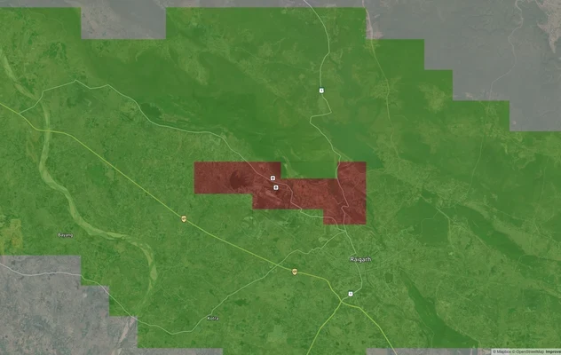
Raigarh Air Funnel Zones
View Raigarh Air Funnel Zones on a live map – check height clearance restrictions on any plot for free on 1acre.in. Raig...
Arang Masterplan
View Arang Masterplan as a live map overlay – check any plot's land use zone for free on 1acre.in. Arang Master Plan 203...
Balodabazaar Masterplan
View Balodabazaar Masterplan as a live map overlay – check any plot's land use zone for free on 1acre.in. Baloda Bazaar ...
More Layers in Chhattisgarh
Raigarh Air Funnel Zones
View Raigarh Air Funnel Zones on a live map – check height clearance restrictions on any plot for free on 1acre.in. Raig...
Arang Masterplan
View Arang Masterplan as a live map overlay – check any plot's land use zone for free on 1acre.in. Arang Master Plan 203...
Balodabazaar Masterplan
View Balodabazaar Masterplan as a live map overlay – check any plot's land use zone for free on 1acre.in. Baloda Bazaar ...