Durg-Bhilai Masterplan
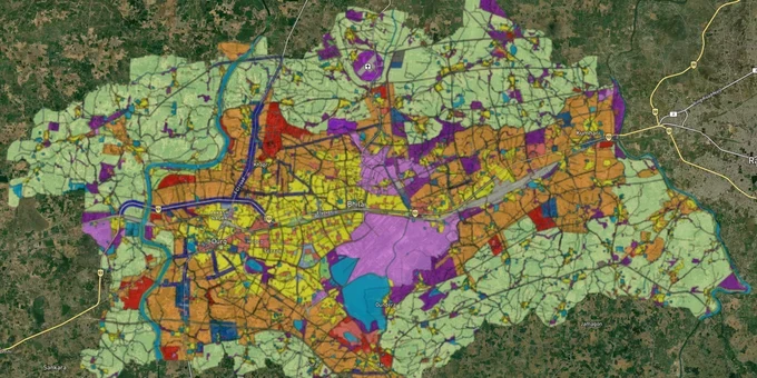
Durg Bihlai Masterplan Preview
Try the Durg-Bhilai Masterplan on the map
Sign in once and explore the layer for a full day.
- No card details needed
- Find nearby verified lands for sale
Overview
The Durg Bhilai Master Plan 2031 is the operative zoning document for the twin-city agglomeration of Durg and Bhilai in Chhattisgarh. The plan was formally approved via Gazette Notification No. 4 dated January 4, 2020, making it a reviewed and notified document (Durg-Bhilai Vikas Yojana Punarvilokan 2031 – the seventh revision after six prior rejections) under the CG Town and Country Planning Act 1973. The planning area covers a dense industrial and residential urban cluster anchored by the Bhilai Steel Plant (BSP), one of India's largest integrated steel facilities. For any buyer evaluating the Durg Bhilai masterplan land zone, understanding the CLU fraud pattern that has already drawn EOW (Economic Offences Wing) and ACB (Anti-Corruption Bureau) attention, the BSP township boundary, and the Bharatmala corridor's active acquisition disputes is the minimum required before signing anything.
CLU Fraud Patterns and Bharatmala Acquisition Disputes in Durg
The Durg-Bhilai land market carries a specific, documented fraud pattern that has resulted in multiple arrests and ongoing EOW and ACB investigations across Chhattisgarh. The mechanism is this: agricultural land earmarked for government acquisition under the Bharatmala expressway project is bought cheaply once the NHAI (National Highways Authority of India) road plans are shared with the local revenue administration. Those plots are then illegally converted to multi-use or commercial status through forged Change of Land Use (CLU) approvals, inflating their compensation value before the acquisition is finalised. An SDM and revenue officials in the Raipur-Durg circuit were directly implicated. The key accused remains absconding as of May 2025.
This matters for private buyers because the same CLU inflation trick is not limited to acquisition corridors. Plots sold in fringe areas of Durg as "diverted" or "commercially converted" land need independent verification of the CLU order at the DTCP Chhattisgarh portal before any trust is placed in the conversion claim.
The second live risk is the Bharatmala 92.5-km expressway running from Durg through Anjora, Patora, Supkona, Abhanpur, and Naya Raipur to Arang. Land acquisition disputes involving over a thousand farmers in Durg alone are active, with 250 to 300 compensation revision cases pending before the Office of Competent Authority. Any parcel within or adjacent to this corridor that changed hands since 2019 carries a potential lien or disputed title risk that a sale deed cannot extinguish.
The table below maps the three verified risk categories for Durg-Bhilai land transactions.
Risk Type
Geographic Trigger
Practical Check
Illegal CLU / false conversion
Fringe agricultural land in Durg rural, Anjora, Patora
Verify CLU order at tcp.cg.gov.in before accepting "diverted plot" claim
Bharatmala acquisition corridor
92.5 km belt: Durg–Anjora–Patora–Abhanpur–Naya Raipur
Check the NHAI acquisition notification for the Khasra number before purchase
Unregistered plot scheme
CG RERA (Real Estate Regulatory Authority) jurisdiction, any plotting >500 sq mt
Verify RERA registration at rera.cgstate.gov.in; absence of a number means non-compliant
No CLU document handed to you by a broker carries automatic credibility in Durg. Verify it independently, or treat the land as undiverted agricultural land for valuation purposes.
Durg-Bhilai Sub-Markets: BSP Township Fringe, Risali–Kumhari Residential, and Borai Industrial
The Durg-Bhilai market has three genuinely distinct value tiers, and understanding them is essential for any buyer.
The first tier is the BSP township fringe. The Bhilai Steel Plant township spans 9,103 acres across 16 residential sectors. BSP-allotted sector land is not available for private purchase; it is SAIL (Steel Authority of India Limited) government land. Transactable private land is in the residential streets and colonies abutting the sector boundary, particularly around GE Road, Supela, and Smriti Nagar, where commercial land is actively transacting, and values are supported by BSP employee purchasing power. SAIL plans ₹7,500 crore in capex in FY26 for plant expansion, which sustains residential and commercial demand adjacent to the plant. The second tier is Risali and Kumhari, the two localities with the highest volume of private residential plot listings in 2025. Risali Bhilai has active residential transactions from ₹20 lakh upward for 1,000–1,500 sq ft plots, while Kumhari sees larger commercial and agricultural land parcels. The third tier is AKVN Borai industrial zone, where 1-acre industrial plots are available, designed for manufacturing and ancillary industries linked to BSP's supply chain. Borai is an approved AKVN industrial area; land here has state-backed industrial zoning without the conversion risk that plagues agricultural-to-industrial conversions elsewhere in the district.
The table below maps each zone against its plan backing and risk profile.
Zone / Locality
Use Classification
Growth Driver
Risk Level
GE Road, Supela, Smriti Nagar
Commercial / Mixed Use
BSP employee demand; ₹7,500 crore SAIL FY26 capex
Low
Risali Bhilai
Residential
Active private transactions, clear title history
Low to Medium
Kumhari
Residential + Agricultural
Proximity to the NRDA corridor and Raipur
Medium (verify diversion status)
AKVN Borai
Industrial (AKVN-designated)
State industrial area; BSP supply chain anchor
Low (for AKVN allotted plots)
Anjora, Patora, Supkona
Acquisition zone
Bharatmala expressway belt
High (active disputes, compensation revision pending)
The most misunderstood zone is Kumhari. It straddles the Durg and Raipur revenue boundaries and is marketed simultaneously as both a Durg fringe investment and a New Raipur spillover play. Buyers need to confirm which municipal planning boundary the specific Khasra falls under before assuming the Durg-Bhilai Master Plan 2031 governs it, because NRDA jurisdiction and DTCP jurisdiction carry different development standards.
Was this layer helpful?
Anything wrong, outdated, or missing we want to hear it.
For Land Owners & Agents
Looking to sell your land in Chhattisgarh?
I want to sell my land in Chhattisgarh
10:32
Plz share your Land's location - We will list it on 1acre map, for Free.
10:32

For Land Buyers
Browse all verified lands & plots in Chhattisgarh
Every listing goes through our Preliminary Verification Process.
More Layers in Chhattisgarh
See all 12 layers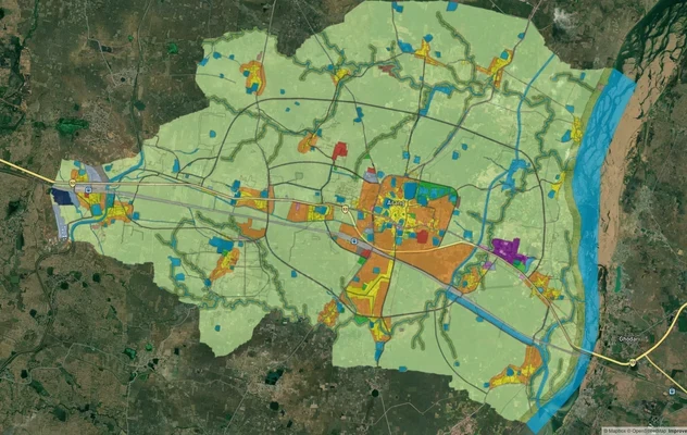
Arang Masterplan
View Arang Masterplan as a live map overlay – check any plot's land use zone for free on 1acre.in. Arang Master Plan 203...
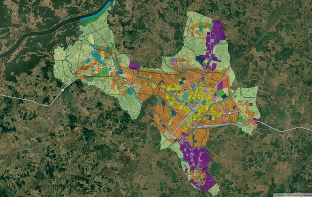
Balodabazaar Masterplan
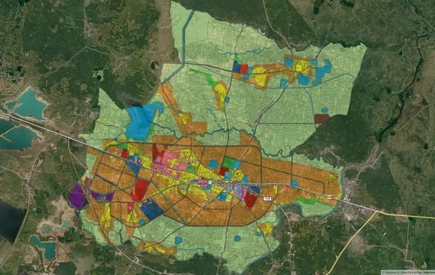
View Balodabazaar Masterplan as a live map overlay – check any plot's land use zone for free on 1acre.in. Baloda Bazaar ...
Bhatapara Masterplan
View Bhatapara Masterplan as a live map overlay – check any plot's land use zone for free on 1acre.in. Bhatapara Master ...
More Layers in Chhattisgarh
Arang Masterplan
View Arang Masterplan as a live map overlay – check any plot's land use zone for free on 1acre.in. Arang Master Plan 203...
Balodabazaar Masterplan
View Balodabazaar Masterplan as a live map overlay – check any plot's land use zone for free on 1acre.in. Baloda Bazaar ...
Bhatapara Masterplan
View Bhatapara Masterplan as a live map overlay – check any plot's land use zone for free on 1acre.in. Bhatapara Master ...