Kannur Masterplan: AMRUT Zone Check and Land Use Guide
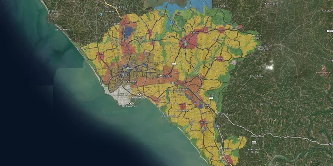
Kannur Masterplan Preview
Try the Kannur Masterplan on the map
Sign in once and explore the layer for a full day.
- No card details needed
- Find nearby verified lands for sale
Overview
The Kannur City Master Plan 2041 was sanctioned by the Government of Kerala on 22 June 2024 and gazetted on 19 July 2024 under the Kerala Town and Country Planning Act 2016. Prepared under the AMRUT scheme by Kannur Municipal Corporation with GIS-based mapping, the plan covers the corporation area across eight revenue villages: Kannur I, Kannur II, Pallikkunnu, Puzhathi, Valiyannur, Chelora, Elayavoor, and Edakkad. Anyone researching Kannur City Master Plan 2041 land buying needs to map their survey number against the proposed land use before signing any agreement, because development rights, building height, and permitted uses all flow from that single classification.
Paddy land and the Conservation Zone: the two traps that end Kannur land deals
Most buyers who run into trouble in the Kannur corporation area hit the same two walls. The first is paddy land. The second is Conservation Zone classification.
On paddy land: The Kerala Conservation of Paddy Land and Wetland Act 2008 bars construction on properties classified as paddy or wetland in the official Land Data Bank. Crucially, a Kerala High Court order from June 2017, implemented by the Revenue Department, blocks conversion for plots purchased after August 2008, even for residential use by the buyer's own family. Sellers in localities like Chelora, Edakkad, and parts of Valiyannur sometimes present plots visually cleared of paddy but still carrying the Land Data Bank classification. Before any purchase in the Kannur Corporation area, check the Land Data Bank at your local Krishi Bhavan or via the ReLIS portal using the survey number. A cleared plot that is still in the Data Bank cannot be legally built on without going through Section 27A conversion, which requires Krishi Bhavan, Village Office, and local authority approvals, a process with no guaranteed timeline.
The second trap is the Conservation Zone. The Master Plan carries two conservation zone categories: Conservation Zone-I and Conservation Zone-II. Zone II is the more restrictive: government and public-sector projects require Town Planner concurrence, and uses that are otherwise permitted or restricted in adjacent zones are explicitly excluded from Zone II plots. Heritage Zone, which protects the Arakkal Kettu area, carries equivalent restrictions. For plots touching a river boundary, the plan bars all construction within 3 metres of the Kattampally and Kakkad rivers, and within 2 metres (or the stream width, whichever is less) of Kanampuzha and its tributaries.
The table below maps the plan's zone categories against what a buyer can actually do with the land:
Zone
Permitted as-of-right
Key restriction
Residential Zone
Housing, home offices
Commercial uses require Town Planner concurrence
Residential Mix Zone
Housing + select commercial
Mixed uses allowed on NH/SH up to 250 m depth
Commercial Zone
Retail, offices, hospitality
Industrial uses prohibited
Dry Agriculture Zone
Farming, permitted ancillary
Large-scale projects (≥1 ha, ₹100 Cr+, 500 jobs) can be permitted with committee approval
Conservation Zone-I
Limited to plan provisions
Restricted uses need Chief Town Planner concurrence
Conservation Zone-II
Severely restricted
Govt projects still need Town Planner concurrence; Heritage Zone rules apply
Beach / River-Front Tourism Promotion Zone
Tourism uses, fisheries within 500 m of HTL
CRZ Notification overrides all plan provisions
Water Body Zone
No construction
EV charging, telecom towers prohibited
One practical rule from the plan that brokers rarely mention: if your plot straddles two zones, the Secretary of Kannur Municipal Corporation can permit uses from both applicable zones throughout the whole plot, except where Water Body, Conservation Zone-I or II, Heritage Zone, Special Zone, or Recreational Open Space falls on any portion. In those cases, the most restrictive zone governs that part of the land, with no override possible.
Growth corridors and micro-markets under the Kannur Master Plan
Kannur city's land market splits into three tiers when you read the plan's transport and land-use proposals together.
The first tier covers the NH-66 corridor and the Kannur-Mattannur axis. The plan grants commercial and residential mix permissions to a depth of 250 metres on both sides of National Highways and State Highways, making every plot within that band eligible for higher-value mixed uses, a direct function of the Master Plan's road depth table. The Thalassery-Koduvalli-Mambaram-Anjarakkandy-Mattannur airport road is the subject of active land acquisition notifications under the Kannur District administration, which means plots in this stretch are facing acquisition risk in some sections while also seeing improved connectivity value. Buyers must cross-check survey numbers against the acquisition gazette before committing.
The second tier covers the established residential pockets, Pallikkunnu, Thottada, Thana, Payyambalam, and Thazhe Chovva, that the plan classifies primarily as Residential Zone or Residential Mix Zone. These areas have the deepest active listing activity in the corporation limits and carry the lowest zoning ambiguity. They are the safest entry point for buyers wanting certainty over development rights today.
The third tier, and the most misunderstood, is the Edakkad-Chelora belt. Parts of this area carry Dry Agriculture Zone classification, which restricts construction to agricultural use by default. Brokers sometimes price these plots at Residential Zone rates, pointing to future conversion potential. That is speculative: Dry Agriculture Zone conversion for general residential use is not provided for in the plan, and the large-scale project exception (₹100 crore investment, 500 direct jobs) is not a realistic basis for individual plot purchases.
Corridor / Locality
Primary Zone (Master Plan 2041)
Growth Driver
Risk
Kannur-Mattannur Highway axis
Residential Mix / Commercial (250 m depth from NH)
Airport road upgradation gazette notifications
Active land acquisition in some stretches
Pallikkunnu, Thottada, Thana
Residential Zone / Residential Mix Zone
Established demand, deep listing inventory
Paddy land overlap in low-lying pockets
Payyambalam, Thavakkara
Residential Zone, Beach Tourism Promotion Zone
Beach access, CRZ-compliant tourism potential
CRZ Notification overrides all plan provisions within coastal setback
Edakkad, Chelora
Dry Agriculture Zone (parts)
Peripheral pricing, possible future urbanisation
No residential conversion pathway for individual plots
Valiyannur, Muzhappilangad
Mixed, Residential / Conservation / Water Body overlap
Muzhappilangad drive-in beach access
Conservation Zone-I/II and water body setbacks apply to coastal portions
The most consistently mispriced corridor is Edakkad. It borders the core residential belt visually, but its Dry Agriculture Zone classification means a buyer cannot build a house there without a change order, which the plan does not automatically provide. Verify the village-specific proposed land use map, not just a broker's description of "near residential area."
Was this layer helpful?
Anything wrong, outdated, or missing we want to hear it.
For Land Owners & Agents
Looking to sell your land in Kerala?
I want to sell my land in Kerala
10:32
Plz share your Land's location - We will list it on 1acre map, for Free.
10:32

For Land Buyers
Browse all verified lands & plots in Kerala
Every listing goes through our Preliminary Verification Process.
More Layers in Kerala
See all 10 layers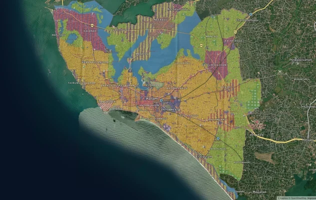
Kollam AMRUT Masterplan: Zone Check and Land Use Guide
View Kollam Masterplan as a live map overlay – check any plot's land use zone for free on 1acre.in. Kollam City Masterpl...
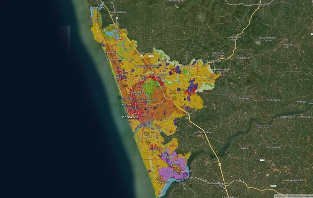
Kozhikode City Masterplan 2040: AMRUT Zone Check and Land Use Guide
View Kozhikode Masterplan as a live map overlay – check any plot's land use zone for free on 1acre.in. Kozhikode masterp...
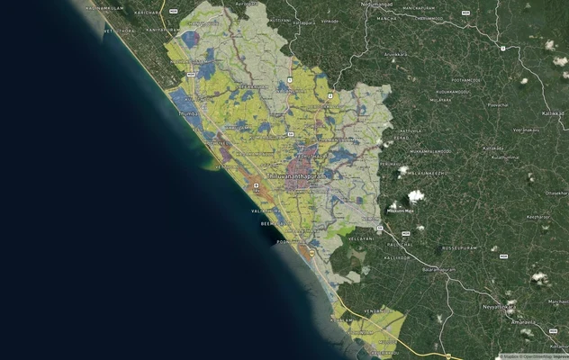
Thiruvananthapuram Masterplan 2040: TRIDA Zone Check and Land Use Guide
View Thiruvananthapuram Masterplan as a live map overlay – check any plot's land use zone for free on 1acre.in. Thiruvan...
More Layers in Kerala
Kollam AMRUT Masterplan: Zone Check and Land Use Guide
View Kollam Masterplan as a live map overlay – check any plot's land use zone for free on 1acre.in. Kollam City Masterpl...
Kozhikode City Masterplan 2040: AMRUT Zone Check and Land Use Guide
View Kozhikode Masterplan as a live map overlay – check any plot's land use zone for free on 1acre.in. Kozhikode masterp...
Thiruvananthapuram Masterplan 2040: TRIDA Zone Check and Land Use Guide
View Thiruvananthapuram Masterplan as a live map overlay – check any plot's land use zone for free on 1acre.in. Thiruvan...