Kerala CRZ
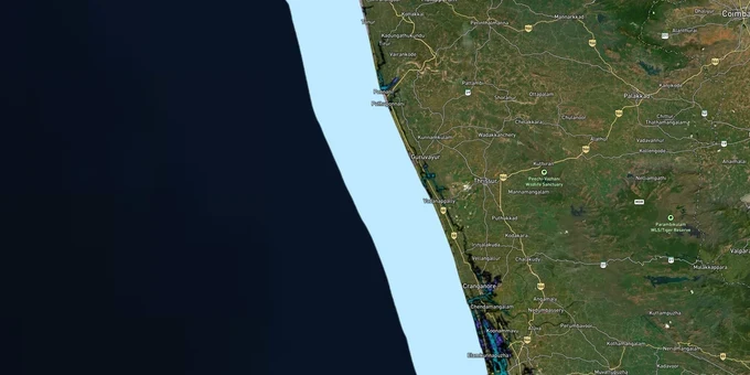
Kerala Crz Preview
Try the Kerala CRZ on the map
Sign in once and explore the layer for a full day.
- No card details needed
- Find nearby verified lands for sale
Overview
The Kerala CRZ layer plots the Coastal Regulation Zone footprint along Kerala's 580 km coastline and the connected backwater system, governed by CRZ Notification 2019 (G.S.R. 37(E)) with amendments up to 24 November 2022. The Kerala Coastal Zone Management Authority (KCZMA), under the Department of Environment and Climate Change, is the regulatory body. The 2019 CZMPs for all 10 coastal districts were approved by MoEFCC in November 2024, making Kerala one of only four states with an approved CZMP under CRZ 2019, alongside Odisha, Karnataka, and Maharashtra, reducing total NDZ (No Development Zone) area in Kerala from 239.431 sq km under CRZ 2011 to 108.397 sq km. This page shows what falls inside CRZ-I, II, III A, III B, and IV across Thiruvananthapuram to Kasaragod.
Regulatory Red Flags After the Maradu Demolition
Kerala is the only state in India where the Supreme Court has actually ordered apartment demolitions for CRZ violations. The Maradu CRZ violation case (Supreme Court order 8 May 2019) ended with four occupied apartment complexes in Kochi imploded on 11-12 January 2020. The court rejected the builders' argument that the area was CRZ-II under the draft 2011 CZMP, holding that the 1996 KCZMP classifying Maradu as CRZ-III was the operative plan when permits were issued.
The fact-pack on what each zone permits in Kerala, drawn from CRZ Notification 2019 and the 1996/2019 CZMPs.
Zone Code
Permitted Use
Requires CRZ Clearance?
Prohibited Without?
Commonly Misrepresented?
CRZ-I A
Mangroves, sand dunes, turtle nesting, Vembanad CVCA
No new construction; only utility
Any building
Sold as "lakefront resort plots"
CRZ-I B
Inter-tidal between LTL (Low Tide Line) and High Tide Line
Salt works, pipelines only
Houses, resorts
Marketed as "beachfront"
CRZ-II
Built-up urban municipal areas (66 panchayats added in 2019 CZMP)
Yes, on landward side
Construction on seaward side
Confused with CRZ-III rural
CRZ-III A
Densely populated rural; NDZ 50 m from HTL (High Tide Line) (37 panchayats in Kerala)
Beyond NDZ only
Construction inside 50 m
Quoted as "approved layout"
CRZ-III B
Sparse rural; NDZ 200 m from HTL
Beyond NDZ only
Anything inside 200 m
Sold without disclosure
CRZ Backwater Islands
HTL to 20 m landward
Limited dwellings only
Resorts, multi-storey
Sold as "private island plots"
CRZ-IV B
Backwaters and tidal water bodies
Fishing only
Reclamation, dwellings
Sold as "houseboat plots"
If a builder shows you a panchayat permit but no KCZMA recommendation, treat it the way the Supreme Court treated Maradu: void from the start. The 1996 KCZMP remained operative for clearance decisions until the 2019 plans were notified, and many disputed parcels still get adjudicated against the older map. The No Development Zone (NDZ) stacks on top of any local Town and Country Planning approval.
Growth Corridors Around Kochi, Vembanad and the Malabar Coast
Kerala's coastal property market splits into three personalities. The Kochi-Ernakulam axis is mostly CRZ-II urban with selective backwater CRZ-IV B exposure. The Vembanad backwaters Kochi to Alappuzha stretch is a Critical Vulnerable Coastal Area (CVCA) with the strictest restrictions. The Malabar coast (Kozhikode, Kannur, Kasaragod) is mixed CRZ-III A and III B, where the CZMP 2019 Kerala has reclassified 37 panchayats from CRZ-III B to III A, reducing NDZ from 200 m to 50 m.
The corridors most asked about, mapped against CRZ classification under the 2019 CZMP.
Corridor / Locality
Zone (Kerala CZMP 2019)
Growth Driver
Known Risk
Maradu, Kochi (Chilavannoor lake)
CRZ-II under 2019; CRZ-III in 1996 plan
Urban redevelopment
Pre-2019 permits still litigable
Marine Drive, Kochi
CRZ-II + CRZ-IV B
Premium waterfront
Reclamation history scrutinised
Vembanad lake, Alappuzha
CVCA + CRZ-I A
Houseboat tourism
Blanket restriction; private builds blocked
Kovalam, Thiruvananthapuram
CRZ-III mix
Tourism, leisure
NDZ enforced; Hazard line marked
Bekal, Kasaragod
CRZ-III + CRZ-I sand dunes
BTDC (Bekal Tourism Development Corporation) tourism push, fort
Dune buffer locks parcels
Kannur airport ribbon
CRZ-III B fringe
Connectivity, NRI demand
Fringe parcels misquoted as "outside CRZ"
Backwater islands (Kumarakom, Vypin)
20 m CRZ from HTL
Resort, second home market
20 m island rule; no relaxation
The most misunderstood corridor is the Vembanad backwater belt. Buyers see houseboats and tourism activity and assume resorts are unlocked. Vembanad is a Critical Vulnerable Coastal Area listed in CRZ Notification 2019 itself, with CRZ-I A status across mangrove and Pokkali stretches. Private resort approvals here face both KCZMA clearance and CVCA-specific restrictions, and post-Maradu the courts treat panchayat permits in this belt with deep suspicion.
Was this layer helpful?
Anything wrong, outdated, or missing we want to hear it.
For Land Owners & Agents
Looking to sell your land in Kerala?
I want to sell my land in Kannur
10:32
Plz share your Land's location - We will list it on 1acre map, for Free.
10:32

For Land Buyers
Browse all verified lands & plots in Kerala
Every listing goes through our Preliminary Verification Process.
More Layers in Kerala
See all 10 layers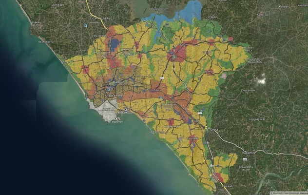
Kannur Masterplan: AMRUT Zone Check and Land Use Guide
View Kannur Masterplan as a live map overlay – check any plot's land use zone for free on 1acre.in. Kannur City Master P...
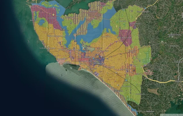
Kollam AMRUT Masterplan: Zone Check and Land Use Guide
View Kollam Masterplan as a live map overlay – check any plot's land use zone for free on 1acre.in. Kollam City Masterpl...
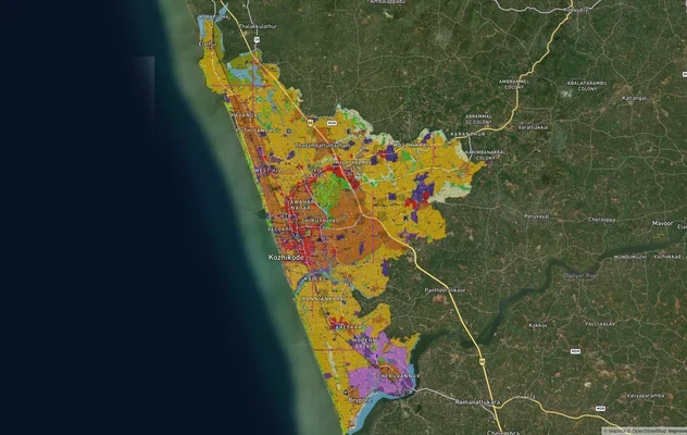
Kozhikode City Masterplan 2040: AMRUT Zone Check and Land Use Guide
View Kozhikode Masterplan as a live map overlay – check any plot's land use zone for free on 1acre.in. Kozhikode masterp...
More Layers in Kerala
Kannur Masterplan: AMRUT Zone Check and Land Use Guide
View Kannur Masterplan as a live map overlay – check any plot's land use zone for free on 1acre.in. Kannur City Master P...
Kollam AMRUT Masterplan: Zone Check and Land Use Guide
View Kollam Masterplan as a live map overlay – check any plot's land use zone for free on 1acre.in. Kollam City Masterpl...
Kozhikode City Masterplan 2040: AMRUT Zone Check and Land Use Guide
View Kozhikode Masterplan as a live map overlay – check any plot's land use zone for free on 1acre.in. Kozhikode masterp...