Kozhikode City Masterplan 2040: AMRUT Zone Check and Land Use Guide
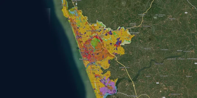
Kozhikode Masterplan Preview
Try the Kozhikode City Masterplan 2040 on the map
Sign in once and explore the layer for a full day.
- No card details needed
- Find nearby verified lands for sale
Overview
The Kozhikode masterplan 2040 land zone map divides the entire Kozhikode Municipal Corporation area into 23 distinct zones, from High-density Residential and Mixed-use to Environmentally Sensitive Zone I and II, Wet Agricultural, Eco Tourism, and IT Park. Governed by the Department of Town and Country Planning Kerala (TCPK) under the Kerala Town and Country Planning Act 2016, the plan covers the Kozhikode Corporation area together with Feroke and Ramanattukara municipalities and selected gram panchayats. Before you buy any plot inside these limits, one question decides everything: what zone is your survey number in? This page shows you why that answer matters and how to act on it.
Zone mismatches that have already cost Kozhikode buyers their permits
The most dangerous mistake buyers make in Kozhikode is assuming that the way a plot is used today tells you what the masterplan permits tomorrow. It does not. The Kerala High Court upheld the Kozhikode Corporation's rejection of a commercial building permit for land in a DTP-designated residential zone, with Justice Bechu Kurian Thomas explicitly stating that rampant construction without heeding zoning regulations harms planned urban development. A separate case confirmed that commercial buildings in DTP-covered zones face a hard cap of 150 sqm and a Floor Space Index (FSI) limit of 1.5, regardless of what neighbouring buildings look like.
Two specific zone types require extra scrutiny before any purchase.
Zone
Permitted Without Further Approval
Requires Concurrence
Prohibited
Environmentally Sensitive Zone I
Very restricted, minimal activity only
Secretary + Chief Town Planner
Most construction
Environmentally Sensitive Zone II
Limited conservation-compatible use
Secretary + Town Planner
Incompatible built use
Wet Agricultural Zone
Agriculture, ponds, open areas; existing ground level must be maintained; filling prohibited
Any non-agricultural use requires Secretary approval
Construction on filled land
High-density Residential
Residential construction
Commercial exceeding zone limits: Secretary with Town Planner concurrence (Uses Restricted 2)
Industrial, incompatible uses
Mixed-use Zone
Residential and commercial
Restricted categories: Secretary concurrence required
Prohibited categories per zoning table
IT Park Zone
IT/ITES development
Other uses: restricted
Incompatible non-IT uses
The plan also imposes a blanket rule for all land within 500 metres of the High Tide Line: Coastal Regulation Zone (CRZ) restrictions override zoning, regardless of what zone the plot falls in. For paddy land and wetland, the Kerala Conservation of Paddy Land and Wetland Act 2008 overrides the masterplan, filling a wetland plot is prohibited even if the zone map shows it as residential.
Do not rely on a revenue record showing "dry land" (purayidam) to confirm buildability. Courts have ruled that the Paddy Land Act operates on ground reality, not on document classification. If the site holds water during monsoon, expect a challenge.
Growth corridors where the masterplan directly shapes land value in Kozhikode
The masterplan creates two tiers of opportunity in Kozhikode: zones where zoning actively enables development, and zones where infrastructure alignment has shifted demand ahead of price.
The IT Park zone centred around Cyberpark Kozhikode (Pantheeramkavu, near Mavoor Road) and the planned IT zone at Ramanattukara are the clearest masterplan-backed value anchors. The plan explicitly designates an IT Park land use category, one of only 23 zones, confirming that peripheral residential land near these nodes sits in a mixed-use or low-density residential zone with straightforward permit pathways.
Corridor / Locality
Zone (Masterplan 2040)
Growth Driver
Known Risk
Ramanattukara–Thondayad Bypass fringe
Mixed-use / Low-density Residential
Bypass completion + IT Park designation nearby
Check exact survey number; bypass alignment may trigger road widening setbacks
Beypore Port area
Port and Allied Development Zone + Industrial Zone
KSINC cruise ops, Kinfra Marine Park expansion
Marine Park industrial zone restricts residential use; verify zone boundary precisely
Kunnamangalam
Low-density Residential / Mixed-use fringe
Truck terminal planned; NH 766 connectivity
Proximity to proposed truck terminal; check Transport Zone boundary
Mavoor Road corridor (Kottooli–Pantheeramkavu)
Mixed-use / IT Park fringe
Cyberpark employment, Medical College proximity
Paddy land parcels in low-lying areas along Mavoor Road carry wetland risk
Kozhikode Beach landward side
Special Economic Zone / Tourism Promotion Zone
SEZ designation in plan
Construction within 500m of HTL subject to CRZ rules, verify CZMP map
The most misread corridor is Beypore. Buyers attracted by port activity often purchase plots inside or adjacent to the Industrial Zone or Port and Allied Development Zone, then discover that residential construction requires Secretary-level approval with Chief Town Planner concurrence, a Uses Restricted 2 process that can take months and may be refused. Confirm the exact zone boundary at the survey number level before negotiating price on any Beypore parcel.
Was this layer helpful?
Anything wrong, outdated, or missing we want to hear it.
For Land Owners & Agents
Looking to sell your land in Kerala?
I want to sell my land in Kerala
10:32
Plz share your Land's location - We will list it on 1acre map, for Free.
10:32

For Land Buyers
Browse all verified lands & plots in Kerala
Every listing goes through our Preliminary Verification Process.
More Layers in Kerala
See all 10 layers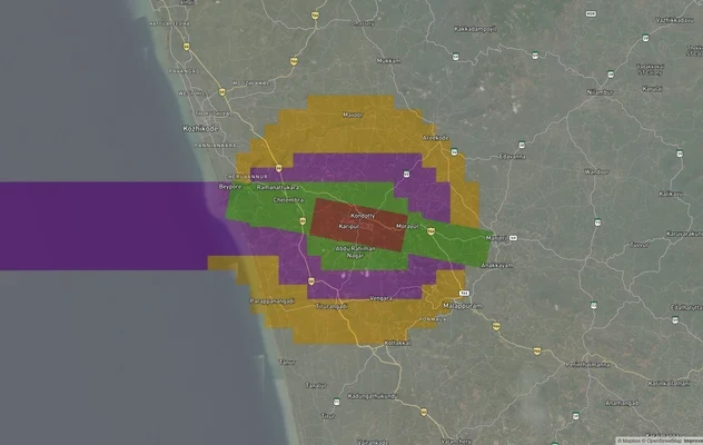
Kozhikode Air Funnel Zones: Building Height Restrictions
View Kozhikode Air Funnel Zones on a live map – check height clearance restrictions on any plot for free on 1acre.in. Ko...
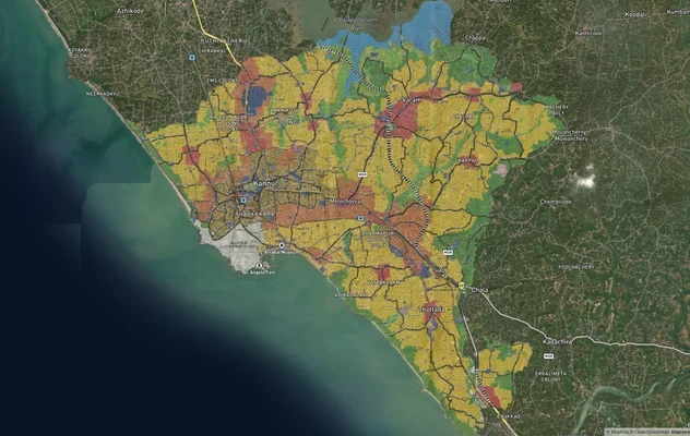
Kannur Masterplan: AMRUT Zone Check and Land Use Guide
View Kannur Masterplan as a live map overlay – check any plot's land use zone for free on 1acre.in. Kannur City Master P...
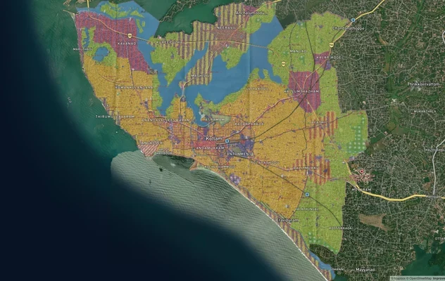
Kollam AMRUT Masterplan: Zone Check and Land Use Guide
View Kollam Masterplan as a live map overlay – check any plot's land use zone for free on 1acre.in. Kollam City Masterpl...
More Layers in Kerala
Kozhikode Air Funnel Zones: Building Height Restrictions
View Kozhikode Air Funnel Zones on a live map – check height clearance restrictions on any plot for free on 1acre.in. Ko...
Kannur Masterplan: AMRUT Zone Check and Land Use Guide
View Kannur Masterplan as a live map overlay – check any plot's land use zone for free on 1acre.in. Kannur City Master P...
Kollam AMRUT Masterplan: Zone Check and Land Use Guide
View Kollam Masterplan as a live map overlay – check any plot's land use zone for free on 1acre.in. Kollam City Masterpl...