Kozhikode Air Funnel Zones: Building Height Restrictions
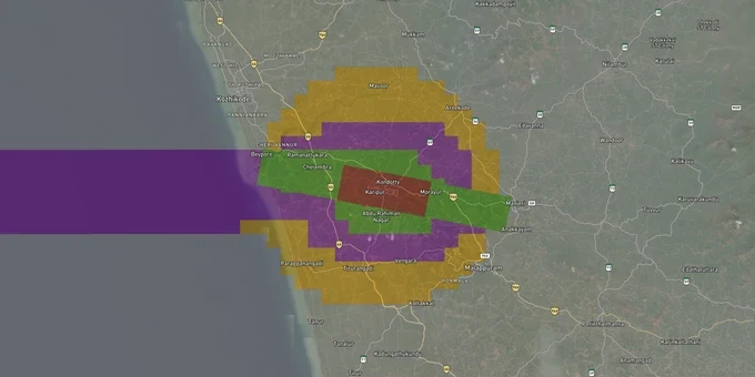
Kozhikode Air Funnel Zones Preview
Try the Kozhikode Air Funnel Zones on the map
Sign in once and explore the layer for a full day.
- No card details needed
- Find nearby verified lands for sale
Overview
Kozhikode Airport's height restriction zone rules govern every plot within 20 km of Calicut International Airport (IATA: CCJ, ICAO: VOCL), located at Karipur in the Malappuram district and operated by AAI. At 343 feet (approx. 104.5 m) above mean sea level, Karipur is one of India's tabletop runways, perched on a plateau. That elevated position fundamentally tightens the AMSL arithmetic for every plot in its 20 km radius. All structures require an AAI height clearance NOC before construction starts.Why Karipur's Tabletop Runway Makes the Height Calculation Harder Than Any Flat-Ground Airport
Most buyers near Indian airports run a simple calculation: how tall can I build? Near Karipur, that calculation has a trap that flat-ground airports do not. Karipur sits on a hilltop plateau at approximately 343 feet (about 104.5 m) AMSL. AAI measures permitted building height in AMSL, not from your ground floor. The airport itself starts high. The Permissible Top Elevation in the CCZM grid around it is set relative to that elevated baseline, so a plot on the approach valley or hillside adjacent to the runway can exhaust its AGL headroom with far fewer floors than a buyer expects.
AAI NOC Requirements Within the Karipur Funnel Zone
Under GSR 751(E), all structures within 20 km of the Aerodrome Reference Point (ARP) at Karipur require an AAI NOC. The airport funnel zone, running along runway 10-28, is the tightest constraint. Inside it, the permitted height equals 2% of the distance from the runway edge in meters AGL. The runway is currently 2,860 m long after the RESA was expanded from 90 m to 240 m on both ends, which reduced the available runway to 2,700 m. AAI has proposed extending the runway to 3,500 m and continues to acquire land in the villages of Pallikkal and Nediyirippu in Kondotty taluk of Malappuram district for RESA expansion. Land in those villages is directly inside the approach acquisition zone. The table below maps how height limits shift across the main OLS zones around Karipur.
Zone
Distance Reference
Max Permitted Height
NOC Required?
Runway Strip (No-build)
0-500 m from runway edge
No construction
N/A
Inner Horizontal Surface
Up to 4 km from ARP
45 m AGL
Yes, AAI mandatory
Airport Funnel (Approach path)
Along runway 10-28 approach
2% of distance from runway edge
Yes, AAI mandatory
Conical Surface
4-8 km approx.
Increases 1 m per 20 m of distance
Yes, AAI mandatory
Outer Horizontal Surface
Up to 15 km from ARP
Up to 300 m AMSL
Yes, AAI mandatory
Peripheral Zone
15-20 km
No hard cap, monitored
Yes, AAI mandatory
Because Karipur itself sits high, plots at lower elevations in the surrounding valleys have a narrower AMSL gap between their ground and the permitted ceiling. Do not rely on an address or a neighbor's building permit as a proxy. The CCZM grid check through NOCAS, using your plot's verified WGS84 coordinates and surveyed site elevation, is the only reliable answer.
Kondotty, Pallikkal and the Ramanattukara NH-966 Corridor: Zones That Carry Both Demand and Acquisition Risk
Karipur Airport sits between two national highways. NH-966 passes 2.3 km from the airport, and NH-66 runs about 8 km away, joining at Ramanattukara, roughly 12 km from the ARP. These corridors drive the highest land activity around the airport. Kondotty, directly adjacent to the airport, is where buyers most often get into trouble: the plot is desirable, the airport is close for NRI families, and the height ceiling is the tightest outside the runway strip itself.
The table below covers the localities most active in the Kozhikode and Malappuram land market around Karipur.
Corridor / Locality
Approx. Distance from ARP
Primary Zone Risk
Key Demand Driver
Karipur/Karippur village
0–2 km
Funnel zone: extreme restriction
Airport employment, NRI return housing
Pallikkal (Kondotty taluk)
0–3 km (Runway 10 west end)
Active land acquisition zone
RESA expansion acquisition, AAI notice
Nediyirippu (Kondotty taluk)
0–3 km (Runway 28 east end)
Active land acquisition zone
RESA expansion acquisition, AAI notice
Kondotty town
2.5–5 km
Conical / inner horizontal surface
NH connectivity, NRI housing demand
Ramanattukara (NH-966/NH-66 junction)
10–14 km
Outer horizontal surface
Commercial growth, NH junction premium
Malappuram town
20–25 km
Outside strict NOC radius
District HQ, education demand
The most dangerous corridor for buyers right now is Pallikkal and Nediyirippu. The state government acquired 12.48 acres from 98 landowners in these villages in 2024 for the RESA extension. AAI has also projected a revised land requirement of approximately 152 acres for the broader runway and terminal development. Any plot in those villages that has not yet been acquired still carries the risk of a future acquisition notice. Check with the Malappuram collectorate for active land acquisition proceedings before paying any advance in this belt.
Was this layer helpful?
Anything wrong, outdated, or missing we want to hear it.
For Land Owners & Agents
Looking to sell your land in Kerala?
I want to sell my land in Kerala
10:32
Plz share your Land's location - We will list it on 1acre map, for Free.
10:32

For Land Buyers
Browse all verified lands & plots in Kerala
Every listing goes through our Preliminary Verification Process.
More Layers in Kerala
See all 10 layers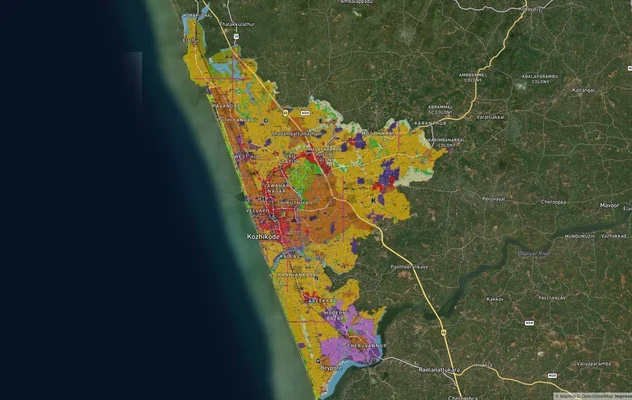
Kozhikode City Masterplan 2040: AMRUT Zone Check and Land Use Guide
View Kozhikode Masterplan as a live map overlay – check any plot's land use zone for free on 1acre.in. Kozhikode masterp...
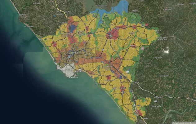
Kannur Masterplan: AMRUT Zone Check and Land Use Guide
View Kannur Masterplan as a live map overlay – check any plot's land use zone for free on 1acre.in. Kannur City Master P...
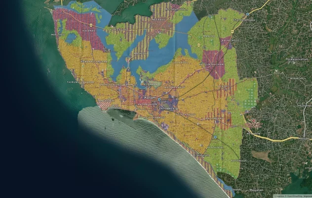
Kollam AMRUT Masterplan: Zone Check and Land Use Guide
View Kollam Masterplan as a live map overlay – check any plot's land use zone for free on 1acre.in. Kollam City Masterpl...
More Layers in Kerala
Kozhikode City Masterplan 2040: AMRUT Zone Check and Land Use Guide
View Kozhikode Masterplan as a live map overlay – check any plot's land use zone for free on 1acre.in. Kozhikode masterp...
Kannur Masterplan: AMRUT Zone Check and Land Use Guide
View Kannur Masterplan as a live map overlay – check any plot's land use zone for free on 1acre.in. Kannur City Master P...
Kollam AMRUT Masterplan: Zone Check and Land Use Guide
View Kollam Masterplan as a live map overlay – check any plot's land use zone for free on 1acre.in. Kollam City Masterpl...