Urukunnu - Kadampattukonam Economic Corridor
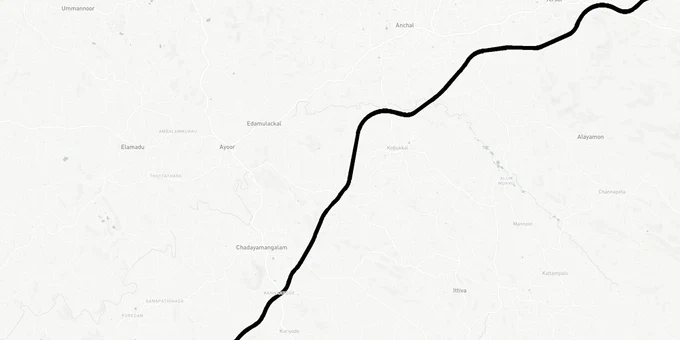
Urukunnu Kadampattukonam Economic Corridor Preview
Try the Urukunnu - Kadampattukonam Economic Corridor on the map
Sign in once and explore the layer for a full day.
- No card details needed
- Find nearby verified lands for sale
Overview
The Urukunnu-Kadampattukonam Economic Corridor is a 38.3-km, 4/6-lane greenfield highway forming part of the NH-744 Kollam-Madurai corridor under Bharatmala Pariyojana. The alignment starts near Urukunnu village in Thenmala, Kollam district, passes through Anchal town, and terminates at Kadampattukonam in Thiruvananthapuram district at its junction with NH-66 near Parippally. The DPR was prepared under the Expert Appraisal Committee (EAC) of MoEFCC, which has given its recommendation for Environmental Clearance. The formal EC order is a separate step that must be confirmed before construction can begin. Around 202 hectares of land, mostly agricultural, falls within the proposed right of way. This page covers acquisition risks, the paddy land restriction trap, and which corridors near this alignment hold genuine investment logic.
Construction is planned under HAM (Hybrid Annuity Model).
PM Modi laid the foundation stone for the Kollam-Madurai NH-744 in 2023.
NH-744 Compensation Disputes and Kerala's Paddy Land Trap: What Buyers Near This Corridor Are Missing
Buying land near the Urukunnu-Kadampattukonam corridor carries two regulatory hazards that most buyers treat as a single problem. They are not.
The first is the acquisition delay hazard. A Section 3A notification for land acquisition along the NH-744 Varkala taluk stretch was issued as far back as September 29, 2022. Yet as of 2024, compensation disbursement was still stalled because of a dispute over depreciation norms. Under the 2018 land acquisition manual of the Ministry of Road Transport and Highways, compensation for structures must account for depreciation. Kerala secured exemptions from this rule for NH-66 and NH-966, but NHAI (National Highways Authority of India) confirmed in February 2024 that those concessions cannot be extended to NH-744. The state government has also requested exemption from its mandatory 25% share of land acquisition costs, state GST, and royalty payments — all of which remain unresolved as of 2024. A buyer who acquires land inside a notified strip today walks into a compensation dispute that has been running for years, not months.
The second hazard is specific to Kerala and applies to land both inside and outside the acquisition zone: the Kerala Conservation of Paddy Land and Wetland Act, 2008. This law prohibits the conversion or reclamation of any paddy land or wetland in Kerala. Every Local Level Monitoring Committee (LLMC) maintains a databank of notified paddy and wetland in its panchayat jurisdiction. If the land you are buying appears in that databank, construction or conversion is legally prohibited regardless of what the seller tells you. Only land classified as "unnotified" (listed in the Basic Tax Register but absent from the LLMC databank) can be converted through a formal application to the Revenue Divisional Officer under Section 27A of the Act, and even then, the RDO (Revenue Divisional Officer) can require 10% of the plot to be set aside for water conservancy.
The table below shows the key regulatory checkpoints that apply to land near this corridor.
Checkpoint
Authority
What to Verify
NH-744 acquisition strip
NHAI / Kollam District Collector
Section 3A gazette notification; check if survey number falls in 45m RoW (revenue land) or 30m RoW (forest areas)
LLMC paddy/wetland databank
Local Panchayat LLMC
Check if land is notified paddy or wetland; if yes, conversion is prohibited
"Unnotified land" status
Revenue Divisional Officer
If listed in BTR (Basic Tax Register) as paddy but absent from databank, apply under Section 27A before purchase
Compensation dispute (NH-744)
State PWD / NHAI
Confirm no pending Section 3A notification on the specific survey number before purchase
If a seller cannot show you a clean LLMC databank check and a gazette verification, that is a reason to pause, not proceed.
Investable Corridors Near Urukunnu-Kadampattukonam: Parippally, Anchal and the NH-66 Junction
The alignment runs approximately 38.3 km through Kollam and Thiruvananthapuram districts, with 99% of it on greenfield land. The two endpoints generate the genuine investment logic for this corridor.
At the northern end, the junction near Urukunnu-Thenmala sits on the NH-744 spine, connecting the Kollam port hinterland to the interior. At the southern end, Kadampattukonam in Varkala taluk, Thiruvananthapuram district, sits at the Kollam-Thiruvananthapuram district border on NH-66. This terminus is also the starting point of the full NH-744 alignment toward Madurai. The principal corridor between those two points, passing near Anchal town, is where logistics and feeder road demand is expected to concentrate once the highway is operational.
Parippally, which the proposed corridor is designed to connect to NH-66, is the most active land market along this route. Popular nearby localities for land buyers include Keralapuram and Anchal. However, proximity to a proposed alignment is not itself an investment thesis: the state-Centre dispute over land acquisition cost-sharing and compensation norms means construction timelines are uncertain.
Zone
Proximity to Corridor
Growth Driver
Key Risk
Kadampattukonam-Parippally fringe
Terminus node, NH-66 junction
NH-66 + NH-744 dual connectivity
Inside acquisition zone for some parcels; paddy land restrictions apply
Anchal town periphery
Mid-corridor, 45m RoW edge
Freight movement, Kollam port linkage
LLMC databank must be checked; greenfield corridor still under DPR approval stage
Thenmala-Urukunnu fringe
Northern terminus
Eco-tourism zone; existing road network
Forest land nearby; 30m RoW applies to forest sections
The most misunderstood situation near this corridor is agricultural land being sold near the alignment with no LLMC databank clearance. The paddy land restriction applies whether or not the state considers the land agricultural in its revenue records. Always obtain an LLMC certificate and a Revenue Divisional Officer opinion before signing.
Was this layer helpful?
Anything wrong, outdated, or missing we want to hear it.
For Land Owners & Agents
Looking to sell your land in Kerala?
I want to sell my land in Kerala
10:32
Plz share your Land's location - We will list it on 1acre map, for Free.
10:32

For Land Buyers
Browse all verified lands & plots in Kerala
Every listing goes through our Preliminary Verification Process.
More Layers in Kerala
See all 10 layers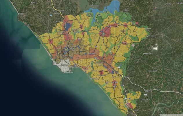
Kannur Masterplan: AMRUT Zone Check and Land Use Guide
View Kannur Masterplan as a live map overlay – check any plot's land use zone for free on 1acre.in. Kannur City Master P...
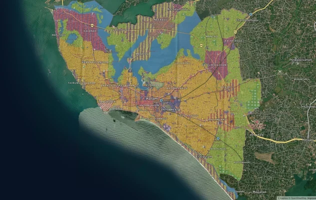
Kollam AMRUT Masterplan: Zone Check and Land Use Guide
View Kollam Masterplan as a live map overlay – check any plot's land use zone for free on 1acre.in. Kollam City Masterpl...
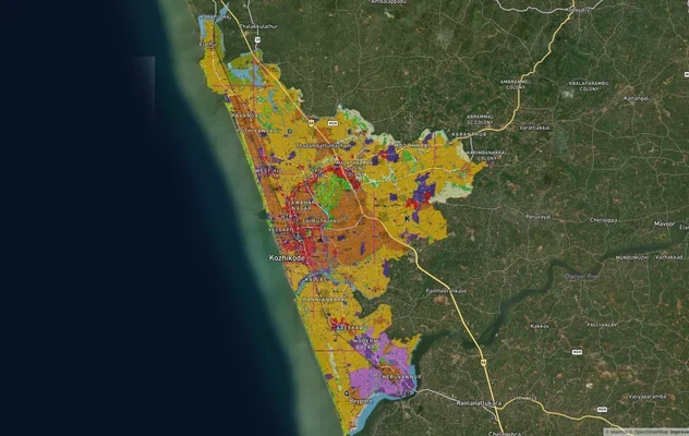
Kozhikode City Masterplan 2040: AMRUT Zone Check and Land Use Guide
View Kozhikode Masterplan as a live map overlay – check any plot's land use zone for free on 1acre.in. Kozhikode masterp...
More Layers in Kerala
Kannur Masterplan: AMRUT Zone Check and Land Use Guide
View Kannur Masterplan as a live map overlay – check any plot's land use zone for free on 1acre.in. Kannur City Master P...
Kollam AMRUT Masterplan: Zone Check and Land Use Guide
View Kollam Masterplan as a live map overlay – check any plot's land use zone for free on 1acre.in. Kollam City Masterpl...
Kozhikode City Masterplan 2040: AMRUT Zone Check and Land Use Guide
View Kozhikode Masterplan as a live map overlay – check any plot's land use zone for free on 1acre.in. Kozhikode masterp...