
IAF Air Funnel Zones - Bathinda


Iaf Air Funnel Zones Bathinda Preview
Try the IAF Air Funnel Zones - Bathinda on the map
एक बार साइन इन करें और पूरे दिन लेयर एक्सप्लोर करें।
- No card details needed
- Find nearby verified lands for sale
Overview
The Bathinda Air Force Station land height restriction question starts with an unusual fact: this is a dual-use aerodrome, meaning it operates as both a strategically important Indian Air Force base and a functioning civil airport at the same time. Officially known as Bhisiana Air Force Station, the base sits roughly 16 kilometres northwest of Bathinda city near the villages of Bhisiana and Killi Nihal Singh Wala. It was constructed in 1975 and upgraded to a strategically important air force station and wing in February 1980.
A civil enclave operated under the Airports Authority of India runs commercial flights from the same site, currently served by FlyBig with connections to Ghaziabad and Dehradun. It covers why this base's dual military-civil status makes its restricted zone more likely to change than a single-purpose airfield, the legal framework governing height limits here, and which villages sit closest to the tightest restriction band.
Bathinda Air Force Station Land: Regulatory Red Flags You Cannot Ignore
The first and most important red flag is that Bathinda Air Force Station carries two separate sources of regulatory pressure on nearby land, not one. As a strategically important IAF base, it is subject to security-driven restricted zone requirements under the Ministry of Defence. As a functioning civil airport with commercial traffic, it is separately subject to height restriction rules under the Directorate General of Civil Aviation and the Airports Authority of India. Most buyers near a typical civilian airport only need to think about one regulatory track.
Land near Bathinda sits under both, and a change driven by either side, a new military asset deployment or growing civilian passenger traffic, can trigger a fresh review of the restricted zone independent of the other.
The second red flag is the specific legal mechanism involved. Construction near any IAF-linked aerodrome requires a No Objection Certificate under a framework built on the Aircraft Act, 1934, and the applicable Civil Aviation Requirements, specifically CAR Section 3, Series C, Part II, which governs height restrictions in relation to runways and approach paths.
Separately, the Ministry of Defence requires its own NOC for construction falling within a base's published Colour Coded Zone Map, covering red zones closest to the runway, the funnel zone aligned with approach and departure paths, and any structure exceeding a locally-specified height threshold. Crucially, the exact boundaries, radii, and height figures in these frameworks are airport-specific. A figure that applies at one Indian Air Force base is not automatically the figure that applies at Bathinda, and the only authoritative source for Bathinda's own restricted zone is its officially published Colour Coded Zone Map, not a general national rule of thumb.
The table below sets out the layered regulatory structure that governs land near a dual-use base like Bathinda.
Regulatory Track
Governing Body
What It Covers
Approval Path
Civil aviation height rules
DGCA / AAI, under CAR Section 3, Series C, Part II
Height limits based on distance from runway and approach/departure paths
Application through AAI's civil aviation NOC process
Military restricted zone
Ministry of Defence
Red zone, funnel zone, and security-driven buffer areas per the base's Colour Coded Zone Map
Separate application through defence clearance channels
Aircraft Act, 1934 framework
Central government
Legal basis underpinning both height restriction and defence NOC requirements
Statutory foundation for both tracks above
Regulatory Track
Governing Body
What It Covers
Approval Path
Civil aviation height rules
DGCA / AAI, under CAR Section 3, Series C, Part II
Height limits based on distance from runway and approach/departure paths
Application through AAI's civil aviation NOC process
Military restricted zone
Ministry of Defence
Red zone, funnel zone, and security-driven buffer areas per the base's Colour Coded Zone Map
Separate application through defence clearance channels
Aircraft Act, 1934 framework
Central government
Legal basis underpinning both height restriction and defence NOC requirements
Statutory foundation for both tracks above
The third red flag is Bathinda's growing strategic and operational footprint, which increases the odds of the restricted zone being revised rather than staying fixed. The Indian Army has deployed aviation units at this location, including Drishti-10 Starliner unmanned aerial vehicle operations, a notable strategic asset addition that can prompt its own separate security review of the surrounding buffer area. At the same time, the civil enclave's commercial traffic has grown sharply: passenger numbers rose 111.7 percent and aircraft movements rose 95.9 percent in the most recent reporting year available. A base experiencing this kind of growth on both its military and civilian sides is not a static regulatory environment, and any land decision here should account for the real possibility that today's zone map is not permanent.
Areas and Micro-Markets Affected by the Bathinda Restricted Zone
Land value and regulatory exposure near Bathinda Air Force Station depend heavily on exact proximity to the runway and the two villages that sit closest to it, rather than general distance from Bathinda city itself.
Locality
Position Relative to the Base
Character
Restriction Exposure
Bhisiana
Immediate vicinity of the airbase
Small village giving the base its alternate name
Highest exposure to both the military red zone and civil aviation funnel restrictions
Killi Nihal Singh Wala
Adjacent village near the base
Rural settlement close to the runway
Similarly high exposure given direct proximity
Bathinda Cantonment
City-side military area
Established cantonment with its own rail station
Distinct from the airbase's own zone; verify separately which restriction, if any, applies
Bathinda city core
Approximately 16 km from the base
Established urban centre of the Malwa region
Likely outside the tightest funnel and red zone bands, but confirm against the runway's specific alignment
Locality
Position Relative to the Base
Character
Restriction Exposure
Bhisiana
Immediate vicinity of the airbase
Small village giving the base its alternate name
Highest exposure to both the military red zone and civil aviation funnel restrictions
Killi Nihal Singh Wala
Adjacent village near the base
Rural settlement close to the runway
Similarly high exposure given direct proximity
Bathinda Cantonment
City-side military area
Established cantonment with its own rail station
Distinct from the airbase's own zone; verify separately which restriction, if any, applies
Bathinda city core
Approximately 16 km from the base
Established urban centre of the Malwa region
Likely outside the tightest funnel and red zone bands, but confirm against the runway's specific alignment
Bhisiana and Killi Nihal Singh Wala are the two localities where buyers face the most direct exposure, precisely because the base's own name reflects Bhisiana's proximity to it. Land in and around these villages sits closest to both the runway's physical footprint and whatever red zone or funnel zone boundary the base's Colour Coded Zone Map defines. Any construction plan here, from a simple farmhouse to a larger residential project, needs to be checked against the base's official zone map before proceeding, not assumed safe simply because it sits outside the airport's fenced perimeter.
Bathinda city itself is the most commonly misunderstood distance point in this picture. Sixteen kilometres feels like a comfortable buffer, and for many national-level height restriction frameworks it likely is, particularly for typical horizontal surface limits that apply within a much tighter four to five kilometre radius around most Indian airports. But funnel zones extend specifically along runway approach and departure alignments, not as a uniform circle, so a location's actual exposure depends on which direction it sits relative to the runway's orientation, not simply how many kilometres separate it from the base. A plot 16 kilometres away but directly in line with an approach path can carry meaningfully more restriction than a plot much closer but off to the side.
क्या यह लेयर सहायक थी?
Anything wrong, outdated, or missing we want to hear it.
ज़मीन मालिकों और एजेंटों के लिए
Punjab में अपनी ज़मीन बेचना चाहते हैं?
मैं Punjab में अपनी ज़मीन बेचना चाहता हूँ
10:32
कृपया अपनी ज़मीन का स्थान साझा करें - हम इसे 1acre मैप पर सूचीबद्ध करेंगे, मुफ़्त.
10:32


ज़मीन खरीदारों के लिए
Punjab में सभी सत्यापित ज़मीन और प्लॉट ब्राउज़ करें
प्रत्येक लिस्टिंग हमारी प्रारंभिक सत्यापन प्रक्रिया से गुज़रती है।
Punjab में और लेयर्स
सभी 14 लेयर्स देखें
IAF Air Funnel Zone Ludhiana: Height Rules
View the Ludhiana air funnel zone on a live map. Check AAI height clearance and Works of Defence Act NOC rules before bu...
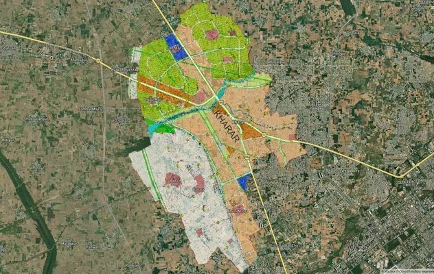
खरार मास्टरप्लान
खरार मास्टरप्लान को लाइव मैप ओवरले के रूप में देखें – 1acre.in पर किसी भी प्लॉट का लैंड यूज़ ज़ोन मुफ्त में चेक करें. खर...

ज़ीरकपुर मास्टरप्लान
ज़ीरकपुर मास्टरप्लान को लाइव मैप ओवरले के रूप में देखें – 1acre.in पर किसी भी प्लॉट का लैंड यूज़ ज़ोन मुफ़्त में चेक करे...
Punjab में और लेयर्स
IAF Air Funnel Zone Ludhiana: Height Rules
View the Ludhiana air funnel zone on a live map. Check AAI height clearance and Works of Defence Act NOC rules before bu...
खरार मास्टरप्लान
खरार मास्टरप्लान को लाइव मैप ओवरले के रूप में देखें – 1acre.in पर किसी भी प्लॉट का लैंड यूज़ ज़ोन मुफ्त में चेक करें. खर...
ज़ीरकपुर मास्टरप्लान
ज़ीरकपुर मास्टरप्लान को लाइव मैप ओवरले के रूप में देखें – 1acre.in पर किसी भी प्लॉट का लैंड यूज़ ज़ोन मुफ़्त में चेक करे...