
Beawar-Bharatpur Expressway


Beawar_bharatpur_expressway Preview
Try the Beawar-Bharatpur Expressway on the map
Sign in once and explore the layer for a full day.
- No card details needed
- Find nearby verified lands for sale
Overview
The Beawar Bharatpur Expressway is a proposed 342 km greenfield corridor announced in Rajasthan's 2024 state budget, one of nine greenfield expressways planned under the state's Vision 2047 infrastructure push. The road will connect NH-58 near Beawar to NH-21 at Bharatpur, passing through Gulabpura, Kekri, Todaraisingh, Uniara, Tonk, and Niwai, and requiring an estimated 3,175 hectares of land. NHAI was assigned an 18-month survey period following DPR approval before construction financing gets finalised. This guide covers what that early project stage means for land buyers, plus the Rajasthan-specific conversion rules that apply regardless of when construction actually begins.
Regulatory Red Flags Along the Beawar Bharatpur Expressway
The single most important fact about this corridor is its stage. As of the DPR approval, NHAI had only just been handed an 18-month window to conduct the detailed survey, and formal land acquisition notification had not begun. The village and town names reported in news coverage, Gulabpura, Kekri, Todaraisingh, Uniara, Tonk, and Niwai, describe an indicative route through those areas, not a finalised, surveyed alignment with fixed survey numbers attached to it.
Land Status
What It Means
Buildable or Sellable Now?
Requires Before Buying or Selling
Commonly Misrepresented?
Outside any survey corridor, converted under Section 90A
Private, converted non-agricultural land
Yes
A standard title and Encumbrance Certificate check
Rarely
Outside the corridor, still agricultural
Private, unconverted farmland
No, until conversion
Written State Government permission under Section 90A, with a premium based on the DLC rate
Yes, sold as "expressway-adjacent" plots at converted-land prices while the land remains agricultural
Inside the reported indicative alignment, pre-survey
No formal acquisition boundary exists yet; the route can still shift
Technically sellable but high risk
Confirmation of the final surveyed alignment once NHAI publishes it
Yes, sold as guaranteed frontage based on a route that has not been formally finalised
Unpaid Section 90A conversion premium
The occupant is deemed a trespasser under Section 91
No
Full payment of the outstanding conversion premium
Yes, sellers frequently omit this status entirely
Land Status
What It Means
Buildable or Sellable Now?
Requires Before Buying or Selling
Commonly Misrepresented?
Outside any survey corridor, converted under Section 90A
Private, converted non-agricultural land
Yes
A standard title and Encumbrance Certificate check
Rarely
Outside the corridor, still agricultural
Private, unconverted farmland
No, until conversion
Written State Government permission under Section 90A, with a premium based on the DLC rate
Yes, sold as "expressway-adjacent" plots at converted-land prices while the land remains agricultural
Inside the reported indicative alignment, pre-survey
No formal acquisition boundary exists yet; the route can still shift
Technically sellable but high risk
Confirmation of the final surveyed alignment once NHAI publishes it
Yes, sold as guaranteed frontage based on a route that has not been formally finalised
Unpaid Section 90A conversion premium
The occupant is deemed a trespasser under Section 91
No
Full payment of the outstanding conversion premium
Yes, sellers frequently omit this status entirely
Rajasthan's conversion law is unforgiving on this point. Under Section 90A of the Rajasthan Land Revenue Act, 1956, no one may use agricultural land for a non-agricultural purpose without written State Government permission, obtained through a formal application with a premium calculated against the District Level Committee rate or the purchase price, whichever is higher.
Fail to pay that premium and the law is explicit: the occupant is deemed a trespasser and can be ejected under Section 91. Layer that onto a plot whose "expressway frontage" claim rests on a route that is still under survey, and the risk compounds rather than cancels out.
The bigger caution is about the alignment itself. NHAI's own survey process exists precisely because the budget-announced route is preliminary. Detailed alignment surveys routinely shift a proposed corridor by hundreds of metres to kilometres to avoid settlements, water bodies, or archaeological sites, and any of the six named towns could see the final chainage pass closer to or further from a specific village than the initial announcement suggested.
Confirm the current survey status and, once published, the finalised alignment with NHAI's Rajasthan regional office and the district Collector before treating any specific plot as guaranteed frontage.
Growth Corridors and Micro Markets Along the Beawar Bharatpur Expressway
The corridor's 342 km stretches across very different parts of Rajasthan, from the Ajmer-adjacent western towns to the Brij pilgrimage belt in the east, and each segment carries a different investment logic even before construction starts.
Corridor / Locality
Zone / Plan Status
Growth Driver
Known Risk
Beawar, NH-58 origin
Pre-survey greenfield corridor start
Connects western Rajasthan, including Jodhpur and Ajmer, into the new corridor
Survey work only recently began; no formal acquisition boundary has been notified yet
Kekri to Todaraisingh stretch
Mid-corridor greenfield, running through Ajmer district
Direct routing through named intermediate towns per the state budget announcement
The alignment remains indicative pending NHAI's 18-month survey; the route through specific villages can still shift
Tonk and Niwai
Mid-to-eastern corridor towns, positioned to also bypass Jaipur city traffic
Growth pressure from Jaipur commuters and freight seeking to avoid city congestion
Confirm whether a plot sits on the eventual surveyed alignment or an earlier indicative route before pricing frontage
Bharatpur, NH-21 terminus, gateway to the Brij region
Corridor terminus
Ties eastern Rajasthan's pilgrimage and tourism economy into the new western connection
Confirm the exact terminus tie-in point and interchange location before assuming connectivity benefits
Corridor / Locality
Zone / Plan Status
Growth Driver
Known Risk
Beawar, NH-58 origin
Pre-survey greenfield corridor start
Connects western Rajasthan, including Jodhpur and Ajmer, into the new corridor
Survey work only recently began; no formal acquisition boundary has been notified yet
Kekri to Todaraisingh stretch
Mid-corridor greenfield, running through Ajmer district
Direct routing through named intermediate towns per the state budget announcement
The alignment remains indicative pending NHAI's 18-month survey; the route through specific villages can still shift
Tonk and Niwai
Mid-to-eastern corridor towns, positioned to also bypass Jaipur city traffic
Growth pressure from Jaipur commuters and freight seeking to avoid city congestion
Confirm whether a plot sits on the eventual surveyed alignment or an earlier indicative route before pricing frontage
Bharatpur, NH-21 terminus, gateway to the Brij region
Corridor terminus
Ties eastern Rajasthan's pilgrimage and tourism economy into the new western connection
Confirm the exact terminus tie-in point and interchange location before assuming connectivity benefits
The corridor's stated purpose extends beyond simply connecting two cities. Rajasthan officials have described it as easing traffic pressure on Jaipur by giving western and eastern Rajasthan a direct link that does not route through the capital, a genuine long-term driver for towns like Tonk and Niwai sitting on that bypass function. But long-term drivers do not change short-term facts.
Currently, this expressway takes roughly seven to eight hours to cover by existing roads across a similar distance, and the promised time savings depend entirely on a corridor that has not yet been formally surveyed, let alone acquired. Land in any of the six named towns deserves genuine long-term interest, not a purchase decision made on the assumption that today's reported route is tomorrow's fixed alignment.
Was this layer helpful?
Anything wrong, outdated, or missing we want to hear it.
For Land Owners & Agents
Looking to sell your land in Rajasthan?
I want to sell my land in Rajasthan
10:32
Plz share your Land's location - We will list it on 1acre map, for Free.
10:32


For Land Buyers
Browse all verified lands & plots in Rajasthan
Every listing goes through our Preliminary Verification Process.
More Layers in Rajasthan
See all 16 layers
Ajmer Masterplan Land: ADA Zones, 90A Rules | 1acre.in
Ajmer masterplan land zone: what every buyer must verify before signing
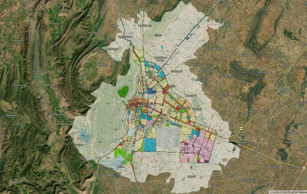
Alwar UIT Masterplan 2031: Zone Check and Land Use Guide
View Alwar Masterplan as a live map overlay – check any plot's land use zone for free on 1acre.in. Alwar Master Plan 205...
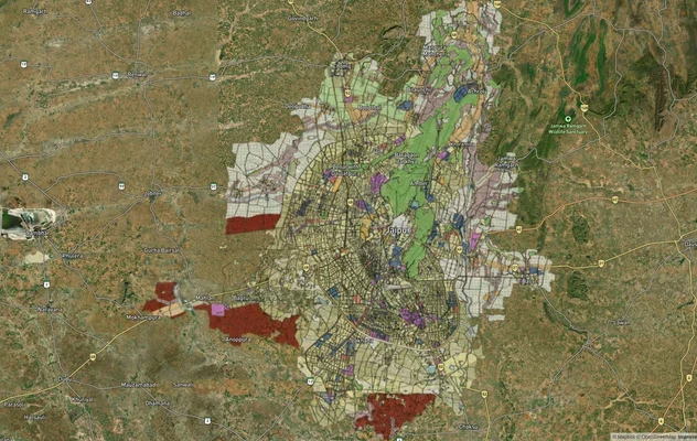
Jaipur JDA Masterplan: Zone Check and Land Use Guide
View Jaipur Masterplan as a live map overlay – check any plot's land use zone for free on 1acre.in. Jaipur masterplan zo...
More Layers in Rajasthan
Ajmer Masterplan Land: ADA Zones, 90A Rules | 1acre.in
Ajmer masterplan land zone: what every buyer must verify before signing
Alwar UIT Masterplan 2031: Zone Check and Land Use Guide
View Alwar Masterplan as a live map overlay – check any plot's land use zone for free on 1acre.in. Alwar Master Plan 205...
Jaipur JDA Masterplan: Zone Check and Land Use Guide
View Jaipur Masterplan as a live map overlay – check any plot's land use zone for free on 1acre.in. Jaipur masterplan zo...