
Chennai Outer Ring Road
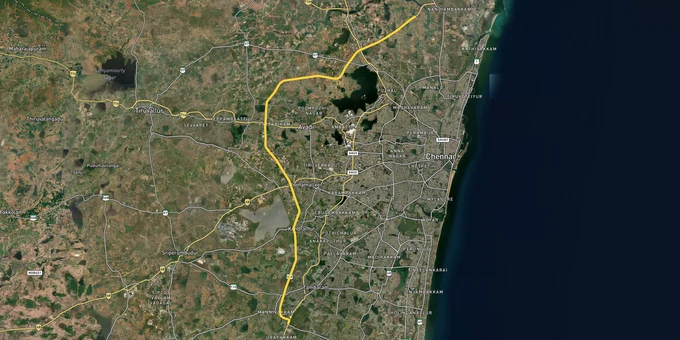

Chennai Outer Ring Road Preview
Try the Chennai Outer Ring Road on the map
Sign in once and explore the layer for a full day.
- No card details needed
- Find nearby verified lands for sale
Overview
Chennai Outer Ring Road land buying sits inside a dual-authority planning system that catches more buyers off guard than any other regulatory detail in Tamil Nadu. The Chennai Metropolitan Development Authority (CMDA), governing the 1,189 sq km Chennai Metropolitan Area under the Second Master Plan 2026, has simultaneously launched a 126 sq km ORR Growth Corridor Master Plan covering the full 62-km stretch from Vandalur on NH-45 to Minjur. As of January 2025, CMDA has begun e-auctioning land parcels between Poonamallee and Vandalur as part of this corridor plan. This page covers the Chennai ORR layer on 1acre, the panchayat plot trap that remains active here, and the pockets where ORR zone designation creates genuine investment value.
Panchayat Plots, the OSR Trap, and Why a Madras High Court Order from 2016 Still Controls What You Can Register
The single most damaging mistake buyers make along the Chennai Outer Ring Road corridor is purchasing a plot marketed as "panchayat approved" and treating that as equivalent to a CMDA or DTCP sanction. It is not. It never was.
DTCP Circular No. 9862/10BA1 dated 14 June 2010 makes this explicit: a layout plan can only be approved by a town planning authority such as CMDA or DTCP. A local panchayat has no legal authority to sanction a layout. What brokers call "panchayat approved" or "NOC plots" along the ORR corridor are agricultural land parcels subdivided and sold without any planning sanction. In 2016, the Madras High Court imposed a ban on registering unapproved plots, panchayat-approved plots, and NOC plots across Tamil Nadu. The ban is still operative. If you register such a plot today, the Sub-Registrar's office processes it under individual sale deed rules, but the layout itself remains unauthorised. You will not receive building plan approval from CMDA. Water and sewage connections from the corporation will be denied. And demolition during enforcement drives, which CMDA conducts actively, cannot be legally challenged.
The second trap is the OSR shortfall. Every sanctioned layout in Tamil Nadu must reserve 10 percent of the total land for Open Space Reservation (parks, playgrounds). Unapproved developers along the ORR fringe skip this entirely to maximise saleable area. When the state eventually initiates a regularisation scheme, plots in layouts that cannot demonstrate the OSR set-aside are restricted from regularisation. Areas located within public water bodies, OSR of approved layouts, and road reservations are permanently ineligible, no matter which regularisation scheme is introduced.
The table below maps the four approval scenarios buyers encounter on the Chennai ORR corridor and what each means legally.
Approval Type
Authority
Layout Sanction
Building Permit Possible
Regularisation Eligible
Bank Loan Eligible
CMDA Approved
CMDA
Yes
Yes
N/A
Yes
DTCP Approved
DTCP
Yes
Yes
N/A
Yes
Panchayat/NOC
Local Panchayat
No
No
Restricted
No
Unapproved (none)
None
No
No
Conditional if eligible area
No
Approval Type
Authority
Layout Sanction
Building Permit Possible
Regularisation Eligible
Bank Loan Eligible
CMDA Approved
CMDA
Yes
Yes
N/A
Yes
DTCP Approved
DTCP
Yes
Yes
N/A
Yes
Panchayat/NOC
Local Panchayat
No
No
Restricted
No
Unapproved (none)
None
No
No
Conditional if eligible area
No
One fact that will not appear on any broker's brochure: check the CMDA list of unauthorised layouts at cmdachennai.gov.in before paying any advance. CMDA publishes this list, and your plot's parent document layout name may already be on it.
Poonamallee, Vandalur, Minjur and Where the 62-km ORR Corridor Creates Differentiated Value
The Chennai ORR is not one uniform investment belt. It runs 62 km across three distinct growth profiles, and buying in the wrong segment at the wrong price will cost years of appreciation.
Poonamallee anchors the western ORR node and is the single most infrastructure-dense pocket in the corridor today. CMDA's own development plan designates it as a business district and multi-modal connectivity hub, citing proximity to the Bengaluru highway and metro connectivity. The Poonamallee Bypass metro station, part of the 26.1 km Yellow Line Corridor 4 from Lighthouse to Poonamallee Bypass, is directly adjacent to the ORR. Land prices in Poonamallee on main road plots have been quoting between Rs 4,000 and Rs 6,990 per sq ft, with CMDA-approved gated community plots ranging from Rs 22.6 lakh to Rs 88.8 lakh for sizes between 611 and 2,400 sq ft. The combination of metro access, ORR interchange at Nazarethpettai, and CMDA e-auction activity in the Poonamallee-Vandalur stretch makes this the most immediately investable node on the corridor.
Vandalur sits at the ORR's southern terminus on NH-45 (GST Road) and benefits from the same e-auction stretch. CMDA's residential and educational development plans for the Vandalur zone integrate with the zoo and Guindy Biosphere Reserve, positioning it for knowledge-economy and mixed-use growth. The GST Road belt here links OMR, GST Road, and the ORR at a single junction.
Minjur and Ponneri at the northern terminus carry the corridor's industrial investment logic. These localities house automobile and component manufacturers, with 50 acres earmarked for an "auto main street" niche retail zone and 150-plus acres of planned residential areas. The Tidel IT Park at Pattabiram, a 21-storey facility spanning 11.41 acres with 5.57 lakh sq ft of office space inaugurated in November 2024, has added white-collar employment within 5 km of the ORR northern belt.
Corridor Node
CMDA Zone Designation
Metro / ORR Access
Key Driver
Primary Risk
Poonamallee
Business District / Mixed Use
Yellow Line + ORR Nazarethpettai interchange
Metro + ORR dual access; CMDA e-auction parcel
Verify CMDA vs DTCP jurisdiction boundary per plot
Vandalur
Mixed Residential / Educational
ORR NH-45 southern terminus
CMDA e-auction stretch; GST Road junction
Unapproved layouts active in surrounding villages
Minjur / Ponneri
Industrial / Residential
ORR northern terminus; port proximity
Auto industry employment; warehouse boom
Confirm CMDA limits vs Thiruvallur DTCP zone
Nemilichery / Redhills
Industrial / Logistic
CTH Road ORR junction
ORR Phase II completed Feb 2021; 40% land appreciation
Agricultural land parcels; panchayat layout exposure
Pattabiram / Avadi
Institutional / Mixed
ORR + Avadi rail
TIDEL IT Park Nov 2024; IT employment
DTCP jurisdiction; verify CMDA expansion coverage
Corridor Node
CMDA Zone Designation
Metro / ORR Access
Key Driver
Primary Risk
Poonamallee
Business District / Mixed Use
Yellow Line + ORR Nazarethpettai interchange
Metro + ORR dual access; CMDA e-auction parcel
Verify CMDA vs DTCP jurisdiction boundary per plot
Vandalur
Mixed Residential / Educational
ORR NH-45 southern terminus
CMDA e-auction stretch; GST Road junction
Unapproved layouts active in surrounding villages
Minjur / Ponneri
Industrial / Residential
ORR northern terminus; port proximity
Auto industry employment; warehouse boom
Confirm CMDA limits vs Thiruvallur DTCP zone
Nemilichery / Redhills
Industrial / Logistic
CTH Road ORR junction
ORR Phase II completed Feb 2021; 40% land appreciation
Agricultural land parcels; panchayat layout exposure
Pattabiram / Avadi
Institutional / Mixed
ORR + Avadi rail
TIDEL IT Park Nov 2024; IT employment
DTCP jurisdiction; verify CMDA expansion coverage
The most misunderstood segment is the Redhills-to-Nemilichery stretch. Land parcels adjacent to the ORR here have seen up to 40 percent appreciation, cited in market studies commissioned by CMDA. But the same area has the highest density of panchayat layout activity in the ORR belt. Brokers exploit the price momentum from the legitimate ORR effect to sell agricultural subdivisions as ORR-adjacent investment land. The CMDA Land Use Maps at cmdachennai.gov.in/LUMaps/Index allow you to check a specific survey number's zone classification instantly. Run that check before you look at anything else.
Was this layer helpful?
Anything wrong, outdated, or missing we want to hear it.

Access Survey NumbersAccess Tamil Nadu
Survey Numbers
Boundaries and numbers come from published state cadastral records. See all map layers.
Looking to sell your land in Tamil Nadu?

Browse all verified lands & plots in Tamil Nadu
More Layers in Tamil Nadu
See all 16 layers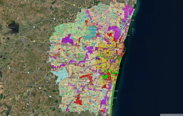
Chennai CMDA Masterplan: Zone Check and Land Use Guide
View Chennai Masterplan as a live map overlay – check any plot's land use zone for free on 1acre.in. Chennai CMDA master...
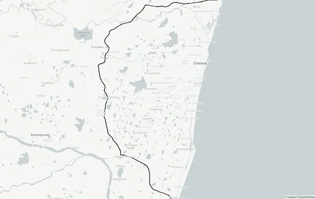
Chennai Peripheral Ring Road
View Chennai Peripheral Ring Road alignment as a live map overlay – check land acquisition risk and plot proximity free ...
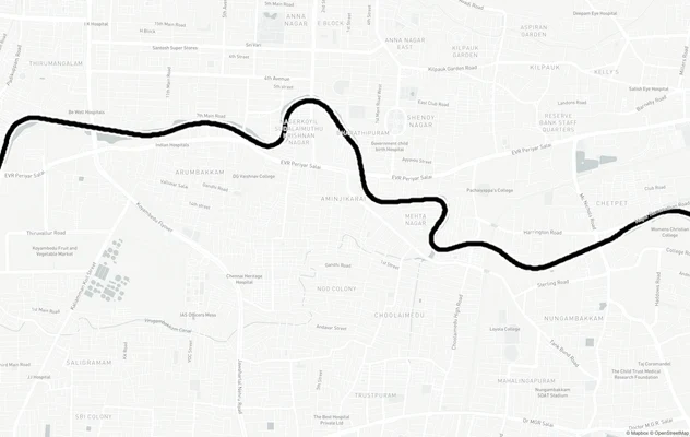
Chennai Port - Maduravoyal Expressway
View Chennai Port - Maduravoyal Expressway alignment as a live map overlay – check land acquisition risk and plot proxim...
More Layers in Tamil Nadu
Chennai CMDA Masterplan: Zone Check and Land Use Guide
View Chennai Masterplan as a live map overlay – check any plot's land use zone for free on 1acre.in. Chennai CMDA master...
Chennai Peripheral Ring Road
View Chennai Peripheral Ring Road alignment as a live map overlay – check land acquisition risk and plot proximity free ...
Chennai Port - Maduravoyal Expressway
View Chennai Port - Maduravoyal Expressway alignment as a live map overlay – check land acquisition risk and plot proxim...