
GST Road Chennai: Route, Localities and Land Checks


Gst Road Preview
Try the GST Road Chennai on the map
Sign in once and explore the layer for a full day.
- No card details needed
- Find nearby verified lands for sale
What is GST Road in Chennai?
GST Road stands for Grand Southern Trunk Road. It is one of Chennai's main arterial roads and the city's trunk route to the south of Tamil Nadu. The name has nothing to do with the Goods and Services Tax. In Tamil it is usually written ஜிஎஸ்டி சாலை (GST Salai), and some people search for it as "GT road Chennai".
Start point: GST Road begins at Kathipara Junction in Guindy, near St Thomas Mount, where it branches off Anna Salai.
Route: It runs south past Meenambakkam (Chennai Airport), Pallavaram, Chromepet, Tambaram, Vandalur, Kilambakkam, Guduvanchery, Maraimalai Nagar and Paranur to Chengalpattu.
End point: Historically the trunk road continued to Tiruchirappalli. Today the name mainly covers the Chennai to Tindivanam stretch, which is National Highway 32 (numbered NH-45 before the 2010 renumbering of national highways).
Agency: The National Highways Authority of India (NHAI) is the agency behind the current widening and flyover plans on the NH-32 stretch.
For a buyer, the practical meaning is simple: an address on "GST Road" can be anywhere from Guindy inside Chennai city to the Chengalpattu district belt far to the south, under different planning authorities. Check which local body and which master plan apply before comparing prices.
Overview
GST Road Chennai land buying tracks the Grand Southern Trunk corridor, redesignated as NH-32 and earlier known as NH-45, that runs south from Guindy through Tambaram, Vandalur, Guduvanchery, Chengalpattu and onward to Tindivanam. The CMDA Second Master Plan 2026 was prepared for the original 1,189 sq km Chennai Metropolitan Area. In October 2022 the CMA was expanded to 5,904 sq km by adding contiguous areas in 1,225 villages, according to CMDA. The plan defines the industrial belt along the corridor and the residential nodes that grew with the electrified suburban line. This page maps the route and localities, the legal traps, the live micro-markets, and the questions every buyer should answer before any token cheque clears.
GST Road route and localities
The table lists the main localities on GST Road in order from the city end, with the junctions and roads that meet it. Use it with the GST Road map layer on 1acre to see exactly where a plot sits in relation to the carriageway.
Order
Locality
Junction or link
Stretch
1
Guindy (Kathipara Junction)
Anna Salai, Mount-Poonamallee Road
Start
2
St Thomas Mount
Mount-Medavakkam High Road
Inner
3
Meenambakkam
Chennai Airport
Inner
4
Pallavaram
Pammal Main Road, Pallavaram-Thuraipakkam Radial Road
Inner
5
Chromepet
Chitlapakkam and Hasthinapuram roads near MIT bridge
Inner
6
Tambaram
Velachery Main Road, Mudichur Road
Inner
7
Irumbuliyur, Perungalathur
Chennai Bypass
Inner to mid
8
Vandalur
Chennai Outer Ring Road, Vandalur-Kelambakkam Road
Mid
9
Kilambakkam
Kalaignar Centenary Bus Terminus
Mid
10
Urapakkam, Guduvanchery
Guduvanchery-Thiruporur Road
Outer
11
Potheri, Kattankulathur
SRM campus area, Potheri station
Outer
12
Maraimalai Nagar, Singaperumal Koil
Industrial belt
Outer
13
Paranur (Mahindra World City)
Paranur toll plaza
Outer
14
Chengalpattu
Kancheepuram Road junction
Outer
15
Madurantakam to Tindivanam
NH-32 continues south
Beyond Chennai
Order
Locality
Junction or link
Stretch
1
Guindy (Kathipara Junction)
Anna Salai, Mount-Poonamallee Road
Start
2
St Thomas Mount
Mount-Medavakkam High Road
Inner
3
Meenambakkam
Chennai Airport
Inner
4
Pallavaram
Pammal Main Road, Pallavaram-Thuraipakkam Radial Road
Inner
5
Chromepet
Chitlapakkam and Hasthinapuram roads near MIT bridge
Inner
6
Tambaram
Velachery Main Road, Mudichur Road
Inner
7
Irumbuliyur, Perungalathur
Chennai Bypass
Inner to mid
8
Vandalur
Chennai Outer Ring Road, Vandalur-Kelambakkam Road
Mid
9
Kilambakkam
Kalaignar Centenary Bus Terminus
Mid
10
Urapakkam, Guduvanchery
Guduvanchery-Thiruporur Road
Outer
11
Potheri, Kattankulathur
SRM campus area, Potheri station
Outer
12
Maraimalai Nagar, Singaperumal Koil
Industrial belt
Outer
13
Paranur (Mahindra World City)
Paranur toll plaza
Outer
14
Chengalpattu
Kancheepuram Road junction
Outer
15
Madurantakam to Tindivanam
NH-32 continues south
Beyond Chennai
For scale: NHAI's earlier elevated highway plan from Perungalathur to beyond the Paranur toll plaza measured 27 km, and the Chengalpattu to Tindivanam stretch now proposed for six-laning is 68 km. Exact distances for a given plot are best read off the map layer rather than a broker's "minutes from GST Road" claim.
Air Funnel Buffers, Layout Approvals and the Document Chain That Decides Everything
Two specific risks separate a clean GST Road Chennai plot from one that will never receive a building approval. The first is buying inside the Air Funnel Zone Tambaram IAF buffer where the master plan flatly prohibits construction. The second is mistaking a Panchayat-level layout for a CMDA-sanctioned or DTCP-approved one, with the discount price hiding a paperwork gap that banks pick up at the loan stage.
The CMDA Master Plan 2026 Regulations zone lands to a depth of 100 m around the Indian Air Force station near Tambaram as areas prohibited for development under the Government of India notification. The Pallikaranai swamp contiguous zone, which overlaps the eastern feeders off GST Road, sits under a separate conservation designation. Across the southern belt, the Redhills catchment regulations further restrict layout patterns near the lake systems. These overlays apply on top of the standard residential, commercial and industrial zoning.
The table below shows how the corridor's plot categories interact with permission status and risk.
Plot Category
What It Means
Buildable Without Friction?
Common Trap
CMDA-approved layout
Sanctioned by CMDA within Chennai Metropolitan Area
Yes, with building plan approval
Verify approval number on CMDA portal
DTCP-approved layout
Sanctioned by Tamil Nadu Directorate of Town and Country Planning outside CMA
Yes, with local body approval
Confirm layout number matches the sanction sheet
Panchayat-only layout
Local body acknowledgement, no CMDA or DTCP sanction
No, bank loans rejected
Marketed as "approved" without specifying authority
Inside Air Funnel buffer
100 m depth around IAF Tambaram
Prohibited
Sold without disclosing buffer overlap
Plot Category
What It Means
Buildable Without Friction?
Common Trap
CMDA-approved layout
Sanctioned by CMDA within Chennai Metropolitan Area
Yes, with building plan approval
Verify approval number on CMDA portal
DTCP-approved layout
Sanctioned by Tamil Nadu Directorate of Town and Country Planning outside CMA
Yes, with local body approval
Confirm layout number matches the sanction sheet
Panchayat-only layout
Local body acknowledgement, no CMDA or DTCP sanction
No, bank loans rejected
Marketed as "approved" without specifying authority
Inside Air Funnel buffer
100 m depth around IAF Tambaram
Prohibited
Sold without disclosing buffer overlap
The DTCP CMDA approved plot Chennai distinction is the single most expensive misunderstanding on the corridor. Inside the expanded CMA, every layout needs CMDA sanction. Beyond CMA, DTCP layouts apply under the Town and Country Planning Act. Pull the patta and chitta from eservices.tn.gov.in, match the survey number, confirm the layout approval number against the relevant authority, and verify that the parcel falls outside the IAF buffer, the Pallikaranai swamp zone and the Redhills catchment. A "panchayat approval" stamp is not a layout sanction. If the seller cannot place the sanction order, the approved layout sheet and the patta together, walk away.
Growth Corridors: Where Metro and Industrial Anchors Decide Returns
The corridor splits into four identifiable bands, each governed by a different layer of the master plan and a different infrastructure timeline. The inner stretch from Guindy to Tambaram is the mature urban belt with the MEPZ Special Economic Zone (105 hectares at Tambaram) anchoring industrial demand. The mid stretch from Tambaram to Vandalur carries the Air Funnel overlay and the new bus terminus catchment. Beyond Vandalur, the Guduvanchery to Chengalpattu band is the freshest supply belt, while the outer Maraimalai Nagar to Tindivanam stretch sits on the industrial anchor of Mahindra World City.
The table below summarises the corridor's main investable bands.
GST Road Band
Key Localities
Primary Driver
Risk
Inner (Guindy to Tambaram)
Chromepet, Pallavaram, Tambaram
MEPZ SEZ, electrified suburban line, Tambaram Corporation
Air Funnel 100 m buffer, IAF restriction
Mid (Vandalur to Urapakkam)
Vandalur, Urapakkam
KCBT Kilambakkam bus terminus operational
DTCP versus Panchayat layout confusion
Outer (Guduvanchery to Chengalpattu)
Guduvanchery, Chengalpattu, Thiruporur Road
Proposed Airport to Kilambakkam metro extension, awaiting the Centre's approval
New extended CMA inclusion under draft TMP
Industrial (Maraimalai Nagar to Tindivanam)
Maraimalai Nagar, Singaperumal Koil
Mahindra World City 520 hectares, Hyundai, Foxconn at Sriperumbudur via cross-link
Industrial zone restrictions on residential FAR
GST Road Band
Key Localities
Primary Driver
Risk
Inner (Guindy to Tambaram)
Chromepet, Pallavaram, Tambaram
MEPZ SEZ, electrified suburban line, Tambaram Corporation
Air Funnel 100 m buffer, IAF restriction
Mid (Vandalur to Urapakkam)
Vandalur, Urapakkam
KCBT Kilambakkam bus terminus operational
DTCP versus Panchayat layout confusion
Outer (Guduvanchery to Chengalpattu)
Guduvanchery, Chengalpattu, Thiruporur Road
Proposed Airport to Kilambakkam metro extension, awaiting the Centre's approval
New extended CMA inclusion under draft TMP
Industrial (Maraimalai Nagar to Tindivanam)
Maraimalai Nagar, Singaperumal Koil
Mahindra World City 520 hectares, Hyundai, Foxconn at Sriperumbudur via cross-link
Industrial zone restrictions on residential FAR
Metro rail to Kilambakkam is the single biggest connectivity story on this corridor, but it is not yet sanctioned by the Centre. The Union Cabinet approved Chennai Metro Phase 2 in October 2024: 118.9 km on three corridors (Madhavaram to SIPCOT, Lighthouse to Poonamallee Bypass, and Madhavaram to Sholinganallur) at ₹63,246 crore. None of the three runs along GST Road. The line that would serve the GST Road belt is the 15.46 km elevated Airport to Kilambakkam extension of Corridor 1, with 13 stations at an estimated ₹9,335 crore. As of July 2026 it was still under preliminary examination at the Union Ministry of Housing and Urban Affairs. The operational Kalaignar Centenary Bus Terminus at Kilambakkam has already shifted the southern travel anchor from Koyambedu, pulling daily commuter volume into the Vandalur and Guduvanchery catchment. Guduvanchery land rates have moved from ₹1,300 to over ₹2,800 per sq ft in recent years, driven by Mahindra World City and Zoho IT park employment.
Maraimalai Nagar is the most misread node on the corridor. Brokers position every adjacent village layout at "Mahindra World City rate," but the SIPCOT-promoted industrial park spans 520 hectares with a defined boundary and its own access controls. Plots inside the SIPCOT estate carry clean industrial allotments. Layouts outside the boundary follow local panchayat rules and need separate CMDA or DTCP sanction. Always reconcile the survey number with the SIPCOT plot map and the master plan land-use sheet before treating any "Mahindra World City Maraimalai Nagar adjacent" listing at face value.
GST Road projects: status as of October 2026
As of October 2026, the main infrastructure projects on GST Road stand as follows. Each line gives the latest update that could be verified and its date.
Project
Stretch
Latest verified status
Airport to Kilambakkam metro extension
15.46 km elevated, 13 stations
DPR sent to the Union Ministry of Housing and Urban Affairs in April 2025; still under preliminary examination in July 2026. The state sanctioned ₹1,964 crore for preparatory works in September 2025
Kilambakkam to Chengalpattu metro extension
About 25 km
CMRL invited bids to prepare the DPR (July 2026)
Tambaram to Chengalpattu elevated highway
Perungalathur to beyond Paranur toll plaza
In June 2024 NHAI was reported to be planning to drop the single 27 km elevated corridor in favour of flyovers at key junctions, with a final decision to follow the DPR; in June 2026 the plan was being redesigned to integrate a planned metro corridor
Chengalpattu to Tindivanam six-laning (NH-32)
68 km, plus a 12 km greenfield Chengalpattu bypass with a new Palar bridge
DPR awaiting MoRTH approval (June 2026)
Project
Stretch
Latest verified status
Airport to Kilambakkam metro extension
15.46 km elevated, 13 stations
DPR sent to the Union Ministry of Housing and Urban Affairs in April 2025; still under preliminary examination in July 2026. The state sanctioned ₹1,964 crore for preparatory works in September 2025
Kilambakkam to Chengalpattu metro extension
About 25 km
CMRL invited bids to prepare the DPR (July 2026)
Tambaram to Chengalpattu elevated highway
Perungalathur to beyond Paranur toll plaza
In June 2024 NHAI was reported to be planning to drop the single 27 km elevated corridor in favour of flyovers at key junctions, with a final decision to follow the DPR; in June 2026 the plan was being redesigned to integrate a planned metro corridor
Chengalpattu to Tindivanam six-laning (NH-32)
68 km, plus a 12 km greenfield Chengalpattu bypass with a new Palar bridge
DPR awaiting MoRTH approval (June 2026)
The Chengalpattu bypass matters for land buyers. It is proposed to leave NH-32 near Pachaiamman Koil, past the Kancheepuram Road junction, and rejoin it at Pakkam near the Uthiramerur Road junction. Until the alignment is notified for land acquisition, treat any "bypass-facing" plot pitch in this belt with care and ask for the notification.
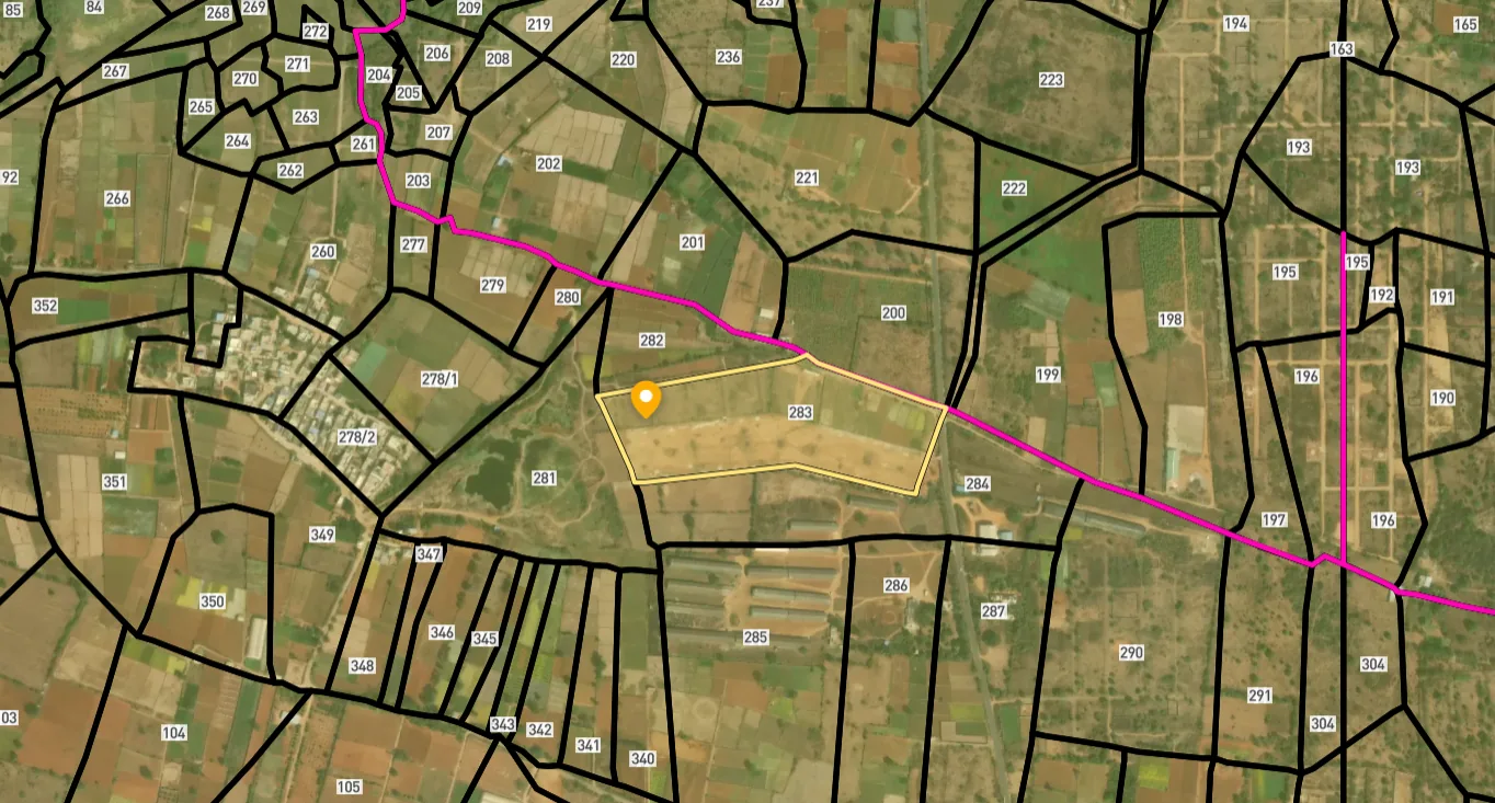
Access Survey NumbersAccess Tamil Nadu
Survey Numbers
Boundaries and numbers come from published state cadastral records. See all map layers.
Looking to sell your land in Tamil Nadu?

Browse all verified lands & plots in Tamil Nadu
More Layers in Tamil Nadu
See all 17 layers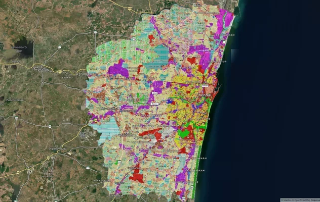
CMDA Land Use Map Chennai: Master Plan 2026 Zones
View the CMDA land use map of Chennai: where to download official village maps, CMDA limits, survey number checks and zo...
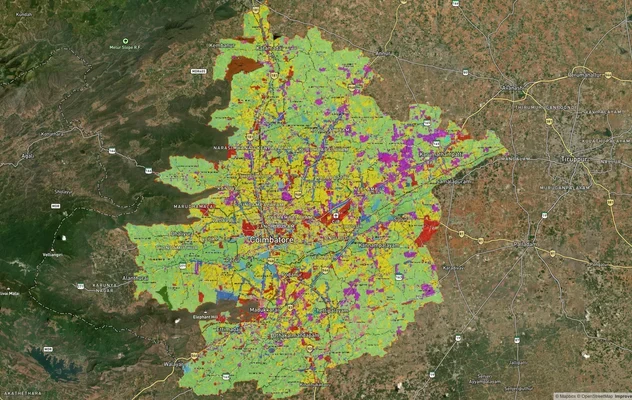
Coimbatore Masterplan 2041: LPA Zone Check and Land Use Guide
View Coimbatore Masterplan as a live map overlay – check any plot's land use zone for free on 1acre.in. Coimbatore maste...
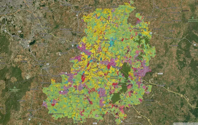
Hosur Masterplan: Zone Check and Land Use Guide
View Hosur Masterplan as a live map overlay – check any plot's land use zone for free on 1acre.in. Hosur masterplan zone...
More Layers in Tamil Nadu
CMDA Land Use Map Chennai: Master Plan 2026 Zones
View the CMDA land use map of Chennai: where to download official village maps, CMDA limits, survey number checks and zo...
Coimbatore Masterplan 2041: LPA Zone Check and Land Use Guide
View Coimbatore Masterplan as a live map overlay – check any plot's land use zone for free on 1acre.in. Coimbatore maste...
Hosur Masterplan: Zone Check and Land Use Guide
View Hosur Masterplan as a live map overlay – check any plot's land use zone for free on 1acre.in. Hosur masterplan zone...
Frequently Asked Questions
Yes. The CMDA Second Master Plan 2026 governs GST Road Chennai land buying decisions inside the original 1,189 sq km Chennai Metropolitan Area. In October 2022 the CMA was expanded to 5,904 sq km by adding contiguous areas in 1,225 villages. A Third Master Plan with a 2046 horizon is being prepared but has not been notified.
The CMDA Regulations zone lands within 100 m of the Indian Air Force station near Tambaram as Air Funnel Zone Tambaram IAF buffer, where construction is prohibited. The exact extent is mapped in Annexure XII of the Master Plan Regulations and overlaps parts of the Pallavaram-Tambaram fringe.
A CMDA-approved layout sits inside the Chennai Metropolitan Area under CMDA jurisdiction. A DTCP-approved layout falls outside CMA under the Tamil Nadu Directorate of Town and Country Planning. Both are valid. Panchayat-only stamps are not a substitute for either sanction.
Phase 2 itself will not reach Kilambakkam. The Union Cabinet approved its three corridors (118.9 km, ₹63,246 crore) in October 2024, and none runs along GST Road. Kilambakkam would be served by the separate 15.46 km Airport to Kilambakkam extension, with 13 stations. As of July 2026 its DPR was still under preliminary examination at the Union Ministry of Housing and Urban Affairs, so no opening date can be given.
Plots inside the SIPCOT-promoted Mahindra World City Maraimalai Nagar boundary, spread over 520 hectares, carry clean industrial allotments. Layouts in adjoining villages follow local panchayat rules and need separate CMDA or DTCP sanction. Verify the SIPCOT plot map before any booking.
Yes. The CMDA Second Master Plan 2026 designates GST Road as the southern industrial belt with MEPZ Tambaram (105 hectares), Thirumudivakkam leather goods estate, and the Maraimalai Nagar to Chengalpattu industrial spine. Residential FAR is permitted only where zoning allows, with leather industry buffers in specific pockets.
Pull the layout sanction number from the CMDA or DTCP portal, match the survey number against the patta and chitta on eservices.tn.gov.in, and confirm the parcel sits outside the IAF Air Funnel and Pallikaranai conservation overlays. Insist on the sanctioned layout sheet before payment.
GST Road stands for Grand Southern Trunk Road. It is the historic trunk road from Chennai to the south of Tamil Nadu and today forms part of National Highway 32, numbered NH-45 before the 2010 renumbering. The name is not connected to the Goods and Services Tax. In Tamil it is usually written ஜிஎஸ்டி சாலை (GST Salai).
GST Road starts at Kathipara Junction in Guindy, where it branches off Anna Salai. It runs south through Meenambakkam, Pallavaram, Chromepet, Tambaram, Vandalur, Guduvanchery and Maraimalai Nagar to Chengalpattu. Today the name mainly covers the Chennai to Tindivanam stretch of NH-32, though the historic trunk road continued to Tiruchirappalli.
In Tamil the road is usually called ஜிஎஸ்டி சாலை (GST Salai), using the same English initials. The initials stand for Grand Southern Trunk Road, meaning the main trunk road leading south from Chennai. Signboards, addresses and property documents generally use "GST Road" or "GST Salai", so search records under both forms.
From the city end, the main areas are Guindy, St Thomas Mount, Meenambakkam, Pallavaram, Chromepet, Tambaram, Perungalathur, Vandalur, Kilambakkam, Urapakkam, Guduvanchery, Potheri, Maraimalai Nagar, Singaperumal Koil, Paranur and Chengalpattu. The inner areas fall in the Chennai and Tambaram urban belt, while the outer areas are in Chengalpattu district, so check whether a plot lies inside the expanded CMA (CMDA) or outside it (DTCP).
South of Chengalpattu, NHAI has proposed six-laning a 68 km stretch to Tindivanam with a 12 km greenfield Chengalpattu bypass; as of June 2026 the DPR was awaiting MoRTH approval. Between Tambaram and Chengalpattu, NHAI was reported in June 2024 to be planning to drop a single 27 km elevated corridor in favour of junction flyovers, and in June 2026 the plan was being redesigned to integrate a metro corridor.
Source
Official Chennai Metropolitan Development Authority (CMDA) documents
Official Website
www.cmdachennai.gov.in
Coordinate Reference System
EPSG:4326 (WGS 84)
Geometry Type
LineString / MultiLineString
Data Format
Vector (GeoJSON) + Raster Tiles
Last Verified
2026
Status
Active
Was this layer helpful?
Anything wrong, outdated, or missing we want to hear it.