
OMR - Rajiv Gandhi Salai
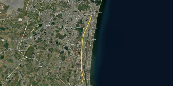

Omr Rajiv Gandhi Salai Preview
Try the OMR - Rajiv Gandhi Salai on the map
Sign in once and explore the layer for a full day.
- No card details needed
- Find nearby verified lands for sale
Overview
OMR Chennai land buying sits on a deceptively simple stretch of road that hides one of the messiest regulatory grids in South India. The Chennai Second Master Plan 2026, notified by the Chennai Metropolitan Development Authority, designates a 500 m belt on either side of Rajiv Gandhi Salai, from Kottivakkam in the north to Semmancheri in the south, as the IT Corridor Zone. The corridor itself, formally State Highway 49A, runs 45 km from Madhya Kailash to East Coast Road. This page maps the marsh-related freezes, the investable sectors, and the documents a serious buyer should pull before any token cheque clears.
Marsh Freezes, Patta Checks and the Documents Brokers Never Show You
Two issues quietly decide whether a plot on this corridor will hold value or turn into a frozen asset. One is proximity to Pallikaranai. The other is a thin land-records trail no one bothered to verify.
The Pallikaranai Marsh, designated India's Ramsar site on 8 April 2022, covers 1,247 hectares and sits right alongside the IT corridor. The Chennai Second Master Plan 2026 already classifies the contiguous swamp area as conservation land where development is prohibited. The recent escalation matters more. On 24 September 2025, the National Green Tribunal Southern Bench ordered CMDA to stop issuing all new approvals inside the Ramsar boundary and its zone of influence, and signalled that even plots outside the marsh, but within a one-kilometre buffer, may be restricted until the Tamil Nadu State Wetland Authority completes a scientific delineation.
The table below shows the OMR localities where this Pallikaranai marsh NGT order directly bites, so you know which postcodes carry an active approval freeze.
Locality
Position on OMR
Regulatory Flag
Velachery, Medavakkam
West feeder, near marsh core
Likely inside 1 km NGT buffer; CMDA approvals frozen
Perungudi, Thoraipakkam
Lower OMR, swamp-adjacent
Master Plan declares Pallikaranai swamp prohibited for development
Perumbakkam, Sholinganallur
Inner OMR
Subject of suo motu NGT case after debris dumping near feeder canals
Navalur, Siruseri (eastern fringe)
Mid-to-lower OMR
Outside core marsh; verify CRZ and storm-water inlet status
Locality
Position on OMR
Regulatory Flag
Velachery, Medavakkam
West feeder, near marsh core
Likely inside 1 km NGT buffer; CMDA approvals frozen
Perungudi, Thoraipakkam
Lower OMR, swamp-adjacent
Master Plan declares Pallikaranai swamp prohibited for development
Perumbakkam, Sholinganallur
Inner OMR
Subject of suo motu NGT case after debris dumping near feeder canals
Navalur, Siruseri (eastern fringe)
Mid-to-lower OMR
Outside core marsh; verify CRZ and storm-water inlet status
Patta chitta verification Tamil Nadu is the second non-negotiable. Pull the patta and chitta directly from the Tamil Nadu eServices portal at eservices.tn.gov.in. For Chennai Corporation pockets, ask for the TSLR Extract; for periurban villages on the lower OMR, ask for the A-Register and the 1-B Register. Cross-check the survey number against the Field Measurement Book sketch and the encumbrance certificate. If the seller balks at any of these, treat it as a decision. The eServices portal also lets you verify whether the parcel is poramboke, which along OMR often means tank-bed or drainage land that was never legally saleable in the first place.
Was this layer helpful?
Anything wrong, outdated, or missing we want to hear it.

Access Survey NumbersAccess Tamil Nadu
Survey Numbers
Boundaries and numbers come from published state cadastral records. See all map layers.
Looking to sell your land in Tamil Nadu?

Browse all verified lands & plots in Tamil Nadu
More Layers in Tamil Nadu
See all 17 layers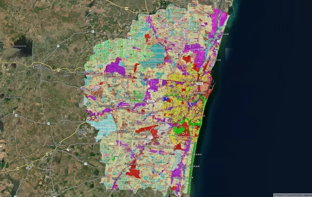
Chennai CMDA Masterplan: Zone Check and Land Use Guide
View Chennai Masterplan as a live map overlay – check any plot's land use zone for free on 1acre.in. Chennai CMDA master...
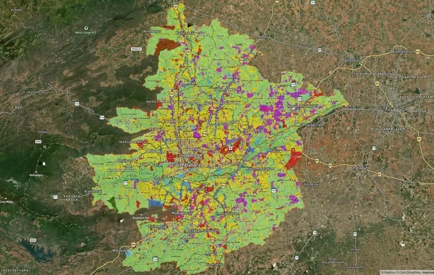
Coimbatore Masterplan 2041: LPA Zone Check and Land Use Guide
View Coimbatore Masterplan as a live map overlay – check any plot's land use zone for free on 1acre.in. Coimbatore maste...
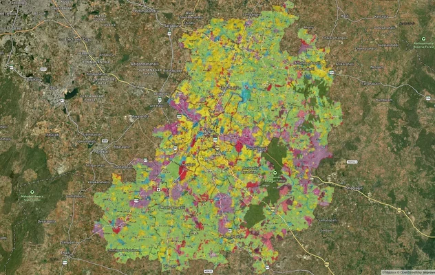
Hosur Masterplan: Zone Check and Land Use Guide
View Hosur Masterplan as a live map overlay – check any plot's land use zone for free on 1acre.in. Hosur masterplan zone...
More Layers in Tamil Nadu
Chennai CMDA Masterplan: Zone Check and Land Use Guide
View Chennai Masterplan as a live map overlay – check any plot's land use zone for free on 1acre.in. Chennai CMDA master...
Coimbatore Masterplan 2041: LPA Zone Check and Land Use Guide
View Coimbatore Masterplan as a live map overlay – check any plot's land use zone for free on 1acre.in. Coimbatore maste...
Hosur Masterplan: Zone Check and Land Use Guide
View Hosur Masterplan as a live map overlay – check any plot's land use zone for free on 1acre.in. Hosur masterplan zone...