New Parandur Airport
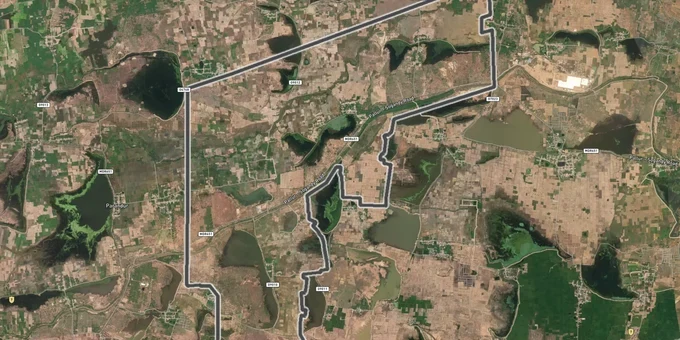
New Parandur Airport Preview
Try the New Parandur Airport on the map
Sign in once and explore the layer for a full day.
- No card details needed
- Find nearby verified lands for sale
Overview
The Parandur Greenfield Airport is Chennai's second airport, sited in Kancheepuram district around 40 km from central Chennai. TIDCO is the developer on behalf of the Tamil Nadu government. The project requires approximately 5,746 acres in total (Deccan Herald, November 2025), of which the government owns about 1,900 acres and is acquiring approximately 3,800 acres from private owners across 13 revenue villages. Phase 1 completion has been pushed to 2030. This Premium layer on 1acre maps the acquisition footprint across all 13 notified villages so buyers can confirm whether a specific survey number falls inside or outside the notified zone before any transaction.
The project is estimated at Rs 27,000 crore with two runways, a dedicated cargo village, and an aerocity.
The project received in-principle approval from the Centre in April 2025, following which TIDCO initiated bids to select a private concessionaire and began preparing the Environmental Impact Assessment (EIA) and Environmental Management Plan (EMP).
Active Acquisition Under Tamil Nadu's 1997 Act: The Real Risk Buying Parandur Airport Land Inside the Notified Villages
The Tamil Nadu government invoked the Tamil Nadu Acquisition of Land for Industrial Purposes Act, 1997 through a Government Order dated 25 June 2025. Of the approximately 5,746 acres required, around 3,800 acres is patta land currently being acquired from private owners. Once a survey number in any of the 13 notified villages is included in an acquisition order, the owner cannot execute a valid registered sale at the Kancheepuram SRO (Sub-Registrar Office); any such transaction is legally challengeable. As of November 2025, over 1,100 acres had been registered in the government's name across 13 villages. Ekanapuram remains unacquired — sources within administration indicate acquisition there is unlikely before the next Assembly elections. Active protests in Ekanapuram, Nagapattur, and Podavur crossed 1,000 days and continue to slow overall acquisition.
The table below shows the primary acquisition villages and status as of late 2025:
Village
Acquisition Status
Notes
Parandur
Partial, ongoing
Core airport zone
Ekanapuram
Partial; strong opposition
2,500+ villagers protesting
Podavur
Notified February 2024
94 farmers detained at protest
Nelvoy
Partial
Adjoining core zone
Akkamapuram
Partial; compensation disbursed
Progressing
Valathoor
Partial; opposition active
Contested
Nagapattur
Protests; election boycott 2024
Delayed
Brokers across Kancheepuram and Thakkolam market DTCP (Directorate of Town and Country Planning)-approved plots as "near the airport" without confirming whether the survey number sits inside or outside the acquisition boundary. Demand the survey number, cross-check it against the acquisition notification under the 1997 Act, and verify the DTCP approval number is genuine before proceeding. The compensation rate is 3.5 times the market guideline value for Kancheepuram and Sriperumbudur taluks; despite that premium, unresolved legal challenges mean any land near the acquisition boundary carries timeline risk that no broker pitch acknowledges. The project's environmental footprint adds another layer: 12 lakes, over 20 ponds, and two canals connected to the Palar and Coocum rivers fall within the project area; plots adjacent to these water bodies need additional due diligence beyond DTCP approval alone.
Sriperumbudur to Sunguvarchatram: Which Corridors Outside the Parandur Airport Land Acquisition Zone Hold Real Investment Value
The 13 acquisition villages are not investable; patta land inside those boundaries is being compulsorily taken. The real estate signal from this airport plays out along the Chennai-Bangalore highway corridor and the proposed metro alignment from Poonamallee toward the airport. Not every point on that corridor carries equal risk or reward.
The table below shows the key micro-markets outside the acquisition zone with the realistic land signal for each:
Corridor
District
Signal
Key Risk
Thakkolam
Kancheepuram
Nearest purchasable land to airport boundary
Verify survey number outside acquisition zone
Sunguvarchatram
Kancheepuram
Metro Phase 1 terminus; 27.9 km from Poonamallee
Metro still at planning stage
Sriperumbudur
Kancheepuram
Industrial hub; existing MNC and automotive demand
Airport uplift already partially priced
Oragadam
Kancheepuram
Automotive and electronics corridor
Demand driven by industry, not airport
Poonamallee
Chennai fringe
Metro starting point; established connectivity
Priced; limited new airport upside
The proposed Chennai Metro extension from Poonamallee to Parandur Airport covers 43.63 km with 20 elevated stations. Phase 1 (Poonamallee to Sunguvarchatram, 27.9 km) carries a project estimate of Rs 15,906 crore; it remains at the planning stage with no civil work commenced. Plots near Sunguvarchatram are being priced as "metro-terminus-adjacent" before any contract is awarded. Thakkolam is the most proximate genuinely purchasable corridor outside the acquisition zone, sitting on the road connecting Walajabad to the airport site; DTCP approval number verification is non-negotiable before any purchase there. Sriperumbudur and Oragadam serve industrial demand, not airport proximity; pricing those markets on Phase 4's 2046 completion is a category error.
Was this layer helpful?
Anything wrong, outdated, or missing we want to hear it.
For Land Owners & Agents
Looking to sell your land in Tamil Nadu?
I want to sell my land in Tamil Nadu
10:32
Plz share your Land's location - We will list it on 1acre map, for Free.
10:32

For Land Buyers
Browse all verified lands & plots in Tamil Nadu
Every listing goes through our Preliminary Verification Process.
More Layers in Tamil Nadu
See all 14 layers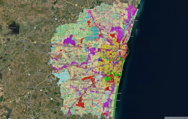
Chennai CMDA Masterplan: Zone Check and Land Use Guide
View Chennai Masterplan as a live map overlay – check any plot's land use zone for free on 1acre.in. Chennai CMDA master...
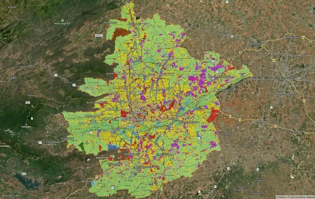
Coimbatore Masterplan 2041: LPA Zone Check and Land Use Guide
View Coimbatore Masterplan as a live map overlay – check any plot's land use zone for free on 1acre.in. Coimbatore maste...
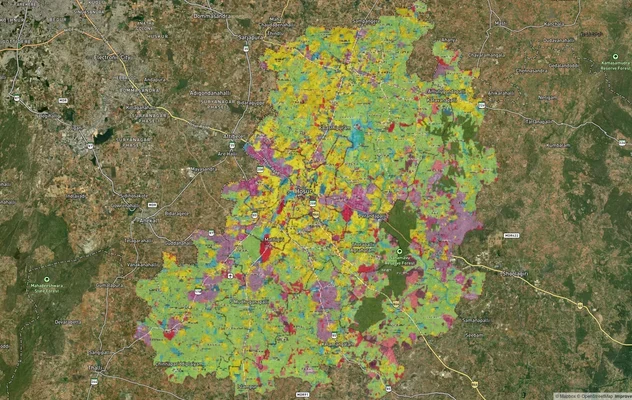
Hosur Masterplan: Zone Check and Land Use Guide
View Hosur Masterplan as a live map overlay – check any plot's land use zone for free on 1acre.in. Hosur masterplan zone...
More Layers in Tamil Nadu
Chennai CMDA Masterplan: Zone Check and Land Use Guide
View Chennai Masterplan as a live map overlay – check any plot's land use zone for free on 1acre.in. Chennai CMDA master...
Coimbatore Masterplan 2041: LPA Zone Check and Land Use Guide
View Coimbatore Masterplan as a live map overlay – check any plot's land use zone for free on 1acre.in. Coimbatore maste...
Hosur Masterplan: Zone Check and Land Use Guide
View Hosur Masterplan as a live map overlay – check any plot's land use zone for free on 1acre.in. Hosur masterplan zone...