
IAF Air Funnel Zones - Coimbatore


Iaf_air_funnel_zones_coimbatore Preview
Try the IAF Air Funnel Zones - Coimbatore on the map
एक बार साइन इन करें और पूरे दिन लेयर एक्सप्लोर करें।
- No card details needed
- Find nearby verified lands for sale
Overview
The Sulur Air Force Station land height restriction picture involves a base unlike any other in India, given the sheer range of aircraft it hosts at a single venue. Sulur Air Force Station, located at Kangayampalayam near Coimbatore, Tamil Nadu, is the second largest air base in the Indian Air Force after Hindon Air Force Station, spanning 1,050.51 acres with a single runway measuring 2,516 metres. Operated by the Southern Air Command, it is responsible for protecting the coasts of Southern India and hosts fighter jets, transport aircraft, helicopters, microlights, and paragliders simultaneously, a combination found nowhere else in the country. It covers why this aircraft diversity likely produces a more complex restricted zone than most bases, how Sulur differs from the separate Coimbatore International Airport nearby, and the base's own remarkable history dating to the Second World War.
Sulur Air Force Station Land: Regulatory Red Flags You Cannot Ignore
The first red flag is genuinely unique to this base: Sulur is described as the only air force station in India that hosts fighters, transport planes, helicopters, microlights, and paragliders at a single venue. The current fleet includes Antonov An-32 transport aircraft, Mil Mi-17 transport helicopters, HAL Dhruv utility helicopters flown by the Sarang aerobatic display team, and HAL Tejas fighter aircraft. Each of these aircraft types operates at different speeds, altitudes, and approach profiles. A base combining this much aviation diversity almost certainly requires a more layered and complex set of protected surfaces than a base flying a single aircraft type would need, and buyers should not assume a simple, single-formula funnel zone applies here the way it might at a more uniform airbase.
The second red flag is scale. At 1,050.51 acres, Sulur ranks as the second largest Indian Air Force base in the country, and its 2,516 metre runway is substantial enough to support fighter operations comfortably. This places Sulur in a genuinely different category of significance than most regional airbases covered in this series, and the size of the restricted footprint around it should be expected to reflect that scale.
The table below sets out the base's core confirmed parameters.
Parameter
Confirmed Detail
Area
1,050.51 acres (425.13 ha), second largest IAF base after Hindon
Runway
Single runway, 2,516 m (8,255 ft)
Elevation
381 m (1,250 ft) AMSL
Command
Southern Air Command
Resident units
No. 5 Base Repair Depot; No. 43 Wing (established 1985); Garud Commando Force
Aircraft hosted
An-32, Mi-17, HAL Dhruv (Sarang team), HAL Tejas fighters, plus microlights and paragliders
Parameter
Confirmed Detail
Area
1,050.51 acres (425.13 ha), second largest IAF base after Hindon
Runway
Single runway, 2,516 m (8,255 ft)
Elevation
381 m (1,250 ft) AMSL
Command
Southern Air Command
Resident units
No. 5 Base Repair Depot; No. 43 Wing (established 1985); Garud Commando Force
Aircraft hosted
An-32, Mi-17, HAL Dhruv (Sarang team), HAL Tejas fighters, plus microlights and paragliders
The third red flag is a genuine, important distinction between Sulur and the separate Coimbatore International Airport nearby. Sulur Air Force Station has no civil enclave of its own and carries no scheduled passenger traffic. It sits roughly 18 kilometres from Coimbatore city centre, in reasonable proximity to Coimbatore International Airport, which enables integrated civil-military logistics and personnel movement between the two facilities. But this proximity does not mean the two share a single restricted zone; they are separate aerodromes governed independently, and a buyer checking Coimbatore International Airport's civil Colour Coded Zoning Map has not thereby checked Sulur's own, separate military restricted zone.
The fourth red flag is Sulur's demonstrated role hosting genuine international military activity. The base has hosted joint air exercises involving the air forces of France, Germany, Spain, and the United Kingdom, underscoring that this is a facility of real international strategic significance rather than a purely domestic training or repair hub. A base that hosts multinational exercises at this level should be expected to maintain a substantial, carefully managed security posture around its perimeter, reinforcing the case for treating any construction clearance request here as a genuinely significant process rather than routine paperwork.
Areas and Micro-Markets Affected by the Sulur Restricted Zone
Land exposure near Sulur concentrates around Kangayampalayam and the immediate base perimeter, while the broader Coimbatore metropolitan area carries a separate, independent set of considerations tied to the civil airport rather than this military installation.
Locality
Position Relative to the Base
Character
Restriction Exposure
Kangayampalayam / Sulur village
Immediate vicinity, historic site of the original 1940s airfield
Small, historically significant locality directly hosting the base
Highest exposure given direct adjacency to an unusually large, aircraft-diverse installation
Sulur town
Surrounding the base
Established Coimbatore-district town
Moderate to high exposure depending on distance and bearing from the runway
Coimbatore city core
Approximately 18 km from the base
Major South Indian industrial and commercial hub
Governed primarily by the separate Coimbatore International Airport's own civil zone, not Sulur's military restrictions
Coimbatore International Airport vicinity
Near, but separate from, Sulur
Established civil aviation hub with integrated logistics ties to Sulur
Subject to its own independent civil aviation height restriction framework
Locality
Position Relative to the Base
Character
Restriction Exposure
Kangayampalayam / Sulur village
Immediate vicinity, historic site of the original 1940s airfield
Small, historically significant locality directly hosting the base
Highest exposure given direct adjacency to an unusually large, aircraft-diverse installation
Sulur town
Surrounding the base
Established Coimbatore-district town
Moderate to high exposure depending on distance and bearing from the runway
Coimbatore city core
Approximately 18 km from the base
Major South Indian industrial and commercial hub
Governed primarily by the separate Coimbatore International Airport's own civil zone, not Sulur's military restrictions
Coimbatore International Airport vicinity
Near, but separate from, Sulur
Established civil aviation hub with integrated logistics ties to Sulur
Subject to its own independent civil aviation height restriction framework
Kangayampalayam and the immediate Sulur base perimeter carry the clearest, most direct exposure in this guide, given the sheer scale and aircraft diversity of the installation next door. Any construction plan here should proceed only after confirming clearance against the base's full range of protected surfaces, given the unusual mix of fighter, transport, helicopter, and even microlight and paraglider operations sharing this single venue.
The relationship between Sulur and Coimbatore International Airport deserves the most careful separation of any comparison in this guide. The two facilities are close enough to support integrated logistics, yet they remain entirely independent aerodromes with their own separate restricted zones. A buyer evaluating land nearer to Coimbatore's civil airport side should apply that airport's own civil aviation clearance process, while land nearer to Sulur itself requires checking against Sulur's separate, military-specific restrictions instead.
क्या यह लेयर सहायक थी?
Anything wrong, outdated, or missing we want to hear it.

सर्वे नंबर देखेंTamil Nadu
के सर्वे नंबर देखें
सीमाएँ और नंबर राज्य के प्रकाशित भू-अभिलेखों से लिए गए हैं। सभी मैप लेयर्स देखें।
Tamil Nadu में अपनी ज़मीन बेचना चाहते हैं?

Tamil Nadu में सभी सत्यापित ज़मीन और प्लॉट ब्राउज़ करें
Tamil Nadu में और लेयर्स
सभी 17 लेयर्स देखें
Tambaram Air Force Station: Height Restrictions
View the Tambaram Air Force Station air funnel zone on a live map — check height clearance restrictions on any plot for ...
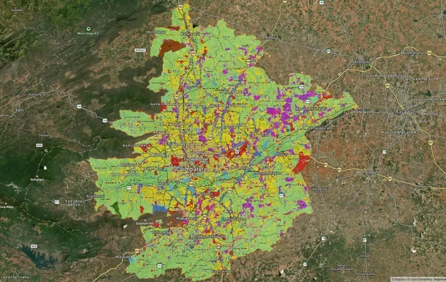
कोयंबटूर मास्टरप्लान 2041: LPA ज़ोन चेक और लैंड यूज़ गाइड
कोयंबटूर मास्टरप्लान को लाइव मैप ओवरले के रूप में देखें – 1acre.in पर किसी भी प्लॉट का लैंड यूज़ ज़ोन मुफ़्त में चेक करे...
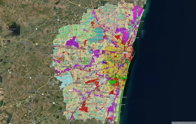
चेन्नई CMDA मास्टरप्लान: ज़ोन चेक और लैंड यूज़ गाइड
चेन्नई मास्टरप्लान को लाइव मैप ओवरले के रूप में देखें – 1acre.in पर किसी भी प्लॉट का लैंड यूज़ ज़ोन मुफ़्त में चेक करें....
Tamil Nadu में और लेयर्स
Tambaram Air Force Station: Height Restrictions
View the Tambaram Air Force Station air funnel zone on a live map — check height clearance restrictions on any plot for ...
कोयंबटूर मास्टरप्लान 2041: LPA ज़ोन चेक और लैंड यूज़ गाइड
कोयंबटूर मास्टरप्लान को लाइव मैप ओवरले के रूप में देखें – 1acre.in पर किसी भी प्लॉट का लैंड यूज़ ज़ोन मुफ़्त में चेक करे...
चेन्नई CMDA मास्टरप्लान: ज़ोन चेक और लैंड यूज़ गाइड
चेन्नई मास्टरप्लान को लाइव मैप ओवरले के रूप में देखें – 1acre.in पर किसी भी प्लॉट का लैंड यूज़ ज़ोन मुफ़्त में चेक करें....