Amaravati - Anantapur Greenfield Expressway
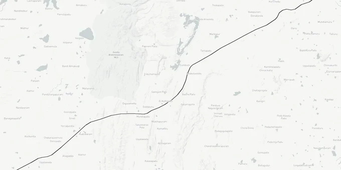
Amaravati Anantapur Greenfield Expressway Preview
Try the Amaravati - Anantapur Greenfield Expressway on the map
Sign in once and explore the layer for a full day.
- No card details needed
- Find nearby verified lands for sale
Overview
The Amaravati Anantapur Greenfield Expressway is a proposed 384-km spinal corridor (six-lane, access-controlled), with two feeder expressways - Kurnool (123.7 km) and Kadapa (104.05 km) - bringing the total network to approximately 612 km in Andhra Pradesh, initially sanctioned by Ministry of Road Transport and Highways (MoRTH) under NHAI's Bharatmala Pariyojana to link Amaravati capital with Anantapur through Guntur, Prakasam, Kadapa, and Kurnool districts. Estimated cost stands at Rs 27,635 crore, with the AP state government committing to bear 50% of land acquisition costs. The project was active under TDP (2016-2019), effectively halted under YSRCP (2019-2024), and partially replaced by the Bengaluru-Vijayawada Expressway. This Premium layer maps the original alignment so buyers can assess corridor exposure before purchasing near the route.
No Active NHAI Notification: The Core Risk for Amaravati Anantapur Greenfield Expressway Land Near the Proposed Alignment
This expressway carries a unique risk that neither a greenfield acquisition notice nor a formal NHAI gazette cancellation has been issued for the original alignment. The project existed in active preparation under TDP (2016-2019): Rs 2,200 crore was allocated for land acquisition, alignment marking was completed across five districts, and MoRTH had approved the initial 4-lane design with provision for 8-lane expansion. Then YSRCP came to power in 2019 and effectively replaced this corridor with the Bengaluru-Vijayawada Expressway (National Highway 544G (NH-544G)), realigning the route via Pulivendula and Chilakaluripet junction on NH-16, saving Rs 3,500 crore and 741 hectares of land.
The Bengaluru-Vijayawada Expressway (NH-544G) already has all 14 construction packages awarded (March 2023) and its foundation stone was laid by the Prime Minister in March 2024. That project is actively under construction. The original Amaravati-Anantapur corridor has no new DPR, no current NHAI notification, and no active land acquisition since 2019.
The table below shows the project's timeline and what each phase means for buyers today:
Phase
Period
Status
Buyer Impact
MoRTH approval; alignment finalized
2016-2018
Completed
Original corridor marked
Land acquisition allocated (Rs 2,200 crore)
2018-2019
Partially executed; halted
Some marking done; no gazette notification finalised
YSRCP replaces with Bengaluru-Vijayawada route
2019-2024
NH-544G now under construction
Original Amaravati-Anantapur alignment no longer active
TDP returns to power
2024-present
No new DPR or notification issued
Corridor uncertain; do not price as active acquisition zone
Any plot being marketed as "expressway-adjacent" along the original Amaravati-Anantapur alignment in Kadapa, Kurnool, or Anantapur districts is being sold against an alignment that has no current legal force. If TDP revives this project, fresh land acquisition notifications will be issued; buying based on the original 2018 marking without a current notification is speculation, not informed investing.
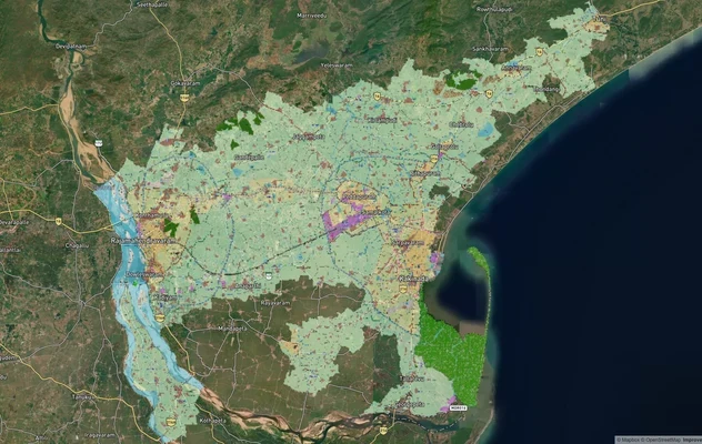
Maruru to Pedaparimi: Which Districts Along the Amaravati Anantapur Expressway Route Hold Structural Land Value
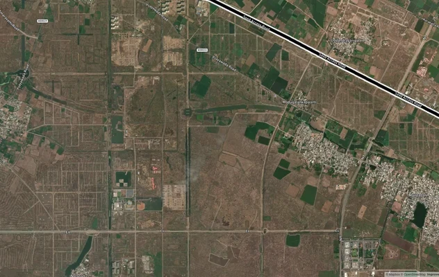
The original spinal corridor starts from NH-44 near Maruru in Anantapur district and terminates at Pedaparimi near Sakhamuru, crossing Vijayawada's Inner Ring Road (IRR) near Tadikonda and Outer Ring Road (ORR) near Velavarthipadu. Two feeder expressways were also planned: a 123.7-km Kurnool Feeder and a 104.05-km Kadapa Feeder. Neither feeder has an active DPR today.
The table below shows the key districts and nodes along the proposed alignment with the current land signal at each:
District / Node
Role in Alignment
Land Signal
Key Risk
Anantapur (Maruru area)
NH-44 start of spinal corridor
Base entry point; Rayalaseema connectivity
No active notification; long-horizon only
Kurnool
Feeder expressway junction (123.7 km feeder)
Regional connectivity gain; industrial interest
Feeder has no active DPR
Kadapa
Feeder expressway junction (104.05 km feeder)
Links Rayalaseema to corridor
Feeder has no active DPR
Prakasam / Chilakaluripet
Modified NH-16 junction; existing connectivity
NH-544G (Bengaluru-Vijayawada) already benefits this zone
NH-544G land acquisition already underway here
Pedaparimi / Sakhamuru (Amaravati end)
Corridor terminus near Amaravati CRDA zone
Capital city adjacency; strong CRDA demand
Amaravati CRDA zone value is independent of this expressway
Chilakaluripet and Prakasam district are the most misread corridors from this alignment. These areas are already benefiting from the active Bengaluru-Vijayawada Expressway (NH-544G), not from the Amaravati-Anantapur proposal. Land near Chilakaluripet has real infrastructure upside but from NH-544G, which is funded, contracted, and under construction. Do not price it against the Amaravati-Anantapur alignment, which has no current legal status. The Amaravati end of the corridor (Pedaparimi, Sakhamuru) gets its value from CRDA capital region development, not from this expressway.
Was this layer helpful?
Anything wrong, outdated, or missing we want to hear it.
For Land Owners & Agents
Looking to sell your land in Andhra Pradesh?
I want to sell my land in Amaravati
10:32
Plz share your Land's location - We will list it on 1acre map, for Free.
10:32

For Land Buyers
Browse all verified lands & plots in Andhra Pradesh
Every listing goes through our Preliminary Verification Process.
More Layers in Andhra Pradesh
See all 17 layers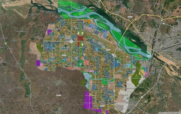
Amaravati APCRDA Masterplan 2050: Zone Check and Land Use Guide
View Amaravati Masterplan as a live map overlay – check any plot's land use zone for free on 1acre.in. APCRDA masterplan...
Amaravati Seed Access Road
View Amaravati Seed Access Road alignment as a live map overlay – check land acquisition risk and plot proximity free on...
Kakinada Masterplan: Zone Check and Land Use Guide
View Kakinada Masterplan as a live map overlay – check any plot's land use zone for free on 1acre.in. Kakinada masterpla...
More Layers in Andhra Pradesh
Amaravati APCRDA Masterplan 2050: Zone Check and Land Use Guide
View Amaravati Masterplan as a live map overlay – check any plot's land use zone for free on 1acre.in. APCRDA masterplan...
Amaravati Seed Access Road
View Amaravati Seed Access Road alignment as a live map overlay – check land acquisition risk and plot proximity free on...
Kakinada Masterplan: Zone Check and Land Use Guide
View Kakinada Masterplan as a live map overlay – check any plot's land use zone for free on 1acre.in. Kakinada masterpla...