Badvel - Nellore Highway
Overview
The Badvel Nellore Greenfield Highway is a 108.134 km, 4-lane Bharatmala corridor approved by the Cabinet Committee on Economic Affairs in May 2025 at Rs 3,653.10 crore. The 4-lane Badvel-Nellore corridor runs from Gopavaram village in YSR Kadapa district to Guruvindapudi on NH-16 near Krishnapatnam Port. NHAI is the project proponent, executing under DBFOT mode. This page covers what every land buyer in Nellore must verify before paying for any plot near the alignment.
Regulatory Red Flags Along the Bharatmala Lot-5 Alignment
Most disputes around Nellore highway land trace back to two things: parcels falling inside the notified Right of Way, and Adangal entries that contradict the Resurvey and Resettlement Register. Get both wrong and your money disappears.
The pre-feasibility report fixed the Right of Way at 45 metres in open areas and 30 metres in forest stretches. The alignment passes through 33 villages in Nellore district plus stretches in YSR Kadapa, with 27.575 hectares of forest land slated for acquisition.
This table shows the regulatory checks you must clear before any payment.
Check
What it confirms
Where to verify
3A notification (NH Act 1956)
Land is being acquired for the corridor
Gazette of India + Nellore Collectorate
Pattadar Passbook + Title Deed
Seller is the recorded owner under ROR Act 1971
Mandal Revenue Office
RSR vs Adangal match
Land is private patta, not deemed government land
Tahsildar of relevant mandal
Distance from centreline
Plot sits outside the 45m RoW
NHAI alignment drawing for Lot-5 Package-1
NALA conversion status
Plot can be used for non-agricultural purpose
MeeSeva NALA application receipt
If the seller cannot show the 3A notification status and a fresh Adangal printout for the survey number, walk away. The Andhra Pradesh High Court has held in multiple Nellore matters that Adangal entries alone do not prove title; mismatches with the RSR have triggered cancellation of pattadar passbooks for parcels in Udaigiri and Indukurpet mandals. Buyers who skip the RSR cross-check are the ones who lose money when acquisition notices arrive.
Growth Corridors and Micro-Markets from Gopavaram to Guruvindapudi
Not every kilometre of this alignment is investable. The corridor splits cleanly into industrial-tail villages, mid-corridor agricultural mandals, and the Krishnapatnam Port connectivity tail where land is already speculative.
The minister's Mahanadu briefing in May 2026 named the alignment passing through Marripadu, Ananthasagaram, Kaluvai, Chejerla, Manubolu, Podalakuru and Venkatachalam mandals before reaching Nellore.
This table maps the corridor's three buyer zones.
Corridor / Locality
Status
Growth Driver
Known Risk
Gopavaram - Marripadu (Kadapa tail)
DPR alignment fixed
Linkage to Kopparthy Node on VCIC
Forest stretch; 30m RoW restrictions
Ananthasagaram - Chejerla (mid-corridor)
Greenfield agricultural
Agricultural land at pre-acquisition rates
Land prohibited if assigned or government patta
Manubolu - Podalakuru - Venkatachalam
Approaching Nellore urban edge
Krishnapatnam Port connectivity, NH-16 junction
Speculative pricing; broker syndicates active
The most misunderstood stretch is between Manubolu and Venkatachalam. Brokers price these parcels as if the highway were already built, but the cabinet approval is from May 2025 and physical construction has not started. Pay agricultural rates for agricultural land. The premium gets earned only after the 3A and 3D notifications are gazetted for the specific survey number you are buying.
Was this layer helpful?
Anything wrong, outdated, or missing we want to hear it.
For Land Owners & Agents
Looking to sell your land in Andhra Pradesh?
I want to sell my land in Amaravati
10:32
Plz share your Land's location - We will list it on 1acre map, for Free.
10:32

For Land Buyers
Browse all verified lands & plots in Andhra Pradesh
Every listing goes through our Preliminary Verification Process.
More Layers in Andhra Pradesh
See all 16 layers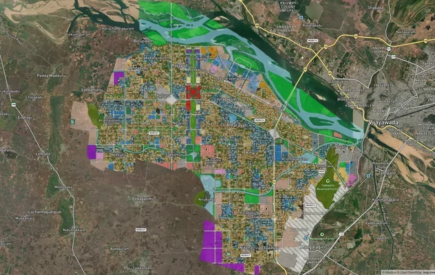
Amaravati APCRDA Masterplan 2050: Zone Check and Land Use Guide
View Amaravati Masterplan as a live map overlay – check any plot's land use zone for free on 1acre.in. APCRDA masterplan...
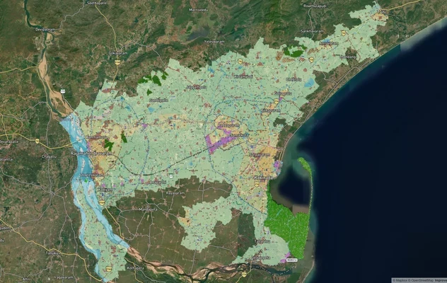
Kakinada Masterplan: Zone Check and Land Use Guide
View Kakinada Masterplan as a live map overlay – check any plot's land use zone for free on 1acre.in. Kakinada masterpla...
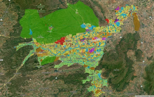
Tirupati TUDA Masterplan: Zone Check and Land Use Guide
View Tirupati Masterplan as a live map overlay – check any plot's land use zone for free on 1acre.in. Tirupati TUDA mast...
More Layers in Andhra Pradesh
Amaravati APCRDA Masterplan 2050: Zone Check and Land Use Guide
View Amaravati Masterplan as a live map overlay – check any plot's land use zone for free on 1acre.in. APCRDA masterplan...
Kakinada Masterplan: Zone Check and Land Use Guide
View Kakinada Masterplan as a live map overlay – check any plot's land use zone for free on 1acre.in. Kakinada masterpla...
Tirupati TUDA Masterplan: Zone Check and Land Use Guide
View Tirupati Masterplan as a live map overlay – check any plot's land use zone for free on 1acre.in. Tirupati TUDA mast...