
Vizag Beach Road Corridor: Coastal Corridor Road Map and Land Guide


Vizag Beach Road Corridor Preview
Try the Vizag Beach Road Corridor on the map
Sign in once and explore the layer for a full day.
- No card details needed
- Find nearby verified lands for sale
Overview
The Vizag Beach Road corridor land buying market stretches 45 kilometers from RK Beach north through Rushikonda, Kapuluppada, INS Kalinga, all the way to Bheemili, where the planned beach corridor to Bhogapuram would take over. VMRDA controls every square meter through their Master Plan 2041, which covers 4,380 square kilometers and got approved in November 2021 under G.O.Ms.No.136. A revised draft of that plan, placed in the public domain for feedback in early 2026, marks a coastal corridor road of about 45 km from Visakhapatnam to Bhogapuram airport, which NHAI is expected to build. As of October 2026 that road is still at the planning stage. Here's the part nobody explains upfront: Coastal Regulation Zone rules slice 30 to 60 percent off what you can actually build on most sea-facing plots. Prices swing from ₹28,000 per square foot in Rushikonda down to ₹6,000 in outer Bheemili, but the real gap is whether banks will touch your plot at all. That comes down to something called an LP Number, and most buyers find out about it way too late.
Vizag coastal corridor route map: RK Beach, Bheemili to Bhogapuram
The Vizag coastal corridor road map has two parts. The first is the existing Beach Road from RK Beach through Rushikonda, Kapuluppada and INS Kalinga to Bheemili. The second is a planned six-lane, access-controlled greenfield road of 19.66 km from Bheemili to Bhogapuram, approved by the Andhra Pradesh cabinet in 2021 with two suspension bridges over the Gosthani river. When NHAI was asked to prepare a feasibility report in 2022, the corridor was described as running from the Vizag port container terminal along the beach road through Rushikonda and Bheemili to NH-16 at Bhogapuram.
VMRDA's revised draft master plan, released for public feedback and reported in February 2026, shows the coastal corridor at about 45 km. It runs mostly along the beachfront, shifting inland where terrain or existing buildings leave no room. Planned width is about 40 metres near Visakhapatnam, widening to about 60 metres towards Bhogapuram.
Stretch
Localities
Today
Planned in the corridor
Port and RK Beach to Rushikonda
RK Beach, Rushikonda
Existing Beach Road
Elevated section of about 1 km at Rushikonda
Rushikonda to Kapuluppada
Rushikonda, Kapuluppada
Existing Beach Road; Boyapalem-Kapuluppada road widening listed by VMRDA among airport access roads
Width of about 40 metres near the city
Kapuluppada to Bheemili
INS Kalinga, Bheemili
Existing Beach Road
Some sections may move inland
Bheemili to Bhogapuram
Bheemili, Gosthani river, Bhogapuram
No direct coastal road
19.66 km six-lane greenfield road, two river bridges, width up to about 60 metres
Stretch
Localities
Today
Planned in the corridor
Port and RK Beach to Rushikonda
RK Beach, Rushikonda
Existing Beach Road
Elevated section of about 1 km at Rushikonda
Rushikonda to Kapuluppada
Rushikonda, Kapuluppada
Existing Beach Road; Boyapalem-Kapuluppada road widening listed by VMRDA among airport access roads
Width of about 40 metres near the city
Kapuluppada to Bheemili
INS Kalinga, Bheemili
Existing Beach Road
Some sections may move inland
Bheemili to Bhogapuram
Bheemili, Gosthani river, Bhogapuram
No direct coastal road
19.66 km six-lane greenfield road, two river bridges, width up to about 60 metres
There is no separate official route map PDF. The alignment appears in VMRDA's revised draft master plan documents, and NHAI's project report has not been made public. You can check a plot's distance from the alignment on the 1acre map layer.
Vizag to Bhogapuram six-lane highway and the airport link
Alluri Sitarama Raju International Airport at Bhogapuram, in Vizianagaram district, started commercial operations on 17 August 2026. Airlines moved their flights from the old civil enclave at INS Dega, and the VTZ airport code moved with them. GMR runs the airport, which is about 44 km from Visakhapatnam.
Today the main road from Vizag to the airport is NH-16. VMRDA set a May 2026 deadline for seven access roads totalling 26.72 km at Rs 156 crore, including the Boyapalem-Kapuluppada widening; a December 2025 report said land acquisition from 348 private owners had slowed that work. The state has also announced a 102 km semi ring road from Rambilli to Bhogapuram, with its detailed project report expected in May 2026.
The six-lane beach corridor would give the airport a second, coastal route. In May 2026 it was still described as in the pipeline, and as of October 2026 no construction contract had been reported.
Route to Bhogapuram
Status as of October 2026
NH-16
In use; main route to the airport
Seven VMRDA access roads (26.72 km)
May 2026 deadline; slowed by land acquisition
Six-lane beach corridor via Bheemili
Proposed; in VMRDA revised draft master plan
Rambilli to Bhogapuram semi ring road (102 km)
Detailed project report stage
Route to Bhogapuram
Status as of October 2026
NH-16
In use; main route to the airport
Seven VMRDA access roads (26.72 km)
May 2026 deadline; slowed by land acquisition
Six-lane beach corridor via Bheemili
Proposed; in VMRDA revised draft master plan
Rambilli to Bhogapuram semi ring road (102 km)
Detailed project report stage
For land buyers the difference matters. Plots near NH-16 already benefit from airport access, while beach-side plots between Bheemili and Bhogapuram depend on a road that is not yet under construction, and still face the same CRZ buildability limits described below.
Your Plot Might Have VMRDA's Name On It But Still Be Unbankable
VMRDA took over from the old VUDA setup when Master Plan 2041 came in. Now every layout goes through two gates. First is the Block Layout Plan, which is basically VMRDA saying "okay, you can start building roads and putting in pipes." Second is the final Layout Plan with an actual LP Number, which only comes after they send inspectors to check that you finished everything you promised. Roads paved. Drains working. Power lines up. Water connected.
Developers love selling during the BLP stage because they can show you VMRDA paperwork and half-finished infrastructure that looks legit enough. Three years later you find out the LP Number never came because the developer ran out of money or failed the inspection or just disappeared. Your plot sits there, paid for, but you can't register it. Banks laugh you out the door because without that LP Number the whole thing is provisional.
Check these four documents before you even think about signing.
Document You Need
What It Actually Proves
Where You Check It
What Happens Without It
7/12 Extract
Someone owns this land
Meebhoomi portal
No proof it's even yours
CLU Certificate
It's not farmland anymore
Revenue office
Illegal to build anything
VMRDA BLP
Layout got initial okay
VMRDA website
Not recognized at all
VMRDA LP Number
Inspectors signed off on completion
VMRDA office, physical document
Bank says no, registration fails
Document You Need
What It Actually Proves
Where You Check It
What Happens Without It
7/12 Extract
Someone owns this land
Meebhoomi portal
No proof it's even yours
CLU Certificate
It's not farmland anymore
Revenue office
Illegal to build anything
VMRDA BLP
Layout got initial okay
VMRDA website
Not recognized at all
VMRDA LP Number
Inspectors signed off on completion
VMRDA office, physical document
Bank says no, registration fails
Bheemili is where this blows up most often. Between 2019 and 2021 prices shot from ₹50 lakh an acre to ₹1.5 crore because everyone thought buying there meant buying the next Rushikonda. Gated communities popped up everywhere. "VMRDA approved" got slapped on every hoarding. Except half of them only had BLP numbers. Fast forward to now and a bunch of those projects are stuck. Infrastructure didn't get finished. VMRDA won't issue the LP. Buyers are holding plots they can't register and can't sell.
Then there's the Coastal Regulation Zone thing sitting on top of all that. CRZ rules chop the coast into four zones. Zone I is the actual beach between low tide and high tide where you can't build anything except maybe a port. Zone II is already-developed areas where you can keep building but with height limits and setback rules. Zone III is undisturbed coastal stretches, which is most of what gets sold as "sea-facing plots." Construction here needs environmental clearance and you've got to stay 200 meters back from the high tide line if it's tourism stuff, 500 meters for anything else. Zone IVA is just water.
Most Beach Road plots sit in Zone III. Building isn't banned, but that 200-meter setback line eats a massive chunk of your plot. Sellers quote you the full 200 square yards at ₹25,000 per square foot. What they don't mention is that after you subtract the CRZ no-construction zone, you're down to maybe 120 buildable square yards. Your ₹50 lakh plot just became ₹30 lakh of actual usable land.
Worse still, VMRDA's Master Plan 2041 is under review. The government ordered them to redo it in 2024 after getting 17,460 complaints about zones getting changed to help specific people protect their land. A revised draft was placed in the public domain for feedback in early 2026, but until the final plan is notified, some plots are sitting in disputed zones. Buy now and you're betting your zone classification doesn't shift when the final revised plan is published.
Rushikonda Costs Double What Kapuluppada Does For One Simple Reason
The corridor splits into four completely different markets depending on whether infrastructure actually exists or just got promised.
RK Beach to Rushikonda runs 8 kilometers and commands ₹20,000 to ₹28,000 per square foot. Why? Because the roads are sealed, the drains work, GVMC water flows, and power never cuts out. The beach pulls tourists every single day. Hotels are full. Restaurants stay packed. IT companies set up offices. Banks hand out loans here without blinking because everything's proven and occupied. The risk is minimal so the price is maximum.
Rushikonda to Kapuluppada is the next 7 kilometers at ₹14,000 to ₹22,000 per square foot. Some VMRDA layouts with proper LP Numbers exist here. But panchayat conversions run the show. A panchayat conversion just means the revenue department certified that agricultural land became non-agricultural. It doesn't mean VMRDA checked the layout or approved infrastructure. Roads are narrower. Drainage is sketchy. Power is hit-or-miss. Banks treat these plots differently. They want bigger down payments, charge higher rates, and take forever processing because the risk jumped.
Kapuluppada to INS Kalinga covers 10 kilometers at ₹10,000 to ₹18,000 per square foot. This is pure speculation on the planned Coastal Corridor Expressway, six lanes connecting Vizag Port to Bhogapuram via NH-16. Supposed to cut the airport drive from 90 minutes to under 30. Developers are buying up agricultural land betting the expressway makes this the next growth zone. Here's the gamble: if the corridor is sanctioned and built, you win. If it stays on paper, you're stuck holding plots with no infrastructure and no buyers.
INS Kalinga to Bheemili is the final 20 kilometers running ₹6,000 to ₹14,000 per square foot. This is the danger zone for CRZ violations. Plots get marketed as "beach-facing VMRDA layouts" but they're sitting in CRZ Zone III where construction needs environmental clearance and that 200-meter setback kills your buildable area. Sellers advertise 200 square yards total but don't tell you only 100 of it is actually usable after CRZ compliance. A ₹60 lakh plot delivers maybe ₹35 lakh of construction space if you're lucky.
Here's how the four zones actually shake out.
Section
Distance
What You Get
Per Sq Ft Price
What Can Go Wrong
RK-Rushikonda
0-8 km
VMRDA LP approved
₹20,000-₹28,000
Nothing left to buy
Rushikonda-Kapuluppada
8-15 km
Mix of VMRDA and panchayat
₹14,000-₹22,000
Banks resist panchayat plots
Kapuluppada-INS Kalinga
15-25 km
BLP without LP, panchayat
₹10,000-₹18,000
LP delays, expressway might not happen
INS Kalinga-Bheemili
25-45 km
Panchayat, some unapproved
₹6,000-₹14,000
CRZ violations, no bank loans
Section
Distance
What You Get
Per Sq Ft Price
What Can Go Wrong
RK-Rushikonda
0-8 km
VMRDA LP approved
₹20,000-₹28,000
Nothing left to buy
Rushikonda-Kapuluppada
8-15 km
Mix of VMRDA and panchayat
₹14,000-₹22,000
Banks resist panchayat plots
Kapuluppada-INS Kalinga
15-25 km
BLP without LP, panchayat
₹10,000-₹18,000
LP delays, expressway might not happen
INS Kalinga-Bheemili
25-45 km
Panchayat, some unapproved
₹6,000-₹14,000
CRZ violations, no bank loans
The Coastal Corridor Expressway zone is the most misread opportunity right now. That planned six-lane highway would run through Rushikonda and Bheemili. Plots within 2-3 kilometers of the route are climbing faster than the rest of Beach Road. But as of October 2026, the latest public updates, VMRDA's revised draft master plan in February 2026 and state announcements in May 2026, still describe the corridor as proposed, with NHAI expected to build it. No construction contract or land acquisition figure has been published, so treat any claim of work on the ground as unverified until you see it on site.
But here's what brokers skip over. The expressway brings trucks. It brings warehouses. It brings cold storage and logistics terminals competing for the same land you wanted for a beach house. VMRDA's Master Plan 2041 zones highway-adjacent areas for mixed-use or straight commercial, not pure residential. You buy thinking quiet coastal living, you end up owning land that gets rezoned for a truck depot by 2030.
Bheemili is the corridor's biggest question mark. It was supposed to be Andhra Pradesh's executive capital when Vizag got named the state capital in 2020. Prices exploded. Then the plan changed. Prices tanked. Now it's just sitting there waiting for the next government announcement that might or might not come. The satellite port they talked about in 2015 never materialized. The secretariat offices got shelved. People who paid ₹1.5 crore per acre in 2021 are holding plots worth ₹80 lakh to ₹1 crore now, hoping the next policy shift unlocks value again.
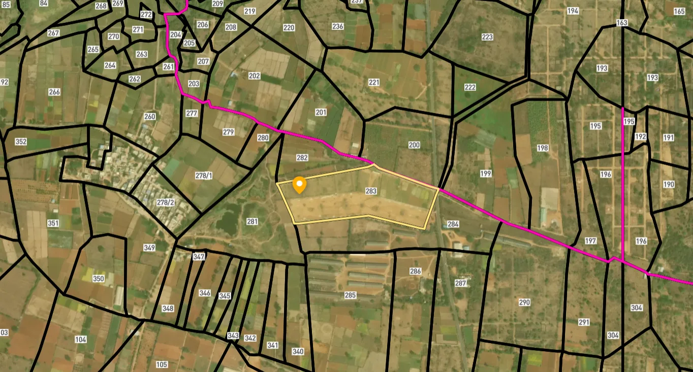
Access Survey NumbersAccess Andhra Pradesh
Survey Numbers
Boundaries and numbers come from published state cadastral records. See all map layers.
Looking to sell your land in Andhra Pradesh?

Browse all verified lands & plots in Andhra Pradesh
More Layers in Andhra Pradesh
See all 19 layers
Vizag Airport Road
View the Vizag Airport Road corridor on a live map overlay – check zoning, approvals and acquisition risk free on 1acre....
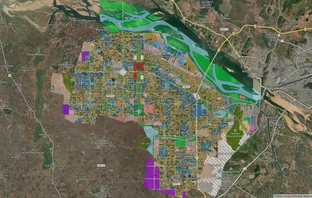
Amaravati APCRDA Masterplan 2050 Map: LPS and Villages
See the Amaravati LPS map, APCRDA villages list, capital area and Phase 2 land pooling status, then check any plot's mas...
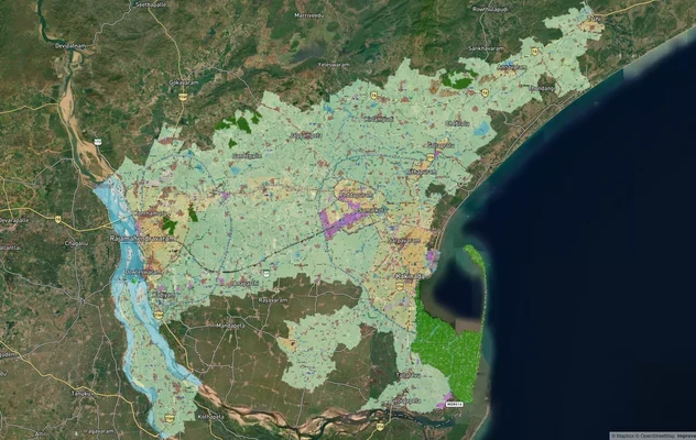
Kakinada Masterplan: Zone Check and Land Use Guide
View Kakinada Masterplan as a live map overlay – check any plot's land use zone for free on 1acre.in. Kakinada masterpla...
More Layers in Andhra Pradesh
Vizag Airport Road
View the Vizag Airport Road corridor on a live map overlay – check zoning, approvals and acquisition risk free on 1acre....
Amaravati APCRDA Masterplan 2050 Map: LPS and Villages
See the Amaravati LPS map, APCRDA villages list, capital area and Phase 2 land pooling status, then check any plot's mas...
Kakinada Masterplan: Zone Check and Land Use Guide
View Kakinada Masterplan as a live map overlay – check any plot's land use zone for free on 1acre.in. Kakinada masterpla...
Frequently Asked Questions
Yes, if you stick to VMRDA LP-approved layouts between RK Beach and Kapuluppada. No, if you're looking at panchayat conversions or BLP-only plots near Bheemili. CRZ rules cut buildable area by 30-60 percent on sea-facing plots, which tanks effective value no matter what the brochure says.
VMRDA approval means the layout meets Master Plan 2041 standards for roads, drainage, and infrastructure. Block Layout Plan is step one. Final Layout Plan with LP Number is step two and the only one that matters for registration and bank loans. No LP Number means no legal registration.
CRZ stands for Coastal Regulation Zone. Rules ban or restrict construction within 200-500 meters of the high tide line depending on which zone you're in. Most undeveloped Beach Road areas are Zone III where you need environmental clearance and must stay 200 meters back. Plots sold as sea-facing often count that unbuildable CRZ strip in the total area.
Block Layout Plan lets developers start infrastructure work. Final Layout Plan with LP Number comes after VMRDA inspects finished roads, drains, water, and power. Only plots with LP Numbers qualify for bank loans and legal registration. BLP plots are provisional and can't be registered.
RK Beach to Rushikonda grew 15-20 percent annually from 2021 to 2026. Kapuluppada to INS Kalinga near the Coastal Corridor Expressway is running 12-18 percent. Bheemili dropped 30-40 percent from 2021 peaks after the executive capital plan died but steadied at ₹80 lakh to ₹1 crore per acre.
Only for VMRDA LP-approved layouts with final plan numbers. Panchayat conversions and BLP-only plots get rejected or need 50-60 percent down with higher interest rates. Most Beach Road plots in Bheemili past INS Kalinga are panchayat conversions that banks won't finance on standard terms.
CLU converts agricultural land to non-agricultural through the Revenue Department. CLU alone doesn't let you build. You still need VMRDA layout approval separately. Plots with CLU but no VMRDA sanction stay legally unbuildable despite the non-agricultural tag. Banks won't finance CLU-only plots without VMRDA backing.
RK Beach to Rushikonda climbed from ₹12,000-₹15,000 per square foot in 2019 to ₹20,000-₹28,000 in 2026. Bheemili peaked at ₹1.5 crore per acre in 2021 during executive capital hype, crashed to ₹80 lakh-₹1 crore by 2024-2026. Coastal Corridor Expressway zones show 10-15 percent yearly gains, priced on a corridor that was still at the planning stage in the latest public updates (May 2026).
No standalone official PDF of the coastal corridor road map has been published. The alignment is shown in VMRDA's revised draft master plan, released for public feedback in early 2026, and NHAI, which is expected to build the road, has not released its project report. Maps on social media and in brochures are not official. Check a plot against the master plan land use map at the VMRDA office.
Rates vary sharply by stretch, approval status and CRZ exposure, so a single per acre figure misleads. Compare current asking prices for similar plots on 1acre listings, then adjust for buildable area after the CRZ setback and for whether the layout has a VMRDA LP Number. The per square foot ranges on this page reflect market reports, not official rates.
As of October 2026 the six-lane beach corridor is still proposed. VMRDA's revised draft master plan, released for public feedback and reported in February 2026, shows a coastal road of about 45 km from Visakhapatnam to Bhogapuram, and NHAI is expected to build it. State announcements in May 2026 described it as in the pipeline. No construction contract or land acquisition figure has been published.
Alluri Sitarama Raju International Airport at Bhogapuram is about 44 km from Visakhapatnam and opened for commercial flights on 17 August 2026. The main road today is NH-16. VMRDA is widening seven access roads, and the planned six-lane beach corridor through Bheemili would add a coastal route once built.
Source
Official Visakhapatnam Metropolitan Region Development Authority (VMRDA) documents
Coordinate Reference System
EPSG:4326 (WGS 84)
Geometry Type
LineString / MultiLineString
Data Format
Vector (GeoJSON) + Raster Tiles
Last Verified
2026
Status
Active
Was this layer helpful?
Anything wrong, outdated, or missing we want to hear it.