Pune Bengaluru Expressway

Pune Bengaluru Expressway Preview
Try the Pune Bengaluru Expressway on the map
Sign in once and explore the layer for a full day.
- No card details needed
- Find nearby verified lands for sale
Overview
The Pune-Bengaluru Expressway land-buying landscape has changed fast. NHAI's approximately 700 km greenfield corridor, approved under Bharatmala Pariyojana Phase 2 at an estimated cost of ₹42,000 crore per the November 2025 DPR, cuts across 13 districts: Pune, Satara, and Sangli in Maharashtra, and Belagavi, Bagalkot, Gadag, Koppal, Vijayanagara, Davanagere, Chitradurga, Tumakuru, and Bengaluru Rural in Karnataka. The DPR received central government approval in November 2025. Construction is expected to begin in 2026, with completion targeted for 2028. This page covers the exact regulatory traps, high-potential corridors, and key questions every buyer must answer before committing.
Fake Alignment Maps and Land Acquisition Traps Along the Expressway Corridor
The biggest risk in Pune-Bengaluru Expressway land buying is not overpaying. It is buying a plot whose survey numbers fall directly within the 100-meter right of way (ROW), or worse, purchasing land based on a broker-drawn "expressway alignment map" that does not match the official Bhoomi Rashi records.
NHAI publishes village-level land acquisition notifications on the Bhoomi Rashi portal at bhoomirashi.gov.in. This is the only authoritative source. Any broker who cannot produce the official acquisition notification for a specific survey number in your target village is asking you to speculate, not invest.
The table below shows the districts where land acquisition is active or pending and the key risk profile for buyers.
District / State
Acquisition Status
Primary Risk for Buyers
Pune, Satara, Sangli (MH)
~80% acquired
Survey numbers inside ROW title may be clouded
Belagavi, Bagalkot (KA)
~60–70% acquired
Farmer protests; acquisition delays possible
Gadag, Koppal, Davanagere (KA)
Active
Speculative pricing ahead of confirmed alignment
Chitradurga, Tumakuru (KA)
Early stage
Limited price discovery; title verification essential
Bengaluru Rural (KA)
Early stage
Premium pricing with limited confirmed ROW data
A second trap specific to the Maharashtra section: the expressway bypasses Satara, Sangli, and Kolhapur city limits entirely to ensure smoother traffic flow. Plots marketed as "expressway-facing" in these city areas are almost certainly not adjacent to the greenfield corridor. Cross-check every claim against the Bhoomi Rashi alignment map before visiting a site.
The third trap applies across both states: brokers routinely market agricultural land without disclosing that non-agricultural (NA) conversion is still pending. An agricultural plot adjacent to the expressway corridor has no commercial development rights until the state government issues NA conversion orders under the relevant revenue code. Confirm the NA status from the Tahsildar's office, not from the broker.
Satara, Belagavi, and Tumakuru: Where the Expressway Corridor Actually Moves Land Values
Not every district along this ~700 km alignment offers the same land investment logic. Three corridor types have distinct value drivers, and confusing them costs buyers money.
The table below maps corridors to their value driver and risk rating based on the confirmed expressway alignment.
Corridor
Districts
Value Driver
Risk Level
Interchange zones (Pune entry / Bengaluru entry)
Pune (Kanjale), Bengaluru Rural (Doddaballapur)
Industrial, logistics, warehousing
Moderate prices already elevated
Mid-corridor agricultural belt
Satara, Sangli, Belagavi, Bagalkot
Agricultural land at lower base price, long-horizon appreciation
Lower entry cost, longer time to liquidity
Karnataka interior belt
Gadag, Koppal, Davanagere, Chitradurga
Underdeveloped; potential for logistics hubs
Higher uncertainty; confirmed interchange locations not finalised
The corridor most consistently misread is Davanagere. It sits in the geographic center of the Karnataka leg. Industrial analysts have flagged it as a future logistics node because it sits at the intersection of the expressway alignment and the existing NH-48 corridor. But no interchange location in Davanagere taluk has been officially confirmed in NHAI's published documentation as of early 2026. Buying land here based on projected interchange proximity is a bet, not a verified infrastructure play.
Belagavi is the opposite case. The expressway enters Karnataka at Bommanal in Athani Taluk (Belagavi district). This is the confirmed border crossing point. Industrial clusters in Belagavi and Jamakhandi (Bagalkot district) are expected to attract investment as the alignment becomes operational. Land prices in these taluks have begun moving already, but base values remain lower than Pune-end parcels, making them worth monitoring if a 5–7-year holding horizon is acceptable.
Was this layer helpful?
Anything wrong, outdated, or missing we want to hear it.
For Land Owners & Agents
Looking to sell your land in Maharashtra?
I want to sell my land in Maharashtra
10:32
Plz share your Land's location - We will list it on 1acre map, for Free.
10:32

For Land Buyers
Browse all verified lands & plots in Maharashtra
Every listing goes through our Preliminary Verification Process.
More Layers in Maharashtra
See all 32 layers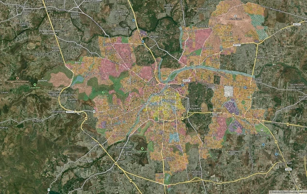
Pune PMC Masterplan: Zone Check and Land Use Guide
View Pune City (PMC) Masterplan as a live map overlay – check any plot's land use zone for free on 1acre.in. Pune Munici...
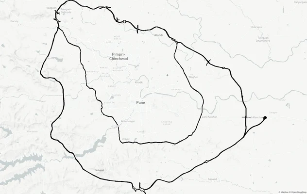
Pune Ring Roads: Route Alignment and Land Impact
View Pune Ring Roads alignment as a live map overlay – check road corridor and land impact free on 1acre.in. Pune Ring R...
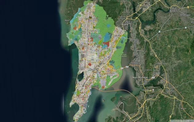
Mumbai Development Plan 2034: Zone Check and Land Use Guide
View Mumbai Masterplan as a live map overlay – check any plot's land use zone for free on 1acre.in. Mumbai masterplan 20...
More Layers in Maharashtra
Pune PMC Masterplan: Zone Check and Land Use Guide
View Pune City (PMC) Masterplan as a live map overlay – check any plot's land use zone for free on 1acre.in. Pune Munici...
Pune Ring Roads: Route Alignment and Land Impact
View Pune Ring Roads alignment as a live map overlay – check road corridor and land impact free on 1acre.in. Pune Ring R...
Mumbai Development Plan 2034: Zone Check and Land Use Guide
View Mumbai Masterplan as a live map overlay – check any plot's land use zone for free on 1acre.in. Mumbai masterplan 20...